Fraud Blocker Skip to main content

Home > Maps and Charts > Americas

Americas Collection (page 4)

"Americas " refers to a collection of maps and charts that depict the geography, topography, climate, demographics, and other aspects of North America

7,835 items

Background imageAmericas Collection: Map, Santa Catalina Island, California, USA

Map, Santa Catalina Island, California, USA
Map of Santa Catalina Island, off the coast of California, USA, with inset scenes. 1935

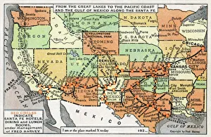
Background imageAmericas Collection: Map, route of Santa Fe Railroad, USA

Map, route of Santa Fe Railroad, USA
Map showing the route of the Santa Fe Railroad, USA, from the Great Lakes in the east, to the Gulf of Mexico in the south, and the Pacific coast in the west

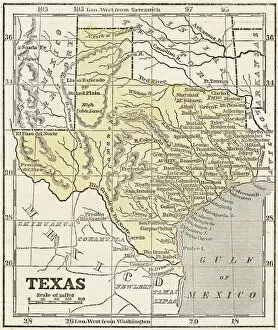
Background imageAmericas Collection: Map of Texas 1855

Map of Texas 1855
System of Geography for the use of schools by Sidney E. Morse - Published by Harper & Brothers - New York 1855

Background imageAmericas Collection: New Hampshire 1852 Map

New Hampshire 1852 Map

Background imageAmericas Collection: Vermont 1852 Map

Vermont 1852 Map

Background imageAmericas Collection: Vintage Map of the World

Vintage Map of the World
Vintage map of the world from 1837

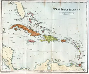
Background imageAmericas Collection: Vintage map of the West India Islands 1860s

Vintage map of the West India Islands 1860s

Background imageAmericas Collection: CABOT: NEW WORLD MAP, 1544. Detail from Sebastian Cabots 1544 map of the New World

CABOT: NEW WORLD MAP, 1544. Detail from Sebastian Cabots 1544 map of the New World

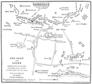
Background imageAmericas Collection: Contemporary map showing the advances of Colonel Theodore Roosevelts Rough Riders at the Battle of

Contemporary map showing the advances of Colonel Theodore Roosevelts Rough Riders at the Battle of San Juan Hill, Cuba
CUBA: SAN JUAN HILL. Contemporary map showing the advances of Colonel Theodore Roosevelts Rough Riders at the Battle of San Juan Hill, Cuba, and of other American forces at El Caney, 1 July 1898

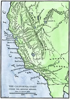
Background imageAmericas Collection: California under Mexican rule, 1800s

California under Mexican rule, 1800s
Map of Alta California under Mexican government, early 1800s. Hand-colored woodcut of a 19th-century illustration

Background imageAmericas Collection: Map of the Americas, 1660

Map of the Americas, 1660
17th century map of the Americas. Published in Amsterdam in 1660, this map by the Dutch cartographer Frederick de Witt (1630-1706) shows the geography of the Americas

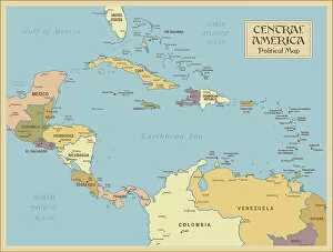
Background imageAmericas Collection: A vintage Central America Political Map

A vintage Central America Political Map
Central America is the thin section of land that links the North American continent with the South American continent. Geographically part of North America, it is made up of seven small

Background imageAmericas Collection: Map of France 1889

Map of France 1889
Comprehensive Geography by James Monteith - American Book Company 1882, 1889

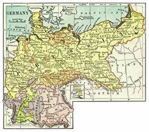
Background imageAmericas Collection: Map of Germany 1889

Map of Germany 1889
Comprehensive Geography by James Monteith - American Book Company 1882, 1889

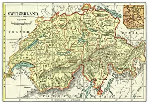
Background imageAmericas Collection: Map of Switzerland 1889

Map of Switzerland 1889
Comprehensive Geography by James Monteith - American Book Company 1882, 1889

Background imageAmericas Collection: Physical map of North America

Physical map of North America
Vector illustration of the physical map of North America Reference map was created by the US Central Intelligence Agency and is available as a public domain map at the University of Texas Libraries

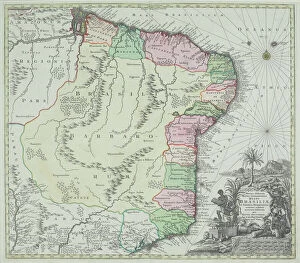
Background imageAmericas Collection: antique, archival, brasil, brasilia, brazil, cartography, cartouche, colored, decorative

antique, archival, brasil, brasilia, brazil, cartography, cartouche, colored, decorative, distribution, districts, elegant, geography, historic, indigenous peoples, key, legend, location, map

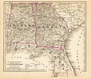
Background imageAmericas Collection: Alabama Florida Georgia map 1881

Alabama Florida Georgia map 1881
Coltons Common School Geography 1881 New York Sheldon and Co

Background imageAmericas Collection: New York Maryland Pennsylvania map 1881

New York Maryland Pennsylvania map 1881
Coltons Common School Geography 1881 New York Sheldon and Co

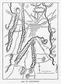
Background imageAmericas Collection: Battle of Gettysburg Map, July 3, 1863 Civil War Engraving

Battle of Gettysburg Map, July 3, 1863 Civil War Engraving
Engraving of the Map of the Battle of Gettysburgs, Pennsylvania, July 3, 1863 Civil War Engraving from Famous Leaders and Battle Scenes of the Civil War, Published in 1864

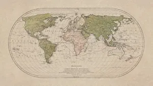
Background imageAmericas Collection: World map by Mathieu Albert Lotter, Augsburg, 1778

World map by Mathieu Albert Lotter, Augsburg, 1778
World map from 1778. Original hand-colored copper engraving by Matthieu Albert Lotter (1741 - 1810, Augsburg) with route of James Cooks First Circumnavigation (1770), through Tahiti

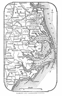
Background imageAmericas Collection: Map of Pamlico and Albemarle Sounds

Map of Pamlico and Albemarle Sounds
Vintage engraving from 1863 of a map of Map of Pamlico and Albemarle Sounds at the time of the American Civil War

Background imageAmericas Collection: Map of United States 1876

Map of United States 1876
Map of United States showing the territorial growth between 1780 and 1876

Background imageAmericas Collection: Planet Earth on human hands, breaking down and crumbling

Planet Earth on human hands, breaking down and crumbling with fragments falling apart. Airbrush illustration

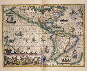
Background imageAmericas Collection: Map of America by Gerardo Mercatore, 1512-1594

Map of America by Gerardo Mercatore, 1512-1594
Cartography, 16th century. Map of America by Gerardo Mercatore (1512-1594)

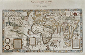
Background imageAmericas Collection: Carta marina (map of the sea). 1516. Facsimile

Carta marina (map of the sea). 1516. Facsimile
" Carta marina (map of the sea). 1516. Facsimile. Sea map described by Carlos Sainz in his work " The name of America". Engraving. SPAIN. Madrid. Americas Museum."

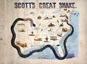
Background imageAmericas Collection: CIVIL WAR: ANACONDA PLAN. Scotts Great Snake or the Anaconda Plan

CIVIL WAR: ANACONDA PLAN. Scotts Great Snake or the Anaconda Plan: General Winfield Scotts plan to blockade the Confederacy and conduct a major offensive down the Mississippi River

Background imageAmericas Collection: MAP: CHICAGO, 1874. Map of Chicago, Illinois, and its suburbs

MAP: CHICAGO, 1874. Map of Chicago, Illinois, and its suburbs. Line engraving, 1874, by Rufus Blanchard

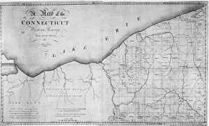
Background imageAmericas Collection: MAP: WESTERN RESERVE. Map of the Connecticut Western Reserve on Lake Erie

MAP: WESTERN RESERVE. Map of the Connecticut Western Reserve on Lake Erie, later to become the northeastern part of the state of Ohio

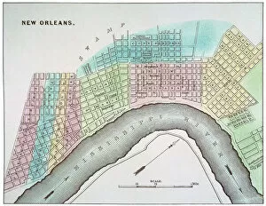
Background imageAmericas Collection: NEW ORLEANS MAP, 1837. Map of New Orleans, Louisiana

NEW ORLEANS MAP, 1837. Map of New Orleans, Louisiana

Background imageAmericas Collection: MAP: UNITED STATES, 1820. Engraved map of the United States, 1820

MAP: UNITED STATES, 1820. Engraved map of the United States, 1820, drawing on the geographical discoveries of the Lewis & Clark expedition

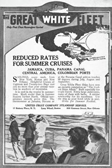
Background imageAmericas Collection: UNITED FRUIT COMPANY, 1922. Advertisement from an American magazine of 1922, for

UNITED FRUIT COMPANY, 1922. Advertisement from an American magazine of 1922, for United Fruit Companys Carribean cruises

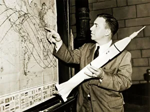
Background imageAmericas Collection: James Van Allen, US astrophysicist

James Van Allen, US astrophysicist
James Van Allen (1914-2006), US astrophysicist, holding a model of the rocket launcher Juno 1 with the satellite Explorer 1 on the nose cone

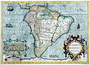
Background imageAmericas Collection: 17th century map of South America

17th century map of South America
South America, 17th century Dutch map. This shows the new continent that was being discovered by European explorers. The shape is distorted because it had not yet been accurately mapped

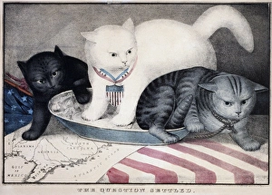
Background imageAmericas Collection: CIVIL WAR: CARTOON, c1865. The Question Settled. White cat labeled Old Abe kicking out a grey cat

CIVIL WAR: CARTOON, c1865. The Question Settled. White cat labeled Old Abe kicking out a grey cat labeled Jeff Davis. Behind Old Abe is a black cat labeled Contraband. Color lithograph, c1865

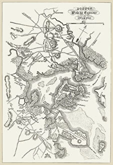
Background imageAmericas Collection: BOSTON: MAP, 1775-1776. Map of Boston, Massachusetts, and the surrounding area, 1775-1776

BOSTON: MAP, 1775-1776. Map of Boston, Massachusetts, and the surrounding area, 1775-1776. Line engraving, 19th century

Background imageAmericas Collection: Manhattan map, 1789

Manhattan map, 1789
Map of the City of New York, 1789. Hand-colored woodcut reproduction of an 18th century illustration

Background imageAmericas Collection: EXPL2A-00377

EXPL2A-00377
Chart of the West Indies sea depths and land elevations. Printed color lithograph of a 19th-century illustration

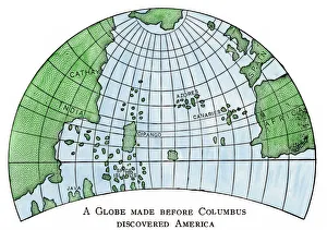
Background imageAmericas Collection: Globe of 1492, lacking the New World

Globe of 1492, lacking the New World
Diagram of Martin Behaims globe, made just before Columbus discovered America. Hand-colored woodcut of a 19th-century illustration

Background imageAmericas Collection: Civil War territory map, 1861

Civil War territory map, 1861
Map showing Confederate-held territory at the end of 1861. Hand-colored woodcut of a 19th-century illustration

Background imageAmericas Collection: EXPL2A-00284

EXPL2A-00284
Early map of Hudsons Strait and Hudsons Bay, 1662, in Arctic Canada. Hand-colored 19th-century woodcut reproduction

Background imageAmericas Collection: EXPL2A-00165

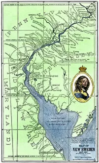
EXPL2A-00165
Map of colonial New Sweden in America, 1638-1685. Hand-colored 19th-century woodcut reproduction of a 17th-century map

Background imageAmericas Collection: US territorial acquisition during the 1800s

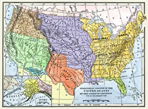
US territorial acquisition during the 1800s
Map showiing the territorial growth of the continental US 1776 to 1899. Hand-colored woodcut of a 19th-century illustration

Background imageAmericas Collection: Map of the world, 1590

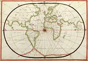
Map of the world, 1590
16th century map of the world. Published around 1590, this map shows the known world, including the new lands being discovered by Europeans exploring across the Atlantic

Background imageAmericas Collection: Map of the continents and seas in the Upper Triassic

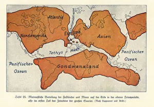
Map of the continents and seas in the Upper Triassic period. North America, Atlantis, Europe, Asia, Gondwanaland. Colour print after an illustration from Wilhelm Bolsches Das Leben der Urwelt

Background imageAmericas Collection: Map of the Siege of Quebec, Canada 1759

Map of the Siege of Quebec, Canada 1759
Vintage engraving of a Map of the Siege of Quebec, Canada 1759. The Battle of the Plains of Abraham, also known as the Battle of Quebec was a pivotal battle in the Seven Years War

Background imageAmericas Collection: Map of the Battle of Valcour Island, 1776

Map of the Battle of Valcour Island, 1776
Vintage engraving of Map of the Battle of Valcour Island, 1776. The naval Battle of Valcour Island, also known as the Battle of Valcour Bay, took place on October 11, 1776, on Lake Champlain

Background imageAmericas Collection: Cartouche on W. Mayos Map of Barbados, 1722, (1944). Creator: William Mayo

Cartouche on W. Mayos Map of Barbados, 1722, (1944). Creator: William Mayo
Cartouche on W. Mayos Map of Barbados, 1722, (1944). A New & Exact Map of the Island of Barbadoes in America. According to an Actual & Accurate Survey


All Professionally Made to Order for Quick Shipping


-

Americas Collection

"Americas " refers to a collection of maps and charts that depict the geography, topography, climate, demographics, and other aspects of North America, Central America, South America, and the Caribbean. These maps and charts are used for educational purposes in schools and universities as well as by researchers studying various topics related to the Americas. They provide valuable information about landforms such as mountains, rivers, lakes; political boundaries between countries; population density; natural resources distribution; transportation networks; weather patterns among others. The use of these maps has helped people understand the complex nature of this vast region better.
+

Our beautiful pictures are available as Framed Prints, Photos, Wall Art and Photo Gifts

The Americas collection from Media Storehouse is a stunning assortment of wall art and framed prints that showcase the beauty and diversity of North, Central, and South America. Our collection features an extensive range of maps and charts that depict various regions, cities, countries, oceans, mountains, rivers, lakes as well as historical events such as explorations and discoveries. The artwork is available in different sizes to suit any space or decor style. Our collection offers a unique opportunity to explore the rich cultural heritage of the Americas through visually striking images. Whether you are looking for vintage maps or contemporary designs with bold colors or intricate details - our collection has something for everyone. These high-quality prints are perfect for home decoration or office spaces. The Americas collection from Media Storehouse provides an excellent way to appreciate the natural beauty and history of this vast continent while adding a touch of sophistication to your living space.
+

What are Americas (Maps and Charts) art prints?

America's Maps and Charts art prints are a collection of stunningly detailed, high-quality reproductions of historical maps and charts from the United States. These prints showcase the rich history and geography of America, featuring intricate details such as coastlines, rivers, mountains, cities, and landmarks. From antique maps dating back to the 18th century to modern-day topographical charts, this collection offers a wide range of styles and subjects for any decor or interest. Whether you're looking for a vintage map of your hometown or an artistic rendering of the Grand Canyon, there is something for everyone in this extensive collection. Each print is carefully crafted using state-of-the-art printing technology to ensure that every detail is captured with precision and accuracy. They are printed on high-quality paper stock that will last for years to come. America's Maps and Charts art prints make excellent gifts for history buffs or anyone who appreciates fine art. They can be framed or displayed as-is to add a touch of sophistication to any room in your home or office.
+

What Americas (Maps and Charts) art prints can I buy from Media Storehouse?

We offer a wide range of America's maps and charts art prints that you can buy. These include vintage maps, antique charts, historical diagrams, and contemporary cartography designs. You can choose from various sizes and formats such as framed or unframed prints, canvas wraps, or photographic prints. Some of the popular America's maps and charts art prints available at Media Storehouse are the Vintage Map of United States by John Melish (1816), Antique Chart of New York Harbor (1855), Historical Diagram Showing the Growth of American Railroads (1860-1890), Contemporary Map Artwork of Manhattan Island in New York City by Michael Tompsett, among others. Whether you're looking for a unique wall decor for your home or office space or searching for a special gift for someone who loves geography or history, we have plenty to offer when it comes to America's maps and charts art prints.
+

How do I buy Americas (Maps and Charts) art prints?

To buy America's maps and charts art prints from Media Storehouse, you can browse our extensive collection of high-quality images online. Once you have found the artwork that you want to purchase, simply select the size and format that suits your needs. You can choose from a range of options including canvas prints, framed prints, or unframed prints. When making your purchase, be sure to provide accurate shipping information so that your order is delivered promptly and securely. We offer a variety of payment options for your convenience. Whether you are looking for historical maps or contemporary chart art, we have something to suit every taste and budget. Their vast selection of fine art prints ensures that there is always something new to discover in their collection. So if you're looking to add some beautiful map or chart artwork to your home or office decor, look no further than Media Storehouse.
+

How much do Americas (Maps and Charts) art prints cost?

We offer a wide range of America-themed art prints including maps and charts. The cost of our art prints varies depending on the size, material, and framing options chosen by the customer. We provide high-quality paper or canvas options for our customers to choose from. Our America-themed art prints are perfect for those who love history, geography or simply want to add some unique decor to their homes or offices. Our collection includes vintage maps and charts that showcase different regions in America such as New York City, California, Florida among others. We take pride in offering affordable prices without compromising on quality. Our team ensures that every print is produced with precision and care so that you can enjoy it for years to come. If you're looking for beautiful America-themed art prints at reasonable prices then look no further than Media Storehouse.
+

How will my Americas (Maps and Charts) art prints be delivered to me?

We take pride in delivering your Americas art prints with utmost care. We use high-quality packaging materials to ensure that your print arrives in perfect condition. Depending on the size of the print you have ordered, it will be either rolled or flat-packed for delivery. For smaller prints, we use a sturdy cardboard envelope to protect them during transit. Larger prints are carefully wrapped in acid-free tissue paper before being placed inside a strong postal tube. This ensures that they remain safe and secure throughout their journey. We work with trusted courier partners who offer reliable delivery services across the world. Once your order has been dispatched, you will receive an email notification containing tracking information so that you can keep track of its progress. At Media Storehouse, our priority is to deliver your Americas art prints safely and efficiently so that they arrive at your doorstep ready to be enjoyed for years to come.