Fraud Blocker Skip to main content

Home > Maps and Charts > Americas

Americas Collection (page 5)

"Americas " refers to a collection of maps and charts that depict the geography, topography, climate, demographics, and other aspects of North America

7,835 items

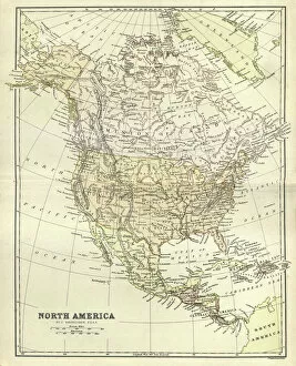
Background imageAmericas Collection: Antique map, North America, Canada and USA, 1884, 19th Century

Antique map, North America, Canada and USA, 1884, 19th Century
Vintage engraving of Antique map, North America, Canada and USA, 1884, 19th Century

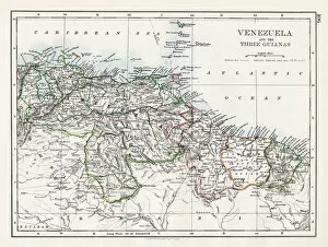
Background imageAmericas Collection: Venezuela and the Guayanas map 1897

Venezuela and the Guayanas map 1897
The World-Wide Atlas of Modern Geography, Political and Physical W. & A.K. Johnston - London 1897

Background imageAmericas Collection: Mexico map 1897

Mexico map 1897
The World-Wide Atlas of Modern Geography, Political and Physical W. & A.K. Johnston - London 1897

Background imageAmericas Collection: Map - Santa Fe Hotels and Dining Stations run by Fred Harvey

Map - Santa Fe Hotels and Dining Stations run by Fred Harvey
Map of the USA, showing the locations Santa Fe Hotels and Dining Stations under the management of Fred Harvey. Date: circa 1935

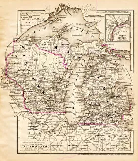
Background imageAmericas Collection: Wisconsin Michigan map 1881

Wisconsin Michigan map 1881
Coltons Common School Geography 1881 New York Sheldon and Co

Background imageAmericas Collection: Map of United States 1869

Map of United States 1869
Cornells Grammars-School Geography - S.S. Cornell - New York D. Appleton and Company 1869

Background imageAmericas Collection: Old map of California 1856

Old map of California 1856
Colton and Fitchs Modern School Geography by George W. Fitch - New York 1856

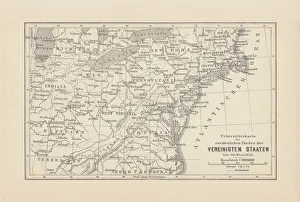
Background imageAmericas Collection: Map of Northeast United States, published in 1882

Map of Northeast United States, published in 1882
Map of the Northeast United States of America. Wood engraving, published in 1882

Background imageAmericas Collection: South America 1852 Map

South America 1852 Map

Background imageAmericas Collection: Antquie Map of The West Indies

Antquie Map of The West Indies
Vintage map of The West Indies from 1837

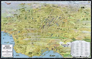
Background imageAmericas Collection: MAP: LOS ANGELES, 1932. Map of Greater Los Angeles, the wonder city of the world

MAP: LOS ANGELES, 1932. Map of Greater Los Angeles, the wonder city of the world. Lithograph, 1932

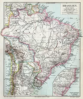
Background imageAmericas Collection: Brazil map 1895

Brazil map 1895
Meyers Konversations-Lexikon. Ein Nachschlagewerk des allgemeinen Wissens, 5th edition 17 volumes Bibliographisches Institut - Leipzig 1895-1897

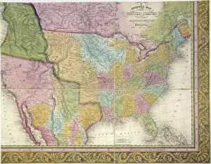
Background imageAmericas Collection: MAP: UNITED STATES, 1849. A General Map of the United States with the contiguous

MAP: UNITED STATES, 1849. A General Map of the United States with the contiguous British & Mexican Possessions: engraved map published, 1849, by Samuel A. Mitchell at Philadelphia

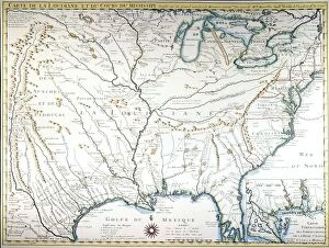
Background imageAmericas Collection: MAP OF COLONIAL AMERICA. Delisles map of colonial America, 1718, showing the Mississippi

MAP OF COLONIAL AMERICA. Delisles map of colonial America, 1718, showing the Mississippi valley in strikingly accurate detail and the first map to use Texas as a place-name

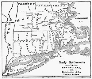
Background imageAmericas Collection: MAP: NEW ENGLAND COLONIES. Early settlements in New England and distribution of

MAP: NEW ENGLAND COLONIES. Early settlements in New England and distribution of Native American tribes

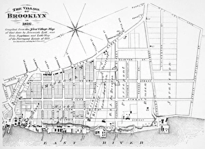
Background imageAmericas Collection: Map of the village of Brooklyn, New York, in 1816

Map of the village of Brooklyn, New York, in 1816
BROOKLYN MAP, 1816. Map of the village of Brooklyn, New York, in 1816

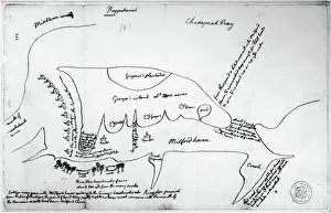
Background imageAmericas Collection: Map drawn by Thomas Jefferson of Milford Haven on Chesapeake Bay and vicinity

Map drawn by Thomas Jefferson of Milford Haven on Chesapeake Bay and vicinity
CHESAPEAKE BAY, 1776. Map drawn by Thomas Jefferson of Milford Haven on Chesapeake Bay and vicinity, showing camp on Gwynns Island and enemy fortifications, June or July 1776

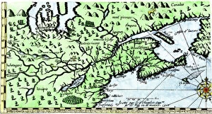
Background imageAmericas Collection: EXPL2A-00184

EXPL2A-00184
Part of the 1613 Samuel de Champlain map of New France. Hand-colored woodcut of a 19th-century reproduction of the original ma

Background imageAmericas Collection: World map, February 2004

World map, February 2004
World Map. Blue Marble: Next Generation cloud-free true-colour composite image of the Earth in February 2004. It is winter in the Northern Hemisphere and large areas of land are covered in snow

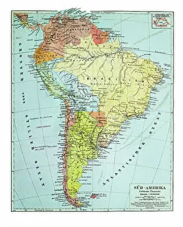
Background imageAmericas Collection: Old map of South America continent

Old map of South America continent
Antique Illustration. Copyright has expired on this artwork. From my own archives, digitally restored

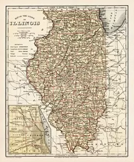
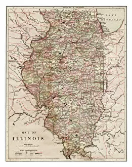
Background imageAmericas Collection: Map of Illinois 1889

Map of Illinois 1889
Indiana Educational Series The Complete Geography - Indianapolis 1889

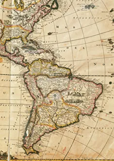
Background imageAmericas Collection: Map of America. Nova Totius Americae Descriptio by Frederik

Map of America. Nova Totius Americae Descriptio by Frederik
Nova Totius Americae Descriptio. Map of America. By Frederik de Wit (1630-1706). Amsterdam, 1666

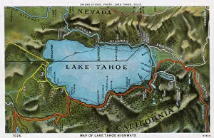
Background imageAmericas Collection: Map of the Lake Tahoe area, Nevada and California, USA

Map of the Lake Tahoe area, Nevada and California, USA, showing the highway system. Date: 1922

Background imageAmericas Collection: Map of United States 1867

Map of United States 1867
Mitchells Modern Atlas - Published by E.H. Buttler & Co - Philadelphia 1867

Background imageAmericas Collection: Ohio 1852 Map

Ohio 1852 Map

Background imageAmericas Collection: Wisconsin 1852 Map

Wisconsin 1852 Map

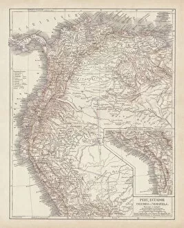
Background imageAmericas Collection: Peru, Ecuador, Colombia, Venezuela, lithograph, published in 1877

Peru, Ecuador, Colombia, Venezuela, lithograph, published in 1877
Ancient map of Peru, Ecuador, Colombia, and Venezuela. Lithograph, published in 1877

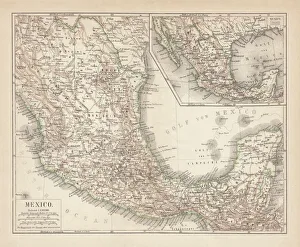
Background imageAmericas Collection: Mexico, ancient map, lithograph, published in 1877

Mexico, ancient map, lithograph, published in 1877
Ancient map of Mexico. Lithograph, published in 1877

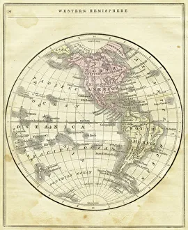
Background imageAmericas Collection: Western Hemisphere map 1856

Western Hemisphere map 1856
Colton and Fitchs Modern School Geography by George W. Fitch - New York 1856

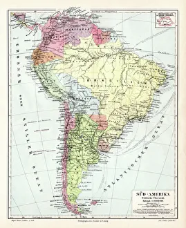
Background imageAmericas Collection: South America political map 1895

South America political map 1895
Meyers Konversations-Lexikon. Ein Nachschlagewerk des allgemeinen Wissens, 5th edition 17 volumes Bibliographisches Institut - Leipzig 1895-1897

Background imageAmericas Collection: North America political map 1895

North America political map 1895
Meyers Konversations-Lexikon. Ein Nachschlagewerk des allgemeinen Wissens, 5th edition 17 volumes Bibliographisches Institut - Leipzig 1895-1897

Background imageAmericas Collection: Indiana USA map 1881

Indiana USA map 1881
Encyclopedia Britannica 9th Edition Vol XII Philadelphia j.M. Stoddart & Co 1881

Background imageAmericas Collection: Illinois map 1881

Illinois map 1881
Encyclopedia Britannica 9th Edition Vol XII Philadelphia j.M. Stoddart & Co 1881

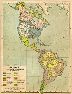
Background imageAmericas Collection: American ethnographic map

American ethnographic map
Illutration of American ethnographic map

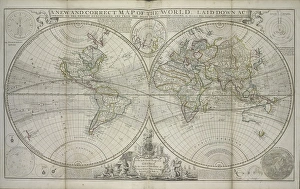
Background imageAmericas Collection: A new and correct map of the world laid down according to the newest discoveries

A new and correct map of the world laid down according to the newest discoveries
XOS1765728 A new and correct map of the world laid down according to the newest discoveries and from the most exact observations, 1736 (hand coloured print) by Moll

Background imageAmericas Collection: MAP: VANCOUVER ISLAND, 1859. Map of Vancouver Island and Washington Territory

MAP: VANCOUVER ISLAND, 1859. Map of Vancouver Island and Washington Territory, shwoing San Juan Island and the disputed territory. Map, 1859

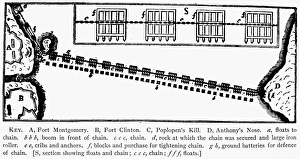
Background imageAmericas Collection: Plan of the chain across the Hudson River at Fort Montgomery

Plan of the chain across the Hudson River at Fort Montgomery
REVOLUTIONAY WAR PLAN. Plan of the chain across the Hudson River at Fort Montgomery

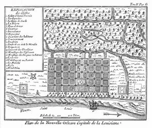
Background imageAmericas Collection: Plan of New Orleans, Louisiana, 1718-1720: engraving, French, 1753

Plan of New Orleans, Louisiana, 1718-1720: engraving, French, 1753
NEW ORLEANS, 1718-1720. Plan of New Orleans, Louisiana, 1718-1720: engraving, French, 1753

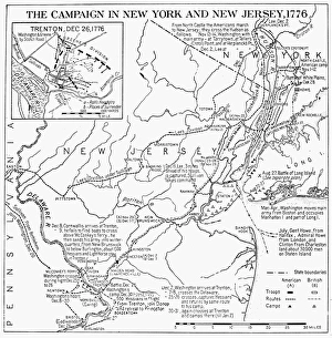
Background imageAmericas Collection: Plan of the campaign in New York and New Jersey during the American Revolutionary War, 1776

Plan of the campaign in New York and New Jersey during the American Revolutionary War, 1776
REVOLUTIONARY WAR MAP, 1776 Plan of the campaign in New York and New Jersey during the American Revolutionary War, 1776

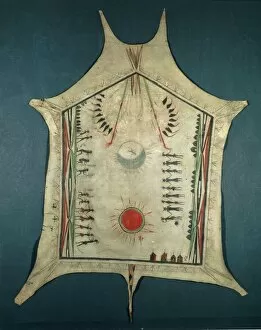
Background imageAmericas Collection: Map of Indian territories, depicting three villages of Quapaw tribe, painted buffalo skins

Map of Indian territories, depicting three villages of Quapaw tribe, painted buffalo skins, 18th Century
Cartography, United States of America, 18th century. Map of Indian territories, depicting three villages of the Quapaw tribe. Painted buffalo skins from mid 18th century. 189.4 x 146.5 cm

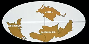
Background imageAmericas Collection: Continental Drift

Continental Drift
The world 380 million years ago during Lower Devonian Times, showing the three continents of Eur-America, Angara and Gondwanaland

Background imageAmericas Collection: Map of Nueva Espa񡠨1767) by Jos頁ntonio Alzate

Map of Nueva Espa񡠨1767) by Jos頁ntonio Alzate
Map of Nueva Espa񡠨 1767) by Jos頁 ntonio Alzate. Addressed to the Cardinal and General Inquisitor Francisco Antonio de Lorenzana. SPAIN. Madrid. Navy Museum

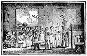
Background imageAmericas Collection: GRAMMAR SCHOOL, 1790s. A schoolmaster instructing a class at a school in New England, 1790s

GRAMMAR SCHOOL, 1790s. A schoolmaster instructing a class at a school in New England, 1790s. Wood engraving

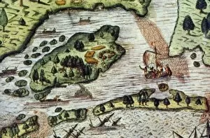
Background imageAmericas Collection: ROANOKE ISLAND, 1585. English settlers landing at Roanoke Island in 1585. Detail of a map, c1590

ROANOKE ISLAND, 1585. English settlers landing at Roanoke Island in 1585. Detail of a map, c1590

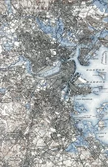
Background imageAmericas Collection: BOSTON MAP, 1903. A map of Boston, Massachusetts. Engraving, 1903

BOSTON MAP, 1903. A map of Boston, Massachusetts. Engraving, 1903

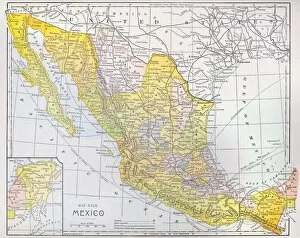
Background imageAmericas Collection: MAP: MEXICO. Color engraving, American, c1900

MAP: MEXICO. Color engraving, American, c1900

Background imageAmericas Collection: CANADA: MAP, 1872. Map of the boundary between British and American territory on the Pacific coast

CANADA: MAP, 1872. Map of the boundary between British and American territory on the Pacific coast, settled by the decision of the Emperor of Germany by arbitration in 1872

Background imageAmericas Collection: NIAGARA FALLS: BEAVERS, 1715. Beavers at Niagara Falls. Detail from Molls Map of North America, 1715

NIAGARA FALLS: BEAVERS, 1715. Beavers at Niagara Falls. Detail from Molls Map of North America, 1715


All Professionally Made to Order for Quick Shipping


-

Americas Collection

"Americas " refers to a collection of maps and charts that depict the geography, topography, climate, demographics, and other aspects of North America, Central America, South America, and the Caribbean. These maps and charts are used for educational purposes in schools and universities as well as by researchers studying various topics related to the Americas. They provide valuable information about landforms such as mountains, rivers, lakes; political boundaries between countries; population density; natural resources distribution; transportation networks; weather patterns among others. The use of these maps has helped people understand the complex nature of this vast region better.
+

Our beautiful pictures are available as Framed Prints, Photos, Wall Art and Photo Gifts

The Americas collection from Media Storehouse is a stunning assortment of wall art and framed prints that showcase the beauty and diversity of North, Central, and South America. Our collection features an extensive range of maps and charts that depict various regions, cities, countries, oceans, mountains, rivers, lakes as well as historical events such as explorations and discoveries. The artwork is available in different sizes to suit any space or decor style. Our collection offers a unique opportunity to explore the rich cultural heritage of the Americas through visually striking images. Whether you are looking for vintage maps or contemporary designs with bold colors or intricate details - our collection has something for everyone. These high-quality prints are perfect for home decoration or office spaces. The Americas collection from Media Storehouse provides an excellent way to appreciate the natural beauty and history of this vast continent while adding a touch of sophistication to your living space.
+

What are Americas (Maps and Charts) art prints?

America's Maps and Charts art prints are a collection of stunningly detailed, high-quality reproductions of historical maps and charts from the United States. These prints showcase the rich history and geography of America, featuring intricate details such as coastlines, rivers, mountains, cities, and landmarks. From antique maps dating back to the 18th century to modern-day topographical charts, this collection offers a wide range of styles and subjects for any decor or interest. Whether you're looking for a vintage map of your hometown or an artistic rendering of the Grand Canyon, there is something for everyone in this extensive collection. Each print is carefully crafted using state-of-the-art printing technology to ensure that every detail is captured with precision and accuracy. They are printed on high-quality paper stock that will last for years to come. America's Maps and Charts art prints make excellent gifts for history buffs or anyone who appreciates fine art. They can be framed or displayed as-is to add a touch of sophistication to any room in your home or office.
+

What Americas (Maps and Charts) art prints can I buy from Media Storehouse?

We offer a wide range of America's maps and charts art prints that you can buy. These include vintage maps, antique charts, historical diagrams, and contemporary cartography designs. You can choose from various sizes and formats such as framed or unframed prints, canvas wraps, or photographic prints. Some of the popular America's maps and charts art prints available at Media Storehouse are the Vintage Map of United States by John Melish (1816), Antique Chart of New York Harbor (1855), Historical Diagram Showing the Growth of American Railroads (1860-1890), Contemporary Map Artwork of Manhattan Island in New York City by Michael Tompsett, among others. Whether you're looking for a unique wall decor for your home or office space or searching for a special gift for someone who loves geography or history, we have plenty to offer when it comes to America's maps and charts art prints.
+

How do I buy Americas (Maps and Charts) art prints?

To buy America's maps and charts art prints from Media Storehouse, you can browse our extensive collection of high-quality images online. Once you have found the artwork that you want to purchase, simply select the size and format that suits your needs. You can choose from a range of options including canvas prints, framed prints, or unframed prints. When making your purchase, be sure to provide accurate shipping information so that your order is delivered promptly and securely. We offer a variety of payment options for your convenience. Whether you are looking for historical maps or contemporary chart art, we have something to suit every taste and budget. Their vast selection of fine art prints ensures that there is always something new to discover in their collection. So if you're looking to add some beautiful map or chart artwork to your home or office decor, look no further than Media Storehouse.
+

How much do Americas (Maps and Charts) art prints cost?

We offer a wide range of America-themed art prints including maps and charts. The cost of our art prints varies depending on the size, material, and framing options chosen by the customer. We provide high-quality paper or canvas options for our customers to choose from. Our America-themed art prints are perfect for those who love history, geography or simply want to add some unique decor to their homes or offices. Our collection includes vintage maps and charts that showcase different regions in America such as New York City, California, Florida among others. We take pride in offering affordable prices without compromising on quality. Our team ensures that every print is produced with precision and care so that you can enjoy it for years to come. If you're looking for beautiful America-themed art prints at reasonable prices then look no further than Media Storehouse.
+

How will my Americas (Maps and Charts) art prints be delivered to me?

We take pride in delivering your Americas art prints with utmost care. We use high-quality packaging materials to ensure that your print arrives in perfect condition. Depending on the size of the print you have ordered, it will be either rolled or flat-packed for delivery. For smaller prints, we use a sturdy cardboard envelope to protect them during transit. Larger prints are carefully wrapped in acid-free tissue paper before being placed inside a strong postal tube. This ensures that they remain safe and secure throughout their journey. We work with trusted courier partners who offer reliable delivery services across the world. Once your order has been dispatched, you will receive an email notification containing tracking information so that you can keep track of its progress. At Media Storehouse, our priority is to deliver your Americas art prints safely and efficiently so that they arrive at your doorstep ready to be enjoyed for years to come.