Fraud Blocker Skip to main content

Home > Maps and Charts > Americas

Americas Collection (page 6)

"Americas " refers to a collection of maps and charts that depict the geography, topography, climate, demographics, and other aspects of North America

7,880 items

Background imageAmericas Collection: COLONIAL AMERICA MAP. A map of the thirteen original American colonies, mid-18th century

COLONIAL AMERICA MAP. A map of the thirteen original American colonies, mid-18th century. Line engraving, late 19th century

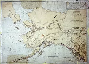
Background imageAmericas Collection: Alaska

Alaska, US Coast Survey, America 1869 Date: 1869

Background imageAmericas Collection: A Texans eye view of the USA

A Texans eye view of the USA, with a certain state having slightly more georgraphical significance than the physical reality....!! Date: circa 1930s

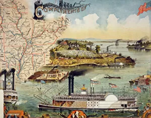
Background imageAmericas Collection: Mississippi river steamboat

Mississippi river steamboat. Steamboats on river with scenes of African-Americans on raft, picking cotton, and dancing and playing instruments. Map of southern states in upper left corner. Date c1895

Background imageAmericas Collection: BRAZIL: MAP AND NATIVE INDIANS. Portuguese map of Brazil, 1565, depicting a family of native Indians

BRAZIL: MAP AND NATIVE INDIANS. Portuguese map of Brazil, 1565, depicting a family of native Indians, one of whom is harvesting brazilwood trees (probably Caesalpinia echinata or Sappan)

Background imageAmericas Collection: SOUTH AMERICA: MAP, c1890. Published in the United States

SOUTH AMERICA: MAP, c1890. Published in the United States

Background imageAmericas Collection: Toscanellis world map, 1474

Toscanellis world map, 1474
Toscanellis world map. This map was drawn by the Italian mathematician and astronomer Paolo Toscanelli (1397-1482) in 1474

Background imageAmericas Collection: Providence, Rhode Island, 1664

Providence, Rhode Island, 1664
Map of Providence, Rhode Island, in 1664, showing property of original proprietors. Hand-colored 19th-century woodcut reproduction of the document

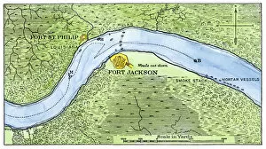
Background imageAmericas Collection: Lower Mississippi River defenses against Union ships, 1862

Lower Mississippi River defenses against Union ships, 1862
Route of the USS " Brooklyn" past Fort Jackson, Civil War battle of New Orleans, 1862. Hand-colored woodcut of a 19th-century illustration

Background imageAmericas Collection: Map of Vicksburg

Map of Vicksburg, Mississippi, during the US Civil War when Ulyssess Grant and his army of the Tennessee drove the Confederate army of John C Pemberton back to Vicksburg and besieged the city

Background imageAmericas Collection: Map of North America, 1845

Map of North America, 1845
Map of North America, showing the United States as they were pre-Civil War, 1845

Background imageAmericas Collection: First World War surveillance kite

First World War surveillance kite. US soldier being lifted up by a surveillance kite during the First World War (1914-1918)

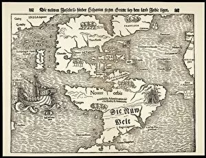
Background imageAmericas Collection: Maps / Americas 1540

Maps / Americas 1540
Map showing the discoveries by explorers during the first half-century after Columbus : note the confusion of India, Japan (Zipangri) and China (Cathay), & the Hesperides

Background imageAmericas Collection: Poster for 'Madame Butterfly 'and child with American flag

Poster for "Madame Butterfly "and child with American flag
LSE4093280 Poster for " Madame Butterfly " and child with American flag, poster for the opera by Giacomo Puccini, n.d. deb. 20th S.Ricordi editore

Background imageAmericas Collection: Portrait of General Stonewall Jackson (colour litho)

Portrait of General Stonewall Jackson (colour litho)
PNP263318 Portrait of General Stonewall Jackson (colour litho) by American School, (19th century); Private Collection; (add.info.: Jackson (1824-75); ); Peter Newark Military Pictures; American

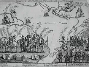
Background imageAmericas Collection: Liberty Triumphant, or the Downfall of Oppression, 1773 (engraving)

Liberty Triumphant, or the Downfall of Oppression, 1773 (engraving)
AQS331983 Liberty Triumphant, or the Downfall of Oppression, 1773 (engraving) by American School, (18th century); 23.2x33.7 cm; American Antiquarian Society, Worcester, Massachusetts

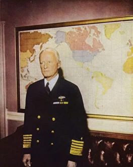
Background imageAmericas Collection: American admiral Chester W Nimitz, Commander in Chief of the US Pacific Fleet, World War II

American admiral Chester W Nimitz, Commander in Chief of the US Pacific Fleet, World War II, 1941-1945 (photo)
6015170 American admiral Chester W Nimitz, Commander in Chief of the US Pacific Fleet, World War II, 1941-1945 (photo) by American Photographer (19th century) (after); Private Collection; (add.info)

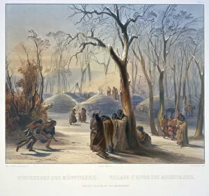
Background imageAmericas Collection: Winter Villiage of the Minatarres

Winter Villiage of the Minatarres
3673658 Winter Villiage of the Minatarres by Bodmer, Karl (1809-93); Newberry Library, Chicago, Illinois, USA; (add.info.: Travels in the interior of North America / by Maximilian)

Background imageAmericas Collection: A Chart of the Atlantic or Western Ocean, showing the track of Nelsons fleet

A Chart of the Atlantic or Western Ocean, showing the track of Nelsons fleet
3244750 A Chart of the Atlantic or Western Ocean, showing the track of Nelsons fleet, 12th May-15th August 1805, 1807 (engraving) by Faden, William (1750-1836); National Museum of the Royal Navy

Background imageAmericas Collection: Map of Virginia and Florida, 1667 (hand-coloured engraving, vellum)

Map of Virginia and Florida, 1667 (hand-coloured engraving, vellum)
985771 Map of Virginia and Florida, 1667 (hand-coloured engraving, vellum) by Blaeu, Joan (1596-1673) (after); 54.6x35.7 (folio size) cm; Private Collection; (add.info.: Map of Virginia and Florida)

Background imageAmericas Collection: North America map 1898

North America map 1898
Map from Physical Geography by R. S. Tarr - The MacMillan Company - London 1898

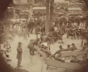
Background imageAmericas Collection: General Grants Council of War, Massaponax Church, Virginia, May 21, 1864

General Grants Council of War, Massaponax Church, Virginia, May 21, 1864

Background imageAmericas Collection: Map New York and vicinities 1889

Map New York and vicinities 1889
Comprehensive Geography by James Monteith - American Book Company 1882, 1889

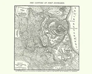
Background imageAmericas Collection: Map of the Battle of Fort Donelson, American Civil War

Map of the Battle of Fort Donelson, American Civil War
Vintage engraving of a Map of the Battle of Fort Donelson, during the American Civil War

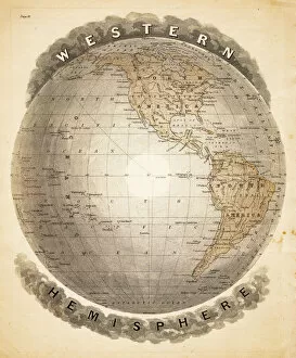
Background imageAmericas Collection: World western hemispheres 1883

World western hemispheres 1883
Warrens Common School Geography

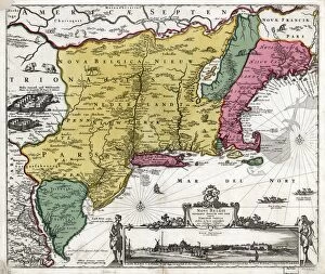
Background imageAmericas Collection: MAP: NEW NETHERLAND, 1685. Novi Belgii Novaeque Angliae

MAP: NEW NETHERLAND, 1685. Novi Belgii Novaeque Angliae
MAP: NEW NETHERLAND, 1685. Novi Belgii Novque Angli. A depiction of Dutch colonial possessions in North America in the mid 1600s. Map by Nicholaes Visscher, 1685

Background imageAmericas Collection: Map of Washington 1898

Map of Washington 1898
Antique illustration of a Map of Washington 1898

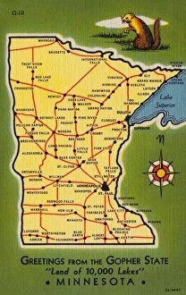
Background imageAmericas Collection: Minnesota State Map. ca. 1938, Minnesota, USA, GREETING FROM THE GOPHER STATE Land of 10

Minnesota State Map. ca. 1938, Minnesota, USA, GREETING FROM THE GOPHER STATE Land of 10, 000 Lakes MINNESOTA

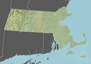
Background imageAmericas Collection: State of Massachusetts, United States, Relief Map

State of Massachusetts, United States, Relief Map
Relief map of the State of Massachusetts, United States. This image was compiled from data acquired by LANDSAT 5 & 7 satellites combined with elevation data

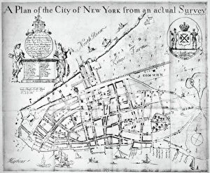
Background imageAmericas Collection: NEW YORK MAP, 1730. The Bradford Map or Lyne Survey of 1730. Line engraving, 1731

NEW YORK MAP, 1730. The Bradford Map or Lyne Survey of 1730. Line engraving, 1731

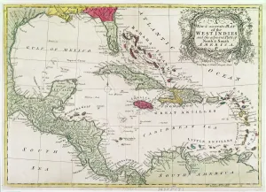
Background imageAmericas Collection: New and accurate map of the West Indies (colour litho)

New and accurate map of the West Indies (colour litho)
XCF274391 New and accurate map of the West Indies (colour litho) by American School; Private Collection; American, out of copyright

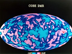
Background imageAmericas Collection: Microwave map of whole sky, c1990s

Microwave map of whole sky, c1990s. A map produced from one years data from NASAs COBE (Cosmic Background Explorer) satellite

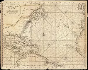
Background imageAmericas Collection: 1683, Mortier Map of North America, the West Indies, and the Atlantic Ocean, topography

1683, Mortier Map of North America, the West Indies, and the Atlantic Ocean, topography
1683, Mortier Map of North America, the West Indies, and the Atlantic Ocean

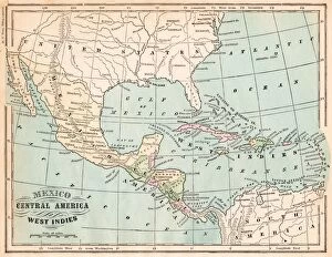
Background imageAmericas Collection: Mexico and West indies map 1875

Mexico and West indies map 1875
The Independent Course Comprehensive Geography by James Monteith, A.S. Barnes & Co, New York & Chicago 1875

Background imageAmericas Collection: Page from the Illustrated London News with map

Page from the Illustrated London News with map

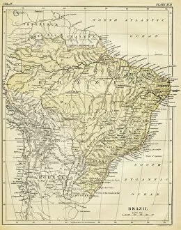
Background imageAmericas Collection: Map of Brazil 1878

Map of Brazil 1878
Encyclopedia Britannica 9th Edition Vol II New York, Samuel Hall 1878

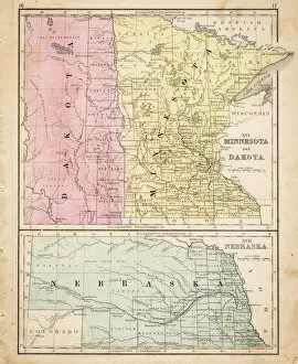
Background imageAmericas Collection: Dakota Missesota Nebraska map 1867

Dakota Missesota Nebraska map 1867
Mitchellas Modern Atlas - Published by E.H. Butler and Co - Philadelphia 1867

Background imageAmericas Collection: Map of countries first discovered by Christopher Columbus (1451-1506) 1500 (gouache

Map of countries first discovered by Christopher Columbus (1451-1506) 1500 (gouache
XIR226789 Map of countries first discovered by Christopher Columbus (1451-1506) 1500 (gouache and pen and ink on paper) (b/w photo) by Cosa, Juan de la (1460-1510); Museo Naval, Madrid

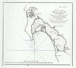
Background imageAmericas Collection: San Diego Bay, California, from the itinerary of La Perouse, 1782 (engraving)

San Diego Bay, California, from the itinerary of La Perouse, 1782 (engraving)
XIR1272876 San Diego Bay, California, from the itinerary of La Perouse, 1782 (engraving) by French School, (18th century); Private Collection; (add.info)

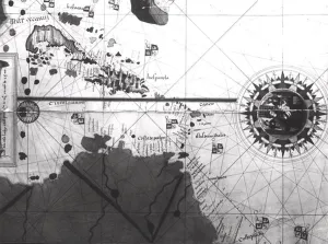
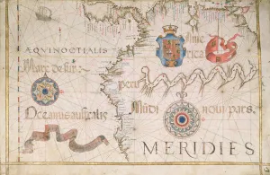
Background imageAmericas Collection: Peru and the Amazon, detail from a world atlas, 1565 (vellum)

Peru and the Amazon, detail from a world atlas, 1565 (vellum)
XJL208771 Peru and the Amazon, detail from a world atlas, 1565 (vellum) by Homem, Diego (16th century); The National Library of Russia, St. Petersburg, Russia; Portuguese, out of copyright

Background imageAmericas Collection: Portrait of Amerigo Vespucci (1454-1512) from The Narrative and Critical History

Portrait of Amerigo Vespucci (1454-1512) from The Narrative and Critical History
BAL111015 Portrait of Amerigo Vespucci (1454-1512) from The Narrative and Critical History of America, edited by Justin Winsor, London, 1886 (engraving) by English School

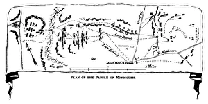
Background imageAmericas Collection: BATTLE OF MONMOUTH, 1778. Plan of the battle of Monmouth, New Jersey, 28 June 1778

BATTLE OF MONMOUTH, 1778. Plan of the battle of Monmouth, New Jersey, 28 June 1778. Line engraving, American, 1852

Background imageAmericas Collection: NEW YORK: ARMIES, 1776. Plan of the positions of the British and American armies in New York

NEW YORK: ARMIES, 1776. Plan of the positions of the British and American armies in New York, Long Island and Staten Island, 27 August 1776. Wood engraving, American, 1852

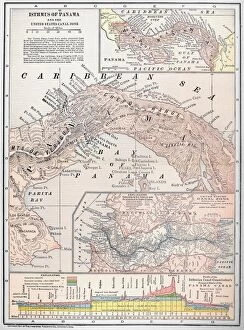
Background imageAmericas Collection: MAP: PANAMA, 1907. Map of Panama showing the United States Canal Zone and proposed route of canal

MAP: PANAMA, 1907. Map of Panama showing the United States Canal Zone and proposed route of canal. Color engraving, 1907

Background imageAmericas Collection: MAP OF NEW ENGLAND, c1674. Line engraving, c1674

MAP OF NEW ENGLAND, c1674. Line engraving, c1674

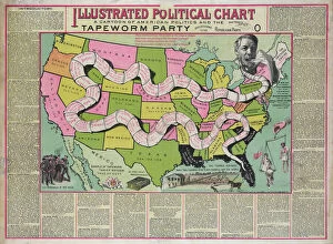
Background imageAmericas Collection: Illustrated political chart, a cartoon of American politics

Illustrated political chart, a cartoon of American politics and the Tapeworm Party. Print shows James G. Blaine as the head of a tapeworm made up of various government scandals over a map of

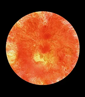
Background imageAmericas Collection: Topographic map of Venusian north polar region

Topographic map of Venusian north polar region
Colour-coded topographic map of the region surrounding Venus north pole. The view is centred on the pole and extends down to a latitude of 20 degrees north

Background imageAmericas Collection: HSET2A-00123

HSET2A-00123
Map of the principal westward trails in the 1800s. Hand-colored woodcut of a 19th-century illustration


All Professionally Made to Order for Quick Shipping


-

Americas Collection

"Americas " refers to a collection of maps and charts that depict the geography, topography, climate, demographics, and other aspects of North America, Central America, South America, and the Caribbean. These maps and charts are used for educational purposes in schools and universities as well as by researchers studying various topics related to the Americas. They provide valuable information about landforms such as mountains, rivers, lakes; political boundaries between countries; population density; natural resources distribution; transportation networks; weather patterns among others. The use of these maps has helped people understand the complex nature of this vast region better.
+

Our beautiful pictures are available as Framed Prints, Photos, Wall Art and Photo Gifts

The Americas collection from Media Storehouse is a stunning assortment of wall art and framed prints that showcase the beauty and diversity of North, Central, and South America. Our collection features an extensive range of maps and charts that depict various regions, cities, countries, oceans, mountains, rivers, lakes as well as historical events such as explorations and discoveries. The artwork is available in different sizes to suit any space or decor style. Our collection offers a unique opportunity to explore the rich cultural heritage of the Americas through visually striking images. Whether you are looking for vintage maps or contemporary designs with bold colors or intricate details - our collection has something for everyone. These high-quality prints are perfect for home decoration or office spaces. The Americas collection from Media Storehouse provides an excellent way to appreciate the natural beauty and history of this vast continent while adding a touch of sophistication to your living space.
+

What are Americas (Maps and Charts) art prints?

America's Maps and Charts art prints are a collection of stunningly detailed, high-quality reproductions of historical maps and charts from the United States. These prints showcase the rich history and geography of America, featuring intricate details such as coastlines, rivers, mountains, cities, and landmarks. From antique maps dating back to the 18th century to modern-day topographical charts, this collection offers a wide range of styles and subjects for any decor or interest. Whether you're looking for a vintage map of your hometown or an artistic rendering of the Grand Canyon, there is something for everyone in this extensive collection. Each print is carefully crafted using state-of-the-art printing technology to ensure that every detail is captured with precision and accuracy. They are printed on high-quality paper stock that will last for years to come. America's Maps and Charts art prints make excellent gifts for history buffs or anyone who appreciates fine art. They can be framed or displayed as-is to add a touch of sophistication to any room in your home or office.
+

What Americas (Maps and Charts) art prints can I buy from Media Storehouse?

We offer a wide range of America's maps and charts art prints that you can buy. These include vintage maps, antique charts, historical diagrams, and contemporary cartography designs. You can choose from various sizes and formats such as framed or unframed prints, canvas wraps, or photographic prints. Some of the popular America's maps and charts art prints available at Media Storehouse are the Vintage Map of United States by John Melish (1816), Antique Chart of New York Harbor (1855), Historical Diagram Showing the Growth of American Railroads (1860-1890), Contemporary Map Artwork of Manhattan Island in New York City by Michael Tompsett, among others. Whether you're looking for a unique wall decor for your home or office space or searching for a special gift for someone who loves geography or history, we have plenty to offer when it comes to America's maps and charts art prints.
+

How do I buy Americas (Maps and Charts) art prints?

To buy America's maps and charts art prints from Media Storehouse, you can browse our extensive collection of high-quality images online. Once you have found the artwork that you want to purchase, simply select the size and format that suits your needs. You can choose from a range of options including canvas prints, framed prints, or unframed prints. When making your purchase, be sure to provide accurate shipping information so that your order is delivered promptly and securely. We offer a variety of payment options for your convenience. Whether you are looking for historical maps or contemporary chart art, we have something to suit every taste and budget. Their vast selection of fine art prints ensures that there is always something new to discover in their collection. So if you're looking to add some beautiful map or chart artwork to your home or office decor, look no further than Media Storehouse.
+

How much do Americas (Maps and Charts) art prints cost?

We offer a wide range of America-themed art prints including maps and charts. The cost of our art prints varies depending on the size, material, and framing options chosen by the customer. We provide high-quality paper or canvas options for our customers to choose from. Our America-themed art prints are perfect for those who love history, geography or simply want to add some unique decor to their homes or offices. Our collection includes vintage maps and charts that showcase different regions in America such as New York City, California, Florida among others. We take pride in offering affordable prices without compromising on quality. Our team ensures that every print is produced with precision and care so that you can enjoy it for years to come. If you're looking for beautiful America-themed art prints at reasonable prices then look no further than Media Storehouse.
+

How will my Americas (Maps and Charts) art prints be delivered to me?

We take pride in delivering your Americas art prints with utmost care. We use high-quality packaging materials to ensure that your print arrives in perfect condition. Depending on the size of the print you have ordered, it will be either rolled or flat-packed for delivery. For smaller prints, we use a sturdy cardboard envelope to protect them during transit. Larger prints are carefully wrapped in acid-free tissue paper before being placed inside a strong postal tube. This ensures that they remain safe and secure throughout their journey. We work with trusted courier partners who offer reliable delivery services across the world. Once your order has been dispatched, you will receive an email notification containing tracking information so that you can keep track of its progress. At Media Storehouse, our priority is to deliver your Americas art prints safely and efficiently so that they arrive at your doorstep ready to be enjoyed for years to come.