Fraud Blocker Skip to main content

Home > Maps and Charts > Americas

Americas Collection (page 9)

"Americas " refers to a collection of maps and charts that depict the geography, topography, climate, demographics, and other aspects of North America

7,835 items

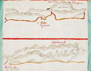
Quillota and Valpariso, South American Pacific coast, 1685 (manuscript)
7339772 Quillota and Valpariso, South American Pacific coast, 1685 (manuscript) by Hack, William (17th Century); 40x50 cm; National Maritime Museum, London

St George, South American Pacific coast, 1685 (manuscript)
7339767 St George, South American Pacific coast, 1685 (manuscript) by Hack, William (17th Century); 40x50 cm; National Maritime Museum, London

Chilca, 1685 (bound sheet)
7339762 Chilca, 1685 (bound sheet) by Hack, William (17th Century); 40x50 cm; National Maritime Museum, London, UK; (add.info.: Creator: William Hack South America, the Pacific Coast and Peru)

Guacho, 1685 (bound sheet)
7339756 Guacho, 1685 (bound sheet) by Hack, William (17th Century); 40x50 cm; National Maritime Museum, London, UK; (add.info.: Creator: William Hack South America, the Pacific Coast)

Pacasmayo and Malabrigo, 1685 (bound sheet)
7339742 Pacasmayo and Malabrigo, 1685 (bound sheet) by Hack, William (17th Century); 40x50 cm; National Maritime Museum, London, UK; (add.info.: Creator: William Hack South America)

Background imageAmericas Collection: The Bay of Colan & Port of Paita, 1685 (bound sheet)

The Bay of Colan & Port of Paita, 1685 (bound sheet)
7339735 The Bay of Colan & Port of Paita, 1685 (bound sheet) by Hack, William (17th Century); 40x50 cm; National Maritime Museum, London, UK; (add.info.: Creator: William Hack South America)

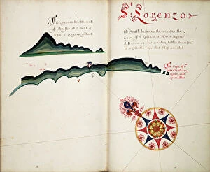
St Lorenzo, 1685 (bound sheet)
7339728 St Lorenzo, 1685 (bound sheet) by Hack, William (17th Century); 40x50 cm; National Maritime Museum, London, UK; (add.info.: Creator: William Hack South America, the Pacific Coast, Ecuador)

Rosario, 1685 (bound sheet)
7339721 Rosario, 1685 (bound sheet) by Hack, William (17th Century); 40x50 cm; National Maritime Museum, London, UK; (add.info.: Creator: William Hack South America, the Pacific Coast)

A description of the Sea Coast from Mta. Puercos to Bad Point, 1685 (bound sheet)
7339707 A description of the Sea Coast from Mta. Puercos to Bad Point, 1685 (bound sheet) by Hack, William (17th Century); 40x50 cm; National Maritime Museum, London

The Point of Meriato, 1685 (bound sheet)
7339706 The Point of Meriato, 1685 (bound sheet) by Hack, William (17th Century); 40x50 cm; National Maritime Museum, London, UK; (add.info.: Creator: William Hack North America, the Pacific Coast)

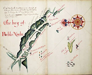
Background imageAmericas Collection: The Bay of Pueblo Nueba, 1685 (bound sheet)

The Bay of Pueblo Nueba, 1685 (bound sheet)
7339704 The Bay of Pueblo Nueba, 1685 (bound sheet) by Hack, William (17th Century); 40x50 cm; National Maritime Museum, London, UK; (add.info.: Creator: William Hack North America)

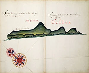
Background imageAmericas Collection: Telica, 1685 (bound sheet)

Telica, 1685 (bound sheet)
7339693 Telica, 1685 (bound sheet) by Hack, William (17th Century); 40x50 cm; National Maritime Museum, London, UK; (add.info.: Creator: William Hack North America, the Pacific Coast and Nicaragua)

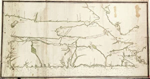
A description of the Plantations in the Valley of Paneca, 1685 (bound sheet)
7339686 A description of the Plantations in the Valley of Paneca, 1685 (bound sheet) by Hack, William (17th Century); 40x50 cm; National Maritime Museum, London

Guatimala, 1685 (bound sheet)
7339683 Guatimala, 1685 (bound sheet) by Hack, William (17th Century); 40x50 cm; National Maritime Museum, London, UK; (add.info.: Creator: William Hack North America, the Pacific Coast)

Arauco, 1682 (manuscript)
7339612 Arauco, 1682 (manuscript) by Ringrose, Basil (c.1653-83); 16x20 cm; National Maritime Museum, London, UK; (add.info.: Creator)

Rio Guayas, 1682 (coloured manuscript)
7339608 Rio Guayas, 1682 (coloured manuscript) by Ringrose, Basil (c.1653-83); 16x20 cm; National Maritime Museum, London, UK; (add.info.: Creator: Basil Ringrose Bound sheet. Col. ms)

Caribbean and coasts of America, 1572 (vellum)
7339653 Caribbean and coasts of America, 1572 (vellum) by Martines, Joan (1556-1590); 30x41 cm; National Maritime Museum, London

Isla Salanga and Santa Elena, 1682 (coloured manuscript)
7339605 Isla Salanga and Santa Elena, 1682 (coloured manuscript) by Ringrose, Basil (c.1653-83); 16x20 cm; National Maritime Museum, London, UK; (add.info.: Creator: Basil Ringrose Bound sheet. Col)

Punta Borrachos, Cabo Pasado and Bahia de Caraquez, 1682 (coloured manuscript)
7339602 Punta Borrachos, Cabo Pasado and Bahia de Caraquez, 1682 (coloured manuscript) by Ringrose, Basil (c.1653-83); 16x20 cm; National Maritime Museum, London

Cojimies, 1682 (coloured manuscript)
7339601 Cojimies, 1682 (coloured manuscript) by Ringrose, Basil (c.1653-83); 16x20 cm; National Maritime Museum, London, UK; (add.info.: Creator: Basil Ringrose Bound sheet. Col. ms)

Bahia San Mateo, 1682 (coloured manuscript)
7339600 Bahia San Mateo, 1682 (coloured manuscript) by Ringrose, Basil (c.1653-83); 16x20 cm; National Maritime Museum, London, UK; (add.info.: Creator: Basil Ringrose Bound sheet. Col. ms)

Map of Florida, 1775 (print)
7339547 Map of Florida, 1775 (print) by Jefferys, Thomas (c.1719-71); 27x37 cm; National Maritime Museum, London, UK; (add.info.: Creator: Thomas Jefferys; Robert Sayer Map on three sheets)

Nova Scotia, c.1760 (paper)
7339546 Nova Scotia, c.1760 (paper) by Unknown artist, (18th century); 47x92 cm; National Maritime Museum, London, UK; (add.info.: Creator: unknown From the Duff Collection)

Map of South America, c.1715 (coloured engraving)
7339355 Map of South America, c.1715 (coloured engraving) by Moll, Hermann (fl.1678-1732); 60x99 cm; National Maritime Museum, London, UK; (add.info.: Creator: Herman Moll Single sheet. Hand col)

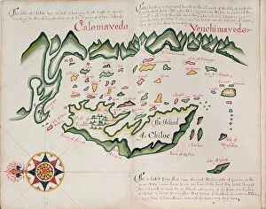
Background imageAmericas Collection: The island of Chiloe, 1685 (bound sheet)

The island of Chiloe, 1685 (bound sheet)
7339331 The island of Chiloe, 1685 (bound sheet) by Hack, William (17th Century); 40x50 cm; National Maritime Museum, London, UK; (add.info.: Creator: William Hack South America)

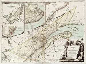
Map of Quebec, Canada, 1776 (coloured engraving)
7339450 Map of Quebec, Canada, 1776 (coloured engraving) by Sayer & Bennett (18th century); 50x67 cm; National Maritime Museum, London

Sapoticlan and Sacatepeque, 1685 (bound sheet)
7339681 Sapoticlan and Sacatepeque, 1685 (bound sheet) by Hack, William (17th Century); 40x50 cm; National Maritime Museum, London, UK; (add.info.: Creator: William Hack North America)

Background imageAmericas Collection: Iquique, Chile, 1682 (manuscript)

Iquique, Chile, 1682 (manuscript)
7339606 Iquique, Chile, 1682 (manuscript) by Ringrose, Basil (c.1653-83); 16x20 cm; National Maritime Museum, London, UK; (add.info.: Creator)

Background imageAmericas Collection: A new & exact map of the island of Barbados in America according to survey made in the years 1717

A new & exact map of the island of Barbados in America according to survey made in the years 1717 to 1721 by William
7295398 A new & exact map of the island of Barbados in America according to survey made in the years 1717 to 1721 by William Mayo, 1722 (technical drawing) by Senex

Gulf of Mexico and the Caribbean, from Blaeu's 'Atlas of the Americas', 17th century (coloured engraving)
7295352 Gulf of Mexico and the Caribbean, from Blaeu's 'Atlas of the Americas', 17th century (coloured engraving) by Blaeu, Joan (1596-1673); National Maritime Museum, London

Background imageAmericas Collection: A chart of the sea coasts of New England, New Jersey, Virginia

A chart of the sea coasts of New England, New Jersey, Virginia, Maryland and Carolina from Cape Cod to Cape Hatteras
7337587 A chart of the sea coasts of New England, New Jersey, Virginia, Maryland and Carolina from Cape Cod to Cape Hatteras, 1675 (engraving) by Seller

Background imageAmericas Collection: New York harbour, 1779 (coloured engraving)

New York harbour, 1779 (coloured engraving)
7337582 New York harbour, 1779 (coloured engraving) by DesBarres, Joseph Frederick Wallet (1721-1824); 81.5x60.5 cm; National Maritime Museum, London, UK; (add.info.: Creator: J.F.W)

Map of the city and environs of Philadelphia, 1777 (engraving)
7337532 Map of the city and environs of Philadelphia, 1777 (engraving) by Faden, William (1750-1836); 18.5x21.9 cm; National Maritime Museum, London

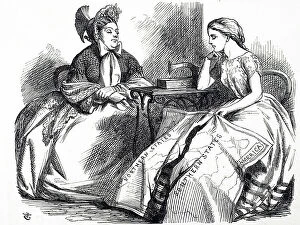
Background imageAmericas Collection: The American Civil War

The American Civil War
5310175 The American Civil War; (add.info.: Cartoon commenting on the American Civil War. A young woman holds a map of a divided United States. On the table next to her is an early sewing machine)

Map of England, Ireland, and Scotland based on Ptolemy's geography showing the island of Brazil just west of Ireland
MMM5473033 Map of England, Ireland, and Scotland based on Ptolemy's geography showing the island of Brazil just west of Ireland

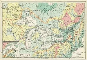
Physical Map of North America in the late 19th century. From North America, published 1883
480074 Physical Map of North America in the late 19th century. From North America, published 1883.; Private Collection

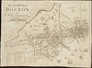
The town of Boston in New England, 1723-33 (engraving)
8703273 The town of Boston in New England, 1723-33 (engraving) by Bonner, John (c.1643-1726); Boston Public Library, Boston, Massachusetts

Map depicting a section of the Atlantic Ocean showing the Gulf Stream
5307365 Map depicting a section of the Atlantic Ocean showing the Gulf Stream.; (add.info.: Map depicting a section of the Atlantic Ocean showing the Gulf Stream)

Captain Meriwether Lewis (1774-1809) and Lieutenant William Clark (1770-1838)
NWI4923604 Captain Meriwether Lewis (1774-1809) and Lieutenant William Clark (1770-1838), American explorers with a map of their expedition through Louisiana to the Pacific Ocean between 1804

Map of the Golden Castile (Venezuela, Panama and Colombia) - Colorisee engraving
NWI4853016 Map of the Golden Castile (Venezuela, Panama and Colombia) - Colorisee engraving, 16th century by Cornelius van Wytfliet (1555-1597) - Castilia del Oro (Gold Coast)

Background imageAmericas Collection: Map of North America as it was in the middle of the 17th century

Map of North America as it was in the middle of the 17th century. Coloring engraving in "" Campanius"", 1702
NWI4852873 Map of North America as it was in the middle of the 17th century. Coloring engraving in "" Campanius"", 1702.; (add.info.: Map of North America as it was in the middle of the 17th century)

Background imageAmericas Collection: Map of the Great Lakes (Upper Lake, Lake Michigan, Lake Huron, Lake Ontario, Lake Erie) and the St

Map of the Great Lakes (Upper Lake, Lake Michigan, Lake Huron, Lake Ontario, Lake Erie) and the St
NWI4852650 Map of the Great Lakes (Upper Lake, Lake Michigan, Lake Huron, Lake Ontario, Lake Erie) and the St. Lawrence River Divide

Background imageAmericas Collection: Map of Hudson Bay and Detroit in the Arctic in Canada, 1662. From the travels of Henry Hudson

Map of Hudson Bay and Detroit in the Arctic in Canada, 1662. From the travels of Henry Hudson (1570-1611)
NWI4851002 Map of Hudson Bay and Detroit in the Arctic in Canada, 1662. From the travels of Henry Hudson (1570-1611), English explorer

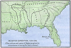
Background imageAmericas Collection: Map of the itinerary of the Spanish expedition of Hernando De Soto (1500-1542)

Map of the itinerary of the Spanish expedition of Hernando De Soto (1500-1542)
NWI4850788 Map of the itinerary of the Spanish expedition of Hernando De Soto (1500-1542) through the southeast of the United States, North America, 1539-1542

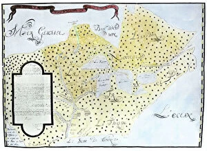
Background imageAmericas Collection: Map of Louisiana showing the Mississippi Way with its estuary in New France, 1744

Map of Louisiana showing the Mississippi Way with its estuary in New France, 1744
NWI4851384 Map of Louisiana showing the Mississippi Way with its estuary in New France, 1744. Colourful engraving of the 18th century.; (add.info)

Map of North American territories (from the polar circle to Central America) on the eve of the American revolution
NWI4852058 Map of North American territories (from the polar circle to Central America) on the eve of the American revolution, during the Paris trade in 1783

Map showing the distribution and new frontiers of the colonies of France in northern America after the French-American
NWI4852050 Map showing the distribution and new frontiers of the colonies of France in northern America after the French-American War, 1760

Map of New France (Canada with Lake Superior, Lake Huron, Lake Illinois and North America)
NWI4852017 Map of New France (Canada with Lake Superior, Lake Huron, Lake Illinois and North America) by Louis Jolliet Canadian explorer (1645-1700), 1673-1674


All Professionally Made to Order for Quick Shipping


-

Americas Collection

"Americas " refers to a collection of maps and charts that depict the geography, topography, climate, demographics, and other aspects of North America, Central America, South America, and the Caribbean. These maps and charts are used for educational purposes in schools and universities as well as by researchers studying various topics related to the Americas. They provide valuable information about landforms such as mountains, rivers, lakes; political boundaries between countries; population density; natural resources distribution; transportation networks; weather patterns among others. The use of these maps has helped people understand the complex nature of this vast region better.
+

Our beautiful pictures are available as Framed Prints, Photos, Wall Art and Photo Gifts

The Americas collection from Media Storehouse is a stunning assortment of wall art and framed prints that showcase the beauty and diversity of North, Central, and South America. Our collection features an extensive range of maps and charts that depict various regions, cities, countries, oceans, mountains, rivers, lakes as well as historical events such as explorations and discoveries. The artwork is available in different sizes to suit any space or decor style. Our collection offers a unique opportunity to explore the rich cultural heritage of the Americas through visually striking images. Whether you are looking for vintage maps or contemporary designs with bold colors or intricate details - our collection has something for everyone. These high-quality prints are perfect for home decoration or office spaces. The Americas collection from Media Storehouse provides an excellent way to appreciate the natural beauty and history of this vast continent while adding a touch of sophistication to your living space.
+

What are Americas (Maps and Charts) art prints?

America's Maps and Charts art prints are a collection of stunningly detailed, high-quality reproductions of historical maps and charts from the United States. These prints showcase the rich history and geography of America, featuring intricate details such as coastlines, rivers, mountains, cities, and landmarks. From antique maps dating back to the 18th century to modern-day topographical charts, this collection offers a wide range of styles and subjects for any decor or interest. Whether you're looking for a vintage map of your hometown or an artistic rendering of the Grand Canyon, there is something for everyone in this extensive collection. Each print is carefully crafted using state-of-the-art printing technology to ensure that every detail is captured with precision and accuracy. They are printed on high-quality paper stock that will last for years to come. America's Maps and Charts art prints make excellent gifts for history buffs or anyone who appreciates fine art. They can be framed or displayed as-is to add a touch of sophistication to any room in your home or office.
+

What Americas (Maps and Charts) art prints can I buy from Media Storehouse?

We offer a wide range of America's maps and charts art prints that you can buy. These include vintage maps, antique charts, historical diagrams, and contemporary cartography designs. You can choose from various sizes and formats such as framed or unframed prints, canvas wraps, or photographic prints. Some of the popular America's maps and charts art prints available at Media Storehouse are the Vintage Map of United States by John Melish (1816), Antique Chart of New York Harbor (1855), Historical Diagram Showing the Growth of American Railroads (1860-1890), Contemporary Map Artwork of Manhattan Island in New York City by Michael Tompsett, among others. Whether you're looking for a unique wall decor for your home or office space or searching for a special gift for someone who loves geography or history, we have plenty to offer when it comes to America's maps and charts art prints.
+

How do I buy Americas (Maps and Charts) art prints?

To buy America's maps and charts art prints from Media Storehouse, you can browse our extensive collection of high-quality images online. Once you have found the artwork that you want to purchase, simply select the size and format that suits your needs. You can choose from a range of options including canvas prints, framed prints, or unframed prints. When making your purchase, be sure to provide accurate shipping information so that your order is delivered promptly and securely. We offer a variety of payment options for your convenience. Whether you are looking for historical maps or contemporary chart art, we have something to suit every taste and budget. Their vast selection of fine art prints ensures that there is always something new to discover in their collection. So if you're looking to add some beautiful map or chart artwork to your home or office decor, look no further than Media Storehouse.
+

How much do Americas (Maps and Charts) art prints cost?

We offer a wide range of America-themed art prints including maps and charts. The cost of our art prints varies depending on the size, material, and framing options chosen by the customer. We provide high-quality paper or canvas options for our customers to choose from. Our America-themed art prints are perfect for those who love history, geography or simply want to add some unique decor to their homes or offices. Our collection includes vintage maps and charts that showcase different regions in America such as New York City, California, Florida among others. We take pride in offering affordable prices without compromising on quality. Our team ensures that every print is produced with precision and care so that you can enjoy it for years to come. If you're looking for beautiful America-themed art prints at reasonable prices then look no further than Media Storehouse.
+

How will my Americas (Maps and Charts) art prints be delivered to me?

We take pride in delivering your Americas art prints with utmost care. We use high-quality packaging materials to ensure that your print arrives in perfect condition. Depending on the size of the print you have ordered, it will be either rolled or flat-packed for delivery. For smaller prints, we use a sturdy cardboard envelope to protect them during transit. Larger prints are carefully wrapped in acid-free tissue paper before being placed inside a strong postal tube. This ensures that they remain safe and secure throughout their journey. We work with trusted courier partners who offer reliable delivery services across the world. Once your order has been dispatched, you will receive an email notification containing tracking information so that you can keep track of its progress. At Media Storehouse, our priority is to deliver your Americas art prints safely and efficiently so that they arrive at your doorstep ready to be enjoyed for years to come.