
Bosnia and Herzegovina Collection
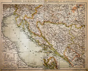
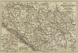
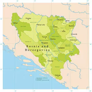
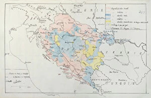
Bosnia and Herzegovina is a country located in southeastern Europe, bordered by Croatia to the north, Serbia to the east and Montenegro to the southeast
Choose a picture from our Bosnia and Herzegovina Collection for your Wall Art and Photo Gifts
58 items


All Professionally Made to Order for Quick Shipping
-
Bosnia and Herzegovina Collection
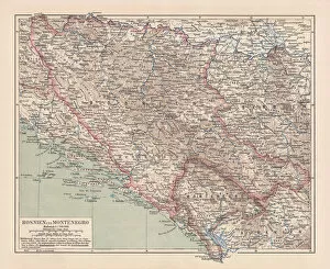
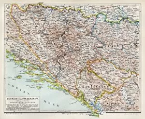
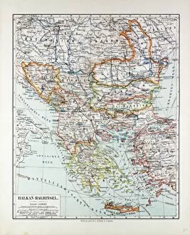
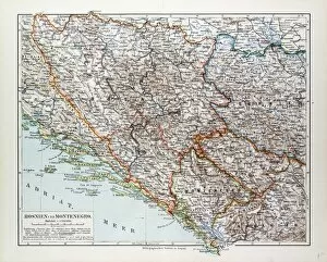
Bosnia and Herzegovina is a country located in southeastern Europe, bordered by Croatia to the north, Serbia to the east and Montenegro to the southeast. The country has a diverse geography with mountainous regions in the central and eastern parts of the country, while its western region comprises mostly of flatlands. A population of around 3.5 million people with Bosniaks being the largest ethnic group followed by Serbs and Croats. The official languages are Bosnian, Serbian, and Croatian. The economy heavily relies on services sector including tourism industry which contributes significantly towards GDP growth.
+
Our beautiful pictures are available as Framed Prints, Photos, Wall Art and Photo Gifts
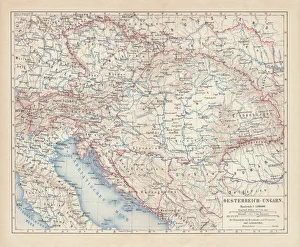
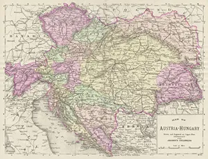
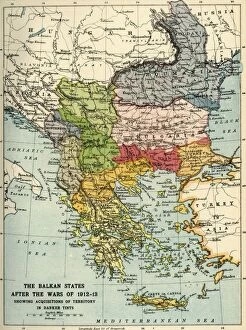
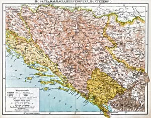
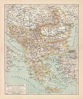
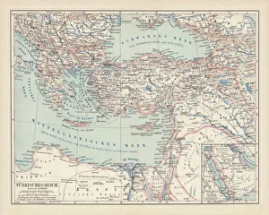
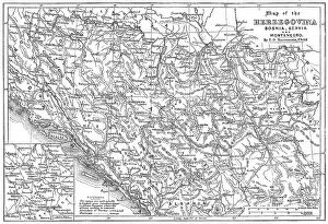
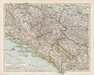
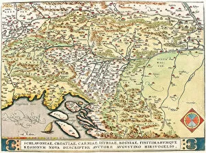
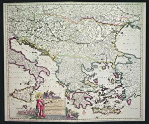
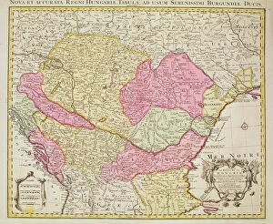
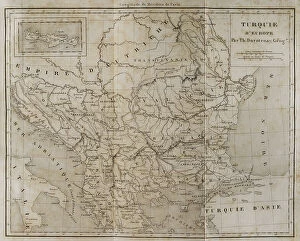
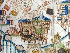
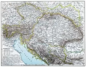
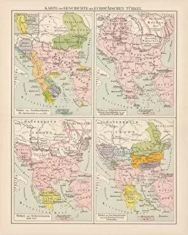
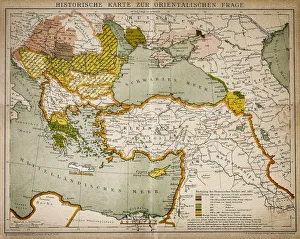
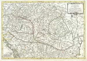
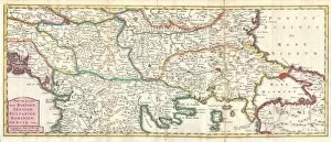
The Bosnia and Herzegovina collection from Media Storehouse offers a wide range of wall art and framed prints that showcase the beauty, history, and culture of this Balkan nation. Our collection features maps and charts that depict the country's geography, topography, political boundaries, historical landmarks, cities, towns, rivers, lakes as well as its diverse flora and fauna. These stunning images are available in various sizes to suit different spaces such as homes or offices. They are printed on high-quality paper using state-of-the-art printing technology to ensure their longevity. Our collection is perfect for anyone who loves history or wants to learn more about Bosnia and Herzegovina. Whether you're looking for a unique gift idea or want to add some character to your living space with beautiful wall art pieces that tell a story about this fascinating country; the Bosnia and Herzegovina Maps & Charts collection from Media Storehouse has something for everyone.
+
What are Bosnia and Herzegovina (Maps and Charts) art prints?
Bosnia and Herzegovina art prints are high-quality reproductions of maps and charts depicting the geography, topography, landmarks, and historical sites of Bosnia and Herzegovina. These prints are created using state-of-the-art printing technology on premium quality paper to ensure that every detail is captured with precision. The collection includes a wide range of maps and charts from different periods in history, including antique maps dating back to the 16th century as well as modern-day satellite images. These art prints are perfect for anyone interested in exploring the rich cultural heritage of Bosnia and Herzegovina or for those who simply appreciate beautiful cartography. They make great gifts for history buffs, travelers, or anyone looking to add a touch of sophistication to their home decor. Whether you're looking for a vintage map or a contemporary chart, there's something in this collection to suit every taste.
+
What Bosnia and Herzegovina (Maps and Charts) art prints can I buy from Media Storehouse?
We offer a wide range of Bosnia and Herzegovina art prints in the form of maps and charts. These prints are perfect for anyone interested in geography, history, or travel. The collection includes detailed topographical maps that showcase the country's diverse landscape, from its rugged mountains to its winding rivers and lakes. Additionally, there are historical maps that depict Bosnia and Herzegovina during different periods throughout history. For those interested in cultural heritage, Media Storehouse also has a selection of charts showcasing traditional Bosnian embroidery patterns as well as intricate designs found on Ottoman-era architecture. These prints would make excellent additions to any home or office decor. Whether you're looking for something educational or simply aesthetically pleasing, we have an extensive collection of Bosnia and Herzegovina map and chart art prints to choose from.
+
How do I buy Bosnia and Herzegovina (Maps and Charts) art prints?
To purchase Bosnia and Herzegovina art prints from Media Storehouse, you can browse our extensive collection of maps and charts online. Once you have found the print that you are interested in, simply add it to your cart and proceed to checkout. You will be prompted to enter your shipping information and payment details. We offer a variety of printing options for their art prints, including canvas, framed prints, and posters. Choose the option that best suits your needs. Their selection includes both historical maps as well as contemporary designs featuring landmarks and attractions throughout Bosnia and Herzegovina. Whether you are looking for a decorative piece for your home or office or need an educational resource for a classroom or library setting, we have something to offer. With high-quality printing techniques used on premium materials, these art prints are sure to make a lasting impression.
+
How much do Bosnia and Herzegovina (Maps and Charts) art prints cost?
We offer a wide range of Bosnia and Herzegovina maps and charts art prints at varying prices. Our collection includes vintage maps, topographic maps, city plans, and more. The cost of each print depends on various factors such as the size, type of paper used, and the complexity of the design. We ensure that our customers receive high-quality prints that are produced using state-of-the-art printing technology. Our prints are perfect for adding a touch of elegance to any room or office space. They also make great gifts for friends or family members who have an interest in geography or history. We take pride in offering affordable art prints without compromising on quality. We strive to provide our customers with excellent service by ensuring that their orders are processed promptly and delivered safely to their doorstep. If you're looking for beautiful Bosnia and Herzegovina map art prints at reasonable prices, look no further than Media Storehouse.
+
How will my Bosnia and Herzegovina (Maps and Charts) art prints be delivered to me?
We take great care in delivering your Bosnia and Herzegovina Maps and Charts art prints to you. We use high-quality packaging materials to ensure that your prints arrive in perfect condition. Our standard delivery service is reliable and efficient, with tracking information available so you can keep an eye on the progress of your order. We offer a range of delivery options depending on your location, including international shipping for customers outside of the UK. Your art prints will be carefully rolled up and placed inside a sturdy cardboard tube for safe transportation. Once your order has been dispatched, we will send you an email confirmation with all relevant details regarding delivery timescales and any tracking information available. If you have any questions or concerns about the delivery process, our customer service team are always happy to help.