Fraud Blocker Skip to main content

Home > Maps and Charts > France

France Collection (page 7)

France is a country located in Western Europe and has a total area of 643,801 square kilometers and a population of approximately 67 million people

13,183 items

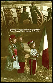
Background imageFrance Collection: First World War: France, Patriotic Map showing children in French soldier's uniform under an image

First World War: France, Patriotic Map showing children in French soldier's uniform under an image of soldiers at
LUX4738458 First World War: France, Patriotic Map showing children in French soldier's uniform under an image of soldiers at the front with the commentary: 'Now that the war is almost over

Background imageFrance Collection: First World War: France, Patriotic Map showing a little girl who thinks of the soldier

First World War: France, Patriotic Map showing a little girl who thinks of the soldier and has her bright future, 1916
LUX4738415 First World War: France, Patriotic Map showing a little girl who thinks of the soldier and has her bright future

Background imageFrance Collection: First World War: France, Patriotic Map showing four young children in Italian, English

First World War: France, Patriotic Map showing four young children in Italian, English
LUX4738404 First World War: France, Patriotic Map showing four young children in Italian, English, Belgian and Russian soldier uniforms around the French flag

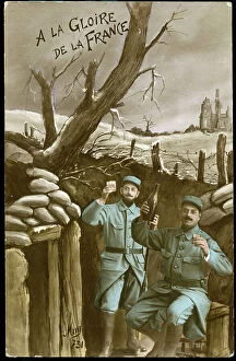
Background imageFrance Collection: First World War: France, Patriotic Map showing in a trench two soldier sen uniform toasting with

First World War: France, Patriotic Map showing in a trench two soldier sen uniform toasting with glasses of red wine
LUX4738377 First World War: France, Patriotic Map showing in a trench two soldier sen uniform toasting with glasses of red wine and a good bottle

Background imageFrance Collection: First World War: France, Patriotic Map showing a new born in his cradle thinking of his father in

First World War: France, Patriotic Map showing a new born in his cradle thinking of his father in battle waiting for
LUX4738341 First World War: France, Patriotic Map showing a new born in his cradle thinking of his father in battle waiting for his return as a vaicher

Background imageFrance Collection: First World War: France, Patriotic Map showing France and its flag protecting two little girls

First World War: France, Patriotic Map showing France and its flag protecting two little girls
LUX4737853 First World War: France, Patriotic Map showing France and its flag protecting two little girls, one Lorraine the other Alsatian, titled: 'The Reunion for Freedom'

Background imageFrance Collection: First World War: France, Patriotic Map showing the five new nes of five allies under

First World War: France, Patriotic Map showing the five new nes of five allies under the protective leadership of
LUX4738234 First World War: France, Patriotic Map showing the five new nes of five allies under the protective leadership of France, entitled: 'For Law, for Liberty, Peace through Victory'

Background imageFrance Collection: First World War: France, Patriotic Map showing a mother speaking of her father has her baby

First World War: France, Patriotic Map showing a mother speaking of her father has her baby sleeping in a bed decor by
LUX4738097 First World War: France, Patriotic Map showing a mother speaking of her father has her baby sleeping in a bed decor by a flag

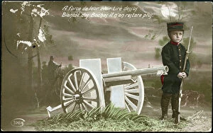
Background imageFrance Collection: First World War: France, Patriotic Map showing a child dislikes as a soldier with his rifle

First World War: France, Patriotic Map showing a child dislikes as a soldier with his rifle keeping guard in a bucolic
LUX4737662 First World War: France, Patriotic Map showing a child dislikes as a soldier with his rifle keeping guard in a bucolic decor next to a cannon 75

Background imageFrance Collection: Greece, Chania, Crete: French Military Circle of Officers. On the wall the Map of Turkey

Greece, Chania, Crete: French Military Circle of Officers. On the wall the Map of Turkey, the Black Sea
LUX4765228 Greece, Chania, Crete: French Military Circle of Officers. On the wall the Map of Turkey, the Black Sea. Letter and Newspaper Sorting Lockers, 1908 - Officers of 122; (add.info.: Greece)

Background imageFrance Collection: gut9896

gut9896
PCT5618415 gut9896; (add.info.: Crue de la Seine a Paris en janvier 1910 : plan de l'inondation en aglomeration dresse par M. Jules Petit, geometre en chef de la Ville de Paris)

Background imageFrance Collection: Mediterranean anchorages on the south coast of Spain from Spanish Government surveys of 1891

Mediterranean anchorages on the south coast of Spain from Spanish Government surveys of 1891
7342490 Mediterranean anchorages on the south coast of Spain from Spanish Government surveys of 1891, 1891-1913 (technical drawing) by British School

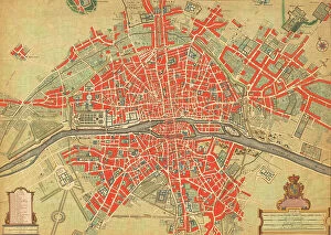
Background imageFrance Collection: 18th century map of Paris, France. (print)

18th century map of Paris, France. (print)
7420032 18th century map of Paris, France. (print); (add.info.: 18th century map of Paris, France with its suburbs and environs.); Photo © Ken Welsh. All rights reserved 2024

Background imageFrance Collection: Cosmographia (Geography) by Ptolemy, 1477 (book)

Cosmographia (Geography) by Ptolemy, 1477 (book)
7415661 Cosmographia (Geography) by Ptolemy, 1477 (book); Bibliotheque Nationale, Paris, France; (add.info.: Claude Ptolemy (c.90-168) Cosmographia (Geography) Printed by Dominicus de Lapis Bologna

Background imageFrance Collection: Chart of the Mediterranean, c.1640 (vellum)

Chart of the Mediterranean, c.1640 (vellum)
7339665 Chart of the Mediterranean, c.1640 (vellum) by Oliva, Joan (fl.16th-17th century); 33x54 cm; National Maritime Museum, London, UK; (add.info.: Creator: Joan Oliva Scale circa 1:7500000)

Background imageFrance Collection: Chart of Kos and Bodrum, c.1420 (vellum)

Chart of Kos and Bodrum, c.1420 (vellum)
7339627 Chart of Kos and Bodrum, c.1420 (vellum) by Buondelmonti, Cristoforo (1385-1430); 25x18 cm; National Maritime Museum, London

Background imageFrance Collection: Black Sea, chart of the South-West Coast of the Krimea from Cape Aia to Alma Bay

Black Sea, chart of the South-West Coast of the Krimea from Cape Aia to Alma Bay. By the officers of H.M.S.V
7339542 Black Sea, chart of the South-West Coast of the Krimea from Cape Aia to Alma Bay. By the officers of H.M.S.V. Spitfire

Background imageFrance Collection: A plan of the city and harbour of Louisburg, Cape Breton, 1750 (engraving)

A plan of the city and harbour of Louisburg, Cape Breton, 1750 (engraving)
7339513 A plan of the city and harbour of Louisburg, Cape Breton, 1750 (engraving) by Hinton, J. (18th century); 27x37 cm; National Maritime Museum, London, UK; (add.info.: Creator: J)

Background imageFrance Collection: Chart of the English Channel and the Atlantic coasts of southern Britain and northern France

Chart of the English Channel and the Atlantic coasts of southern Britain and northern France, 1692 (coloured engraving)
7339354 Chart of the English Channel and the Atlantic coasts of southern Britain and northern France, 1692 (coloured engraving) by Sanson D'Abbeville

Background imageFrance Collection: Chart of the western Mediterrean showing the north African and Spanish coasts

Chart of the western Mediterrean showing the north African and Spanish coasts, 17th century (ink on vellum)
7339121 Chart of the western Mediterrean showing the north African and Spanish coasts, 17th century (ink on vellum) by Unknown Artist, (17th century); 151.8x274.3 cm; National Maritime Museum

Background imageFrance Collection: Chart of the Mediterrean, showing Italy and the north African coast, 17th century (ink on vellum)

Chart of the Mediterrean, showing Italy and the north African coast, 17th century (ink on vellum)
7339119 Chart of the Mediterrean, showing Italy and the north African coast, 17th century (ink on vellum) by Unknown Artist, (17th century); 76.2x106.7 cm; National Maritime Museum, London

Background imageFrance Collection: First World War: France, Propaganda map showing the photo of an Alsatian spinning wool for France

First World War: France, Propaganda map showing the photo of an Alsatian spinning wool for France, 1915
LUX4734477 First World War: France, Propaganda map showing the photo of an Alsatian spinning wool for France, 1915; (add.info.: First World War - War 14-18 (1914-1918) - World War I (WWI or WW1)

Background imageFrance Collection: First World War: Patriotic map showing soldiers from Africa and India in the aid of the allies

First World War: Patriotic map showing soldiers from Africa and India in the aid of the allies, 1916, Baker
LUX4744489 First World War: Patriotic map showing soldiers from Africa and India in the aid of the allies, 1916, Baker; (add.info.: World War I - War 14-18 (1914-1918) - World War I (WWI or WW1)

Background imageFrance Collection: First World War: Patriotic map showing a soldier taking his fiancee to see the cinema map entitled

First World War: Patriotic map showing a soldier taking his fiancee to see the cinema map entitled The Cinema
LUX4744472 First World War: Patriotic map showing a soldier taking his fiancee to see the cinema map entitled The Cinema d'Amour

Background imageFrance Collection: Patriotic map showing a good sister to rescue a soldier wounds near the cathedrale of Reims in

Patriotic map showing a good sister to rescue a soldier wounds near the cathedrale of Reims in ruins map entitled Au
LUX4743817 Patriotic map showing a good sister to rescue a soldier wounds near the cathedrale of Reims in ruins map entitled Au seuil de la cathedrale pour la Patrie

Background imageFrance Collection: Patriotic map showing in a village of the Vosges a cure recomfort as a French soldier saying

Patriotic map showing in a village of the Vosges a cure recomfort as a French soldier saying the faith will lead our
LUX4743784 Patriotic map showing in a village of the Vosges a cure recomfort as a French soldier saying the faith will lead our blows

Background imageFrance Collection: First World War: Patriotic map showing a fight between the French and Germans in a village, 1915

First World War: Patriotic map showing a fight between the French and Germans in a village, 1915
LUX4744325 First World War: Patriotic map showing a fight between the French and Germans in a village, 1915, 'the resumption of the village'; (add.info)

Background imageFrance Collection: First World War: Patriotic Map of Allied Soldiers Fighting the Enemy, 1915, Baker, 'Towards Victory'

First World War: Patriotic Map of Allied Soldiers Fighting the Enemy, 1915, Baker, 'Towards Victory'
LUX4744324 First World War: Patriotic Map of Allied Soldiers Fighting the Enemy, 1915, Baker, 'Towards Victory'; (add.info.: World War I - War 14-18 (1914-1918) - World War I (WWI or WW1)

Background imageFrance Collection: First World War: Patriotic map showing a soldier holding a Prussian flag has his hand which he has

First World War: Patriotic map showing a soldier holding a Prussian flag has his hand which he has just taken
LUX4744308 First World War: Patriotic map showing a soldier holding a Prussian flag has his hand which he has just taken, congratulated by his superior and sent back to the front declaring

Background imageFrance Collection: First World War: Christmas Patriotic Map showing a child in a Bleriot plane thinking admiring over

First World War: Christmas Patriotic Map showing a child in a Bleriot plane thinking admiring over a dragon regiment
LUX4744256 First World War: Christmas Patriotic Map showing a child in a Bleriot plane thinking admiring over a dragon regiment

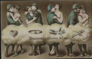
Background imageFrance Collection: Patriotic map showing four soldiers on leave retracing their engagement and titled 'Always

Patriotic map showing four soldiers on leave retracing their engagement and titled "Always and Still", 1916
LUX4743599 Patriotic map showing four soldiers on leave retracing their engagement and titled "Always and Still"

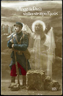
Background imageFrance Collection: Patriotic map showing a soldier in uniform in a trench protected by an angel

Patriotic map showing a soldier in uniform in a trench protected by an angel
LUX4743511 Patriotic map showing a soldier in uniform in a trench protected by an angel and titled "Angel of God please on my spousal"

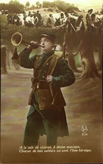
Background imageFrance Collection: First World War: Patriotic map showing a soldier making a bugle

First World War: Patriotic map showing a soldier making a bugle and saying To the voice of the bugle o Divine each of
LUX4744010 First World War: Patriotic map showing a soldier making a bugle and saying To the voice of the bugle o Divine each of our soldiers feels the heroic soul

Background imageFrance Collection: Patriotic map showing a little boy thinking of his brother who rests on the forehead behind a

Patriotic map showing a little boy thinking of his brother who rests on the forehead behind a barrel of bundles
LUX4743386 Patriotic map showing a little boy thinking of his brother who rests on the forehead behind a barrel of bundles and titled " Big Brother we are Proud of you"

Background imageFrance Collection: Patriotic map showing a war wounds heals by his wife and son disguises as a nurse who decorates

Patriotic map showing a war wounds heals by his wife and son disguises as a nurse who decorates him by saying "I
LUX4743341 Patriotic map showing a war wounds heals by his wife and son disguises as a nurse who decorates him by saying "I decorate you friend you deserve it"

Background imageFrance Collection: First World War: France, Patriotic Map showing a soldier in a flowery trench thinking about his

First World War: France, Patriotic Map showing a soldier in a flowery trench thinking about his fiancee while preparing
LUX4742598 First World War: France, Patriotic Map showing a soldier in a flowery trench thinking about his fiancee while preparing his soup

Background imageFrance Collection: First World War: France, Patriotic Map showing an American thinking of his fiancee ' keep my

First World War: France, Patriotic Map showing an American thinking of his fiancee " keep my though with
LUX4743174 First World War: France, Patriotic Map showing an American thinking of his fiancee " keep my though with you"" keep my mind with you, 1917

Background imageFrance Collection: First World War: France, Patriotic Map showing a young woman indicating the direction of the front

First World War: France, Patriotic Map showing a young woman indicating the direction of the front has a soldier
LUX4742496 First World War: France, Patriotic Map showing a young woman indicating the direction of the front has a soldier, or he must surrender

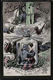
Background imageFrance Collection: First World War: France, Carte patriotique humoristique showing the different perfumes of hairy

First World War: France, Carte patriotique humoristique showing the different perfumes of hairy (old pipe)
LUX4742487 First World War: France, Carte patriotique humoristique showing the different perfumes of hairy (old pipe, cockroach...), 1918

Background imageFrance Collection: First World War: France, Patriotic Map showing a soldier contemplating traces of shells writing in

First World War: France, Patriotic Map showing a soldier contemplating traces of shells writing in the sky
LUX4742970 First World War: France, Patriotic Map showing a soldier contemplating traces of shells writing in the sky "Victory" and saying " this is no longer a dream

Background imageFrance Collection: First World War: France, Patriotic Map showing a soldier making the Military Salvation under a

First World War: France, Patriotic Map showing a soldier making the Military Salvation under a coin of 5 francs silver
LUX4742953 First World War: France, Patriotic Map showing a soldier making the Military Salvation under a coin of 5 francs silver

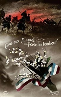
Background imageFrance Collection: First World War: France, Patriotic Map showing under scenes of combat from the front a graceful

First World War: France, Patriotic Map showing under scenes of combat from the front a graceful bouquet of thrush prote
LUX4742293 First World War: France, Patriotic Map showing under scenes of combat from the front a graceful bouquet of thrush prote happiness

Background imageFrance Collection: First World War: France, A child photograph glued to a patriotic map representing the flag of

First World War: France, A child photograph glued to a patriotic map representing the flag of allies including that of
LUX4742809 First World War: France, A child photograph glued to a patriotic map representing the flag of allies including that of Japan, 1914

Background imageFrance Collection: First World War: Patriotic map showing a swallow carrying in its beak a patritotic bouquet

First World War: Patriotic map showing a swallow carrying in its beak a patritotic bouquet surrounded by a tricolor
LUX4745073 First World War: Patriotic map showing a swallow carrying in its beak a patritotic bouquet surrounded by a tricolor ribbon

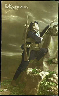
Background imageFrance Collection: First World War: Patriotic map showing an alpine hunter climbing a mountain with his luggage

First World War: Patriotic map showing an alpine hunter climbing a mountain with his luggage, 1915, 'climbing'
LUX4744987 First World War: Patriotic map showing an alpine hunter climbing a mountain with his luggage, 1915, 'climbing'; (add.info.: World War I - War 14-18 (1914-1918) - World War I (WWI or WW1)

Background imageFrance Collection: First World War: Patriotic map showing a bouquet of tricolor flower surrounded by angelot bearing

First World War: Patriotic map showing a bouquet of tricolor flower surrounded by angelot bearing the flags of
LUX4744965 First World War: Patriotic map showing a bouquet of tricolor flower surrounded by angelot bearing the flags of the allies

Background imageFrance Collection: First World War: Patriotic map showing the five flags of the allies with the commentary

First World War: Patriotic map showing the five flags of the allies with the commentary: 'They are also as many
LUX4744940 First World War: Patriotic map showing the five flags of the allies with the commentary: 'They are also as many, you will have to count with them'

Background imageFrance Collection: First World War: Patriotic map showing a photograph of the hotel of the church of

First World War: Patriotic map showing a photograph of the hotel of the church of Saint-Valery-en-Caux containing a
LUX4744898 First World War: Patriotic map showing a photograph of the hotel of the church of Saint-Valery-en-Caux containing a prayer for the Blessed Virgin and entitled: 'Memorial of the war 1914


All Professionally Made to Order for Quick Shipping


-

France Collection

France is a country located in Western Europe and has a total area of 643,801 square kilometers and a population of approximately 67 million people. The capital city is Paris, which is also the largest city in the country. France is known for its rich history, culture, cuisine, fashion and art and has diverse landscapes ranging from mountains to beaches and forests to vineyards. The economy is one of the largest in the world with major industries including tourism, agriculture, aerospace and technology. The country also has an extensive transportation network consisting of highways, railways and airports connecting it to other parts of Europe and beyond.
+

Our beautiful pictures are available as Framed Prints, Photos, Wall Art and Photo Gifts

The France collection from Media Storehouse is a stunning array of wall art and framed prints featuring maps and charts of various regions in France. Our collection showcases the beauty of French geography, highlighting its diverse landscapes, cities, rivers, mountains, and coastlines. From vintage maps to contemporary designs, our collection offers a wide range of styles to suit any taste or decor. Each print is expertly crafted using high-quality materials that ensure longevity and durability. The prints are available in different sizes to fit any space or wall size. Whether you're looking for an eye-catching focal point for your living room or office or want to add some French charm to your bedroom or kitchen walls, the France collection has something for everyone. Our collection is perfect for anyone who loves France's rich history and culture or wants to bring a touch of French elegance into their home.
+

What are France (Maps and Charts) art prints?

France art prints are high-quality reproductions of historical maps and charts depicting various regions of France. These prints showcase the intricate details and artistic styles of cartographers from different eras, providing a unique glimpse into the country's rich history. These art prints are perfect for those who appreciate vintage aesthetics or have an interest in geography, history, or French culture. They can be used to decorate homes, offices, classrooms, or any space that could benefit from a touch of sophistication and intellectual curiosity. We offer a wide selection of France art prints in various sizes and formats to suit different preferences. You can choose between framed or unframed options depending on their needs. With our commitment to quality printing techniques using archival materials ensures that these art prints will last for years without fading or deteriorating over time.
+

What France (Maps and Charts) art prints can I buy from Media Storehouse?

We offer a wide variety of France Maps and Charts art prints that are perfect for adding a touch of sophistication to any room. These art prints feature detailed maps and charts depicting the geography, history, culture, and landmarks of France. Whether you're looking for vintage or contemporary designs, we have something to suit every taste. Some popular options include antique maps of Paris, historical charts detailing the French Revolution, colorful illustrations showcasing famous French cities like Marseille or Lyon, and intricate topographical maps highlighting the diverse landscapes of France. These high-quality art prints are available in various sizes and formats such as canvas prints or framed prints. They make great gifts for anyone who loves travel or is interested in French culture. With so many beautiful options to choose from at Media Storehouse, you're sure to find the perfect addition to your home decor collection.
+

How do I buy France (Maps and Charts) art prints?

To buy France art prints from Media Storehouse, you can browse our extensive collection of artwork online. Once you have found the print that you would like to purchase, simply add it to your cart and proceed to checkout. During the checkout process, you will be prompted to enter your shipping information and payment details. We offer a range of sizes for their art prints, so make sure to select the size that best fits your needs. Additionally, we offer various framing options if you would like your print framed before delivery. Once your order has been placed, Media Storehouse will carefully package and ship your artwork directly to you. Their high-quality printing process ensures that each print is produced with vibrant colors and sharp detail. Whether as a gift or for personal use in decorating your home or office space, buying France art prints from Media Storehouse is an easy way to add beautiful artwork inspired by French culture into any setting.
+

How much do France (Maps and Charts) art prints cost?

We offer a wide range of France art prints at varying prices. Our collection includes vintage maps, antique charts, and contemporary illustrations that capture the beauty and history of France. The cost of our art prints depends on various factors such as size, framing options, and printing materials. We use high-quality paper stock to ensure that our art prints are long-lasting and retain their vibrant colors for years to come. Our you can choose from different sizes ranging from small to large formats depending on their preferences. Our France art prints make great gifts for friends or family members who love travel or have an interest in geography. They also add character to any living space or office setting with their unique designs. The cost of our France art prints is reasonable considering the quality of our products. We strive to provide affordable yet exceptional artwork that meets the needs of all our customers without compromising on quality.
+

How will my France (Maps and Charts) art prints be delivered to me?

We take great care in ensuring that your France art prints are delivered to you safely and securely. We use high-quality packaging materials to protect your artwork during transit, so you can be sure that it will arrive in pristine condition. All of our art prints are carefully rolled and placed into a sturdy cardboard tube for shipping. This ensures that the print is protected from any damage or creases during transportation. The tube is then sealed with tape to prevent any moisture or dust from entering. Once your order has been dispatched, you will receive an email notification with tracking information so you can keep track of its progress. Our delivery partners are reliable and experienced in handling delicate items like art prints, so you can rest assured that your order is in good hands. We strive to provide a seamless delivery experience for all our customers, ensuring their satisfaction with every purchase they make through us.