Fraud Blocker Skip to main content

Home > Maps and Charts > France

France Collection (page 9)

France is a country located in Western Europe and has a total area of 643,801 square kilometers and a population of approximately 67 million people

12,792 items

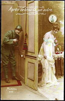
Patriotic humouristic map showing a soldier who finds his wife on leave and opening the door "After this hole there
LUX4743440 Patriotic humouristic map showing a soldier who finds his wife on leave and opening the door "After this hole there, another""

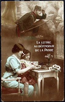
Background imageFrance Collection: Patriotic map showing a mother and daughter receiving a letter from the father at the front 'The

Patriotic map showing a mother and daughter receiving a letter from the father at the front "The letter to
LUX4743274 Patriotic map showing a mother and daughter receiving a letter from the father at the front "The letter to the defenseur de la Fatherland""

First World War: France, Patriotic Map showing in a bucolic trench a hairy with his pipe opening a gift package
LUX4742624 First World War: France, Patriotic Map showing in a bucolic trench a hairy with his pipe opening a gift package containing drink and chocolate, titled 'Thank you'

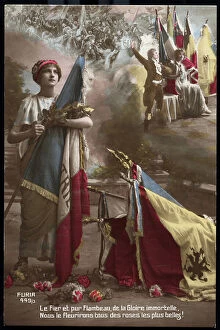
Background imageFrance Collection: First World War: France, Patriotic Map showing a young woman draped with all the flags of

First World War: France, Patriotic Map showing a young woman draped with all the flags of the Allies, 1915
LUX4742600 First World War: France, Patriotic Map showing a young woman draped with all the flags of the Allies, 1915; (add.info.: First World War - War 14-18 (1914-1918) - World War I (WWI or WW1)

Background imageFrance Collection: First World War: France, Patriotic Map showing a child disguise as a soldier in a bourgeois

First World War: France, Patriotic Map showing a child disguise as a soldier in a bourgeois interior accompanied by his
LUX4742589 First World War: France, Patriotic Map showing a child disguise as a soldier in a bourgeois interior accompanied by his mother asking him to go fight like his father, 1915

First World War: France, Patriotic Map showing a young woman contemplating a cannon 75 and saying
LUX4742373 First World War: France, Patriotic Map showing a young woman contemplating a cannon 75 and saying: 'For you tremble my sensitive heart, the cannon is awful plays'

First World War: France, Propaganda map showing a British tank in action, 1918
LUX4742268 First World War: France, Propaganda map showing a British tank in action, 1918; (add.info.: World War I - War 14-18 (1914-1918) - World War I (WWI or WW1): France

Background imageFrance Collection: First World War: France, Patriotic Map showing a wounded soldier recounting the fighting with his

First World War: France, Patriotic Map showing a wounded soldier recounting the fighting with his cane
LUX4742881 First World War: France, Patriotic Map showing a wounded soldier recounting the fighting with his cane and titled "" the story of the fight"""

Background imageFrance Collection: First World War: France, Patriotic Map showing a drum titled'' Victory Drum '''' That the enemy come

First World War: France, Patriotic Map showing a drum titled"" Victory Drum """" That the enemy come
LUX4742756 First World War: France, Patriotic Map showing a drum titled"" Victory Drum """" That the enemy come and retaliate drum from France is at his post

First World War: Patriotic map showing a soldier in uniform distributing flowers
LUX4745051 First World War: Patriotic map showing a soldier in uniform distributing flowers and eggs of Easter in the idyllic slices

First World War: Patriotic Map showing a helmet serving as a vase for a patriotic bouquet with the Caroussel Arc in
LUX4745047 First World War: Patriotic Map showing a helmet serving as a vase for a patriotic bouquet with the Caroussel Arc in the background, 1918, 'November 11

First World War: Patriotic map showing a woman with the harvest thinking of her husband, a soldier on the forehead
LUX4745369 First World War: Patriotic map showing a woman with the harvest thinking of her husband, a soldier on the forehead, and declaring 'thinking of you is a need'

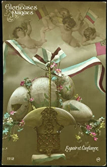
Background imageFrance Collection: First World War: Patriotic map showing in a Russian vase eggs painted with angelots bearing

First World War: Patriotic map showing in a Russian vase eggs painted with angelots bearing the flags of the allies
LUX4744935 First World War: Patriotic map showing in a Russian vase eggs painted with angelots bearing the flags of the allies, 1915, 'Glorious Easter

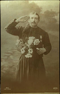
First World War: Patriotic map showing a Zouave in uniform with a medal making military salvation, 1917
LUX4745318 First World War: Patriotic map showing a Zouave in uniform with a medal making military salvation, 1917; (add.info.: World War I - War 14-18 (1914-1918) - World War I (WWI or WW1)

Background imageFrance Collection: First World War: Patriotic map showing General Joffre receiving a bouquet of flowers from four

First World War: Patriotic map showing General Joffre receiving a bouquet of flowers from four small Alsatians, 1915
LUX4745302 First World War: Patriotic map showing General Joffre receiving a bouquet of flowers from four small Alsatians, 1915

First World War: Patriotic map showing under a view of the city of Strasbourg a young Alsatian
LUX4744731 First World War: Patriotic map showing under a view of the city of Strasbourg a young Alsatian and her son imagining the soldiers on Clebert Square and titled Tomorrow

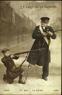
Background imageFrance Collection: First World War: Patriotic map showing a veteran with a wooden leg educating a young child to

First World War: Patriotic map showing a veteran with a wooden leg educating a young child to resistance
LUX4744552 First World War: Patriotic map showing a veteran with a wooden leg educating a young child to resistance and titled the School of Glory

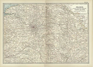
Map of France, c.1900 (engraving)
532949 Map of France, c.1900 (engraving); (add.info.: Map of north central France, in the vicinity of Paris, circa 1902, from the 10th edition of Encyclopaedia Britannica)

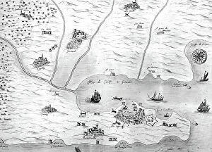
Map of gulf of Saint-Tropez, France, 17th century, engraving
1746062 Map of gulf of Saint-Tropez, France, 17th century, engraving; (add.info.: Map of gulf of Saint-Tropez, France, 17th century, engraving); Photo: Tallandier

Background imageFrance Collection: 19th Century Map of Paris with the River Seine depicted

19th Century Map of Paris with the River Seine depicted
1578945 19th Century Map of Paris with the River Seine depicted; (add.info.: 19th Century Map of Paris with the River Seine depicted. Dated 1880); Universal History Archive/UIG

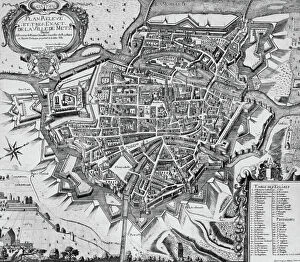
Map of Metz (Lorraine, France) with fortifications by Vauban, engraving by Molina, 1696
1758143 Map of Metz (Lorraine, France) with fortifications by Vauban, engraving by Molina, 1696; (add.info.: Map of Metz (Lorraine, France) with fortifications by Vauban, engraving by Molina

Montpellier, France : map of citadel (1624-1627), engraving, 17th century
1759479 Montpellier, France : map of citadel (1624-1627), engraving, 17th century; (add.info.: Montpellier (Herault) : plan de la citadelle (1624-1627), gravure, 17e siecle Montpellier

Map of Montpellier, France, with the citadel, engraving, c. 1770
1759340 Map of Montpellier, France, with the citadel, engraving, c. 1770; (add.info.: Map of Montpellier, France, with the citadel, engraving, c. 1770); Photo: Tallandier

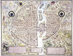
Map of Paris in 1540 with Philippe-Auguste wall, 19th century (engraving)
1801358 Map of Paris in 1540 with Philippe-Auguste wall, 19th century (engraving); (add.info.: Map of Paris in 1540 : wee see the Philippe-Auguste wall, measuring 5km long and 10m high)

Map of the town of Saint Omer, 17th century, engraving
1758361 Map of the town of Saint Omer, 17th century, engraving; (add.info.: Map of the town of Saint Omer, 17th century, engraving); Photo: Tallandier

Orleans before Joan of Arc's Entry (litho)
8652540 Orleans before Joan of Arc's Entry (litho) by Bartholomew, John George (1860-1920) ; Private Collection; (add.info.: Orleans before Joan of Arc's Entry)

L'Atlas des Vins de France: Region des Graves (b/w photo)
8675264 L'Atlas des Vins de France: Region des Graves (b/w photo) by French Photographer, (20th century); Private Collection; (add.info.: Region des Graves)

L'Atlas des Vins de France: Region du Medoc (b/w photo)
8675216 L'Atlas des Vins de France: Region du Medoc (b/w photo) by French Photographer, (20th century); Private Collection; (add.info.: Region du Medoc)

L'Atlas des Vins de France: Rive Gauche, Region de Sauternes et Barsac Region de Cerons, Rive Droite
8675208 L'Atlas des Vins de France: Rive Gauche, Region de Sauternes et Barsac Region de Cerons, Rive Droite, Sainte-Croix-du-Mont Loupiac, etc (b/w photo) by French Photographer

Battle of Salamis, 480 BC (engraving)
8663911 Battle of Salamis, 480 BC (engraving) by German School, (20th century); Private Collection; (add.info.: Map showing the Greek and Persian fleets at the Battle of Salamis, 480 BC)

Map of Switzerland (litho)
8661130 Map of Switzerland (litho) by English School, (20th century); Private Collection; (add.info.: Map of Switzerland. The Swiss nation offers an instance of a unique historical freak)

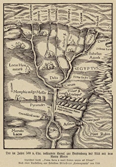
Canal connecting the Nile and the Red Sea, 500 BC (engraving)
8663872 Canal connecting the Nile and the Red Sea, 500 BC (engraving) by German School, (16th century) (after); Private Collection; (add.info.: Canal connecting the Nile and the Red Sea, Egypt)

Background imageFrance Collection: Map of the north western coast of Africa, from the Strait of Gibraltar to the Canary Islands

Map of the north western coast of Africa, from the Strait of Gibraltar to the Canary Islands, 1753 (engraving)
7339418 Map of the north western coast of Africa, from the Strait of Gibraltar to the Canary Islands, 1753 (engraving) by Bellin, Jacques Nicolas (1703-72) ; 63.5x93.5 cm; National Maritime Museum

Map of Acadia, 17th century colony of New France in northeastern North America, and the water highway to Canada
2603482 Map of Acadia, 17th century colony of New France in northeastern North America, and the water highway to Canada. From The History of Our Country, published 1899

Background imageFrance Collection: Revolt des vignerons du Midi in 1907 (postcard)

Revolt des vignerons du Midi in 1907 (postcard)
PCT4264100 Revolt des vignerons du Midi in 1907 (postcard); (add.info.: Revolt des vignerons du Midi in 1907: postcard showing the "" chef des gueux""" Marcelin (Marcellin) Albert

Map of France at the end of the regne of King Louis XIV and after the treats of Utrecht and Rastadt between 1643
ELD4930134 Map of France at the end of the regne of King Louis XIV and after the treats of Utrecht and Rastadt between 1643 and 1715

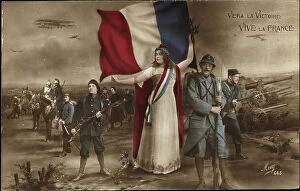
Background imageFrance Collection: Patriotic map showing the republic in the midst of all its defenseur who represents all

Patriotic map showing the republic in the midst of all its defenseur who represents all the different army bodies ""
LUX4743569 Patriotic map showing the republic in the midst of all its defenseur who represents all the different army bodies "" Vers la Victoire, Vive la France""

Background imageFrance Collection: First World War: France, Patriotic Map showing a woman and her child reading the letters of

First World War: France, Patriotic Map showing a woman and her child reading the letters of the father
LUX4740269 First World War: France, Patriotic Map showing a woman and her child reading the letters of the father and husband at the front and saying: 'We are happy to read your letters'

Background imageFrance Collection: First World War: France, A woman reads a letter thinking about her fiance

First World War: France, A woman reads a letter thinking about her fiance, map titled: 'Thinking about her', 1918
LUX4740152 First World War: France, A woman reads a letter thinking about her fiance, map titled: 'Thinking about her', 1918; (add.info)

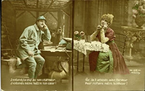
First World War: France, Patriotic Map showing a hairy in his trench cabin elbow resting on a telephone dictionary with
LUX4738586 First World War: France, Patriotic Map showing a hairy in his trench cabin elbow resting on a telephone dictionary with his fiance lying in a luxurious apartment

Background imageFrance Collection: First World War: France, Patriotic Map showing France with its Phrygian cap

First World War: France, Patriotic Map showing France with its Phrygian cap and sword announcing triumph for 1915
LUX4739603 First World War: France, Patriotic Map showing France with its Phrygian cap and sword announcing triumph for 1915, titled: '1915 towards triumph in the Auroral Year'

Patriotic map showing an allegory of Joan of Arc with flag, sword, and cross, titled 'faith, hope', 1914
LUX4728332 Patriotic map showing an allegory of Joan of Arc with flag, sword, and cross, titled 'faith, hope', 1914; (add.info.: Patriotic map showing an allegory of Joan of Arc with flag, sword)

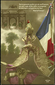
First World War: Patriotic map showing a Gallic rooster terassing the German eagle and its flag, 1917
LUX4745183 First World War: Patriotic map showing a Gallic rooster terassing the German eagle and its flag, 1917; (add.info.: World War I - War 14-18 (1914-1918) - World War I (WWI or WW1)

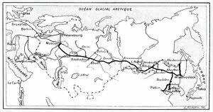
Route of Trans - Siberian Railway
2603882 Route of Trans - Siberian Railway; (add.info.: The route of the Trans - Siberian Railway. From "La Nature", Paris, 1904. Engraving)

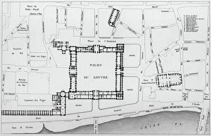
Map of the Louvre area in 1836 in Paris : c : the Louvre palace, engraving by Dufour after Hoffbauer
1760479 Map of the Louvre area in 1836 in Paris : c : the Louvre palace, engraving by Dufour after Hoffbauer; (add.info.: Map of the Louvre area in 1836 in Paris : c : the Louvre palace)

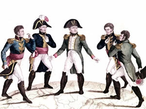
cartoon of French emperor Napoleon 1st positioning his four brothers (Joseph king of Naples and Sicily)
1749617 cartoon of French emperor Napoleon 1st positioning his four brothers (Joseph king of Naples and Sicily and later king of Spain, Lucien prince of Canino, Louis king of Holland)

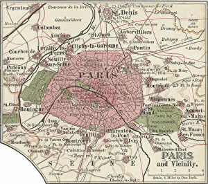
Background imageFrance Collection: Map of Paris, c.1900 (engraving)

Map of Paris, c.1900 (engraving)
532819 Map of Paris, c.1900 (engraving); (add.info.: Map of Paris, circa 1900, from the 10th edition of Encyclopaedia Britannica.); Encyclopaedia Britannica/UIG

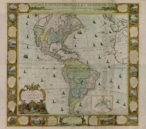
Map of America
2902810 Map of America; (add.info.: Map of America, Western Hemisphere, 1781.); Buyenlarge Archive/UIG


All Professionally Made to Order for Quick Shipping


-

France Collection

France is a country located in Western Europe and has a total area of 643,801 square kilometers and a population of approximately 67 million people. The capital city is Paris, which is also the largest city in the country. France is known for its rich history, culture, cuisine, fashion and art and has diverse landscapes ranging from mountains to beaches and forests to vineyards. The economy is one of the largest in the world with major industries including tourism, agriculture, aerospace and technology. The country also has an extensive transportation network consisting of highways, railways and airports connecting it to other parts of Europe and beyond.
+

Our beautiful pictures are available as Framed Prints, Photos, Wall Art and Photo Gifts

The France collection from Media Storehouse is a stunning array of wall art and framed prints featuring maps and charts of various regions in France. Our collection showcases the beauty of French geography, highlighting its diverse landscapes, cities, rivers, mountains, and coastlines. From vintage maps to contemporary designs, our collection offers a wide range of styles to suit any taste or decor. Each print is expertly crafted using high-quality materials that ensure longevity and durability. The prints are available in different sizes to fit any space or wall size. Whether you're looking for an eye-catching focal point for your living room or office or want to add some French charm to your bedroom or kitchen walls, the France collection has something for everyone. Our collection is perfect for anyone who loves France's rich history and culture or wants to bring a touch of French elegance into their home.
+

What are France (Maps and Charts) art prints?

France art prints are high-quality reproductions of historical maps and charts depicting various regions of France. These prints showcase the intricate details and artistic styles of cartographers from different eras, providing a unique glimpse into the country's rich history. These art prints are perfect for those who appreciate vintage aesthetics or have an interest in geography, history, or French culture. They can be used to decorate homes, offices, classrooms, or any space that could benefit from a touch of sophistication and intellectual curiosity. We offer a wide selection of France art prints in various sizes and formats to suit different preferences. You can choose between framed or unframed options depending on their needs. With our commitment to quality printing techniques using archival materials ensures that these art prints will last for years without fading or deteriorating over time.
+

What France (Maps and Charts) art prints can I buy from Media Storehouse?

We offer a wide variety of France Maps and Charts art prints that are perfect for adding a touch of sophistication to any room. These art prints feature detailed maps and charts depicting the geography, history, culture, and landmarks of France. Whether you're looking for vintage or contemporary designs, we have something to suit every taste. Some popular options include antique maps of Paris, historical charts detailing the French Revolution, colorful illustrations showcasing famous French cities like Marseille or Lyon, and intricate topographical maps highlighting the diverse landscapes of France. These high-quality art prints are available in various sizes and formats such as canvas prints or framed prints. They make great gifts for anyone who loves travel or is interested in French culture. With so many beautiful options to choose from at Media Storehouse, you're sure to find the perfect addition to your home decor collection.
+

How do I buy France (Maps and Charts) art prints?

To buy France art prints from Media Storehouse, you can browse our extensive collection of artwork online. Once you have found the print that you would like to purchase, simply add it to your cart and proceed to checkout. During the checkout process, you will be prompted to enter your shipping information and payment details. We offer a range of sizes for their art prints, so make sure to select the size that best fits your needs. Additionally, we offer various framing options if you would like your print framed before delivery. Once your order has been placed, Media Storehouse will carefully package and ship your artwork directly to you. Their high-quality printing process ensures that each print is produced with vibrant colors and sharp detail. Whether as a gift or for personal use in decorating your home or office space, buying France art prints from Media Storehouse is an easy way to add beautiful artwork inspired by French culture into any setting.
+

How much do France (Maps and Charts) art prints cost?

We offer a wide range of France art prints at varying prices. Our collection includes vintage maps, antique charts, and contemporary illustrations that capture the beauty and history of France. The cost of our art prints depends on various factors such as size, framing options, and printing materials. We use high-quality paper stock to ensure that our art prints are long-lasting and retain their vibrant colors for years to come. Our you can choose from different sizes ranging from small to large formats depending on their preferences. Our France art prints make great gifts for friends or family members who love travel or have an interest in geography. They also add character to any living space or office setting with their unique designs. The cost of our France art prints is reasonable considering the quality of our products. We strive to provide affordable yet exceptional artwork that meets the needs of all our customers without compromising on quality.
+

How will my France (Maps and Charts) art prints be delivered to me?

We take great care in ensuring that your France art prints are delivered to you safely and securely. We use high-quality packaging materials to protect your artwork during transit, so you can be sure that it will arrive in pristine condition. All of our art prints are carefully rolled and placed into a sturdy cardboard tube for shipping. This ensures that the print is protected from any damage or creases during transportation. The tube is then sealed with tape to prevent any moisture or dust from entering. Once your order has been dispatched, you will receive an email notification with tracking information so you can keep track of its progress. Our delivery partners are reliable and experienced in handling delicate items like art prints, so you can rest assured that your order is in good hands. We strive to provide a seamless delivery experience for all our customers, ensuring their satisfaction with every purchase they make through us.