Fraud Blocker Skip to main content

Home > Maps and Charts > Georgia

Georgia Collection

Georgia is a state located in the southeastern region of the United States

Choose a picture from our Georgia Collection for your Wall Art and Photo Gifts

460 items

Background imageGeorgia Collection: Illustrated map of Augusta National Golf Course, Augusta, Georgia, USA

Illustrated map of Augusta National Golf Course, Augusta, Georgia, USA

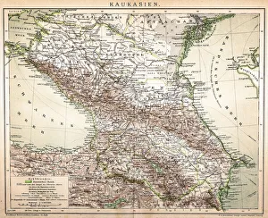
Background imageGeorgia Collection: Old Caucasus map

Old Caucasus map
Antique map of Caucasus

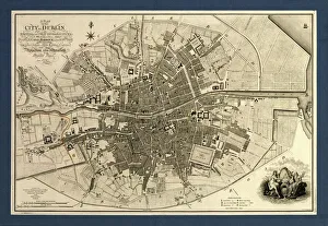
Background imageGeorgia Collection: Map of the City of Dublin, 1797

Map of the City of Dublin, 1797
Map of the City of Dublin, Ireland. Published in 1797, this map includes details of the canals being built at the time. Canal Harbour (lower right)

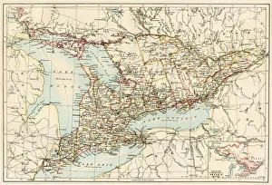
Background imageGeorgia Collection: Ontario, 1870s

Ontario, 1870s
Map of Ontario, Canada, 1870s. Printed color lithograph

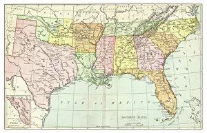
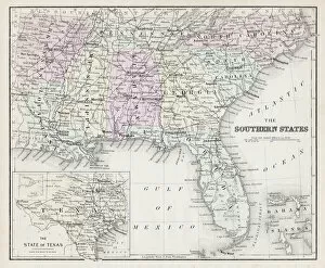
Background imageGeorgia Collection: Map of Southern States USA 1895

Map of Southern States USA 1895
The Rand-McNally Grammar School Geography 1895 - Chicago & New York

Background imageGeorgia Collection: Georgia State Vector Map

Georgia State Vector Map
Highly detailed vector map of Georgia, United States. File was created on April 17, 2012. The colors in the.eps-file are ready for print (CMYK). Included files: EPS (v8) and Hi-Res JPG

Background imageGeorgia Collection: Map of St Marylebone, London

Map of St Marylebone, London
Map of St Marylebone, from a plan of London published by Richard Phillips. Date: 1813

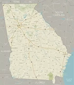
Background imageGeorgia Collection: Georgia Map

Georgia Map
A detailed map of Georgia state with cities, roads, major rivers, and lakes. Includes neighboring states and surrounding water

Background imageGeorgia Collection: Map of Southern States USA 1877

Map of Southern States USA 1877
Warrens Common School Geography 1877

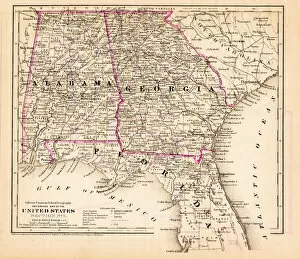
Background imageGeorgia Collection: Alabama Florida Georgia map 1881

Alabama Florida Georgia map 1881
Coltons Common School Geography 1881 New York Sheldon and Co

Background imageGeorgia Collection: Georgia map 1884

Georgia map 1884
Encyclopedia Britannica 9th Edition New York Charles Scribners and Sonsl 1884 Vol X

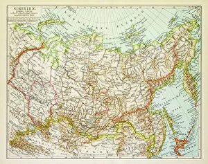
Background imageGeorgia Collection: Map of Siberia 1895

Map of Siberia 1895
Map of Siberia

Background imageGeorgia Collection: Great North Road out of London, 1st July 1790 (colour litho)

Great North Road out of London, 1st July 1790 (colour litho)
XCF275041 Great North Road out of London, 1st July 1790 (colour litho) by English School, (18th century); Private Collection; English, out of copyright

Background imageGeorgia Collection: MAP: VANCOUVER ISLAND, 1859. Map of Vancouver Island and Washington Territory

MAP: VANCOUVER ISLAND, 1859. Map of Vancouver Island and Washington Territory, shwoing San Juan Island and the disputed territory. Map, 1859

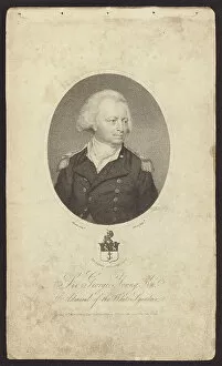
Background imageGeorgia Collection: Sir George Young, British admiral (engraving)

Sir George Young, British admiral (engraving)
7150339 Sir George Young, British admiral (engraving) by Smart, John (1741-1811); Private Collection; (add.info.: Sir George Young (1732-1810), British admiral.); © Look and Learn

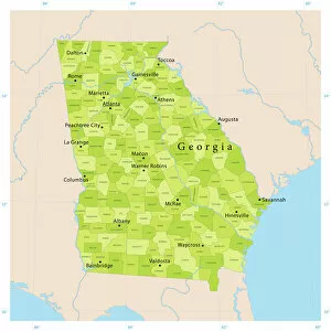
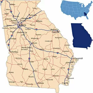
Background imageGeorgia Collection: A yellow map of the state of Georgia with cities marked

A yellow map of the state of Georgia with cities marked
Vector illustration of map of Georgia with major roads, rivers and lakes

Map of Savannah, c.1900 (engraving)
532860 Map of Savannah, c.1900 (engraving); (add.info.: Map of Savannah, Georgia, circa 1900, from the 10th edition of Encyclopaedia Britannica.); Encyclopaedia Britannica/UIG

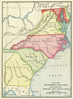
Southern colonies just before the French and Indian War
NWI4712671 Southern colonies just before the French and Indian War.; (add.info.: Southern colonies just before the French and Indian War.); Photo © North Wind Pictures

Background imageGeorgia Collection: Map of the United States of 1803 showing the partition of the state (Kentucky, Tennessee, Georgia)

Map of the United States of 1803 showing the partition of the state (Kentucky, Tennessee, Georgia, Florida, Carolina)
NWI4901249 Map of the United States of 1803 showing the partition of the state (Kentucky, Tennessee, Georgia, Florida, Carolina, Virginia, Massachusetts, Indian territories)

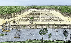
Background imageGeorgia Collection: United States, State of Georgia: City of Savannah as established by James Oglethorpe, 1741

United States, State of Georgia: City of Savannah as established by James Oglethorpe, 1741
NWI4965146 United States, State of Georgia: City of Savannah as established by James Oglethorpe, 1741. Colour engraving of the 19th century.; (add.info.: United States)

Background imageGeorgia Collection: Learning to map the Parish, Gammon Theological Seminary, 1922. Creator: Unknown

Learning to map the Parish, Gammon Theological Seminary, 1922. Creator: Unknown
Learning to map the Parish, Gammon Theological Seminary, 1922

Background imageGeorgia Collection: 1 Maps 3 21

1 Maps 3 21
Emiliano Deificus

Background imageGeorgia Collection: 1 Maps 3 21

1 Maps 3 21
Emiliano Deificus

Background imageGeorgia Collection: 1 Maps 3 21

1 Maps 3 21
Emiliano Deificus

Background imageGeorgia Collection: Mingrelian. Guriits, 1862. Creator: Frants Taikhel

Mingrelian. Guriits, 1862. Creator: Frants Taikhel
Mingrelian. Guriits, 1862. Sheet 27 from the album "Description ethnographique des peuples de la Russie", volume 1

Background imageGeorgia Collection: Georgian. Imeretin, 1862. Creator: Frants Taikhel

Georgian. Imeretin, 1862. Creator: Frants Taikhel
Georgian. Imeretin, 1862. Sheet 26 from the album "Description ethnographique des peuples de la Russie", volume 1

Background imageGeorgia Collection: Georgians, 1862. Creator: Karlis Huns

Georgians, 1862. Creator: Karlis Huns
Georgians, 1862. Sheet 25 from the album "Description ethnographique des peuples de la Russie", volume 1. Description ethnographique des peuples de la Russie

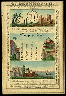
Background imageGeorgia Collection: Kutaisi Province, 1856. Creator: Unknown

Kutaisi Province, 1856. Creator: Unknown
Kutaisi Province, 1856. This card is one of a souvenir set of 82 illustrated cards-one for each province of the Russian Empire as it existed in 1856

Background imageGeorgia Collection: Tiflis Province, 1856. Creator: Unknown

Tiflis Province, 1856. Creator: Unknown
Tiflis Province, 1856. This card is one of a souvenir set of 82 illustrated cards-one for each province of the Russian Empire as it existed in 1856

Background imageGeorgia Collection: 1 Maps 3 21

1 Maps 3 21
Emiliano Deificus

Background imageGeorgia Collection: 1 Maps 3 21

1 Maps 3 21
Emiliano Deificus

Background imageGeorgia Collection: Georgia road map

Georgia road map
illustration of Georgia state road & highway map for your design and products

Background imageGeorgia Collection: Blackboys Mill a028912

Blackboys Mill a028912
BLACKBOYS POST MILL, FRAMFIELD, WEALDEN, EAST SUSSEX. A view of Blackboys Mill, showing the post mill in working condition

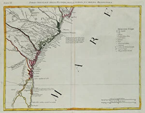
Background imageGeorgia Collection: The eastern part of Florida, Georgia and South Carolina, engraving by G

The eastern part of Florida, Georgia and South Carolina, engraving by G. Zuliani taken from Tome I of the "Newest Atlas" published in Venice in 1778 by Antonio Zatta

Background imageGeorgia Collection: English Louisiana with the western part of Florida, Georgia and South Carolina, engraving by G

English Louisiana with the western part of Florida, Georgia and South Carolina, engraving by G. Zuliani taken from Tome I of the "Newest Atlas" published in Venice in 1778 by Antonio Zatta

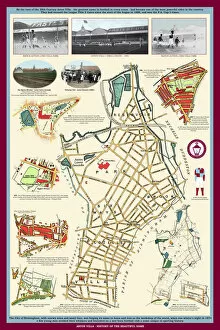
Background imageGeorgia Collection: Aston Villa - History of the Beautiful Name

Aston Villa - History of the Beautiful Name
This is a captivating pictorial history map that traces the history of the famous name through rare antique maps and images back to 1820 where one such map shows the building " Aston Villa"

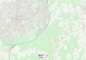
Background imageGeorgia Collection: Crawley RH10 7 Map

Crawley RH10 7 Map
Postcode Sector Map of Crawley RH10 7

Background imageGeorgia Collection: Cardiff CF14 5 Map

Cardiff CF14 5 Map
Postcode Sector Map of Cardiff CF14 5

Background imageGeorgia Collection: Bournemouth BH10 7 Map

Bournemouth BH10 7 Map
Postcode Sector Map of Bournemouth BH10 7

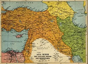
Background imageGeorgia Collection: Asia Minor, the Caucasus Region and Mesopotamia, First World War, c1915, (c1920)

Asia Minor, the Caucasus Region and Mesopotamia, First World War, c1915, (c1920). Map of part of the Middle East, showing eastern Turkey, Cyprus, Syria, Lebanon, Palestine

Background imageGeorgia Collection: Map of Hornsey and Neighbourhood in 1819, (c1876). Creator: Unknown

Map of Hornsey and Neighbourhood in 1819, (c1876). Creator: Unknown
Map of Hornsey and Neighbourhood in 1819, (c1876).. The village grew dramatically after c1860. From " Old and New London: A Narrative of Its History, Its People, and Its Places

Background imageGeorgia Collection: Mark Hole Cottage MCF01_02_1305

Mark Hole Cottage MCF01_02_1305
MARK HOLE COTTAGE, THE CLIFFS, CHEDDAR, SEDGEMOOR, SOMERSET. Looking across the mill pond near Cox's Mill towards Mark Hole Cottage and Lion Rock on the hillside above

Background imageGeorgia Collection: Georgia Home State Rustic Poster Wall Art

Georgia Home State Rustic Poster Wall Art
dekik saad

Background imageGeorgia Collection: Georgia?, ca. 1940. Creators: Marion Post Wolcott, Jack Delano

Georgia?, ca. 1940. Creators: Marion Post Wolcott, Jack Delano
Georgia? [Men and women looking at a map]

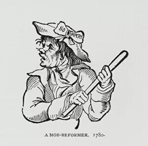
Background imageGeorgia Collection: A Mob-Reformer, 1780 (engraving)

A Mob-Reformer, 1780 (engraving)
7148353 A Mob-Reformer, 1780 (engraving) by English School, (18th century); Private Collection; (add.info.: A Mob-Reformer, 1780)

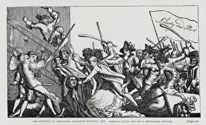
Background imageGeorgia Collection: The Hustings at Brentford, Middlesex Election, 1768. Serjeant Glynn and Sir W Beauchamp Proctor

The Hustings at Brentford, Middlesex Election, 1768. Serjeant Glynn and Sir W Beauchamp Proctor (engraving)
7148322 The Hustings at Brentford, Middlesex Election, 1768. Serjeant Glynn and Sir W Beauchamp Proctor (engraving) by English School

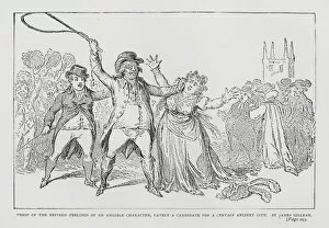
Background imageGeorgia Collection: Proof of the Refined Feelings of an Amiable Character, Lately a Candidate for a Certain Ancient City

Proof of the Refined Feelings of an Amiable Character, Lately a Candidate for a Certain Ancient City
7148307 Proof of the Refined Feelings of an Amiable Character, Lately a Candidate for a Certain Ancient City, satire depicting an election candidate assaulting a woman canvasser for soliciting votes

Background imageGeorgia Collection: Antique map of Ancient Armenia, Colchis Iberia, Albania, Atlas of Ancient Geography

Antique map of Ancient Armenia, Colchis Iberia, Albania, Atlas of Ancient Geography
Vintage illustration of Antique map of Ancient Armenia, Colchis Iberia, Albania, Atlas of Ancient Geography. By Samuel Butler


All Professionally Made to Order for Quick Shipping


-

Georgia Collection

Georgia is a state located in the southeastern region of the United States. It borders Florida to the south, Alabama to the west, Tennessee and North Carolina to the north, and South Carolina to the east. The capital city is Atlanta, which is also its largest city. A diverse geography that includes mountains in the northern part of the state and coastal plains in the southern part. Its economy relies heavily on agriculture, manufacturing, and service industries such as tourism. Georgia's population is over 10 million people with a mix of ethnicities including African American, Hispanic/Latino, Asian American among others.
+

Our beautiful pictures are available as Framed Prints, Photos, Wall Art and Photo Gifts

The Georgia collection from Media Storehouse is a stunning compilation of vintage maps and charts that depict the state of Georgia in various eras. Our collection includes detailed topographical maps, antique city plans, historical railroad maps, nautical charts, and more. These beautiful prints are ideal for anyone who loves history or geography or wants to add a touch of elegance to their home decor. Each print in the Georgia collection is carefully reproduced using high-quality materials such as fine art paper or canvas. The prints are available in different sizes to suit any space, from small offices to large living rooms. They can be framed with a variety of frames that complement any interior design style. Whether you're looking for a unique gift idea for someone special or want to decorate your own home with something truly special, the Georgia collection from Media Storehouse is an excellent choice.
+

What are Georgia (Maps and Charts) art prints?

Georgia art prints are high-quality reproductions of vintage maps and charts depicting the state of Georgia. These prints showcase the intricate details of historical cartography, including topographical features, city layouts, and transportation routes. We offer a unique glimpse into the past and provide an excellent way to decorate homes or offices with a touch of nostalgia. These art prints come in various sizes to suit different preferences and spaces. They are printed on premium paper using advanced printing technology that ensures vibrant colors, sharp lines, and long-lasting quality. The Georgia art prints are perfect for history buffs, geography enthusiasts, or anyone who appreciates beautiful artwork. Whether you want to add some character to your living room or create a focal point in your office space, these art prints will make an excellent addition to any wall. With their timeless appeal and classic style, they are sure to impress visitors while also providing a source of inspiration for years to come.
+

What Georgia (Maps and Charts) art prints can I buy from Media Storehouse?

We offer a wide range of Georgia maps and charts art prints that you can purchase. These include antique maps, vintage travel posters, city street maps, topographical maps, and nautical charts. You can choose from various sizes and framing options to suit your preferences. The antique maps showcase the historical evolution of Georgia's geography over time. The vintage travel posters capture the beauty of Georgia's landscapes and attractions in an artistic way. The city street maps provide a detailed view of major cities like Atlanta and Savannah while the topographical maps offer a comprehensive understanding of Georgia's terrain. Moreover, Media Storehouse also has nautical charts that depict the coastal regions around Georgia with intricate details such as water depths, currents, tides, and landmarks. Whether you are looking for decorative pieces or educational resources about Georgia's geography or history, we have something for everyone.
+

How do I buy Georgia (Maps and Charts) art prints?

To purchase Georgia art prints from Media Storehouse, you can browse our extensive collection of artwork online. Once you have found the print that you would like to buy, simply add it to your cart and proceed to checkout. You will be prompted to enter your billing and shipping information before completing the purchase. We offer a variety of payment options including credit card, PayPal, and Apple Pay. We also offer international shipping for customers outside of the United States. Their Georgia art prints are available in a range of sizes and formats including framed prints, canvas prints, metal prints, and more. Whether you're looking for a small print to display on your desk or a large statement piece for your living room wall, we have something for everyone. With high-quality printing technology used in all their products combined with excellent customer service support team makes shopping at Media Storehouse an enjoyable experience.
+

How much do Georgia (Maps and Charts) art prints cost?

We offer a wide range of Georgia art prints that are available for purchase. Our prices vary depending on the size and type of print you choose. We have a selection of high-quality paper prints that are perfect for framing or displaying as is. Alternatively, we also offer canvas prints which provide a more contemporary look and feel to your artwork. Our Georgia art prints come in various sizes ranging from small to large so you can find the perfect fit for your space. Each print is carefully crafted using premium materials to ensure longevity and durability. We take pride in offering affordable pricing without compromising on quality. Whether you're looking for an eye-catching piece to add some personality to your home or office, our Georgia art prints are sure to impress.
+

How will my Georgia (Maps and Charts) art prints be delivered to me?

We take great care in delivering your Georgia art prints to you. We use high-quality packaging materials to ensure that your artwork arrives safely and undamaged. Your print will be carefully rolled and placed inside a sturdy cardboard tube for protection during transit. We work with trusted courier partners who provide reliable delivery services worldwide. Once your order has been dispatched, you will receive a tracking number so that you can keep an eye on its progress. Our standard delivery times vary depending on the destination country, but we aim to deliver within 5-10 working days for UK orders and up to 14 working days for international orders. If you have any questions or concerns about the delivery of your Georgia art prints, please do not hesitate to contact our customer service team who will be happy to assist you.