
Greece Collection
Greece is a country located in southeastern Europe, with a population of approximately 10.7 million people
Choose a picture from our Greece Collection for your Wall Art and Photo Gifts
1,503 items


All Professionally Made to Order for Quick Shipping
-
Greece Collection
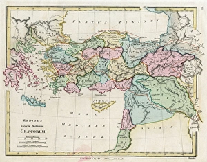
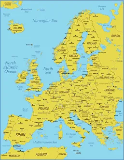
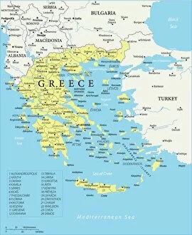
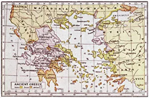
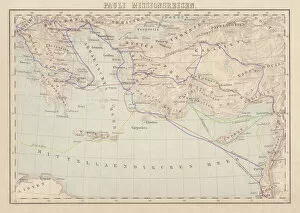
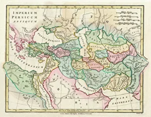
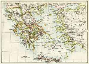
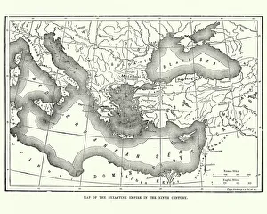
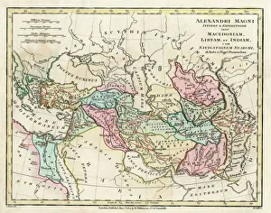
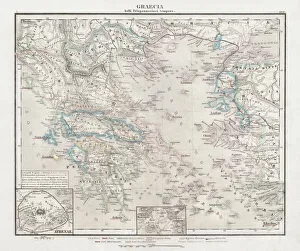
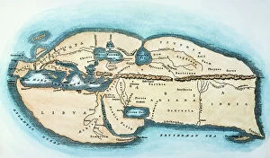
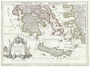
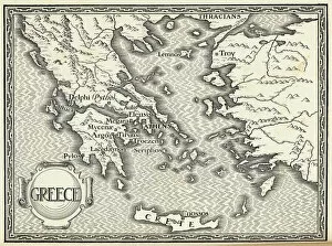
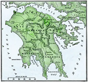
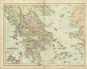
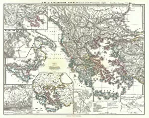
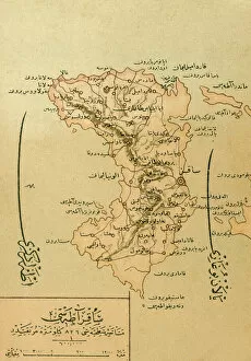
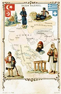
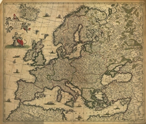
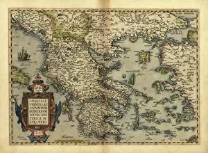
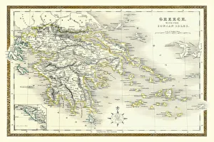
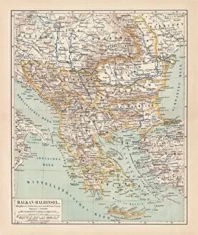
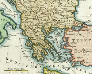
Greece is a country located in southeastern Europe, with a population of approximately 10.7 million people. The country has an area of 131,957 square kilometers and is divided into thirteen administrative regions. Greece's capital city is Athens, which is also the largest city in the country. The geography includes numerous islands scattered throughout the Aegean and Ionian Seas, as well as mountainous terrain on the mainland. The highest point is Mount Olympus at 2,917 meters. A rich history dating back to ancient times when it was home to some of the world's most famous philosophers and mathematicians such as Socrates, Plato, and Aristotle. Today, Greece remains an important cultural center with many historical landmarks including the Acropolis in Athens and Delphi archaeological site. Overall, maps and charts can provide valuable insights into various aspects of Greek society such as demographics or economic activity while also showcasing its unique geography and cultural heritage.
+
Our beautiful pictures are available as Framed Prints, Photos, Wall Art and Photo Gifts
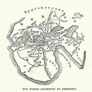
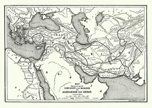
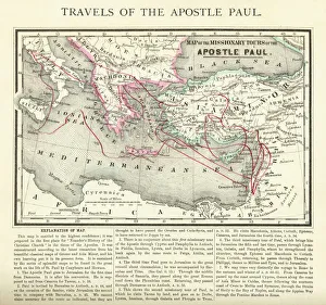
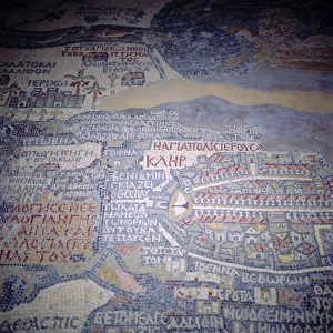
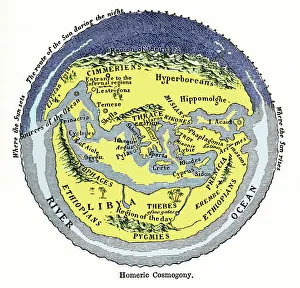
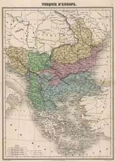
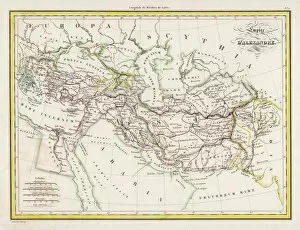
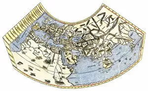
The Greece collection from Media Storehouse is a stunning assortment of wall art and framed prints that showcases the beauty, history, and culture of Greece. Our collection features an array of maps and charts that depict various regions, cities, islands, landmarks, and historical events in Greece. The maps are intricately detailed with accurate geographical information such as topography, rivers, mountains, coastlines etc., while the charts provide valuable insights into ancient Greek mythology, philosophy or architecture. These artworks are printed on high-quality paper using advanced printing technology to ensure vibrant colors and sharp details. They come in different sizes to suit any space or decor style. Whether you're a history buff or simply love the Mediterranean charm of Greece's landscapes and seascapes - our collection has something for everyone. Overall our collection offers a unique opportunity to bring some Greek heritage into your home or office space through beautiful artwork that captures its rich cultural legacy.
+
What are Greece (Maps and Charts) art prints?
Greece art prints are a collection of high-quality, visually stunning reproductions of maps and charts depicting the geography, history, culture, and landmarks of Greece. These art prints showcase the intricate details of ancient Greek architecture, mythology, and landscapes in vivid colors that capture the essence of this beautiful country. These prints are perfect for anyone who loves Greece or wants to learn more about its rich heritage. They make great gifts for travelers or those interested in history or geography. The collection includes a variety of styles from vintage to modern designs that will suit any decor style. Whether you're looking for a map to hang on your wall or an artistic representation of Greece's famous landmarks like the Acropolis or Santorini's blue-domed churches overlooking the Aegean Sea - these art prints are sure to impress with their attention to detail and quality craftsmanship.
+
What Greece (Maps and Charts) art prints can I buy from Media Storehouse?
We offer a wide variety of Greece art prints in the form of maps and charts. These prints showcase the beauty and history of Greece, including its stunning landscapes, ancient ruins, and iconic landmarks. Some popular options include detailed maps of Athens or Crete, vintage travel posters featuring Greek islands like Santorini or Mykonos, and historical charts depicting the mythology and gods of Ancient Greece. In addition to these traditional map and chart styles, Media Storehouse also offers modern interpretations that incorporate bold colors and abstract designs. Whether you're looking for a classic depiction of Greece's rich cultural heritage or a contemporary take on its natural wonders, there is sure to be an art print that suits your taste. All prints are available in various sizes to fit any space in your home or office. They are printed using high-quality materials to ensure vibrant colors and crisp details that will last for years to come.
+
How do I buy Greece (Maps and Charts) art prints?
To buy Greece art prints from Media Storehouse, you can browse our extensive collection of high-quality prints online. Simply search for the specific artwork or artist you are interested in, or explore their curated collections to discover new pieces. Once you have found a print that catches your eye, select the size and framing options that best suit your needs. You can choose from a range of materials and finishes to create a custom look that complements your decor. When you are ready to purchase, simply add the item to your cart and proceed through the checkout process. We accept various payment methods for easy and secure transactions. Whether you are looking for a unique piece of wall art for your home or office, or searching for a special gift for someone who loves Greece , we have something to suit every taste and budget.
+
How much do Greece (Maps and Charts) art prints cost?
We offer a wide range of Greece art prints at varying prices. Our collection includes high-quality prints featuring maps and charts of Greece that are perfect for adding a touch of sophistication to any room in your home or office. The cost of our Greece art prints depends on the size, framing options, and other customizations you choose. We take pride in offering affordable yet premium quality artwork that is sure to impress anyone who sees it. Whether you're looking for a small print to hang on your wall or a large canvas to make a statement piece, we have something for everyone's budget. Our team works hard to ensure that each order is processed quickly and efficiently so you can enjoy your new artwork as soon as possible. So if you're looking for beautiful Greece art prints at reasonable prices, look no further than Media Storehouse.
+
How will my Greece (Maps and Charts) art prints be delivered to me?
We take great care in ensuring that your Greece art prints are delivered to you safely and securely. We use high-quality packaging materials to protect your artwork during transit, so it arrives in pristine condition. Your prints will be carefully rolled and placed into a sturdy cardboard tube for delivery. This ensures that they remain flat and free from creases or damage during transportation. The tube is then sealed with tape to prevent any moisture or dust from entering. Once your order has been dispatched, you will receive an email confirmation with tracking information so you can monitor the progress of your delivery. Our shipping partners are reliable and efficient, ensuring that your package arrives on time. We pride ourselves on providing excellent customer service, so if there are any issues with the delivery of your Greece art prints, please do not hesitate to contact us.