Fraud Blocker Skip to main content

Home > Maps and Charts > Italy

Italy Collection (page 4)

Italy is a country located in southern Europe, bordered by the Mediterranean Sea to the south and surrounded by several other countries including France

4,102 items

Background imageItaly Collection: Marco Polo (1254-1324) from the Sala del Mappamondo (Hall of the World Maps)

Marco Polo (1254-1324) from the Sala del Mappamondo (Hall of the World Maps)
XIR184034 Marco Polo (1254-1324) from the Sala del Mappamondo (Hall of the World Maps) (fresco) by Varese, Antonio Giovanni de (16th century); Villa Farnese, Caprarola, Lazio, Italy; Italian

Background imageItaly Collection: Portrait of Amerigo Vespucci (1454-1512) from The Narrative and Critical History

Portrait of Amerigo Vespucci (1454-1512) from The Narrative and Critical History
BAL111015 Portrait of Amerigo Vespucci (1454-1512) from The Narrative and Critical History of America, edited by Justin Winsor, London, 1886 (engraving) by English School

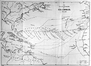
Background imageItaly Collection: Columbus Voyages

Columbus Voyages
1889: A map of the four voyages of the Italian navigator, Christopher Columbus (1451 - 1506), from The Worlds Great Explorers, by J Scott Keltic, (London 1889). (Photo by Hulton Archive/Getty Images)

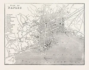
Background imageItaly Collection: MAP OF NAPLES, ITALY, 1860 engraving

MAP OF NAPLES, ITALY, 1860 engraving

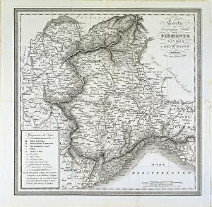
Background imageItaly Collection: Map of Piedmont, of the Savoy and Genovas. Cremona, engraving on copper, 1832

Map of Piedmont, of the Savoy and Genovas. Cremona, engraving on copper, 1832
Cartography, Italy, 19th century. Map of Piedmont, of the Savoy and Genovas. Cremona, 1832. Engraving on copper

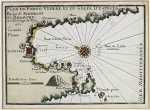
Background imageItaly Collection: Portovenere and the Gulf of La Spezia, Map by Henry Michelot

Portovenere and the Gulf of La Spezia, Map by Henry Michelot and Laurens Bremond from the Portolan Charts of
Cartography, Italy, 18th century. Portovenere and the Gulf of La Spezia. Map by Henry Michelot and Laurens Bremond from the Portolan Charts of the Mediterranean Sea, Amsterdam 1709. Copper engraving

Background imageItaly Collection: Map of the Horn of Africa, oil painting by Stefano Buonsignori 1575-1584

Map of the Horn of Africa, oil painting by Stefano Buonsignori 1575-1584
Italy - Tuscany region - Florence. Palazzo Vecchio, Hall of the Geographical Maps. Map of the Horn of Africa, oil painting by Stefano Buonsignori 1575-1584

Section through the Mausoleum of Hadrian in Parco Adriano, Rome, from Bartoli
FLO4679380 Section through the Mausoleum of Hadrian in Parco Adriano, Rome, from Bartoli. Copperplate engraving by Henry Moses from A Collection of Antique Vases, Altars, etc., London

United States, Bomber Pilot's Printed Silk Cloth Map
3032599 United States, Bomber Pilot's Printed Silk Cloth Map ; Private Collection; (add.info.: World War II, United States, Bomber Pilot's Printed Silk United States Army Air Force)

Rome on the Tiber, The Vatican, 1700
2900912 Rome on the Tiber, The Vatican, 1700; (add.info.: Rome on the Tiber, The Vatican, 1700.); Buyenlarge Archive/UIG

Background imageItaly Collection: Fortifications at Nice, France, 1700

Fortifications at Nice, France, 1700
2900899 Fortifications at Nice, France, 1700; (add.info.: Throughout the ages the town changed hands many times. Its strategic location and port significantly contributed to its maritime strength)

Map of Naples, c.1900 (engraving)
533313 Map of Naples, c.1900 (engraving); (add.info.: Map of Naples, Italy, circa 1902, from the 10th edition of Encyclopaedia Britannica.); Encyclopaedia Britannica/UIG

Map of Italy with Sicily and Naples, c.1900 (engraving)
532989 Map of Italy with Sicily and Naples, c.1900 (engraving); (add.info.: Map of central and southern Italy with insets map of Sicily and Naples, circa 1902)

Caesar, Gallic War: Ariovisti Clades (litho)
8636508 Caesar, Gallic War: Ariovisti Clades (litho) by English School, (20th century); Private Collection; (add.info.: Ariovisti Clades)

Adriatic chart, c.1620 (vellum)
7339786 Adriatic chart, c.1620 (vellum) by Unknown Artist, (17th century); 41x60 cm; National Maritime Museum, London, UK; (add.info.: Creator)

Chart of Moscow and the Black Sea, 1554 (vellum)
7339650 Chart of Moscow and the Black Sea, 1554 (vellum) by Agnese, Battista (c.1500-64); 26x40 cm; National Maritime Museum, London, UK; (add.info.: Creator: Johan B. Agnese 'Moscaw oder Reuss')

Chrso, 1590 (Manuscript)
7339637 Chrso, 1590 (Manuscript) by Antonio, Millo (16th century); 31x205 cm; National Maritime Museum, London, UK; (add.info.: Creator: Millo, Antonio Bound sheet. Ms. Additional Places: Cres)

Map of Lampedusa, Sicily, 1803 (engraving)
7339532 Map of Lampedusa, Sicily, 1803 (engraving) by Dalrymple, Alexander (18th-19th century); 48.5x64 cm; National Maritime Museum, London

Cosimo I de' Medici (Cosimo I de' Medici, 1519-1574) planning the conquest of Siena in 1555. Detail
BEN5475972 Cosimo I de' Medici (Cosimo I de' Medici, 1519-1574) planning the conquest of Siena in 1555. Detail. With a compass and a map on his desk, he is looking for a combat strategy

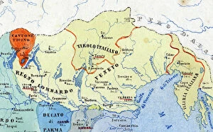
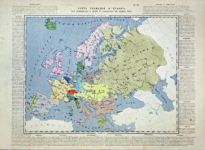
Primary cities of Italy, their population and historical division - statistics of the individual states""
FGL5504190 Primary cities of Italy, their population and historical division - statistics of the individual states"", detail of the territories marked in yellow in the eastern part of the north which

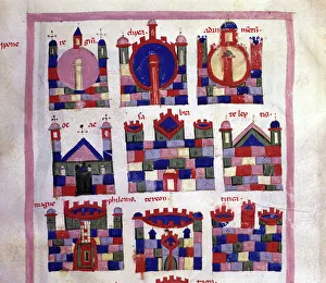
A city in Libya after the Cosmographia of Julius Solinus (14th century). In the middle row
GIA5033683 A city in Libya after the Cosmographia of Julius Solinus (14th century). In the middle row, in the center and on the left you can recognize Sabratha and Leptis Magna.; (add.info)

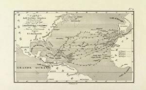
Geography : map representing the Americas with the traces of the voyages of the navigator Christopher Columbus to
VEN5031147 Geography : map representing the Americas with the traces of the voyages of the navigator Christopher Columbus to the New World.; (add.info)

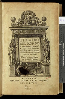
Frontispice of the atlas "" Theatre of the World"" (Theatrum Orbis Terrarum) by Abraham Ortelius (1528-1598)
VEN5030419 Frontispice of the atlas "" Theatre of the World"" (Theatrum Orbis Terrarum) by Abraham Ortelius (1528-1598), Dutch cartographer in an Italian edition, late 16th century

First World War: Patriotic Map showing five young women representing the Allied countries in their symbolic dress
LUX4745083 First World War: Patriotic Map showing five young women representing the Allied countries in their symbolic dress, 1915

Background imageItaly Collection: Geographic map of the French Empire and Kingdom of Italy in 1809

Geographic map of the French Empire and Kingdom of Italy in 1809 (Map of french empire and kingdom of Italy)
ELD4925058 Geographic map of the French Empire and Kingdom of Italy in 1809 (Map of french empire and kingdom of Italy, 1809) Engraving from "" Atlas Universel"" by Houze

Map of the Eastern Empire after the fall of Constantinople by the French Crusaders in 1204
ELD4927970 Map of the Eastern Empire after the fall of Constantinople by the French Crusaders in 1204 and map of Italy during the Guelphs and Ghibellin fights (Guelfi e ghibellini)

Map of the Atlantic with the coasts of the New World made by the navigator of the expedition of Christopher Columbus
NWI4846249 Map of the Atlantic with the coasts of the New World made by the navigator of the expedition of Christopher Columbus, Juan de la Cosa (1460-1510), in 1500

Allegory of the British Empire as the Colossus of Rhodes, 19th century
CUL4940269 Allegory of the British Empire as the Colossus of Rhodes, 19th century; (add.info.: Il Colosso di Rodi. Allegory of the British Empire as the 'Colossus of Rhodes" monitoring)

First World War: France, Patriotic Map showing four young children in Italian, English
LUX4738398 First World War: France, Patriotic Map showing four young children in Italian, English, Belgian and Russian soldier uniforms around the French flag

First World War: France, Patriotic Map showing four soldiers representing Allied Armies firing in heart on enemy
LUX4742673 First World War: France, Patriotic Map showing four soldiers representing Allied Armies firing in heart on enemy aircraft

First World War: France, Patriotic Map showing a young woman wearing the Allies flags, 1915
LUX4741716 First World War: France, Patriotic Map showing a young woman wearing the Allies flags, 1915, Map titled: Long live the Allies; (add.info)

Mosaic of a bear wounded with a spear from the Casa dell'Orso, House of the Bear, VII.II.45
FLO4687099 Mosaic of a bear wounded with a spear from the Casa dell'Orso, House of the Bear, VII.II.45. Chromolithograph by Victor Steeger after an illustration by Geremia Discanno from Emile Presuhn

Mural from the Casa di Arianna or House of Ariadne, Reg. VII, Ins. IV, No
FLO4687004 Mural from the Casa di Arianna or House of Ariadne, Reg. VII, Ins. IV, No. 51, and wallpaper from the House of Chlorus and Caprasia or Casa del Gallo II, Reg. IX, Ins. II, No. 10

Decorated ceiling from the House of Chlorus and Caprasia or Casa del Gallo II, Reg. IX, Ins. II, No. 10
FLO4687002 Decorated ceiling from the House of Chlorus and Caprasia or Casa del Gallo II, Reg. IX, Ins. II, No. 10. Chromolithograph by Victor Steeger after an illustration by Geremia Discanno

Plaster cast of a man's body from the Via Stabiana, now in the Museum of Pompeii
FLO4687098 Plaster cast of a man's body from the Via Stabiana, now in the Museum of Pompeii. Chromolithograph by Victor Steeger after an illustration by Geremia Discanno from Emile Presuhn (1844-1878)

Map showing the course of Christopher Columbus from Guanahani to Cuba in 1492
2915328 Map showing the course of Christopher Columbus from Guanahani to Cuba in 1492. From the book Life of Christopher Columbus by Clements R. Markham published 1892.; Photo © Hilary Morgan

Trevise in the Italian Po Valley, 1700
2900911 Trevise in the Italian Po Valley, 1700; (add.info.: Trevise in the Italian Po Valley, 1700.); Buyenlarge Archive/UIG

Casal on the Po River, 1700
2900909 Casal on the Po River, 1700; (add.info.: Casal on the Po River, 1700.); Buyenlarge Archive/UIG

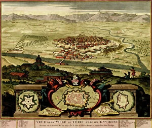
Ivrea Near Turin, 1700
2900908 Ivrea Near Turin, 1700; (add.info.: Ivrea is a town and commune of the province of Turin in the Piedmont region of northwestern Italy)

Background imageItaly Collection: Syracuse at the Time of the Siege, 415-413 BC (litho)

Syracuse at the Time of the Siege, 415-413 BC (litho)
8652547 Syracuse at the Time of the Siege, 415-413 BC (litho) by Bartholomew, John George (1860-1920) ; Private Collection; (add.info.: Syracuse at the Time of the Siege, 415-413 BC)

Caesar, Gallic War: Clades Belgarum (litho)
8636507 Caesar, Gallic War: Clades Belgarum (litho) by English School, (20th century); Private Collection; (add.info.: Clades Belgarum)

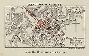
Background imageItaly Collection: Caesar, Gallic War: Nerviorum Clades (litho)

Caesar, Gallic War: Nerviorum Clades (litho)
8636505 Caesar, Gallic War: Nerviorum Clades (litho) by English School, (20th century); Private Collection; (add.info.: Nerviorum Clades)

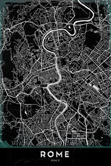
Background imageItaly Collection: ROMA

ROMA
StudioSix

Background imageItaly Collection: Roman Britain (litho)

Roman Britain (litho)
8661402 Roman Britain (litho) by English School, (20th century); Private Collection; (add.info.: Roman Britain. Following the raids of Julius Caesar in 55 and 54 BC the southern British tribes)

Background imageItaly Collection: Floor Plan Of The 6Th Century Byzantine San Vitale Church In Ravenna, Italy

Floor Plan Of The 6Th Century Byzantine San Vitale Church In Ravenna, Italy
UIG5420216 Floor Plan Of The 6Th Century Byzantine San Vitale Church In Ravenna, Italy. From Les Artes Au Moyen Age, Published Paris 1873 ©UIG/Leemage

Background imageItaly Collection: Primary cities of Europe, their population and degree of trade of individual states (print)

Primary cities of Europe, their population and degree of trade of individual states (print)
6202957 Primary cities of Europe, their population and degree of trade of individual states (print; (add.info.: CARTOGRAPHY "Primary cities of Europe)

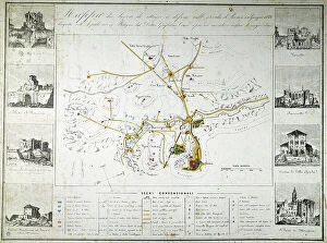
Risorgimento: map of attack and defense works at the time of the siege of Rome by the French of Oudinot in June 1849
BEN5479528 Risorgimento: map of attack and defense works at the time of the siege of Rome by the French of Oudinot in June 1849

Background imageItaly Collection: Map of Milan, Italy, 1726. (print)

Map of Milan, Italy, 1726. (print)
7419906 Map of Milan, Italy, 1726. (print); (add.info.: Map of Milan, Italy, 1726. After an 18th century print by Daniel Stopendaal.); Photo © Ken Welsh. All rights reserved 2024


All Professionally Made to Order for Quick Shipping


-

Italy Collection

Italy is a country located in southern Europe, bordered by the Mediterranean Sea to the south and surrounded by several other countries including France, Switzerland, Austria, and Slovenia. The country has a population of approximately 60 million people and its capital city is Rome. Italy is known for its rich history, culture, art, architecture, fashion industry and cuisine and has a diverse landscape with mountains in the north and beaches along the coastlines. Italy's economy relies heavily on tourism as well as industries such as agriculture, manufacturing and services. The country also plays an important role in international politics as a member of the European Union (EU) and United Nations (UN).
+

Our beautiful pictures are available as Framed Prints, Photos, Wall Art and Photo Gifts

The Italy collection from Media Storehouse is a stunning assortment of wall art and framed prints that showcase the beauty, history, and culture of Italy. Our collection features an extensive range of maps and charts that depict various regions, cities, landmarks, and historical events in Italy. These artworks are available in different sizes to suit any space or decor style. Whether you're a lover of Italian cuisine or architecture, our collection has something for everyone. You can choose from vintage-style maps that capture the essence of old-world charm or modern designs that reflect contemporary trends. Each print is made using high-quality materials to ensure longevity and durability. The Italy collection is perfect for anyone who wants to add a touch of Italian elegance to their home or office decor. With its rich history, breathtaking landscapes, and vibrant culture - there's no better way to celebrate all things Italian than with these beautiful artworks.
+

What are Italy (Maps and Charts) art prints?

Italy art prints are a collection of high-quality, visually stunning prints that showcase the beauty and history of Italy. These prints feature detailed maps and charts of various regions in Italy, including cities such as Rome, Florence, Venice, and Naples. The artwork is created using advanced printing techniques to ensure that each print captures the intricate details of the original map or chart. The result is a beautiful piece of art that not only looks great on your wall but also provides an educational insight into Italian geography. These art prints are perfect for anyone who loves travel or has an interest in Italian culture. They make excellent gifts for friends or family members who have visited Italy or plan to do so in the future. These Italy art prints offer a unique way to appreciate the beauty and complexity of one of Europe's most fascinating countries.
+

What Italy (Maps and Charts) art prints can I buy from Media Storehouse?

We offer a wide range of Italy art prints that are perfect for adding a touch of Italian charm to your home or office. You can choose from vintage maps, antique charts, and contemporary designs that showcase the beauty and diversity of Italy's landscapes, cities, and regions. Some popular options include detailed maps of Rome, Florence, Venice, Naples, Sicily, Tuscany, and the Amalfi Coast. These prints feature intricate illustrations of famous landmarks such as the Colosseum, St. Peter's Basilica, Ponte Vecchio Bridge or Mount Etna. In addition to city maps you can also find regional maps highlighting areas like Lake Como or Cinque Terre. For those interested in history there are historic charts depicting ancient Roman Empire territories. Whether you're looking for a unique gift or simply want to decorate your own space with beautiful artwork inspired by Italy's rich culture and heritage Media Storehouse has something for everyone.
+

How do I buy Italy (Maps and Charts) art prints?

To purchase Italy art prints from Media Storehouse, you can browse our extensive collection of high-quality prints online. Simply search for the specific print you are looking for or browse through the Italy category to find a selection of maps and charts that capture the beauty and history of this iconic country. Once you have found your desired print, select the size and format that best suits your needs. You can choose from a range of options including framed or unframed prints, canvas wraps, or mounted prints. To complete your purchase, simply add the item to your cart and follow the checkout process. Payment options may vary depending on your location but typically include credit card or PayPal. With our secure online ordering system, you can be confident in purchasing authentic Italy art prints that will make a stunning addition to any home or office decor.
+

How much do Italy (Maps and Charts) art prints cost?

We offer a wide range of Italy art prints at varying prices. Our collection includes vintage maps, contemporary charts, and artistic interpretations of Italy's geography. The cost of each print depends on several factors such as the size, material, and framing options chosen by the customer. We strive to provide affordable yet high-quality art prints that cater to different tastes and preferences. Our selection features various styles ranging from classic black-and-white designs to colorful illustrations that capture the beauty of Italy's landscapes. Whether you're looking for a unique piece to decorate your home or office or searching for a thoughtful gift for someone who loves Italy, our collection has something for everyone. With our easy-to-use website and secure payment system, ordering your favorite Italy art print is just a few clicks away.
+

How will my Italy (Maps and Charts) art prints be delivered to me?

We take pride in delivering your Italy art prints with utmost care. We use high-quality packaging materials to ensure that your print arrives in perfect condition. Your art print will be rolled up carefully and placed inside a sturdy cardboard tube for protection during transit. We work with trusted courier partners who are experienced in handling delicate items like art prints. Once your order is dispatched, you will receive a tracking number so you can monitor the progress of your delivery. Our team also ensures that all necessary customs paperwork is completed accurately and efficiently to avoid any delays or additional charges at the destination country. We understand how important it is for our customers to receive their orders promptly and securely. That's why we strive to provide reliable delivery services that meet our customers' expectations every time.