
Portugal Collection
Portugal is a country located in southwestern Europe, bordered by Spain to the north and east, and the Atlantic Ocean to the west and south
Choose a picture from our Portugal Collection for your Wall Art and Photo Gifts
567 items


All Professionally Made to Order for Quick Shipping
-
Portugal Collection
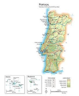
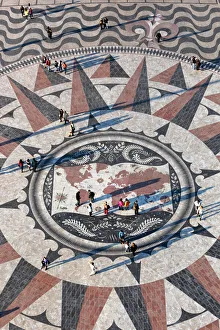
Portugal is a country located in southwestern Europe, bordered by Spain to the north and east, and the Atlantic Ocean to the west and south. The country has a population of approximately 10 million people and covers an area of 92,212 square kilometers. Portugal's capital city is Lisbon, which is also its largest city. The official language spoken is Portuguese. The country has a diverse economy with industries such as tourism, agriculture, manufacturing, and services contributing significantly to its GDP. Portugal has several natural landmarks including beaches along its coastline, mountain ranges like Serra da Estrela and Peneda-Gerês National Park that attract tourists from all over the world.
+
Our beautiful pictures are available as Framed Prints, Photos, Wall Art and Photo Gifts
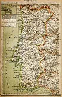
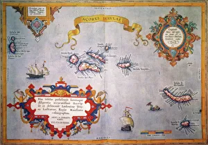
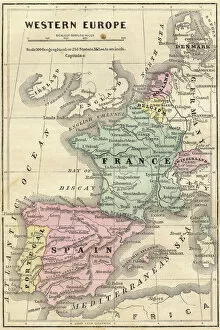
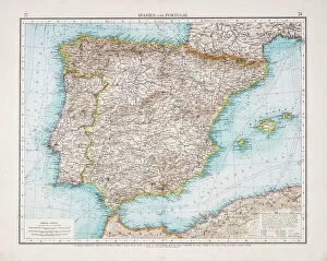
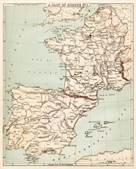
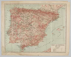
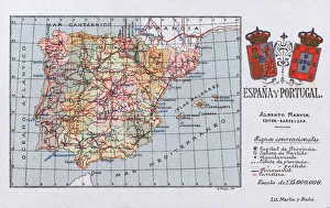
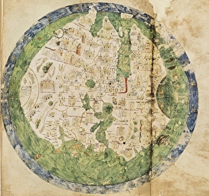
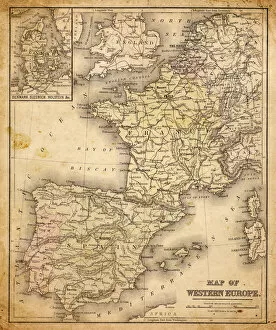
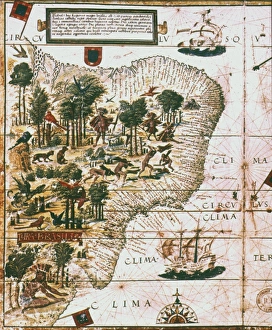
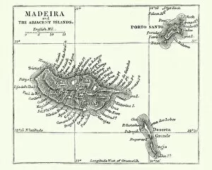
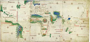
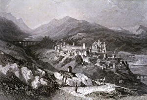
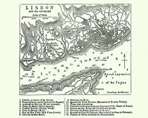
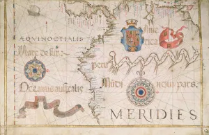
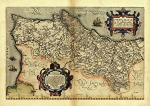
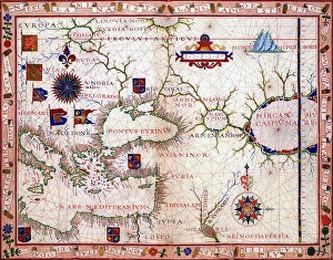
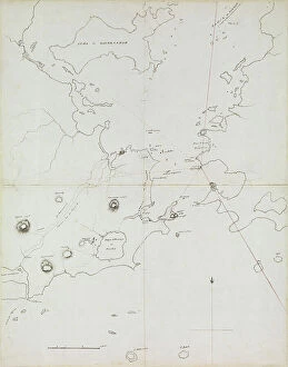
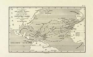
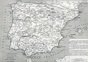
The Portugal collection from Media Storehouse is a stunning compilation of vintage maps and charts that showcase the rich history and culture of Portugal. Our collection features a wide range of maps, including antique world maps, detailed city plans, topographical maps, nautical charts, and more. Each map has been carefully selected for its historical significance and artistic value. These beautiful prints are perfect for anyone who loves travel or history. They make great wall art for homes or offices and can add character to any room. The Portugal collection also makes an excellent gift for those who appreciate fine art or have a special connection to Portugal. Media Storehouse offers high-quality prints in various sizes that are printed on premium paper using archival inks to ensure longevity. With this collection, you can bring the beauty of Portugal's past into your home with ease.
+
What are Portugal (Maps and Charts) art prints?
Portugal art prints are a collection of high-quality, visually stunning maps and charts that depict the geography, history, culture, and landmarks of Portugal. These art prints showcase various regions of Portugal such as Lisbon, Porto, Algarve, Madeira Island among others. They come in different sizes to suit any space or decor style. These art prints are perfect for those who love travel or have an interest in Portuguese history and culture. They can be used to decorate homes or offices with a touch of elegance while also serving as educational tools for students studying geography or history. The Portugal art print collection is carefully curated by Media Storehouse to ensure that customers receive only the best quality products available on the market. Each piece is printed using state-of-the-art technology on premium paper stock to guarantee long-lasting durability and vibrant colors. These beautiful pieces make great gifts for anyone who loves Portugal or simply appreciates fine artwork that captures its essence.
+
What Portugal (Maps and Charts) art prints can I buy from Media Storehouse?
We offer a wide range of Portugal art prints that can be purchased by anyone interested in the country's geography, history, or culture. These prints include vintage maps of Portugal from different eras, charts depicting the country's coastline and ports, as well as illustrations showcasing its landmarks and attractions. Some popular options among customers are antique maps featuring Lisbon or Porto, which provide a unique perspective on these cities' development over time. Others prefer more contemporary designs such as colorful posters highlighting Portugal's wine regions or iconic beaches. Regardless of your preference, we have something for everyone looking to add some Portuguese flair to their home decor or office space. All prints are available in various sizes and formats to suit any budget and taste.
+
How do I buy Portugal (Maps and Charts) art prints?
To purchase Portugal art prints from Media Storehouse, you can browse our extensive collection of high-quality images online. Once you have found the print that you would like to purchase, simply add it to your cart and proceed to checkout. At this point, you will be prompted to enter your shipping and payment information. We offer a variety of sizes for their art prints, so make sure to select the size that best fits your needs. We also offer different paper options such as matte or glossy finishes. If you are looking for a specific type of map or chart related to Portugal, try using their search function or browsing through their curated collections. With thousands of images available on their website, there is sure to be something that catches your eye. Buying Portugal art prints from Media Storehouse is easy and convenient with just a few clicks online.
+
How much do Portugal (Maps and Charts) art prints cost?
We offer a wide variety of Portugal maps and charts art prints for sale. Our collection includes high-quality reproductions of vintage maps and charts that showcase the beauty and history of this fascinating country. The cost of our Portugal maps and charts art prints varies depending on the size, type, and framing options you choose. We have a range of sizes available to suit any space or budget, from small 8x10 inch prints to large wall-sized pieces. Our selection also includes different types of paper finishes such as glossy or matte, which can affect the price point. Additionally, we offer various framing options like wood frames or metal frames that will add an extra touch to your artwork but may increase the overall cost slightly. Regardless of your preferences, our Portugal maps and charts art prints are affordable yet stunning additions to any home or office decor.
+
How will my Portugal (Maps and Charts) art prints be delivered to me?
Your Portugal art prints will be delivered to you in a secure and safe manner. We take great care in packaging your order so that it arrives at your doorstep without any damage. Our delivery partners are reliable and efficient, ensuring that your prints reach you on time. We offer different shipping options depending on your location and the size of your order. You can choose standard or express delivery during checkout, whichever suits you best. All our art prints are carefully rolled into tubes for protection during transit. Once they arrive, simply unroll them and frame as desired. We pride ourselves on providing high-quality products with excellent customer service. If you have any questions about the delivery process or need assistance with tracking your order, please don't hesitate to contact us.