
Romania Collection
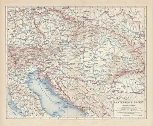
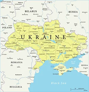
Romania is a country located in Southeastern Europe, bordered by Ukraine to the north, Moldova to the northeast, Hungary to the west
Choose a picture from our Romania Collection for your Wall Art and Photo Gifts
115 items


All Professionally Made to Order for Quick Shipping
-
Romania Collection
Romania is a country located in Southeastern Europe, bordered by Ukraine to the north, Moldova to the northeast, Hungary to the west, Serbia to the southwest and Bulgaria to the south. The country has a population of approximately 19 million people and covers an area of 238,391 square kilometers. Romania's capital city is Bucharest which is also its largest city with a population of over two million people. The official language spoken is Romanian and its currency is Leu (RON). Romania has diverse geography including mountain ranges such as Carpathians and Danube Delta which makes it an ideal destination for tourists looking for outdoor activities like hiking or birdwatching.
+
Our beautiful pictures are available as Framed Prints, Photos, Wall Art and Photo Gifts
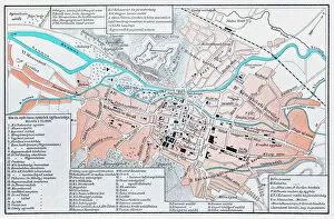
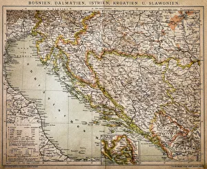
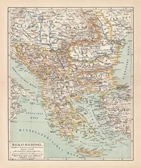
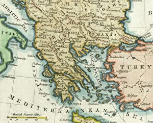
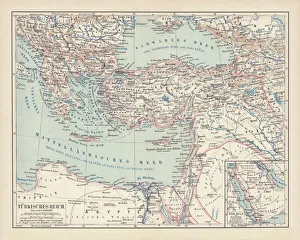
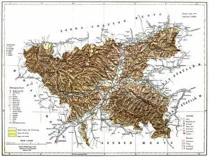
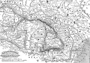
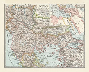
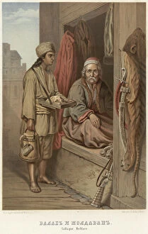
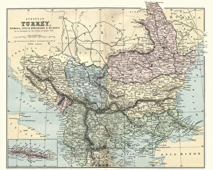
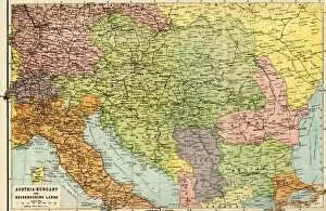
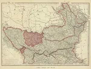
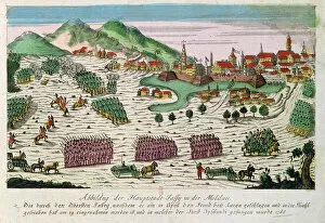
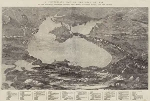
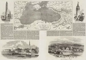
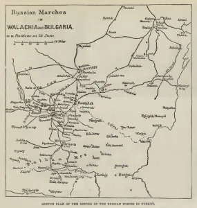
The Romania collection from Media Storehouse offers a wide range of wall art and framed prints that showcase the country's rich history, culture, and geography. Our collection features vintage maps, charts, and illustrations that depict various regions in Romania, including Transylvania, Wallachia, Moldavia, and Dobruja. These artworks provide a unique perspective on the country's past as well as its present-day landscape. Our collection includes high-quality reproductions of antique maps created by renowned cartographers such as Gerard Mercator and Abraham Ortelius. These maps are not only visually stunning but also offer valuable insights into the historical development of Romania. In addition to maps, our collection also features charts depicting natural resources such as minerals and forests found in different parts of Romania. This information is useful for researchers interested in studying the country's natural environment. The Romania collection from Media Storehouse is an excellent resource for anyone interested in exploring this fascinating country through visual art.
+
What are Romania (Maps and Charts) art prints?
Romania art prints are a collection of high-quality, visually stunning prints that showcase the beauty and history of Romania. These art prints feature detailed maps and charts that highlight the country's geography, topography, landmarks, and historical sites. They are perfect for anyone who loves to travel or has an interest in Romanian culture. We offer a wide range of Romania art prints that cater to different tastes and preferences. Whether you're looking for vintage-style maps or modern-day charts, there is something for everyone in this collection. These art prints are printed on premium quality paper using state-of-the-art printing technology to ensure maximum clarity, sharpness, and color accuracy. They make great gifts for friends or family members who have a passion for travel or history. Romania art prints from Media Storehouse offer a unique way to explore the rich heritage of this beautiful country through stunning visual representations.
+
What Romania (Maps and Charts) art prints can I buy from Media Storehouse?
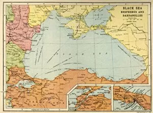
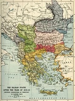
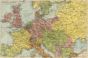
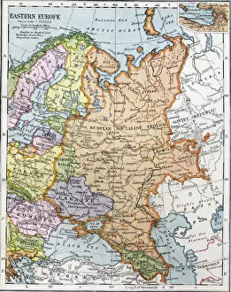
We offer a wide range of Romania maps and charts art prints that are perfect for decorating your home or office. You can choose from vintage maps, antique charts, and modern designs that showcase the beauty of this European country. These art prints feature different regions of Romania, including Transylvania, Bucharest, and the Carpathian Mountains. Some popular options include detailed topographic maps that highlight the terrain and elevation changes in various parts of Romania. There are also historical maps that show how the borders of this country have changed over time. For those who love nautical themes, we have several maritime charts depicting the Black Sea coastlines. Whether you're looking to add some color to your walls or want to display your love for Romanian culture and history, we have plenty of options to choose from.
+
How do I buy Romania (Maps and Charts) art prints?
To buy Romania art prints from Media Storehouse, you can browse our extensive collection of high-quality images online. Once you have found the print that you like, simply select the size and format that suits your needs. You can choose from a range of options including canvas prints, framed prints or unframed prints. We offer a secure checkout process where you can pay for your order using various payment methods such as credit card or PayPal. Your order will then be processed and shipped to your chosen address. Our website is user-friendly and easy to navigate with clear product descriptions and high-resolution images allowing you to see exactly what you are buying before making a purchase. Whether it's for personal use or as a gift, buying Romania art prints from Media Storehouse is an excellent way to add some unique artwork into your home or office space.
+
How much do Romania (Maps and Charts) art prints cost?
We offer a wide range of Romania maps and charts art prints at varying prices. The cost of these prints depends on several factors such as the size, quality, and type of paper used to print them. Our collection includes vintage maps, contemporary charts, and aerial views that capture the beauty and diversity of Romania's landscape. Our art prints are perfect for decorating your home or office space with unique pieces that showcase your love for travel or interest in geography. They also make great gifts for friends and family who share similar interests. We take pride in providing high-quality art prints that are affordable without compromising on their aesthetic value. Whether you're looking for a small print to fit into a frame or a large canvas to hang on your wall, we have something suitable for every budget. Our Romania maps and charts art prints are reasonably priced considering their quality and uniqueness.
+
How will my Romania (Maps and Charts) art prints be delivered to me?
Your Romania art prints will be delivered to you through a reliable shipping service. Our team takes great care in packaging your order to ensure that it arrives at your doorstep in perfect condition. The prints are carefully rolled and placed inside a sturdy tube, which is then sealed with protective caps on both ends. We work with trusted courier services who offer fast and secure delivery options for our customers. Once your order has been dispatched, you will receive an email notification containing the tracking information so that you can keep track of its progress. We understand the importance of delivering high-quality products to our customers promptly. That's why we have partnered with some of the best logistics providers in the industry to ensure that your Romania art prints arrive safely and on time. We take pride in providing exceptional customer service from start to finish, ensuring that every aspect of your shopping experience is seamless and hassle-free.