Fraud Blocker Skip to main content

Home > Maps and Charts > Russia

Russia Collection (page 2)

Russia is the largest country in the world

1,562 items

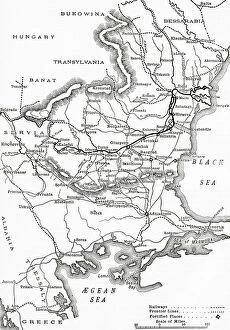
Background imageRussia Collection: The Russo-Turkish War, 1877-78, map of the seat of war in Europe

The Russo-Turkish War, 1877-78, map of the seat of war in Europe
3062101 The Russo-Turkish War, 1877-78, map of the seat of war in Europe.; Private Collection; (add.info.: From The Century Edition of Cassell's History of England, published c. 1900)

Background imageRussia Collection: A general chart of the northern navigation, 1675 (coloured engraving)

A general chart of the northern navigation, 1675 (coloured engraving)
7340043 A general chart of the northern navigation, 1675 (coloured engraving) by Seller, John (1632-97); 43.5x54 cm; National Maritime Museum, London

Background imageRussia Collection: Soviet Budenovka Winter Army Cap, 1920s-1930s (object)

Soviet Budenovka Winter Army Cap, 1920s-1930s (object)
7177609 Soviet Budenovka Winter Army Cap, 1920s-1930s (object); Private Collection; (add.info.: Famous style of Cap worn by the Red Army during the Russian Civil War and later); © Don Troiani

Background imageRussia Collection: First World War: Patriotic map showing a Cossack soldier in uniform with his flag

First World War: Patriotic map showing a Cossack soldier in uniform with his flag
LUX4745240 First World War: Patriotic map showing a Cossack soldier in uniform with his flag, titled: 'Cossack ardent and strong, proud and faithful soldier, France waits there

Background imageRussia Collection: First World War: Patriotic map showing three sailors of the allies: French, English and Russian

First World War: Patriotic map showing three sailors of the allies: French, English and Russian
LUX4745102 First World War: Patriotic map showing three sailors of the allies: French, English and Russian, hand in hand on a warship, declaring: 'But let's always go and hand in hand a babord

Background imageRussia Collection: First World War: France, Patriotic Map showing a French soldier

First World War: France, Patriotic Map showing a French soldier and a Russian soldier on guard at you side by side
LUX4737735 First World War: France, Patriotic Map showing a French soldier and a Russian soldier on guard at you side by side under the benevolent gaze of France

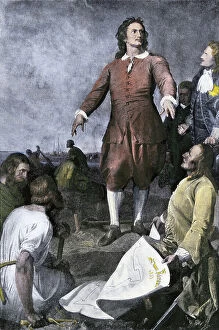
Background imageRussia Collection: Peter I The Great Founding the City of St. Petersburg, Russia, 1703

Peter I The Great Founding the City of St. Petersburg, Russia, 1703
NWI4945420 Peter I The Great Founding the City of St. Petersburg, Russia, 1703.; (add.info.: Peter I The Great Founding the City of St. Petersburg, Russia, 1703.); Photo © North Wind Pictures

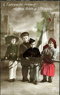
Background imageRussia Collection: First World War: France, Patriotic Map showing four young children in Italian, English

First World War: France, Patriotic Map showing four young children in Italian, English
LUX4738404 First World War: France, Patriotic Map showing four young children in Italian, English, Belgian and Russian soldier uniforms around the French flag

Background imageRussia Collection: First World War: France, Patriotic Map showing the five new nes of five allies under

First World War: France, Patriotic Map showing the five new nes of five allies under the protective leadership of
LUX4738234 First World War: France, Patriotic Map showing the five new nes of five allies under the protective leadership of France, entitled: 'For Law, for Liberty, Peace through Victory'

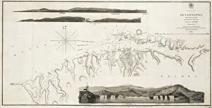
Background imageRussia Collection: Black Sea Sevastopol Harbour from the Russian Survey of 1836, 1853 (print)

Black Sea Sevastopol Harbour from the Russian Survey of 1836, 1853 (print)
7339521 Black Sea Sevastopol Harbour from the Russian Survey of 1836, 1853 (print) by British School, (19th century); 26x52.5 cm; National Maritime Museum, London, UK; (add.info.: British School)

Background imageRussia Collection: First World War: Patriotic map showing a bouquet of tricolor flower surrounded by angelot bearing

First World War: Patriotic map showing a bouquet of tricolor flower surrounded by angelot bearing the flags of
LUX4744965 First World War: Patriotic map showing a bouquet of tricolor flower surrounded by angelot bearing the flags of the allies

Background imageRussia Collection: First World War: Patriotic map showing the five flags of the allies with the commentary

First World War: Patriotic map showing the five flags of the allies with the commentary: 'They are also as many
LUX4744940 First World War: Patriotic map showing the five flags of the allies with the commentary: 'They are also as many, you will have to count with them'

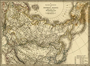
Background imageRussia Collection: Geographic map of Russia under the rule of the tsars, 1870. 19th century lithography

Geographic map of Russia under the rule of the tsars, 1870. 19th century lithography
NWI4870820 Geographic map of Russia under the rule of the tsars, 1870. 19th century lithography.; (add.info.: Geographic map of Russia under the rule of the tsars, 1870)

Background imageRussia Collection: Illustration of Edouard Carrier in Le Pelerin, 10/07/04 - Arrest of a Japanese spy disguise as an

Illustration of Edouard Carrier in Le Pelerin, 10/07/04 - Arrest of a Japanese spy disguise as an organ player - Music
ICA4855232 Illustration of Edouard Carrier in Le Pelerin, 10/07/04 - Arrest of a Japanese spy disguise as an organ player - Music, Russian-Japanese War, Barbary organ

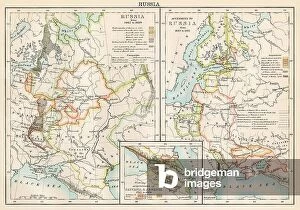
Background imageRussia Collection: Maps of Russia from 1462 to 1689 (left) and map of territories added to the Russian Empire (right)

Maps of Russia from 1462 to 1689 (left) and map of territories added to the Russian Empire (right) from 1689 to 1825
NWI4872109 Maps of Russia from 1462 to 1689 (left) and map of territories added to the Russian Empire (right) from 1689 to 1825

Background imageRussia Collection: Patriotic map showing the three allied nations France, England and Russia holding hands

Patriotic map showing the three allied nations France, England and Russia holding hands and heading towards Victory
LUX4743785 Patriotic map showing the three allied nations France, England and Russia holding hands and heading towards Victory

Background imageRussia Collection: First World War: Patriotic map showing the five allied armed forces represented by children in

First World War: Patriotic map showing the five allied armed forces represented by children in uniform pose under an
LUX4744153 First World War: Patriotic map showing the five allied armed forces represented by children in uniform pose under an airship balloon called Alsace and entitled Victoire et Liberte

Background imageRussia Collection: St Petersburg, Russia, 1776

St Petersburg, Russia, 1776
2902729 St Petersburg, Russia, 1776; (add.info.: St. Petersburg, Russia, 1776.); Buyenlarge Archive/UIG

Background imageRussia Collection: Siberia, Russia, 1706

Siberia, Russia, 1706
2902723 Siberia, Russia, 1706; (add.info.: Siberia, Russia, 1706.); Buyenlarge Archive/UIG

Background imageRussia Collection: Asiatic Russia - 1868

Asiatic Russia - 1868
2902718 Asiatic Russia - 1868; (add.info.: Asiatic Russia - 1868); Buyenlarge Archive/UIG

Background imageRussia Collection: Ethnographic Map of Asiatic Russia, 1870

Ethnographic Map of Asiatic Russia, 1870
2902750 Ethnographic Map of Asiatic Russia, 1870; (add.info.: Ethnographic Map of Asiatic Russia, 1870.); Buyenlarge Archive/UIG

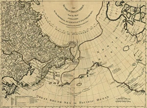
Background imageRussia Collection: Russian Discoveries, 1775

Russian Discoveries, 1775
2902732 Russian Discoveries, 1775; (add.info.: Russian discoveries from the map published by the Imperial Academy of St. Petersburg.); Buyenlarge Archive/UIG

Background imageRussia Collection: map of Saint Petersburg 1862, engraving

map of Saint Petersburg 1862, engraving
1753780 map of Saint Petersburg 1862, engraving; (add.info.: map of Saint Petersburg 1862, engraving); Photo: Tallandier

Background imageRussia Collection: Map of St. Petersburg, c.1900 (engraving)

Map of St. Petersburg, c.1900 (engraving)
532866 Map of St. Petersburg, c.1900 (engraving); (add.info.: Map of St. Petersburg, circa 1900, from the 10th edition of Encyclopaedia Britannica.); Encyclopaedia Britannica/UIG

Background imageRussia Collection: Map of Russia showing historical boundaries of Russia in Europe with Poland and Finland, circa 1902

Map of Russia showing historical boundaries of Russia in Europe with Poland and Finland, circa 1902
532992 Map of Russia showing historical boundaries of Russia in Europe with Poland and Finland, circa 1902; (add.info.: Map showing historical boundaries of Russia in Europe with Poland and Finland)

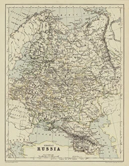
Background imageRussia Collection: European Russia (colour litho)

European Russia (colour litho)
8658799 European Russia (colour litho) by English School, (20th century); Private Collection; (add.info.: European Russia)

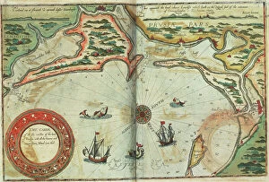
Background imageRussia Collection: Coast of Prussia with all the havens and rivers from Memel to Heel, 1588 (coloured engraving)

Coast of Prussia with all the havens and rivers from Memel to Heel, 1588 (coloured engraving)
7340016 Coast of Prussia with all the havens and rivers from Memel to Heel, 1588 (coloured engraving) by Janszoon Waghenaer, Lucas (c.1533-c.1606) ; 33x51 cm; National Maritime Museum, London

Background imageRussia Collection: Chart of Moscow and the Black Sea, 1554 (vellum)

Chart of Moscow and the Black Sea, 1554 (vellum)
7339650 Chart of Moscow and the Black Sea, 1554 (vellum) by Agnese, Battista (c.1500-64); 26x40 cm; National Maritime Museum, London, UK; (add.info.: Creator: Johan B. Agnese 'Moscaw oder Reuss')

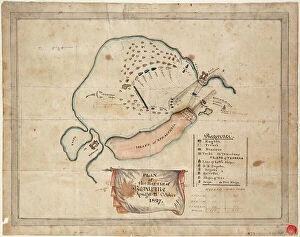
Background imageRussia Collection: Plan of the Battle of Navarino, 21 October 1827, 1827 (coloured manuscript)

Plan of the Battle of Navarino, 21 October 1827, 1827 (coloured manuscript)
7339519 Plan of the Battle of Navarino, 21 October 1827, 1827 (coloured manuscript) by Unknown Artist, (19th century); 32x42 cm; National Maritime Museum, London

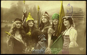
Background imageRussia Collection: First World War: Patriotic Map showing five young women representing the Allied countries in their

First World War: Patriotic Map showing five young women representing the Allied countries in their symbolic dress
LUX4745083 First World War: Patriotic Map showing five young women representing the Allied countries in their symbolic dress, 1915

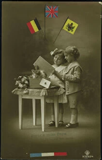
Background imageRussia Collection: First World War: Patriotic map showing a little boy and a little girl sends to their father at

First World War: Patriotic map showing a little boy and a little girl sends to their father at the forehead a wooden
LUX4744189 First World War: Patriotic map showing a little boy and a little girl sends to their father at the forehead a wooden crate with a card and kitten

Background imageRussia Collection: Map of Russia from Arctic zones to the Black Sea, late 19th century - Colour lithograph of a

Map of Russia from Arctic zones to the Black Sea, late 19th century - Colour lithograph of a 19th-century illustration
NWI4872077 Map of Russia from Arctic zones to the Black Sea, late 19th century - Colour lithograph of a 19th-century illustration; (add.info.: Map of Russia from Arctic zones to the Black Sea)

Background imageRussia Collection: Napoleon Bonaparte (1769-1821) and Tsar Alexander I Emperor of Russia (1801-1825)

Napoleon Bonaparte (1769-1821) and Tsar Alexander I Emperor of Russia (1801-1825)
NWI4835723 Napoleon Bonaparte (1769-1821) and Tsar Alexander I Emperor of Russia (1801-1825) negociating a treaty of alliance at Tilsit (Tilsitt), 1807

Background imageRussia Collection: Allegory of the British Empire as the Colossus of Rhodes, 19th century

Allegory of the British Empire as the Colossus of Rhodes, 19th century
CUL4940269 Allegory of the British Empire as the Colossus of Rhodes, 19th century; (add.info.: Il Colosso di Rodi. Allegory of the British Empire as the 'Colossus of Rhodes" monitoring)

Background imageRussia Collection: First World War: France, Patriotic Map showing four young children in Italian, English

First World War: France, Patriotic Map showing four young children in Italian, English
LUX4738398 First World War: France, Patriotic Map showing four young children in Italian, English, Belgian and Russian soldier uniforms around the French flag

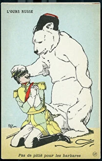
Background imageRussia Collection: First World War: France, Patriotic Map showing William II in the grip of the Russian bear

First World War: France, Patriotic Map showing William II in the grip of the Russian bear
LUX4739416 First World War: France, Patriotic Map showing William II in the grip of the Russian bear, titled: 'No pity for the beards', 1914

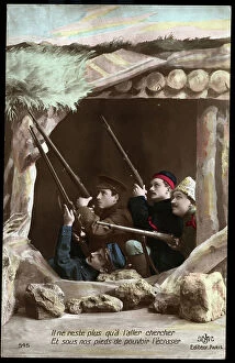
Background imageRussia Collection: First World War: France, Patriotic Map showing four soldiers representing Allied Armies firing in

First World War: France, Patriotic Map showing four soldiers representing Allied Armies firing in heart on enemy
LUX4742673 First World War: France, Patriotic Map showing four soldiers representing Allied Armies firing in heart on enemy aircraft

Background imageRussia Collection: First World War: France, Patriotic Map showing a French soldier

First World War: France, Patriotic Map showing a French soldier and a Russian soldier next to a cannon 75
LUX4742468 First World War: France, Patriotic Map showing a French soldier and a Russian soldier next to a cannon 75, encouraged by a young girl with a Phrygian cap representing the republic to shoot

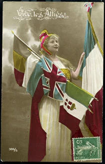
Background imageRussia Collection: First World War: France, Patriotic Map showing a young woman wearing the Allies flags, 1915

First World War: France, Patriotic Map showing a young woman wearing the Allies flags, 1915
LUX4741716 First World War: France, Patriotic Map showing a young woman wearing the Allies flags, 1915, Map titled: Long live the Allies; (add.info)

Background imageRussia Collection: Map illustrating the advance of the Russian Army of Invasion in the east of Germany (litho)

Map illustrating the advance of the Russian Army of Invasion in the east of Germany (litho)
3252895 Map illustrating the advance of the Russian Army of Invasion in the east of Germany (litho); Private Collection; (add.info)

Background imageRussia Collection: European Russia, North, 1745

European Russia, North, 1745
2902747 European Russia, North, 1745; (add.info.: European Russia, North, 1745.); Buyenlarge Archive/UIG

Background imageRussia Collection: Kiev, Smolensk - Voronezh, Russia, 1745

Kiev, Smolensk - Voronezh, Russia, 1745
2902746 Kiev, Smolensk - Voronezh, Russia, 1745; (add.info.: Kiev, Smolensk - Voronezh, Russia, 1745.); Buyenlarge Archive/UIG

Background imageRussia Collection: Russian Lapland, 1745

Russian Lapland, 1745
2902742 Russian Lapland, 1745; (add.info.: Lapponia or Laponia is the Latin name of the historic region, later province (landskap) of Lapland

Background imageRussia Collection: Imperial Russia, 1876

Imperial Russia, 1876
2902727 Imperial Russia, 1876; (add.info.: Imperial Russia, 1876.); Buyenlarge Archive/UIG

Background imageRussia Collection: Map of European Russia (colour litho)

Map of European Russia (colour litho)
8664039 Map of European Russia (colour litho) by English School, (19th century); Private Collection; (add.info.: Map of European Russia)

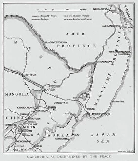
Background imageRussia Collection: Status of Manchuria as determined by the Treaty of Portsmouth ending the Russo-Japanese War

Status of Manchuria as determined by the Treaty of Portsmouth ending the Russo-Japanese War, 1905 (litho)
8655654 Status of Manchuria as determined by the Treaty of Portsmouth ending the Russo-Japanese War, 1905 (litho) by English School

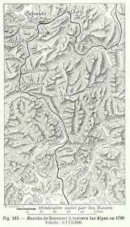
Background imageRussia Collection: Marshal Suvorov's march across the Alps, 1799 (engraving)

Marshal Suvorov's march across the Alps, 1799 (engraving)
8673050 Marshal Suvorov's march across the Alps, 1799 (engraving) by Swiss School, (19th Century); Private Collection; (add.info)

Background imageRussia Collection: SAINT PETERSBURG

SAINT PETERSBURG
StudioSix


All Professionally Made to Order for Quick Shipping


-

Russia Collection

Russia is the largest country in the world, spanning across two continents and covering an area of 17.1 million square kilometers and has a population of over 144 million people, making it the ninth most populous country globally. The country's economy heavily relies on its vast reserves of natural resources such as oil, gas, coal, and timber. Moscow is Russia's capital city and home to over 12 million residents. Other major cities include Saint Petersburg, Novosibirsk, Yekaterinburg, Nizhny Novgorod and Kazan. The Russian Federation comprises eighty-five federal subjects that are divided into seven federal districts for administrative purposes.
+

Our beautiful pictures are available as Framed Prints, Photos, Wall Art and Photo Gifts

The Russia collection from Media Storehouse offers a stunning array of wall art and framed prints that showcase the beauty, history, and culture of Russia. Our collection features an extensive range of maps and charts that depict various regions, cities, landmarks, and historical events in Russia. Our collection includes vintage maps dating back to the 18th century as well as contemporary designs that capture the modern-day landscape of this vast country. Whether you are looking for a unique piece to decorate your home or office or seeking inspiration for your next travel adventure, our collection has something for everyone. From iconic landmarks such as St. Basil's Cathedral in Moscow to lesser-known gems like Lake Baikal in Siberia, these prints offer a glimpse into the diverse landscapes and rich cultural heritage of Russia. The Russia collection is a must-see for anyone interested in exploring one of the world's most fascinating countries through beautiful artwork.
+

What are Russia (Maps and Charts) art prints?

Russia art prints are a collection of high-quality, visually stunning prints that showcase the geography and history of Russia. These prints feature detailed maps and charts that highlight various regions, cities, rivers, mountains, and other important landmarks in Russia. They also include historical information about the country's culture, economy, politics, and society. These art prints are perfect for anyone who is interested in Russian history or geography. They can be used to decorate homes or offices with a unique touch of sophistication. The intricate details on these maps make them an excellent educational tool for students studying Russian history or geography. The We offer a wide range of Russia art prints in different sizes to suit every need. These prints are made using high-quality materials to ensure their longevity so they can be enjoyed for years to come. Whether you're looking for something classic or contemporary, there is sure to be a print that will capture your imagination at Media Storehouse.
+

What Russia (Maps and Charts) art prints can I buy from Media Storehouse?

We offer a wide range of Russia art prints that you can purchase. These include antique maps, vintage charts, and contemporary illustrations showcasing the beauty and history of Russia. You can choose from various sizes, styles, and materials to suit your preferences. Some popular options include detailed maps of Moscow or St. Petersburg, historic charts depicting the Russian Empire's expansion over time, or modern illustrations featuring iconic landmarks such as the Kremlin or Red Square. Whether you're looking for a unique piece to decorate your home or office space or a thoughtful gift for someone who loves travel and culture, we have something for everyone. Their high-quality prints are produced using state-of-the-art printing technology on premium paper stock to ensure vibrant colors and sharp details that will last for years to come. With so many beautiful Russia art prints available at Media Storehouse, you're sure to find something that catches your eye.
+

How do I buy Russia (Maps and Charts) art prints?

To buy Russia art prints from Media Storehouse, you can browse our extensive collection of artwork online. Simply search for the specific type of print you are looking for using keywords such as "Russia maps" or "Russian charts". Once you have found a print that catches your eye, select the size and format that best suits your needs. We offer a range of formats including canvas prints, framed prints, and poster prints. You can also choose to have your print mounted on wood or metal for added durability. After selecting your preferred format, simply add the item to your cart and proceed to checkout. At checkout, you will be prompted to enter your shipping information and payment details. Once this is complete, Media Storehouse will process your order and ship it directly to you. With high-quality printing techniques used in all their products, purchasing Russia art prints from Media Storehouse is an excellent way to add unique decor pieces with historical significance to any space.
+

How much do Russia (Maps and Charts) art prints cost?

We offer a wide range of Russia art prints that vary in price depending on the size and type of print you choose. Our collection includes vintage maps, historical charts, and contemporary artwork featuring iconic Russian landmarks and landscapes. Our prices are competitive with other online retailers offering similar products. We strive to provide high-quality prints at affordable prices so that everyone can enjoy beautiful artwork in their home or office. Whether you're looking for a small print to add some color to your space or a large statement piece to make a bold impression, we have something for every budget. Our selection is constantly updated with new designs, so be sure to check back often for the latest additions. Our Russia art prints are priced fairly based on their quality and uniqueness.
+

How will my Russia (Maps and Charts) art prints be delivered to me?

We take pride in delivering your Russia art prints to you with utmost care. We use high-quality packaging materials to ensure that your artwork arrives safely and securely at your doorstep. Your art print will be carefully rolled into a sturdy tube, which is then placed inside a protective cardboard box for added security during transit. We work with trusted courier partners who offer reliable delivery services worldwide. Once your order has been dispatched from our warehouse, you will receive an email notification containing the tracking details of your shipment so that you can monitor its progress until it reaches you. We understand the value of preserving art pieces as they are meant to be seen by their creators. That's why we go above and beyond to make sure that every customer receives their Russia art prints in pristine condition – ready for framing or display as soon as they arrive.