Fraud Blocker Skip to main content

Home > Maps and Charts > Russia

Russia Collection (page 6)

Russia is the largest country in the world

1,547 items

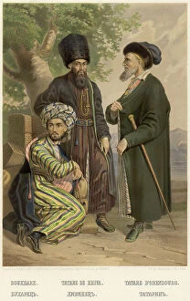
Background imageRussia Collection: Bukharka. Khivinka. Tatar, 1862. Creator: Karlis Huns

Bukharka. Khivinka. Tatar, 1862. Creator: Karlis Huns
Bukharka. Khivinka. Tatar, 1862. Sheet 46 from the album "Description ethnographique des peuples de la Russie", volume 1

Background imageRussia Collection: Bukharan. Kievan. Tatar, 1862. Creator: Karlis Huns

Bukharan. Kievan. Tatar, 1862. Creator: Karlis Huns
Bukharan. Kievan. Tatar, 1862. Sheet 45 from the album "Description ethnographique des peuples de la Russie", volume 1

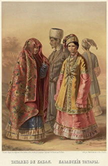
Background imageRussia Collection: Kazan Tatars, 1862. Creator: Karlis Huns

Kazan Tatars, 1862. Creator: Karlis Huns
Kazan Tatars, 1862. Sheet 44 from the album "Description ethnographique des peuples de la Russie", volume 1. Description ethnographique des peuples de la Russie

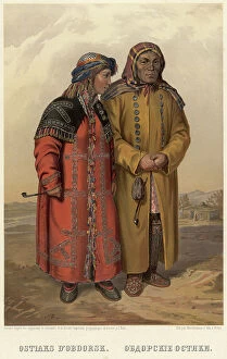
Background imageRussia Collection: Obdorsk Ostyaks, 1862. Creator: Karlis Huns

Obdorsk Ostyaks, 1862. Creator: Karlis Huns
Obdorsk Ostyaks, 1862. Sheet 42 from the album "Description ethnographique des peuples de la Russie", volume 1. Description ethnographique des peuples de la Russie

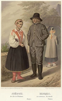
Background imageRussia Collection: Swedes. On the islands of Estonia, 1862. Creator: Karl Fiale

Swedes. On the islands of Estonia, 1862. Creator: Karl Fiale
Swedes. On the islands of Estonia, 1862. Sheet 18 from the album "Description ethnographique des peuples de la Russie", volume 1

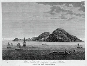
Background imageRussia Collection: View of Boca De Tigres Near Macao, 1813. Creator: Koz'ma Vasil'evich Chesky

View of Boca De Tigres Near Macao, 1813. Creator: Koz'ma Vasil'evich Chesky
View of Boca De Tigres Near Macao, 1813. In 1803-06, Captain I. F. Kruzenshtern became the first Russian to circumnavigate the globe

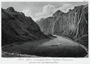
Background imageRussia Collection: View of the Canal, Leading to Gonamu Opposite Canton, 1813.. Creator: Ivan Vasil'evich Chesky

View of the Canal, Leading to Gonamu Opposite Canton, 1813.. Creator: Ivan Vasil'evich Chesky
View of the Canal, Leading to Gonamu Opposite Canton, 1813. In 1803-06, Captain I. F. Kruzenshtern became the first Russian to circumnavigate the globe

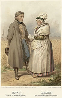
Background imageRussia Collection: Latvians. (Festive attire of Lemzal peasants), 1862. Creator: Karl Fiale

Latvians. (Festive attire of Lemzal peasants), 1862. Creator: Karl Fiale
Latvians. (Festive attire of Lemzal peasants), 1862. Sheet 14 from the album "Description ethnographique des peuples de la Russie", volume 1

Background imageRussia Collection: View of the Seashore Near Port Chichagov, 1813. Creator: Koz'ma Vasil'evich Chesky

View of the Seashore Near Port Chichagov, 1813. Creator: Koz'ma Vasil'evich Chesky
View of the Seashore Near Port Chichagov, 1813. In 1803-06, Captain I. F. Kruzenshtern became the first Russian to circumnavigate the globe

Background imageRussia Collection: Goppo, or the Custom Office Director in Canton, Sailing on His Vessel, 1813

Goppo, or the Custom Office Director in Canton, Sailing on His Vessel, 1813. Creator: Ivan Vasil'evich Chesky
Goppo, or the Custom Office Director in Canton, Sailing on His Vessel, 1813. In 1803-06, Captain I. F. Kruzenshtern became the first Russian to circumnavigate the globe

Background imageRussia Collection: Convicts During a Geography Lesson, 1906-1911. Creator: Isaiah Aronovich Shinkman

Convicts During a Geography Lesson, 1906-1911. Creator: Isaiah Aronovich Shinkman
Convicts During a Geography Lesson, 1906-1911. This photograph is from an album of 47 views of convicts and structures at the Akatuy Prison

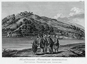
Background imageRussia Collection: A Conversation Between Japanese Officials, 1813. Creator: Stepan Galaktionov

A Conversation Between Japanese Officials, 1813. Creator: Stepan Galaktionov
A Conversation Between Japanese Officials, 1813. In 1803-06, Captain I. F. Kruzenshtern became the first Russian to circumnavigate the globe

Background imageRussia Collection: Japanese Interpreters Kneeling in Front of Their Chief, 1813. Creator: Stepan Galaktionov

Japanese Interpreters Kneeling in Front of Their Chief, 1813. Creator: Stepan Galaktionov
Japanese Interpreters Kneeling in Front of Their Chief, 1813. In 1803-06, Captain I. F. Kruzenshtern became the first Russian to circumnavigate the globe

Background imageRussia Collection: Belarusians (Mogilev province), 1862. Creator: Karl Fiale

Belarusians (Mogilev province), 1862. Creator: Karl Fiale
Belarusians (Mogilev province), 1862. Sheet 6 from the album "Description ethnographique des peuples de la Russie", volume 1

Background imageRussia Collection: View of Cemetery on Nukagiva Island, 1813. Creator: Koz'ma Vasil'evich Chesky

View of Cemetery on Nukagiva Island, 1813. Creator: Koz'ma Vasil'evich Chesky
View of Cemetery on Nukagiva Island, 1813. In 1803-06, Captain I. F. Kruzenshtern became the first Russian to circumnavigate the globe

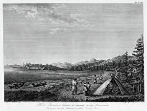
Background imageRussia Collection: View of Aniva Bay in the Southern Part of Sakhalin Island, 1813. Creator: Stepan Galaktionov

View of Aniva Bay in the Southern Part of Sakhalin Island, 1813. Creator: Stepan Galaktionov
View of Aniva Bay in the Southern Part of Sakhalin Island, 1813. In 1803-06, Captain I. F. Kruzenshtern became the first Russian to circumnavigate the globe

Background imageRussia Collection: Gypsies, 1862. Creator: Karl Fiale

Gypsies, 1862. Creator: Karl Fiale
Gypsies, 1862. Sheet 21 from the album "Description ethnographique des peuples de la Russie", volume 1. Description ethnographique des peuples de la Russie

Background imageRussia Collection: Greek and Arnaut, 1862. Creator: Karl Fiale

Greek and Arnaut, 1862. Creator: Karl Fiale
Greek and Arnaut, 1862. Sheet 19 from the album "Description ethnographique des peuples de la Russie", volume 1

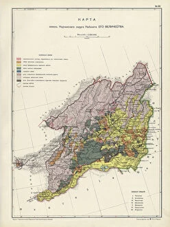
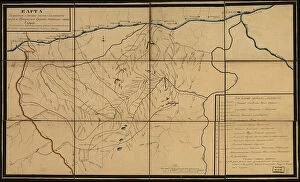
Background imageRussia Collection: Map of the Nerchinsk Region from the Office of His Majesty, 1914. Creator

Map of the Nerchinsk Region from the Office of His Majesty, 1914. Creator
Map of the Nerchinsk Region from the Office of His Majesty, 1914. From the atlas "Atlas of Asian Russia."

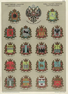
Background imageRussia Collection: Seals of the Provinces and Oblasts of Asiatic Russia, 1914. Creator

Seals of the Provinces and Oblasts of Asiatic Russia, 1914. Creator: Resettlement Department of the Land Regulation
Seals of the Provinces and Oblasts of Asiatic Russia, 1914. From the atlas "Atlas of Asian Russia."

Background imageRussia Collection: Map on the drainage of the Barabinsk steppe in the Tomsk province, Kainsk district, 1914

Map on the drainage of the Barabinsk steppe in the Tomsk province, Kainsk district, 1914. From the atlas "Atlas of Asian Russia."

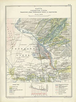
Background imageRussia Collection: Map of the barren steppe of the Khodzhentsk distric, Samarkand region, with its environs, 1914

Map of the barren steppe of the Khodzhentsk distric, Samarkand region, with its environs, 1914. From the atlas "Atlas of Asian Russia."

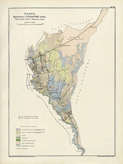
Background imageRussia Collection: Plan Murgabskogo Gosudareva imeniia, Zakaspiiskoi oblasti, Mervskogo uezda, 1914

Plan Murgabskogo Gosudareva imeniia, Zakaspiiskoi oblasti, Mervskogo uezda, 1914. From the atlas "Atlas of Asian Russia."

Background imageRussia Collection: Map of the Altai Region from the Office of His Majesty, 1914

Map of the Altai Region from the Office of His Majesty, 1914. Creator: Resettlement Department of the Land Regulation
Map of the Altai Region from the Office of His Majesty, 1914. From the atlas "Atlas of Asian Russia."

Background imageRussia Collection: Map of Zabaikal Province, 1914. Creator: Resettlement Department of the Land Regulation

Map of Zabaikal Province, 1914. Creator: Resettlement Department of the Land Regulation and Agriculture Administration
Map of Zabaikal Province, 1914. From the atlas "Atlas of Asian Russia."

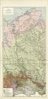
Background imageRussia Collection: Map of Enisei Province, 1914. Creator: Resettlement Department of the Land Regulation

Map of Enisei Province, 1914. Creator: Resettlement Department of the Land Regulation and Agriculture Administration
Map of Enisei Province, 1914. From the atlas "Atlas of Asian Russia."

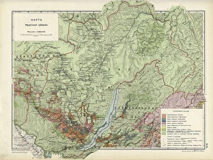
Background imageRussia Collection: Map of Irkutsk Province, 1914. Creator: Resettlement Department of the Land Regulation

Map of Irkutsk Province, 1914. Creator: Resettlement Department of the Land Regulation and Agriculture Administration
Map of Irkutsk Province, 1914. From the atlas "Atlas of Asian Russia."

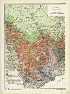
Background imageRussia Collection: Map of Tomsk Province, 1914. Creator: Resettlement Department of the Land Regulation

Map of Tomsk Province, 1914. Creator: Resettlement Department of the Land Regulation and Agriculture Administration
Map of Tomsk Province, 1914. From the atlas "Atlas of Asian Russia."

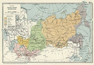
Background imageRussia Collection: Map of the Military Districts of Asiatic Russia, 1914. Creator

Map of the Military Districts of Asiatic Russia, 1914. Creator: Resettlement Department of the Land Regulation
Map of the Military Districts of Asiatic Russia, 1914. From the atlas "Atlas of Asian Russia."

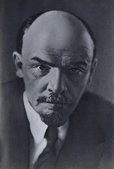
Background imageRussia Collection: Portrait of Lenin, 1970. Creator: Unknown

Portrait of Lenin, 1970. Creator: Unknown
Portrait of Lenin, 1970. From We Live and Work According to Lenin: Atlas of the Novosibirsk Region, 1970. The Communist Party of the Soviet Union drew its legitimacy from the life

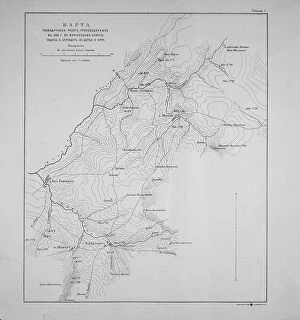
Background imageRussia Collection: Map of exploration work carried out in 1895 in the Mariinsky District. Ubienka.. 1895

Map of exploration work carried out in 1895 in the Mariinsky District. Ubienka.. 1895. Creator: Unknown
Map of exploration work carried out in 1895 in the Mariinsky District. Ubienka, B. Barandat, lake; Pike and so on, 1895

Background imageRussia Collection: Map of the Kuril Islands with Surrounding Areas, 1700-1799. Creator: Unknown

Map of the Kuril Islands with Surrounding Areas, 1700-1799. Creator: Unknown
Map of the Kuril Islands with Surrounding Areas, 1700-1799. This 18th century Russian map depicts the Kurile Islands archipelago, located on the far eastern edge of the Russian Empire

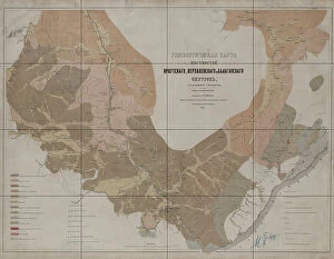
Background imageRussia Collection: Geognostic Map of the Localities of Irkutsk, Verkholensk, and Balagansk Districts, 1873

Geognostic Map of the Localities of Irkutsk, Verkholensk, and Balagansk Districts, 1873. The first geological (geognostic) maps in Russia were produced in the 1850s

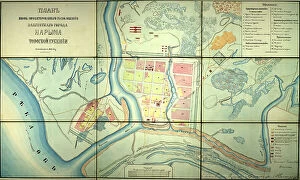
Background imageRussia Collection: Plan of the newly designed location of the provincial town of Narym, Tomsk province, 1868

Plan of the newly designed location of the provincial town of Narym, Tomsk province, 1868. Creator: Unknown
Plan of the newly designed location of the provincial town of Narym, Tomsk province, 1868

Background imageRussia Collection: Projecting Plan of a District City Tomsk, Made in 1872, 1873. Creator: Unknown

Projecting Plan of a District City Tomsk, Made in 1872, 1873. Creator: Unknown
Projecting Plan of a District City Tomsk, Made in 1872, 1873

Background imageRussia Collection: Map of the Route of the Siberian Railway Line, 1891-1916.. Creator: Unknown

Map of the Route of the Siberian Railway Line, 1891-1916.. Creator: Unknown
Map of the Route of the Siberian Railway Line, 1891-1916

Background imageRussia Collection: Map of the Far East of the USSR, Northern China (Manchuria) and Mongolia, 1930. Creator: Unknown

Map of the Far East of the USSR, Northern China (Manchuria) and Mongolia, 1930. Creator: Unknown
Map of the Far East of the USSR, Northern China (Manchuria) and Mongolia, 1930. This Soviet-era map is intended to serve a propaganda purpose

Background imageRussia Collection: Karta I?A?kutskoi? oblasti chasti Olekminskago okruga i Irkutskoi? guberni¯i? Kirenskogo... 1853

Karta I?A?kutskoi? oblasti chasti Olekminskago okruga i Irkutskoi? guberni¯i? Kirenskogo... 1853. Creator: Unknown
Karta I?A?kutskoi? oblasti chasti Olekminskago okruga i Irkutskoi? guberni¯i? Kirenskogo [sic] chast okrugas pokazani¯em zolotosoderzhashchikh pri¯i?skov razrabatyvaemyi?a? : gg

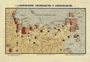
Background imageRussia Collection: The direction of reindeer husbandry and dog breeding, 1932. Creator: Unknown

The direction of reindeer husbandry and dog breeding, 1932. Creator: Unknown
The direction of reindeer husbandry and dog breeding, 1932. Conventional signs: adult reindeer with the distinction of sled dogs, adult dogs with the distinction of sled dogs, herding dogs

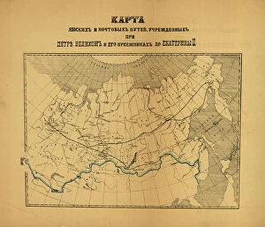
Background imageRussia Collection: [Karty pochtovykh soobshcheni¯i? uchrezhdennykh v Rossi¯i?skoi? Imperi¯i pri T?S?ari?e... (186-?)

[Karty pochtovykh soobshcheni¯i? uchrezhdennykh v Rossi¯i?skoi? Imperi¯i pri T?S?ari?e... (186-?). Creator: Unknown
[Karty pochtovykh soobshcheni¯i? uchrezhdennykh v Rossi¯i?skoi? Imperi¯i pri T?S?ari?e? Aleksi?e?i?e? Mikhailovichi?e? i ego preemnikakh do Ekateriny II], (186-?)

Background imageRussia Collection: The Russian discoveries from the map published by the Imperial Academy of St. Petersburg, 1775

The Russian discoveries from the map published by the Imperial Academy of St. Petersburg, 1775. Creator: Unknown
The Russian discoveries from the map published by the Imperial Academy of St. Petersburg, 1775. This map, showing the known geography of Alaska in the late 18th century

Background imageRussia Collection: Kartogramma 'grippa' : [Russia], 1890. Creator: Unknown. Kartogramma 'grippa' : [Russia], 1890

Kartogramma "grippa" : [Russia], 1890. Creator: Unknown. Kartogramma "grippa" : [Russia], 1890
Kartogramma "grippa" : [Russia], 1890. Shows occurrence of influenza by province. Each map has a number at head of title, and a month or months at the end of the title: No. 50
Background imageRussia Collection: E?tnograficheskai?a? karta Azi¯i?a?tskoi? Rossi¯i, (187-?). Creator: Mikhail Veniukov

E?tnograficheskai?a? karta Azi¯i?a?tskoi? Rossi¯i, (187-?). Creator: Mikhail Veniukov
E?tnograficheskai?a? karta Azi¯i?a?tskoi? Rossi¯i, (187-?). Pulkovo meridian

Background imageRussia Collection: Industry of binding building materials on January 1, 1933, 1934

Industry of binding building materials on January 1, 1933, 1934. Creator: Mikhail Alekseevich TSvetkov
Industry of binding building materials on January 1, 1933, 1934. From the atlas "Industry of the USSR at the beginning of the 2nd Five-Year Plan

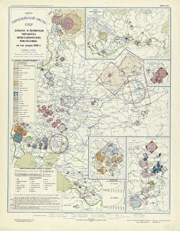
Background imageRussia Collection: Extraction and primary processing of non-metallic minerals as of January 1, 1933, 1934

Extraction and primary processing of non-metallic minerals as of January 1, 1933, 1934. From the atlas "Industry of the USSR at the beginning of the 2nd Five-Year Plan

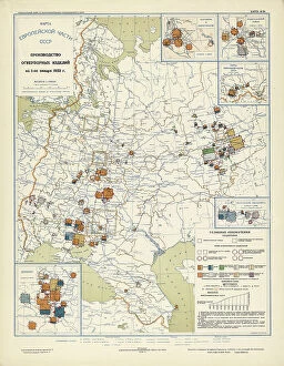
Background imageRussia Collection: Production of refractory products on January 1, 1933, 1934. Creator: Mikhail Alekseevich TSvetkov

Production of refractory products on January 1, 1933, 1934. Creator: Mikhail Alekseevich TSvetkov
Production of refractory products on January 1, 1933, 1934. From the atlas "Industry of the USSR at the beginning of the 2nd Five-Year Plan

Background imageRussia Collection: Chemical industry of the USSR on January 1, 1933, 1934. Creator: Mikhail Alekseevich TSvetkov

Chemical industry of the USSR on January 1, 1933, 1934. Creator: Mikhail Alekseevich TSvetkov
Chemical industry of the USSR on January 1, 1933, 1934. From the atlas "Industry of the USSR at the beginning of the 2nd Five-Year Plan

Background imageRussia Collection: Precision mechanics on January 1, 1933, 1934. Creator: Mikhail Alekseevich TSvetkov

Precision mechanics on January 1, 1933, 1934. Creator: Mikhail Alekseevich TSvetkov
Precision mechanics on January 1, 1933, 1934. From the atlas "Industry of the USSR at the beginning of the 2nd Five-Year Plan


All Professionally Made to Order for Quick Shipping


-

Russia Collection

Russia is the largest country in the world, spanning across two continents and covering an area of 17.1 million square kilometers and has a population of over 144 million people, making it the ninth most populous country globally. The country's economy heavily relies on its vast reserves of natural resources such as oil, gas, coal, and timber. Moscow is Russia's capital city and home to over 12 million residents. Other major cities include Saint Petersburg, Novosibirsk, Yekaterinburg, Nizhny Novgorod and Kazan. The Russian Federation comprises eighty-five federal subjects that are divided into seven federal districts for administrative purposes.
+

Our beautiful pictures are available as Framed Prints, Photos, Wall Art and Photo Gifts

The Russia collection from Media Storehouse offers a stunning array of wall art and framed prints that showcase the beauty, history, and culture of Russia. Our collection features an extensive range of maps and charts that depict various regions, cities, landmarks, and historical events in Russia. Our collection includes vintage maps dating back to the 18th century as well as contemporary designs that capture the modern-day landscape of this vast country. Whether you are looking for a unique piece to decorate your home or office or seeking inspiration for your next travel adventure, our collection has something for everyone. From iconic landmarks such as St. Basil's Cathedral in Moscow to lesser-known gems like Lake Baikal in Siberia, these prints offer a glimpse into the diverse landscapes and rich cultural heritage of Russia. The Russia collection is a must-see for anyone interested in exploring one of the world's most fascinating countries through beautiful artwork.
+

What are Russia (Maps and Charts) art prints?

Russia art prints are a collection of high-quality, visually stunning prints that showcase the geography and history of Russia. These prints feature detailed maps and charts that highlight various regions, cities, rivers, mountains, and other important landmarks in Russia. They also include historical information about the country's culture, economy, politics, and society. These art prints are perfect for anyone who is interested in Russian history or geography. They can be used to decorate homes or offices with a unique touch of sophistication. The intricate details on these maps make them an excellent educational tool for students studying Russian history or geography. The We offer a wide range of Russia art prints in different sizes to suit every need. These prints are made using high-quality materials to ensure their longevity so they can be enjoyed for years to come. Whether you're looking for something classic or contemporary, there is sure to be a print that will capture your imagination at Media Storehouse.
+

What Russia (Maps and Charts) art prints can I buy from Media Storehouse?

We offer a wide range of Russia art prints that you can purchase. These include antique maps, vintage charts, and contemporary illustrations showcasing the beauty and history of Russia. You can choose from various sizes, styles, and materials to suit your preferences. Some popular options include detailed maps of Moscow or St. Petersburg, historic charts depicting the Russian Empire's expansion over time, or modern illustrations featuring iconic landmarks such as the Kremlin or Red Square. Whether you're looking for a unique piece to decorate your home or office space or a thoughtful gift for someone who loves travel and culture, we have something for everyone. Their high-quality prints are produced using state-of-the-art printing technology on premium paper stock to ensure vibrant colors and sharp details that will last for years to come. With so many beautiful Russia art prints available at Media Storehouse, you're sure to find something that catches your eye.
+

How do I buy Russia (Maps and Charts) art prints?

To buy Russia art prints from Media Storehouse, you can browse our extensive collection of artwork online. Simply search for the specific type of print you are looking for using keywords such as "Russia maps" or "Russian charts". Once you have found a print that catches your eye, select the size and format that best suits your needs. We offer a range of formats including canvas prints, framed prints, and poster prints. You can also choose to have your print mounted on wood or metal for added durability. After selecting your preferred format, simply add the item to your cart and proceed to checkout. At checkout, you will be prompted to enter your shipping information and payment details. Once this is complete, Media Storehouse will process your order and ship it directly to you. With high-quality printing techniques used in all their products, purchasing Russia art prints from Media Storehouse is an excellent way to add unique decor pieces with historical significance to any space.
+

How much do Russia (Maps and Charts) art prints cost?

We offer a wide range of Russia art prints that vary in price depending on the size and type of print you choose. Our collection includes vintage maps, historical charts, and contemporary artwork featuring iconic Russian landmarks and landscapes. Our prices are competitive with other online retailers offering similar products. We strive to provide high-quality prints at affordable prices so that everyone can enjoy beautiful artwork in their home or office. Whether you're looking for a small print to add some color to your space or a large statement piece to make a bold impression, we have something for every budget. Our selection is constantly updated with new designs, so be sure to check back often for the latest additions. Our Russia art prints are priced fairly based on their quality and uniqueness.
+

How will my Russia (Maps and Charts) art prints be delivered to me?

We take pride in delivering your Russia art prints to you with utmost care. We use high-quality packaging materials to ensure that your artwork arrives safely and securely at your doorstep. Your art print will be carefully rolled into a sturdy tube, which is then placed inside a protective cardboard box for added security during transit. We work with trusted courier partners who offer reliable delivery services worldwide. Once your order has been dispatched from our warehouse, you will receive an email notification containing the tracking details of your shipment so that you can monitor its progress until it reaches you. We understand the value of preserving art pieces as they are meant to be seen by their creators. That's why we go above and beyond to make sure that every customer receives their Russia art prints in pristine condition – ready for framing or display as soon as they arrive.