
Scotland Collection
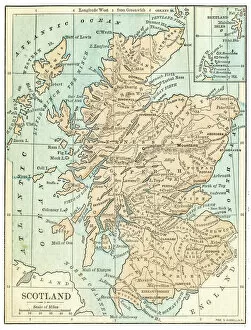
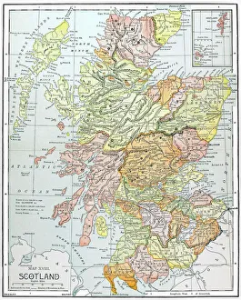
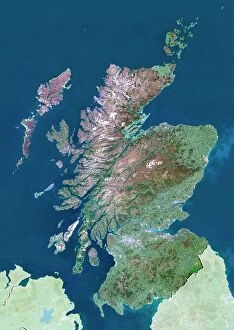
Scotland is a country located in the northern part of the United Kingdom and has a population of around 5.4 million people...
Choose a picture from our Scotland Collection for your Wall Art and Photo Gifts
1,260 items


All Professionally Made to Order for Quick Shipping
-
Scotland Collection
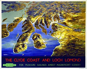
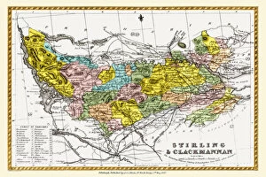
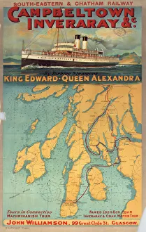
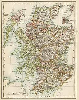
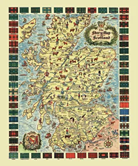
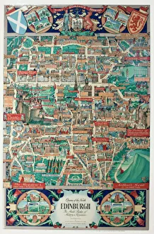
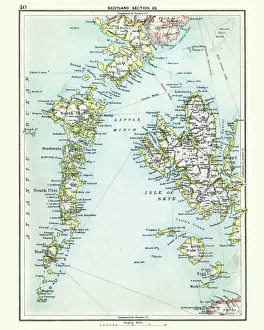
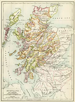
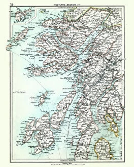
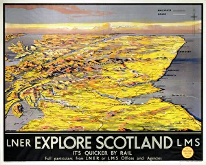
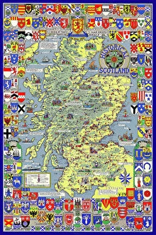
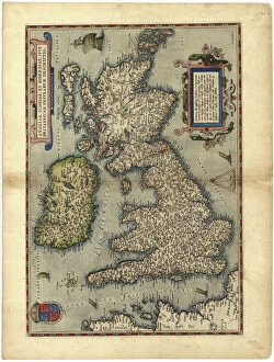
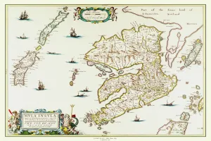
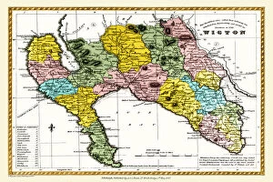
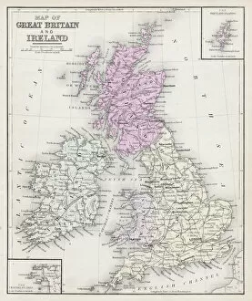
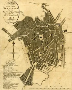
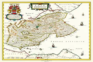
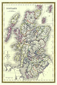
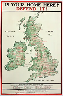
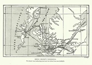
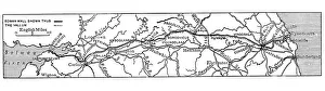
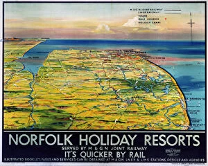
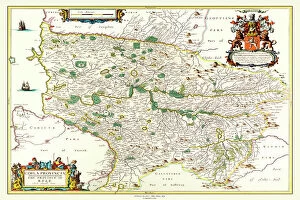
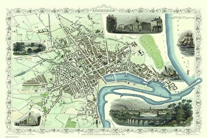
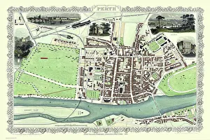
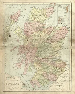
Scotland is a country located in the northern part of the United Kingdom and has a population of around 5.4 million people and covers an area of approximately 78,000 square kilometers. The country is known for its stunning landscapes, including rugged mountains, rolling hills, and beautiful coastlines. Scotland's economy is diverse, with industries such as oil and gas exploration, tourism, agriculture, and fishing contributing significantly to its GDP. The capital city is Edinburgh while Glasgow is the largest city in terms of population. Maps and charts are used extensively to navigate through Scotland's cities and countryside areas by tourists and locals alike.
+
Our beautiful pictures are available as Framed Prints, Photos, Wall Art and Photo Gifts
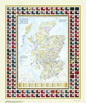
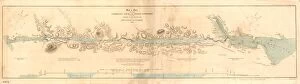
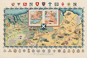
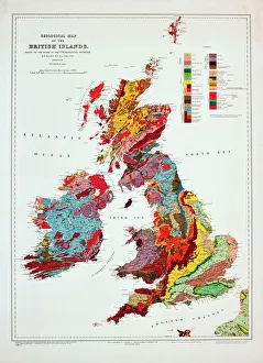
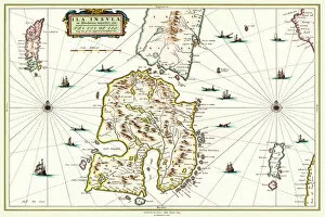
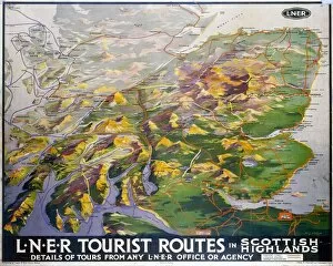
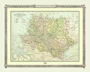
The Scotland collection from Media Storehouse offers a wide range of wall art and framed prints that showcase the beauty and history of Scotland. Our collection features various maps and charts, including antique maps, topographical maps, geological maps, sea charts, and more. These high-quality prints are perfect for anyone who loves Scotland or wants to add a touch of Scottish charm to their home or office decor. They are available in different sizes and styles to suit any taste or space. Whether you're looking for a vintage map of Edinburgh or a detailed chart of the Scottish coastline, our collection has something for everyone. Each print is carefully crafted using premium materials to ensure long-lasting quality. The Scotland collection from Media Storehouse is an excellent choice for anyone who wants to celebrate the rich culture and heritage of Scotland through beautiful artwork.
+
What are Scotland (Maps and Charts) art prints?
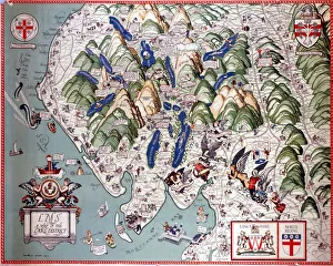
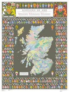
Scotland art prints are a collection of high-quality reproductions of historic maps and charts that depict the geography, topography, and landmarks of Scotland. These prints showcase the beauty and diversity of Scotland's landscape, from its rugged coastlines to its rolling hillsides. The collection includes a wide range of maps and charts dating back several centuries, including antique maps from the 16th century as well as more modern depictions. Each print is carefully crafted using state-of-the-art printing technology to ensure that every detail is captured with precision. These art prints are perfect for anyone who loves Scottish history or has an interest in cartography. They make great gifts for friends or family members who have a connection to Scotland or simply appreciate fine art. Whether you're looking to decorate your home or office space, these beautiful prints will add character and charm to any room.
+
What Scotland (Maps and Charts) art prints can I buy from Media Storehouse?
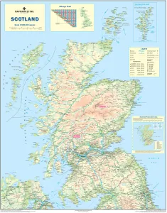
We offer a wide range of Scotland maps and charts art prints that are perfect for anyone who loves the beauty and history of this country. You can choose from a variety of styles, including vintage maps, contemporary designs, and detailed charts that showcase everything from the geography to the wildlife of Scotland. Some popular options include antique maps that show the layout of Scottish cities like Edinburgh or Glasgow in intricate detail, as well as more modern designs that highlight famous landmarks such as Loch Ness or Ben Nevis. Whether you're looking for something to hang in your home or office, these high-quality prints are sure to impress with their stunning colors and attention to detail. So if you're interested in adding some beautiful Scotland maps and charts art prints to your collection, be sure to check out our extensive selection today.
+
How do I buy Scotland (Maps and Charts) art prints?
To purchase Scotland art prints from Media Storehouse, you can browse our extensive collection of high-quality images online. Once you have found the print that you would like to purchase, simply add it to your cart and proceed to checkout. During the checkout process, you will be prompted to enter your shipping information and payment details. We offer a range of different sizes for their art prints, so make sure that you select the size that best suits your needs before completing your order. Additionally, we offer a variety of framing options if you would like to have your print framed before it is shipped out. Purchasing Scotland art prints from Media Storehouse is a straightforward process that can be completed entirely online. With their vast selection of images and easy-to-use website interface, finding and ordering the perfect print has never been easier.
+
How much do Scotland (Maps and Charts) art prints cost?
We offer a wide range of Scotland art prints at various prices to suit different budgets. Our collection includes high-quality reproductions of antique maps and charts that showcase the rich history and culture of Scotland. These prints are perfect for adding a touch of Scottish charm to any home or office space. Our pricing is competitive, and we strive to provide our customers with affordable options without compromising on quality. We understand that everyone has different preferences when it comes to artwork, which is why we have curated a diverse selection of Scotland art prints in different styles, sizes, and formats. Whether you're looking for a vintage-inspired map or an intricate chart detailing the Scottish coastline, we have something for every taste. Our team takes pride in sourcing only the best images from top photographers and artists around the world so that you can enjoy stunning artwork that captures the essence of Scotland's beauty.
+
How will my Scotland (Maps and Charts) art prints be delivered to me?
We take great care in delivering your Scotland art prints to you. We use high-quality packaging materials to ensure that your artwork arrives in pristine condition. Depending on the size of your print, it will be either rolled or flat-packed for delivery. For smaller prints, we use a sturdy cardboard envelope with protective padding inside. Larger prints are carefully rolled and placed into a strong tube for safe transportation. All our deliveries are tracked so you can keep an eye on its progress from dispatch to arrival. We work with trusted courier partners who have years of experience in handling delicate items like art prints. They understand the importance of ensuring that every item is delivered safely and securely. We strive to make sure that your Scotland art print reaches you in perfect condition, ready for framing or display as soon as it arrives at your doorstep.