
Spain Collection
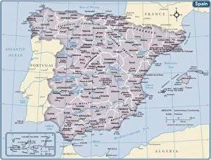
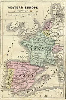
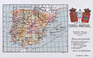
Spain is a country located in southwestern Europe
Choose a picture from our Spain Collection for your Wall Art and Photo Gifts
1,714 items


All Professionally Made to Order for Quick Shipping
-
Spain Collection
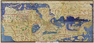
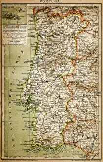
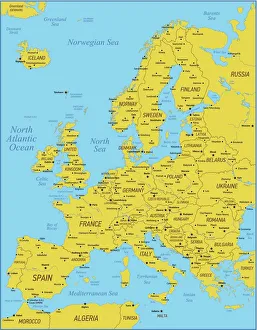
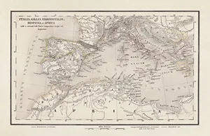
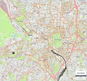
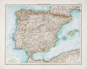
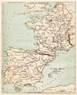
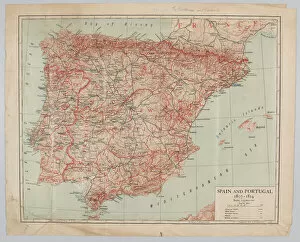
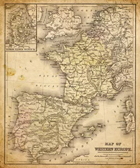
Spain is a country located in southwestern Europe, bordered by Portugal to the west and France to the northeast and has a population of approximately 47 million people and its capital city is Madrid. Spain's geography includes mountain ranges such as the Pyrenees and Sierra Nevada, as well as coastal regions along both the Mediterranean Sea and Atlantic Ocean. The country has a diverse economy with industries including tourism, agriculture, manufacturing, and services. Spain is known for its rich history and culture, including famous landmarks like La Sagrada Familia in Barcelona and flamenco dancing in Andalusia.
+
Our beautiful pictures are available as Framed Prints, Photos, Wall Art and Photo Gifts
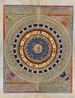
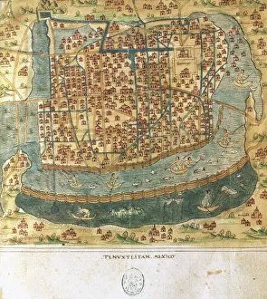
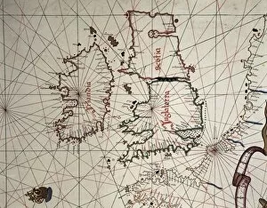
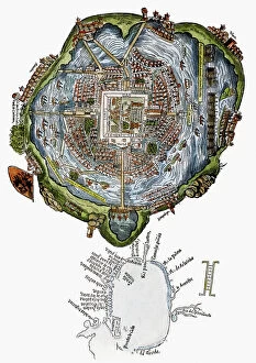
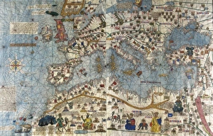
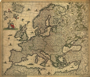
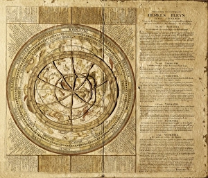
The Spain collection from Media Storehouse is a stunning assortment of wall art and framed prints that showcase the beauty, history, and culture of Spain. Our collection features an array of maps and charts that depict different regions, cities, landmarks, and historical events in Spain. These pieces are perfect for those who love to travel or have a passion for geography. From vintage-style maps to contemporary designs, the Spain collection offers something for everyone's taste. Each piece is printed on high-quality paper using archival inks to ensure long-lasting color vibrancy. The frames are made with premium materials such as wood or metal to provide durability while complementing the artwork. Whether you're looking for a unique gift or want to add some character to your home decor, our collection has plenty of options. With its rich history and diverse landscapes, Spain is truly a country worth exploring - let these beautiful maps and charts take you there.
+
What are Spain (Maps and Charts) art prints?
Spain art prints are a collection of high-quality, visually stunning prints that showcase the beauty and intricacies of Spain's geography. These prints feature detailed maps and charts that highlight the country's diverse regions, cities, landmarks, and topography. They are perfect for anyone who loves to explore new places or has an interest in history, geography or travel. These art prints are created using state-of-the-art printing technology on premium quality paper to ensure their longevity and durability. They come in various sizes to suit different preferences and can be framed or mounted according to individual taste. Whether you're looking for a unique piece of wall decor for your home or office space or want to gift someone with a special memento from Spain, these art prints offer something for everyone. With their intricate details and vibrant colors, they capture the essence of this beautiful country like no other medium can.
+
What Spain (Maps and Charts) art prints can I buy from Media Storehouse?
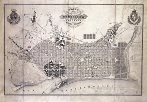
We offer a wide variety of Spain art prints for purchase. These prints range from vintage maps of Spain to modern charts depicting the country's geography, landmarks, and attractions. Some popular options include antique city plans of Madrid or Barcelona, detailed topographical maps highlighting the Pyrenees Mountains or Andalusian coastlines, and colorful illustrations showcasing Spanish culture such as flamenco dancing or bullfighting. In addition to traditional paper prints, Media Storehouse also offers canvas and framed options for many of their Spain pieces. You can choose from a range of sizes to fit their space needs, whether they are looking for a small accent piece or a large statement print. We provide an extensive selection of high-quality Spain art prints that cater to various tastes and preferences.
+
How do I buy Spain (Maps and Charts) art prints?
To buy Spain art prints from Media Storehouse, you can browse our extensive collection of artwork online. Simply search for "Spain Maps and Charts" in the search bar on our website to find a range of options available. Once you have found the print that you like, select the size and format that suits your needs. We offer a variety of printing options including canvas, framed prints, posters, and photographic prints. You can choose between different sizes as well as finishes such as gloss or matte. Once you have made your selection, add it to your cart and proceed to checkout where you will be prompted to enter your payment details. After completing the purchase process, your order will be processed by our team who will ensure that it is printed according to your specifications before being shipped out for delivery. Buying Spain art prints from Media Storehouse is an easy process with plenty of options available for customization so that you can get exactly what you want.
+
How much do Spain (Maps and Charts) art prints cost?
We offer a wide range of Spain art prints at varying prices. Our collection includes vintage maps, antique charts, and contemporary designs that capture the beauty and history of this fascinating country. The cost of our Spain art prints depends on various factors such as size, framing options, and printing materials. We use high-quality paper stock to ensure that our prints are long-lasting and vibrant in color. Our you can choose from different sizes ranging from small to large formats depending on their preferences. We also offer custom framing services for those who want to display their artwork in style. Our Spain art prints are perfect for home or office decor, gifts for friends or family members who love travel or history buffs interested in exploring the rich cultural heritage of Spain. With our extensive collection of Spain art prints available at affordable prices, you're sure to find something that suits your taste.
+
How will my Spain (Maps and Charts) art prints be delivered to me?
Your Spain art prints will be delivered to you in a secure and protective packaging. We take great care in ensuring that your artwork arrives at your doorstep in perfect condition. We use high-quality materials for our packaging to prevent any damage during transit. The delivery method may vary depending on your location and the size of the print(s). For smaller prints, we usually ship them via standard mail or courier service. Larger prints may require special handling and will be shipped using a different carrier. Once your order is dispatched, you will receive an email notification with tracking information so that you can monitor its progress until it reaches you. If there are any issues with delivery, please do not hesitate to contact us as we are always happy to assist our customers. Rest assured that your Spain art prints will be delivered safely and securely to your chosen address.