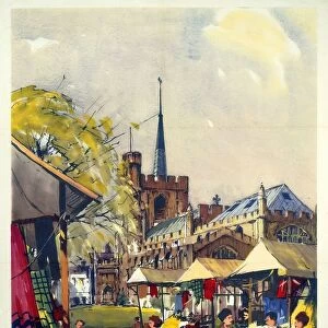
Home > Europe > United Kingdom > England > London > Towns > Welling
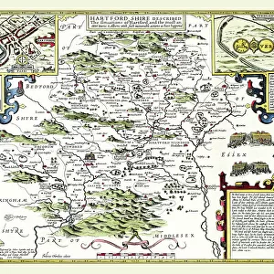
Old County Map of Hertfordshire 1836 by Thomas Moule

![]()
Wall Art and Photo Gifts from MapSeeker
Old County Map of Hertfordshire 1836 by Thomas Moule
This is a fine decorative reproduction County Map of Hertfordshire from the First Edition series of Thomas Moule Maps, originally Published in 1836. The well-known series of County Maps which are known as Moules feature beautiful vignette views and were first published in separate sections for each county in 1830-32, they were then published in collected form in a two-volume work: The English Counties Delineated: or a Topographical Description of England: Illustrated by a Complete Series of County Maps by Thomas Moule: London: Published by George Virtue 1836
Welcome to the Mapseeker Image library and enter an historic gateway to one of the largest on-line collections of Historic Maps, Nostalgic Views, Vista's and Panorama's from a World gone by.
Media ID 20347899
© Mapseeker Publishing Ltd
County Map County Map Of England English County Map Historic Map Moule Map Old County Map Old English County Map Old Moule Map Thomas Moule Thomas Moule Map Hertfordshire
FEATURES IN THESE COLLECTIONS
> Arts
> Artists
> M
> Thomas Moule
> Europe
> United Kingdom
> England
> Hertfordshire
> Related Images
> Europe
> United Kingdom
> England
> London
> Towns
> Welling
> Europe
> United Kingdom
> England
> Maps
> Europe
> United Kingdom
> England
> Wells
> Maps and Charts
> Early Maps
> Maps and Charts
> Related Images
> MapSeeker
> Maps from the British Isles
> England and Counties PORTFOLIO
EDITORS COMMENTS
This exquisite print showcases the "Old County Map of Hertfordshire 1836" by Thomas Moule, a renowned cartographer of his time. Originally published in 1836 as part of the first edition series, this decorative reproduction captures the beauty and historical significance of Hertfordshire. Moule's county maps were highly regarded for their intricate details and captivating vignette views. Each map was meticulously crafted to provide a topographical description of England, offering a comprehensive understanding of the region. The English Counties Delineated: or a Topographical Description of England: Illustrated by a Complete Series of County Maps by Thomas Moule became an iconic two-volume work that showcased his exceptional talent. The charm and allure of this particular map lie in its depiction of Hertfordshire during the early 19th century. It allows us to travel back in time and explore the rich history embedded within its borders. From quaint villages to sprawling landscapes, every corner is beautifully illustrated with precision and artistry. As we gaze upon this historic map, we are reminded not only of our connection to the past but also how geography has shaped our present-day surroundings. This old county map serves as both an educational tool and a piece of art that celebrates Hertfordshire's heritage. With this photo print, you can now bring home a piece of history and proudly display it as a testament to your appreciation for cartography and British culture.
MADE IN AUSTRALIA
Safe Shipping with 30 Day Money Back Guarantee
FREE PERSONALISATION*
We are proud to offer a range of customisation features including Personalised Captions, Color Filters and Picture Zoom Tools
SECURE PAYMENTS
We happily accept a wide range of payment options so you can pay for the things you need in the way that is most convenient for you
* Options may vary by product and licensing agreement. Zoomed Pictures can be adjusted in the Cart.