Home > Arts > Artists > C > Andreas Cellarius
Andreas Cellarius (1596-1665). Dutch-German cartographer. Ha
. Dutch-German cartographer. Ha")
![]()
Wall Art and Photo Gifts from Mary Evans Picture Library
Andreas Cellarius (1596-1665). Dutch-German cartographer. Ha
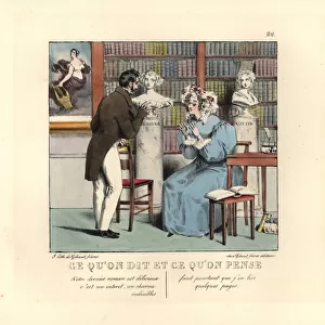
Andreas Cellarius (1596-1665). Dutch-German cartographer. Harmonia Macrocosmica, 1660, a major star atlas, published by Johannes Janssonius in Amsterdam
Mary Evans Picture Library makes available wonderful images created for people to enjoy over the centuries
Media ID 14353822
© Thaliastock / Mary Evans
1596 1660 1665 Amsterdam Andreas Atlas Cartographer Cartography Cellarius Constellation Cosmos Harmonia Johannes Macrocosmica Major
FEATURES IN THESE COLLECTIONS
> Arts
> Artists
> C
> Andreas Cellarius
> Europe
> Related Images
> Maps and Charts
> Star Charts
EDITORS COMMENTS
1. Title: "Andreas Cellarius: The Dutch-German Cartographer Who Mapped the Stars of the Cosmos in the 17th Century" Andreas Cellarius (1596-1665), a Dutch-German cartographer, is renowned for his significant contributions to the field of astronomy and cartography during the 17th century. Born in Frankfurt am Main, Germany, Cellarius studied mathematics and astronomy at the University of Altdorf before moving to the Netherlands to work with the renowned publisher Johannes Janssonius in Amsterdam. Cellarius' most notable work is the "Harmonia Macrocosmica," a major star atlas published by Janssonius in 1660. This groundbreaking atlas, which consists of 22 plates, represents a significant advancement in the field of astronomy during the modern age. The intricately detailed maps depict the constellations, stars, and planets, as well as the relationships between them, providing a comprehensive view of the cosmos. The Harmonia Macrocosmica was a masterpiece of its time, featuring innovative techniques such as the use of perspective and accurate representations of the positions and sizes of stars. The atlas was widely adopted by astronomers and scholars throughout Europe and remained a standard reference work for several decades. Cellarius' work had a profound impact on the study of astronomy and cartography during the 17th century, paving the way for future advancements in the fields. His intricate and detailed star maps continue to be admired for their beauty and accuracy, making them an essential part of the history of astronomy and cartography. This image showcases a page from the Harmonia Macrocosmica, highlighting Cellarius' exceptional cartographic skills and his deep understanding of the cosmos. The intricate details of the constellations and the relationships between the stars are beautifully rendered, offering a glimpse into the wonders of the universe as it was understood during the 17th century.
MADE IN AUSTRALIA
Safe Shipping with 30 Day Money Back Guarantee
FREE PERSONALISATION*
We are proud to offer a range of customisation features including Personalised Captions, Color Filters and Picture Zoom Tools
SECURE PAYMENTS
We happily accept a wide range of payment options so you can pay for the things you need in the way that is most convenient for you
* Options may vary by product and licensing agreement. Zoomed Pictures can be adjusted in the Cart.