Home > Europe > United Kingdom > England > Maps
Map of Lancashire

![]()
Wall Art and Photo Gifts from Mary Evans Picture Library
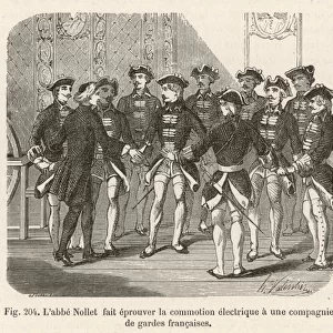
Map of Lancashire
A map of Lancashire, from the mid 18th century. Date: Mid 18th century
Mary Evans Picture Library makes available wonderful images created for people to enjoy over the centuries
Media ID 14168056
© Mary Evans Picture Library
FEATURES IN THESE COLLECTIONS
> Europe
> United Kingdom
> England
> Lancashire
> Related Images
> Europe
> United Kingdom
> England
> Maps
> Maps and Charts
> Early Maps
EDITORS COMMENTS
1. Title: "Exploring the Past: A Glimpse into 18th Century Lancashire through this Detailed Map" This map print takes us on a journey back in time to the mid-18th century, offering a fascinating glimpse into the historical landscape of Lancashire, England. Dated from the 1750s, this antique map is an essential addition to any history or geography enthusiast's collection, providing valuable insights into the geographical features, settlements, and topography of this ancient county. Lancashire, located in the northwest of England, has a rich and diverse history that spans over a thousand years. This meticulously crafted map, with its intricate details and precise cartography, allows us to explore the county's past as it appeared over three centuries ago. From the winding rivers and expansive bays to the dense forests and sprawling estates, this map offers a detailed and accurate representation of the county's topography. The map also highlights various towns, villages, and other settlements, providing a glimpse into the economic and social fabric of 18th century Lancashire. The bustling port towns of Liverpool and Preston, as well as the historic city of Lancaster, are prominently featured, reflecting their significance during this period. This map is not only a testament to the cartographic skills of the time but also a valuable resource for historians, genealogists, and anyone interested in the history of England. By studying this map, we can gain a deeper understanding of the historical context of Lancashire and the broader context of England during the 18th century. In conclusion, this exquisite map print of Lancashire from the mid-18th century is an essential addition to any history or geography collection, offering a unique window into the past and providing valuable insights into the historical landscape of this fascinating county.
MADE IN AUSTRALIA
Safe Shipping with 30 Day Money Back Guarantee
FREE PERSONALISATION*
We are proud to offer a range of customisation features including Personalised Captions, Color Filters and Picture Zoom Tools
SECURE PAYMENTS
We happily accept a wide range of payment options so you can pay for the things you need in the way that is most convenient for you
* Options may vary by product and licensing agreement. Zoomed Pictures can be adjusted in the Cart.