Fraud Blocker Skip to main content

Home > North America > Canada > Maps

Maps Collection (page 9)

Maps of Canada North America are a great way to explore the vastness and beauty of this region

799 items

Background imageMaps Collection: Modern Night Sky Constellation - Libra

Modern Night Sky Constellation - Libra
Simple, modern depiction of a celestial constellation. Libra constellation lies in the southern sky. It is one of the zodiac constellations, first catalogued by Ptolemy in the 2nd century
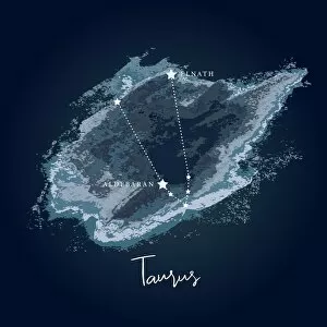
Background imageMaps Collection: Modern Night Sky Constellation - Taurus

Modern Night Sky Constellation - Taurus
Taurus is one of the largest constellations in the night sky.Taurus is visible in both the Northern and Southern hemispheres

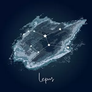
Background imageMaps Collection: Modern Night Sky Constellation - Lepus

Modern Night Sky Constellation - Lepus
Simple, modern depiction of a celestial constellation on a navy backdrop. The name " Lepus" derives from the Latin word for " hare"

Background imageMaps Collection: Modern Night Sky Constellation - Ursa Minor

Modern Night Sky Constellation - Ursa Minor
Simple, modern depiction of a celestial constellation on a navy backdrop. Ursa Minor constellation lies in the northern sky

Background imageMaps Collection: Modern Night Sky Constellation - Cancer

Modern Night Sky Constellation - Cancer
Simple, modern depiction of a celestial constellation on a navy backdrop. Cancer constellation is located in the northern sky. Its name means " the crab" in Latin

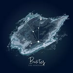
Background imageMaps Collection: Modern Night Sky Constellation - Bootes

Modern Night Sky Constellation - Bootes
Simple, modern depiction of a celestial constellation on a navy backdrop. Bo├Âtes constellation lies in the northern hemisphere. It is one of the largest constellations in the sky

Background imageMaps Collection: Modern Night Sky Constellation - Andromeda

Modern Night Sky Constellation - Andromeda
Simple, modern depiction of a celestial constellation on a navy backdrop. Andromeda constellation is located in the northern sky, between Cassiopeias W asterism and the Great Square of Pegasus

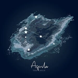
Background imageMaps Collection: Modern Night Sky Constellation - Aquila

Modern Night Sky Constellation - Aquila
Simple, modern depiction of a celestial constellation on a navy backdrop. Aquila is a constellation on the celestial equator

Background imageMaps Collection: Modern Night Sky Constellation - Cygnus

Modern Night Sky Constellation - Cygnus
Simple, modern depiction of a celestial constellation on a navy backdrop. Cygnus is one of the most recognizable constellations of the northern summer and autumn

Background imageMaps Collection: The North-West Passage, 1874, (1901). Creator: Unknown

The North-West Passage, 1874, (1901). Creator: Unknown
The North-West Passage, 1874, (1901). An old seaman looks thoughtful as he considers the danger of an expedition to find the sea route round North America via the Canadian Arctic

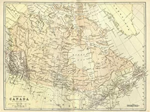
Background imageMaps Collection: Antique map of Canada, 1884, 19th Century

Antique map of Canada, 1884, 19th Century
Vintage engraving of Antique map of Canada, 1884, 19th Century

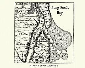
Background imageMaps Collection: Map of Harbour of St Augustine, Canada. 18th Century

Map of Harbour of St Augustine, Canada. 18th Century
Vintage engraving of Map of Harbour of St Augustine, Canada. 18th Century

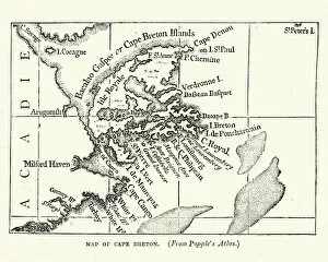
Background imageMaps Collection: Map of Cape Breton, early 18th Century

Map of Cape Breton, early 18th Century
Vintage engraving of a Map of Cape Breton, Nova Scotia, Canada, early 18th Century

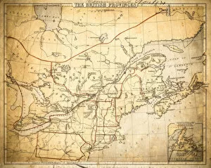
Background imageMaps Collection: Map of British provinces Canada 1889

Map of British provinces Canada 1889
Comprehensive Geography by James Monteith - American Book Company 1882, 1889

Background imageMaps Collection: Map of the Canada dominion 1877

Map of the Canada dominion 1877
The Eclectic Elementary Geography by Wilson & Hinkle / Cincinnati -New York 1881

Background imageMaps Collection: Map of British Canada 1900

Map of British Canada 1900
Meyers hand-Atlas Leipzig und Wien Verlag des Bibliographischen Instituts 1900

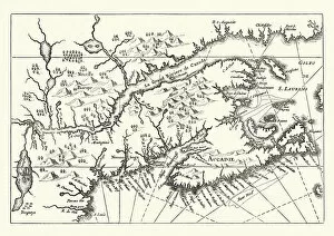
Background imageMaps Collection: Map of Canada and Nova Scotia, 17th Century

Map of Canada and Nova Scotia, 17th Century
Vintage engraving of Map of Canada and Nova Scotia, 17th Century

Background imageMaps Collection: Portrait of Major General Paul Mascarene, 1729 (oil on canvas)

Portrait of Major General Paul Mascarene, 1729 (oil on canvas)
3432749 Portrait of Major General Paul Mascarene, 1729 (oil on canvas) by Smibert, John (1688-1751); 103.03u80.33 cm; Los Angeles County Museum of Art, CA

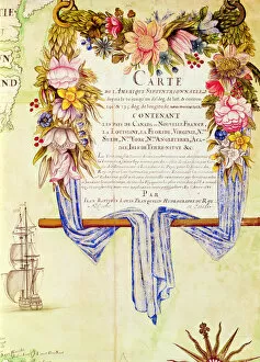
Background imageMaps Collection: Cartouche from Carte de l Amerique Septentrionale (coloured engraving)

Cartouche from Carte de l Amerique Septentrionale (coloured engraving)
XIR181213 Cartouche from Carte de l Amerique Septentrionale (coloured engraving) by Franquelin, Jean Baptiste Louis (17th century); Service Historique de la Marine, Vincennes

Background imageMaps Collection: Antique map of Canada, 1897, late 19th Century

Antique map of Canada, 1897, late 19th Century
Vintage engraving of a Antique map of Canada, 1897, late 19th Century. British America, Canada, New Brunswick, Nova Scotia

Background imageMaps Collection: Canada British America map of 1869

Canada British America map of 1869
Cornells Grammar School Geography By S.S. Cornell - New York 1869

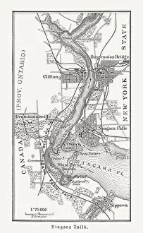
Background imageMaps Collection: Map of the Niagara Falls, Canada, USA, woodcut, published 1897

Map of the Niagara Falls, Canada, USA, woodcut, published 1897
Map of the Niagara Falls, Canada, USA. Wood engraving, published in 1897

Background imageMaps Collection: Map of North America, 1902. Creator: Unknown

Map of North America, 1902. Creator: Unknown
Map of North America, 1902. Showing the USA, Canada, Greenland, Central America and the Caribbean, with an inset of the Isthmus of Nicaragua. From The Century Atlas of the World

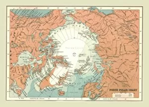
Background imageMaps Collection: North Polar Chart, 1902. Creator: Unknown

North Polar Chart, 1902. Creator: Unknown
North Polar Chart, 1902. Showing the Arctic Circle. From The Century Atlas of the World. [John Walker & Co, Ltd. London, 1902]

Background imageMaps Collection: Map of the Dominion of Canada, Eastern Provinces, 1902. Creator: Unknown

Map of the Dominion of Canada, Eastern Provinces, 1902. Creator: Unknown
Map of the Dominion of Canada, Eastern Provinces, 1902. Showing Newfoundland, Nova Scotia, the Gulf of St Lawrence and the Great Lakes. From The Century Atlas of the World. [John Walker & Co, Ltd

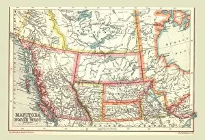
Background imageMaps Collection: Map of Manitoba and the North West, 1902. Creator: Unknown

Map of Manitoba and the North West, 1902. Creator: Unknown
Map of Manitoba and the North West, 1902. Showing the Pacific coast. From The Century Atlas of the World. [John Walker & Co, Ltd. London, 1902]

Background imageMaps Collection: Chart of the North Atlantic, 1902. Creator: Unknown

Chart of the North Atlantic, 1902. Creator: Unknown
Chart of the North Atlantic, 1902. Showing North and Central America, West Africa and Western Europe, and transatlantic shipping routes. From The Century Atlas of the World. [John Walker & Co, Ltd

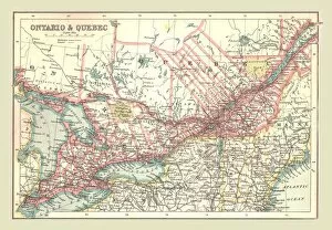
Background imageMaps Collection: Map of Ontario and Quebec, 1902. Creator: Unknown

Map of Ontario and Quebec, 1902. Creator: Unknown
Map of Ontario and Quebec, 1902. Showing the Great Lakes and St Lawrence Seaway. From The Century Atlas of the World. [John Walker & Co, Ltd. London, 1902]

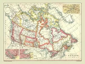
Background imageMaps Collection: Map of the Dominion of Canada, 1902. Creator: Unknown

Map of the Dominion of Canada, 1902. Creator: Unknown
Map of the Dominion of Canada, 1902. Showing the various provinces. From The Century Atlas of the World. [John Walker & Co, Ltd. London, 1902]

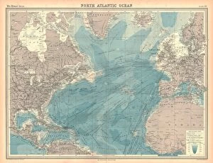
Background imageMaps Collection: Map of the North Atlantic Ocean

Map of the North Atlantic Ocean. Map showing western Europen and Iceland, Greenland, eastern Canada and the United States, Central American and the Caribbean, and West Africa

Background imageMaps Collection: Map of the North Polar Regions

Map of the North Polar Regions. Map of the Arctic Circle showing Iceland and Scandinavia, northern Russia, Greenland, northern Canada and Alaska. Plate 8 from The Times Atlas

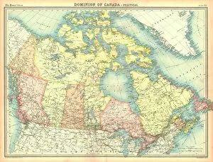
Background imageMaps Collection: Political map of the Dominion of Canada

Political map of the Dominion of Canada. Canada was known as the Dominion of Canada from 1867 until after the Second World War. Plate 82 from The Times Atlas

Background imageMaps Collection: Political map of North America

Political map of North America. Map showing Canada, the United States, Mexico, the Caribbean and Central America. Plate 80 from The Times Atlas

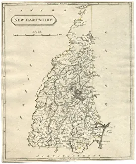
Background imageMaps Collection: Antique map of New Hampshire USA 19th century 1819

Antique map of New Hampshire USA 19th century 1819
This is a copperplate engraving, a 19th century map of New Hampshire in the United States of America, with hand-coloured borders with Canada, Maine, Massachusetts and Vermont

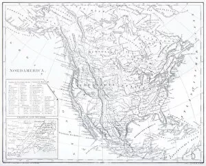
Background imageMaps Collection: Engraving: Map of North America

Engraving: Map of North America
Engraved illustrations of the Theory of the Art of Drawing from Iconographic Encyclopedia of Science, Literature and Art, Published in 1851. Copyright has expired on this artwork. Digitally restored

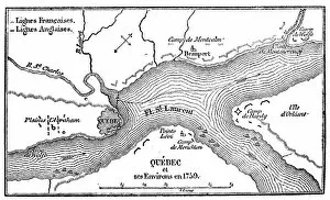
Background imageMaps Collection: Antique illustration of Quebec map

Antique illustration of Quebec map

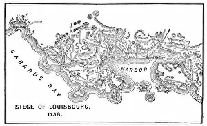
Background imageMaps Collection: Antique Map of the Siege of Louisbourg - 18th Century

Antique Map of the Siege of Louisbourg - 18th Century
Vintage map of the Siege of Louisbourg in Nova Scotia, Canada. Vintage etching circa late 19th century

Background imageMaps Collection: Antique Map of the Siege of Quebec - 18th Century

Antique Map of the Siege of Quebec - 18th Century
Vintage map of the Siege of Quebec in Quebec, Canada. Vintage etching circa late 19th century

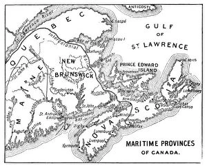
Background imageMaps Collection: Antique Map of Maritime Provinces of Canada - 19th Century

Antique Map of Maritime Provinces of Canada - 19th Century
Vintage map of the Maritime Provinces of Canada. Vintage etching circa late 19th century

Background imageMaps Collection: Antique Map of Canada - 19th Century

Antique Map of Canada - 19th Century
Vintage map of Canada at the end of the 19th century. Vintage etching circa late 19th century

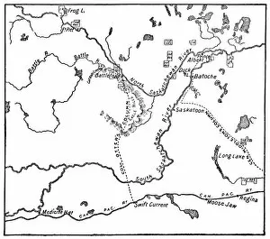
Background imageMaps Collection: Antique Map of the North-West Rebellion in Saskatchewan, Canada - 19th Century

Antique Map of the North-West Rebellion in Saskatchewan, Canada - 19th Century
Vintage map of the North-West Rebellion under the leadership of Louis Riel in the North-West Territories (now the province of Saskatchewan), Canada. This is the Metis conflict area

Background imageMaps Collection: Antique Map of North America at Canadas Confederation - 19th Century

Antique Map of North America at Canadas Confederation - 19th Century
Vintage map of the territories of North America at Canadian Confederation in 1867. Vintage etching circa late 19th century

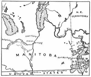
Background imageMaps Collection: Antique Map of the New Province of Manitoba, Canada - 1870s

Antique Map of the New Province of Manitoba, Canada - 1870s
Vintage map of the newly acquired region near the city of Winnipeg, it was made the province of Manitoba, Canada. Vintage etching circa late 19th century

Background imageMaps Collection: Canada, c1920, (c1920)

Canada, c1920, (c1920)
Canada, 1908, (c1920). A map of the Dominion of Canada, in English Miles. From Our Empire Story, by H. E. Marshall. [Thomas Nelsom And Sons, London, c1920]

Background imageMaps Collection: Map of Manitoba and the Northwest, Canada, c1893. Artist: George Philip & Son Ltd

Map of Manitoba and the Northwest, Canada, c1893. Artist: George Philip & Son Ltd
Map of Manitoba and the Northwest, Canada, c1893. From Outlines of British Colonisation, by William Henry Parr Greswell

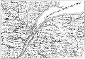
Background imageMaps Collection: Map of the course of the River St Lawrence as far as Quebec, 1730 (c1880)

Map of the course of the River St Lawrence as far as Quebec, 1730 (c1880). From Popples Atlas, 1730. A print from Cassells History of the United States, by Edmund Ollier, Volume I

Background imageMaps Collection: Old map of Acadia, 17th century (c1880)

Old map of Acadia, 17th century (c1880). Acadia (Acadie) was part of the territory claimed by the French in North America from 1604

Background imageMaps Collection: Map of North America

Map of North America. Hand-coloured later


All Professionally Made to Order for Quick Shipping


-

Maps Collection

Maps of Canada North America are a great way to explore the vastness and beauty of this region. They provide an overview of the geography, topography, and political boundaries that make up this part of the world. It also show major cities, rivers, lakes, mountains, national parks and other points of interest and can be used for navigation purposes or simply to appreciate the natural beauty that exists in Canada North America. With detailed maps available online or in print form it is easy to find out more about this region and plan trips accordingly and can an invaluable tool for anyone looking to explore all that Canada North America has to offer.
+

Our beautiful pictures are available as Framed Prints, Photos, Wall Art and Photo Gifts

Media Storehouse offers a collection of Maps of Canada North America that showcases the geography, history and culture of this vast region. Our collection features an extensive range of maps dating back to the 16th century, including antique maps from renowned cartographers such as Gerard Mercator and Abraham Ortelius. These historic maps provide a fascinating insight into how early explorers perceived the landmasses and waterways that make up Canada and North America. In addition to these vintage maps, Media Storehouse also offers contemporary versions that highlight modern-day cities, landmarks and natural wonders. These high-quality prints are available in various sizes and formats, including canvas prints, framed prints or posters. Whether you're looking for a unique piece of wall art for your home or seeking inspiration for your next adventure across Canada or North America, our Maps of Canada North America collection is sure to captivate your imagination with its rich history and stunning visuals.
+

What are Maps of Canada North America art prints?

Maps of Canada North America art prints are high-quality reproductions of historical and contemporary maps that depict the geography, topography, and political boundaries of Canada and North America. These art prints showcase the intricate details and artistic styles used by cartographers throughout history to create these important navigational tools. These maps provide a fascinating glimpse into the evolution of geographic knowledge over time, from early explorers' crude sketches to modern satellite imagery. We also offer insight into how borders have shifted over time due to political changes or territorial disputes. Whether you're a history buff, geography enthusiast, or simply looking for a unique piece of wall decor, Maps of Canada North America art prints are an excellent choice. With their rich colors and intricate details, they make great conversation starters in any room. Plus, they can be framed in a variety of styles to match your decor preferences.
+

What Maps of Canada North America art prints can I buy from Media Storehouse?

We offer a wide range of Maps of Canada North America art prints that you can buy. These maps showcase the geographical features, topography, and political boundaries of Canada and North America in stunning detail. You can choose from vintage or contemporary styles, with options ranging from antique maps to modern satellite imagery. Some popular choices include detailed road maps that highlight major highways and cities across the country, as well as topographic maps that show elevation changes and natural landmarks like mountains and rivers. There are also historical maps depicting important events such as explorations or battles. In addition to traditional paper prints, Media Storehouse also offers canvas prints for a more textured look. These high-quality reproductions are perfect for adding a touch of sophistication to any home or office decor. Whether you're looking for a unique gift idea or simply want to decorate your own space with beautiful artwork, we have an extensive selection of Maps of Canada North America art prints to choose from.
+

How do I buy Maps of Canada North America art prints?

To buy Maps of Canada North America art prints from Media Storehouse, you can browse our extensive collection online. The website offers a wide range of maps in different styles and sizes to suit your preferences. You can search for specific locations or themes using the search bar on the homepage or explore the various categories available. Once you have found a map that catches your eye, simply select the size and framing options you prefer before adding it to your cart. The checkout process is straightforward, and you will be prompted to enter your shipping and payment details. We offer high-quality prints that are perfect for home decor or as gifts for friends and family who love geography or travel. Their selection includes vintage maps, topographical maps, political maps, and more. Buying Maps of Canada North America art prints from Media Storehouse is an easy process that allows you to add beautiful pieces of artwork to your home with just a few clicks.
+

How much do Maps of Canada North America art prints cost?

Maps of Canada and North America art prints are available at Media Storehouse. The cost of these prints varies depending on the size, material, and framing options chosen by the customer. However, you can rest assured that they will receive high-quality prints that showcase intricate details of maps in stunning colors. We offer a wide range of map art prints to suit different preferences and budgets. You can choose from various sizes such as small, medium, large or extra-large to fit their space requirements. Additionally, there are different materials available for printing including canvas or paper. Framing options include black frames with white mounts or natural wood frames with cream mounts. These framing options add an elegant touch to the artwork while protecting it from damage. Maps of Canada and North America art prints from Media Storehouse offer excellent value for money considering their quality and customization options available to customers.
+

How will my Maps of Canada North America art prints be delivered to me?

Your Maps of Canada North America art prints will be delivered to you through a reliable and secure delivery service. The company takes pride in ensuring that your order is carefully packaged and shipped to your preferred location. Your art prints will be rolled up and placed inside a sturdy tube, which protects them from any damage during transit. The tube is then sealed with protective caps at both ends to ensure that the contents remain intact. The delivery process is efficient, and you can track your package using the tracking number provided by the company once it has been dispatched. You can expect your Maps of Canada North America art prints to arrive in excellent condition within a reasonable time frame, depending on your location. Media Storehouse values customer satisfaction; hence they strive to deliver quality products while ensuring that their customers receive their orders promptly and securely.