Fraud Blocker Skip to main content

Home > North America > Cuba > Related Images

Related Images Collection (page 9)

9,749 items

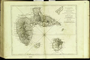
Background imageRelated Images Collection: Geography Atlas: representation of the archipelago of Guadeloupe

Geography Atlas: representation of the archipelago of Guadeloupe. Map taken from "The west indian atlas or general
VEN5029635 Geography Atlas: representation of the archipelago of Guadeloupe. Map taken from "The west indian atlas or general description of west indies" by Thomas Jefferys

Background imageRelated Images Collection: Geography Atlas: representation of the island of Santo Domingo in the West Indies

Geography Atlas: representation of the island of Santo Domingo in the West Indies
VEN5031371 Geography Atlas: representation of the island of Santo Domingo in the West Indies. Map from an atlas by Antonio del Monte y Tejada (1783-1861), 1860

Background imageRelated Images Collection: Geography Atlas: representation of the island of Santo Domingo in the West Indies

Geography Atlas: representation of the island of Santo Domingo in the West Indies. Map from an atlas by J. B
VEN5031350 Geography Atlas: representation of the island of Santo Domingo in the West Indies. Map from an atlas by J. B. Poirson (1761-1831), French geographer, 1803

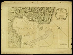
Background imageRelated Images Collection: Geography Atlas: representation of Cape Francais (Cap de la Republique)

Geography Atlas: representation of Cape Francais (Cap de la Republique) in Santo Domingo in the West Indies
VEN5031342 Geography Atlas: representation of Cape Francais (Cap de la Republique) in Santo Domingo in the West Indies. Map from an atlas by Thomas Jefferys, geographer of the Prince of Wales, 1760

Background imageRelated Images Collection: Geography: map of the island of Guadeloupe in the West Indies

Geography: map of the island of Guadeloupe in the West Indies. Map from an Atlas de Villers from 1843
VEN5031313 Geography: map of the island of Guadeloupe in the West Indies. Map from an Atlas de Villers from 1843. Biblioteca Jose Marti, Havana

Background imageRelated Images Collection: Geography: map of the island of Guadeloupe, Marie Galante, Desirade in the West Indies

Geography: map of the island of Guadeloupe, Marie Galante, Desirade in the West Indies
VEN5031309 Geography: map of the island of Guadeloupe, Marie Galante, Desirade in the West Indies. Map from an Atlas by Rigobert Bonne (1756-1823) from 1780

Background imageRelated Images Collection: Geography: map of Cuba, Puerto Rico and general view of the Caribbean Sea

Geography: map of Cuba, Puerto Rico and general view of the Caribbean Sea. Map from an Atlas of Camilo Alabern, 1853
VEN5031293 Geography: map of Cuba, Puerto Rico and general view of the Caribbean Sea. Map from an Atlas of Camilo Alabern, 1853

Background imageRelated Images Collection: Geography: map of the island of Cuba with map in the Caribbean Sea

Geography: map of the island of Cuba with map in the Caribbean Sea. Map from an Atlas by Rigobert Bonne (1756-1823)
VEN5031278 Geography: map of the island of Cuba with map in the Caribbean Sea. Map from an Atlas by Rigobert Bonne (1756-1823) from 1780

Background imageRelated Images Collection: Geography: map showing Central America (Mexico, Yucatan, Honduras, Nicaragua, Costa Rica)

Geography: map showing Central America (Mexico, Yucatan, Honduras, Nicaragua, Costa Rica)
VEN5031262 Geography: map showing Central America (Mexico, Yucatan, Honduras, Nicaragua, Costa Rica), the Gulf of Mexico and the Caribbean Sea islands (Antilles)

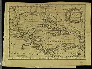
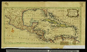
Background imageRelated Images Collection: Geography: map showing the Gulf of Mexico and the Caribbean Sea islands (Caribbean)

Geography: map showing the Gulf of Mexico and the Caribbean Sea islands (Caribbean)
VEN5031256 Geography: map showing the Gulf of Mexico and the Caribbean Sea islands (Caribbean). Plate from an Atlas by Thomas Kitchin (1718-1784) 1780-1790 Biblioteca Jose Marti, Havana

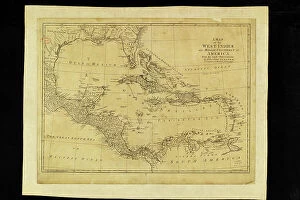
Background imageRelated Images Collection: Geography: map showing the Gulf of Mexico, the Caribbean Islands, Central America (Mexico)

Geography: map showing the Gulf of Mexico, the Caribbean Islands, Central America (Mexico, Yucatan, Salvador, Honduras)
VEN5031245 Geography: map showing the Gulf of Mexico, the Caribbean Islands, Central America (Mexico, Yucatan, Salvador, Honduras, Nicaragua, Costarica)

Background imageRelated Images Collection: Geography: map of the island of Cuba with detailed map of the city of Havana

Geography: map of the island of Cuba with detailed map of the city of Havana. View of the entire Gulf of Mexico
VEN5031239 Geography: map of the island of Cuba with detailed map of the city of Havana. View of the entire Gulf of Mexico. Map from an Atlas of 1763

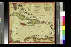
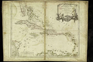
Background imageRelated Images Collection: Geography: map representing the Greater and Lesser Antilles in the Caribbean Sea

Geography: map representing the Greater and Lesser Antilles in the Caribbean Sea
VEN5031208 Geography: map representing the Greater and Lesser Antilles in the Caribbean Sea. Plate taken from an Atlas of the geographer Robert, 1750

Background imageRelated Images Collection: Geography: map showing Central America (Mexico, Honduras, Yucatan)

Geography: map showing Central America (Mexico, Honduras, Yucatan) and the Caribbean Sea Islands (Antilles)
VEN5031197 Geography: map showing Central America (Mexico, Honduras, Yucatan) and the Caribbean Sea Islands (Antilles). Plate taken from an Atlas by Thomas Kitchin (1718-1784)

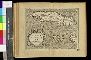
Background imageRelated Images Collection: Geography map: representation of the islands of the Greater Antilles (Cuba, Hispaniola)

Geography map: representation of the islands of the Greater Antilles (Cuba, Hispaniola, Jamaica) in the Caribbean Sea
VEN5030433 Geography map: representation of the islands of the Greater Antilles (Cuba, Hispaniola, Jamaica) in the Caribbean Sea. Engraved board from an Atlas of the 18th century

Background imageRelated Images Collection: Geography map: representation of the island of Cuba in the Caribbean

Geography map: representation of the island of Cuba in the Caribbean, made by Dutch cartographer Gerard van Keulen
VEN5030107 Geography map: representation of the island of Cuba in the Caribbean, made by Dutch cartographer Gerard van Keulen (1678-1726) 1709-1713

Background imageRelated Images Collection: The American Hispano War (Desastre of 98) in 1898 between the United States of America and Spain

The American Hispano War (Desastre of 98) in 1898 between the United States of America and Spain
NWI4832538 The American Hispano War (Desastre of 98) in 1898 between the United States of America and Spain: Colonel Roosevelt

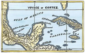
Background imageRelated Images Collection: Map of Mexico and the Gulf of Mexico during the debarkage of Hernan Cortes

Map of Mexico and the Gulf of Mexico during the debarkage of Hernan Cortes (Fernando Cortes Monroy Pizarro Altamirano)
NWI4850926 Map of Mexico and the Gulf of Mexico during the debarkage of Hernan Cortes (Fernando Cortes Monroy Pizarro Altamirano, 1485-1547, Spanish conquistador), 1519

Background imageRelated Images Collection: Flags of forty countries, circa 1890. Colour lithography, 19th century

Flags of forty countries, circa 1890. Colour lithography, 19th century
NWI4851551 Flags of forty countries, circa 1890. Colour lithography, 19th century.; (add.info.: Flags of forty countries, circa 1890)

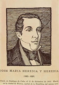
Background imageRelated Images Collection: HEREDIA Y HEREDIA, Jose Maria (1803-1839). Cuban writer. Engraving. SPAIN

HEREDIA Y HEREDIA, Jose Maria (1803-1839). Cuban writer. Engraving. SPAIN. MADRID (AUTONOMOUS COMMUNITY). Madrid
CUL4868944 HEREDIA Y HEREDIA, Jose Maria (1803-1839). Cuban writer. Engraving. SPAIN. MADRID (AUTONOMOUS COMMUNITY). Madrid

Background imageRelated Images Collection: Cuba. War of independence (1868-1898). Fire and plunder at Baracoa outskirts. Etching. SPAIN

Cuba. War of independence (1868-1898). Fire and plunder at Baracoa outskirts. Etching. SPAIN
CUL4868925 Cuba. War of independence (1868-1898). Fire and plunder at Baracoa outskirts. Etching. SPAIN. MADRID (AUTONOMOUS COMMUNITY). Madrid

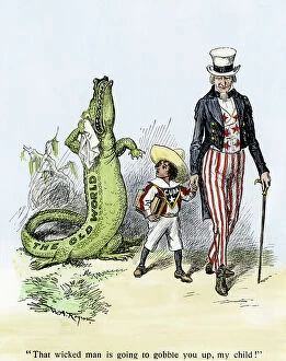
Background imageRelated Images Collection: Uncle Sam leads the child Cuba away from the old world by saying

Uncle Sam leads the child Cuba away from the old world by saying, "That wicked man is going to gobble you up
NWI4866057 Uncle Sam leads the child Cuba away from the old world by saying, "That wicked man is going to gobble you up, my child", and trains him into the new world of progress, 1901

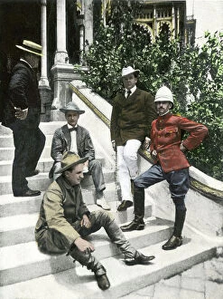
Background imageRelated Images Collection: American-Spanish War: War Correspondents in Tampa including Frederic Remington (left) (1861-1909)

American-Spanish War: War Correspondents in Tampa including Frederic Remington (left) (1861-1909)
NWI4835194 American-Spanish War: War Correspondents in Tampa including Frederic Remington (left) (1861-1909), American artist and Richard Harding Davis (second from right) (1864-1916)

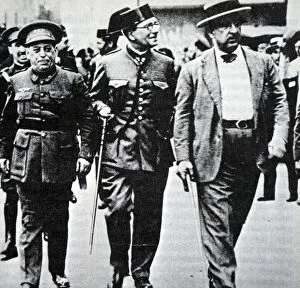
Background imageRelated Images Collection: Photograph of Jose Sanjurjo and Calixto Garcia during the Spanish-American War

Photograph of Jose Sanjurjo and Calixto Garcia during the Spanish-American War
3120161 Photograph of Jose Sanjurjo and Calixto Garcia during the Spanish-American War; (add.info.: Photograph of Jose Sanjurjo and Calixto Garcia during the Spanish-American War)

Background imageRelated Images Collection: Jose Manuel de Ezpeleta y Galdeano, 1st Count of Ezpeleta de Beire

Jose Manuel de Ezpeleta y Galdeano, 1st Count of Ezpeleta de Beire, from Enciclopedia Ilustrada Segui, c.1900
3432466 Jose Manuel de Ezpeleta y Galdeano, 1st Count of Ezpeleta de Beire, from Enciclopedia Ilustrada Segui, c.1900; Private Collection; (add.info.: Jose Manuel de Ezpeleta y Galdeano)

Background imageRelated Images Collection: Paradise parrot or yellow parrot of Cuba - Lithography and drawing by Richard Polydore Nodder

Paradise parrot or yellow parrot of Cuba - Lithography and drawing by Richard Polydore Nodder (1774-1823)
FLO4682716 Paradise parrot or yellow parrot of Cuba - Lithography and drawing by Richard Polydore Nodder (1774-1823), for " naturalist collection" by George Shaw and Frederick Nodder

Background imageRelated Images Collection: Map showing the course of Christopher Columbus from Guanahani to Cuba in 1492

Map showing the course of Christopher Columbus from Guanahani to Cuba in 1492
2915328 Map showing the course of Christopher Columbus from Guanahani to Cuba in 1492. From the book Life of Christopher Columbus by Clements R. Markham published 1892.; Photo © Hilary Morgan

Background imageRelated Images Collection: Royal purple gaybine, Pharbitis ostrina, from Cuba. Handcoloured copperplate engraving by George

Royal purple gaybine, Pharbitis ostrina, from Cuba. Handcoloured copperplate engraving by George Barclay after an
FLO4588657 Royal purple gaybine, Pharbitis ostrina, from Cuba. Handcoloured copperplate engraving by George Barclay after an illustration by Miss Sarah Drake from Edwards' Botanical Register

Background imageRelated Images Collection: Cooling off

Cooling off
Ling Zhang

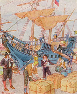
Background imageRelated Images Collection: Hafen Mit Tabakballen / Port with Tobacco Bales (colour litho)

Hafen Mit Tabakballen / Port with Tobacco Bales (colour litho)
8666144 Hafen Mit Tabakballen / Port with Tobacco Bales (colour litho) by Christophe (Colomb, Georges) (1856-1945); Private Collection; (add.info.: Hafen Mit Tabakballen)

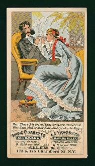
Background imageRelated Images Collection: Advertising card for Allen & Co cigarettes, New York (colour litho)

Advertising card for Allen & Co cigarettes, New York (colour litho)
8677544 Advertising card for Allen & Co cigarettes, New York (colour litho) by American School, (19th century); Private Collection; (add.info.: Advertising card for Allen & Co cigarettes)

Background imageRelated Images Collection: Cuban Exiles Making Cigar, 1873

Cuban Exiles Making Cigar, 1873
1574614 Cuban Exiles Making Cigar, 1873; (add.info.: Cuban exiles making cigars in New York using tobacco imported from Cuba. They are rolling cigars while a man hired by them is reading to them)

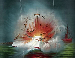
Background imageRelated Images Collection: Explosion of the Maine, 1898

Explosion of the Maine, 1898
1575210 Explosion of the Maine, 1898; (add.info.: Explosion of the Maine 1898. Print shows the USS Maine blowing up in the harbour at Havana, Cuba, a small portrait of Captain C. D)

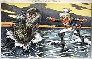
Background imageRelated Images Collection: The daughter of the Sea, Uncle Sam and Cuba, 1898 (illustration)

The daughter of the Sea, Uncle Sam and Cuba, 1898 (illustration)
1836065 The daughter of the Sea, Uncle Sam and Cuba, 1898 (illustration); (add.info.: The daughter of the Sea, Uncle Sam and Cuba)

Background imageRelated Images Collection: La Cuba at Palermo (engraving)

La Cuba at Palermo (engraving)
8627338 La Cuba at Palermo (engraving) by European School, (19th century); Private Collection; (add.info.: La Cuba at Palermo)

Background imageRelated Images Collection: Walking in the morning Sun

Walking in the morning Sun
Ling Zhang

Background imageRelated Images Collection: Malecon

Malecon
Andy Bauer

Background imageRelated Images Collection: CUBA NEVERENDING STORY

CUBA NEVERENDING STORY
Gina Buliga

Background imageRelated Images Collection: Femm au cigare

Femm au cigare
Maja Tomljanovic

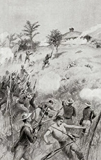
Background imageRelated Images Collection: Charge of the Rough Riders at The Battle of San Juan Hill, near Santiago de Cuba, Cuba, July 1, 1898

Charge of the Rough Riders at The Battle of San Juan Hill, near Santiago de Cuba, Cuba, July 1, 1898
UIG5419660 Charge of the Rough Riders at The Battle of San Juan Hill, near Santiago de Cuba, Cuba, July 1, 1898, aka the battle for the San Juan Heights, decisive battle of the Spanish-American War

Background imageRelated Images Collection: The Battle of Las Guasimas, Cuba, June 24, 1898, the first land engagement of the Spanish-American

The Battle of Las Guasimas, Cuba, June 24, 1898, the first land engagement of the Spanish-American War
UIG5419659 The Battle of Las Guasimas, Cuba, June 24, 1898, the first land engagement of the Spanish-American War. From The History of Our Country, published 1900 ©UIG/Leemage

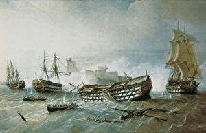
Background imageRelated Images Collection: War of the Austrian Succession (1740-1748), 18th century (oil on canvas)

War of the Austrian Succession (1740-1748), 18th century (oil on canvas)
MMM5458331 War of the Austrian Succession (1740-1748), 18th century (oil on canvas) by Scott, Samuel (c.1702-72); National Maritime Museum, London

Background imageRelated Images Collection: View of the capture of the forts and the city of Havana (Cuba), by the English in 1762

View of the capture of the forts and the city of Havana (Cuba), by the English in 1762
MMM5482064 View of the capture of the forts and the city of Havana (Cuba), by the English in 1762. Color engraving (30.1 x 45.7 cm), 18th century French art.; 30.1x45.7 cm; National Maritime Museum

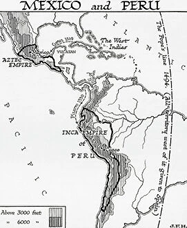
Background imageRelated Images Collection: Map of Mexico and Peru, showing the Aztec Empire and the Inca Empire. (print)

Map of Mexico and Peru, showing the Aztec Empire and the Inca Empire. (print)
7420055 Map of Mexico and Peru, showing the Aztec Empire and the Inca Empire. (print); (add.info.: Map of Mexico and Peru, showing the Aztec Empire and the Inca Empire)

Background imageRelated Images Collection: Antonio Caballero y Fernandez de Rodas (1816-1876). Spanish militar. El Museo Universal. 1868

Antonio Caballero y Fernandez de Rodas (1816-1876). Spanish militar. El Museo Universal. 1868
AIS5394623 Antonio Caballero y Fernandez de Rodas (1816-1876). Spanish militar. El Museo Universal. 1868. Engraving ©Lorio/Iberfoto/Leemage

Background imageRelated Images Collection: The death of Antonio Maceo Grajales

The death of Antonio Maceo Grajales
5305304 The death of Antonio Maceo Grajales.; (add.info.: Painting depicting the death of Antonio Maceo Grajales (1845-1896) second in command of the Cuban Army of Independence. Dated 19th Century

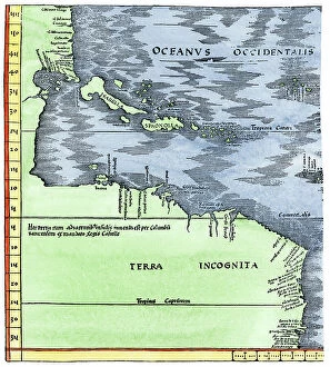
Background imageRelated Images Collection: Geographic map of the New World, 1513, admiral map of the Caribbean and unknown lands of North

Geographic map of the New World, 1513, admiral map of the Caribbean and unknown lands of North and South America
NWI4846079 Geographic map of the New World, 1513, admiral map of the Caribbean and unknown lands of North and South America

Background imageRelated Images Collection: The defense of the promontory of Havana, 1862 - MONLEON Y TORRES, Rafael (1835-1900)

The defense of the promontory of Havana, 1862 - MONLEON Y TORRES, Rafael (1835-1900)
CUL4877070 The defense of the promontory of Havana, 1862 - MONLEON Y TORRES, Rafael (1835-1900). Defence of the Havana Promontory (1st july 1862). 1873. (100 x 170 cm.). Seven Years' War


All Professionally Made to Order for Quick Shipping


-

Why Choose Us?

We are a leading provider of Art Prints and Photo Gifts since 2004, working in partnership with a range of Sporting Clubs, Charities, Museums and Picture Libraries. A large share of profits from any of their images will go directly towards supporting that charity or club. Our archive of images is carefully curated to bring you a wide range of subjects, including landscapes, wildlife, architecture, and more. We ship from our partner labs in the UK, USA, EU (Netherlands) and Australia.
+

How do I place an order?

Ordering is quick & easy - Just follow 5 Simple Steps:
  1. Find your image: Use our search box or browse our online photo Collections to find the image you want.

  2. Choose your print format: Select your desired product and add it to your cart.

  3. Enter your details: If you're a returning customer, simply enter your email address and password, and we'll fill in your billing and shipping address details. All personal details are held securely and are fully GDPR compliant. As standard, we remove all Personally Identifiable Information after 12 months.

  4. Pay for your purchase: We use state-of-the-art security for online shopping and do not have access to your card details.

  5. Sit back and relax: We'll email you confirmation of your order and when it's dispatched. Registered customers can also track orders in the 'My Account' area.

+

How do I pay for an order?

You can pay for your order with most of the major credit and debit cards, or PayPal. For added security, major financial institutions process payment details separately and securely on our behalf. We do not have access to your online payment card details. Online payments are preferred however we do take phone orders. For UK customers only we accept cheques issued against a UK bank.
+

Is my data safe?

We take data security very seriously. We do not have access to your full card details and all payments are requested over a fully secure connection. Additionally, we fully comply with current European and GDPR legislation, and automatically remove all personal data after at most 12 months (unless you have an account with us and have signed in recently). We also have a strict opt-in policy and would never sell your personal details. Your data is only used to fulfill your order promptly and efficiently.
+

Is wall art ready to hang?

For quick and easy installation all wall art, including framed prints, canvas prints and metal prints are supplied with a ready to hang solution on the back. Generally, saw tooth hangers are applied as they allow wall art to hang flush against the wall. The serrated edge of the hanger prevents the frame from shifting or tilting when hung.
+

Are the photo prints fade resistant?

Yes, we use archival quality photo paper photographic paper for vivid reproduction Prints are an accurate representations of the original artwork, which is preserved for artistic character and authenticity. We guarantee they match previews shown on our web site