
Maps Collection
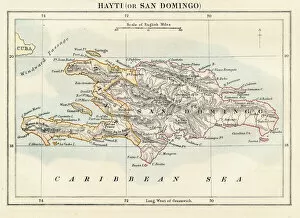
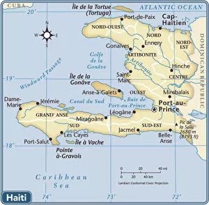
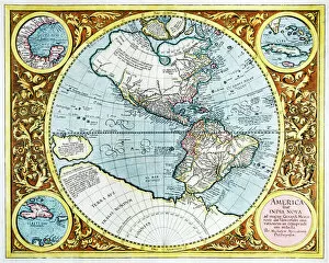
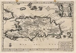
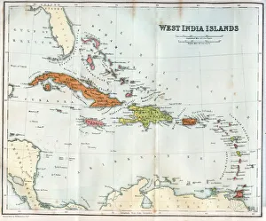
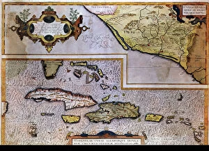
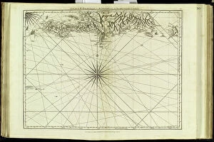
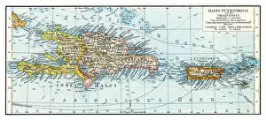
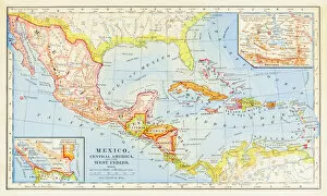
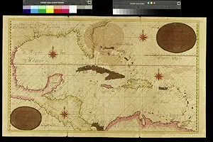
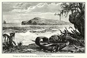
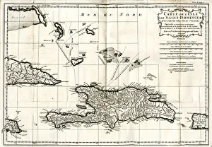
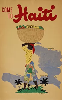
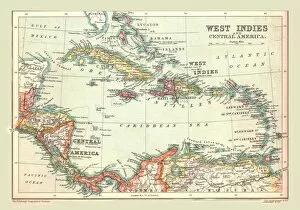
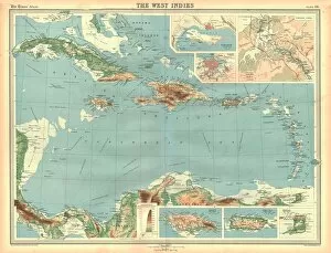
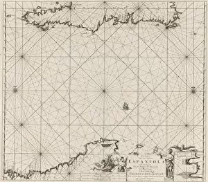
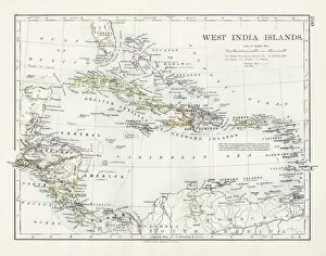
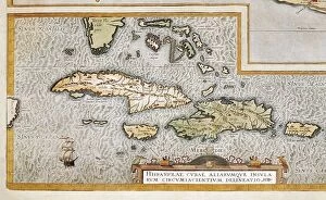
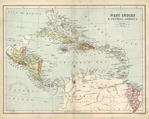
Haiti is an island nation located in the Caribbean Sea, just off the coast of North America
Choose a picture from our Maps Collection for your Wall Art and Photo Gifts
78 items


All Professionally Made to Order for Quick Shipping
-
Maps Collection
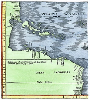
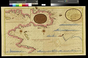
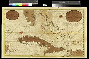
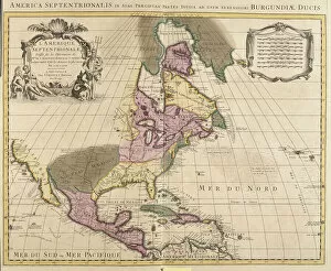
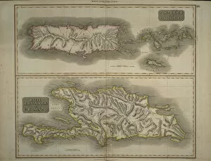
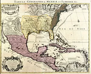
Haiti is an island nation located in the Caribbean Sea, just off the coast of North America, and is bordered by the Dominican Republic to its east and Cuba to its north. Maps of Haiti North America provide a comprehensive view of this small country, including its topography, rivers, cities and towns. they also show Haiti's main roads and highways as well as its international airports. Additionally, they illustrate the country's natural resources such as forests and beaches. Maps of Haiti North America are essential for travelers who want to explore this beautiful Caribbean nation with rich culture and history and can help visitors plan their trips more efficiently while avoiding any potential hazards or risks associated with traveling in a foreign land like Haiti.
+
Our beautiful pictures are available as Framed Prints, Photos, Wall Art and Photo Gifts
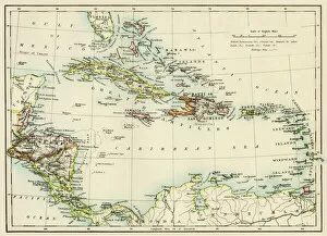
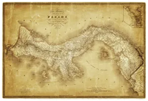
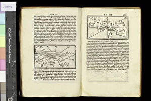
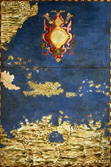
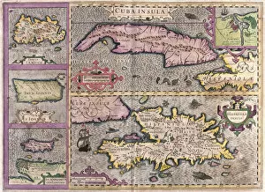
The Maps of Haiti North America collection from Media Storehouse is a stunning compilation of vintage and contemporary maps that depict the geography, history, and culture of Haiti. Our collection features a wide range of maps, including topographical maps, political maps, historical maps, and artistic renditions. Each map is carefully selected for its unique style and aesthetic appeal. The Maps of Haiti North America collection offers a glimpse into the rich cultural heritage of this Caribbean nation. From colonial-era depictions to modern-day cartography, these prints showcase the evolution of Haitian society over time. Whether you're interested in exploring the country's mountainous terrain or tracing its complex political history, there's something for everyone in this comprehensive collection. With high-quality printing techniques and framing options available through our wall art and framed prints service, these beautiful maps are sure to make an eye-catching addition to any home decor.
+
What are Maps of Haiti North America art prints?
Maps of Haiti North America art prints are high-quality reproductions of maps that depict the geography, topography, and landmarks of Haiti and North America. These prints are created using advanced printing technology to ensure that every detail is captured with precision and accuracy. They come in a range of sizes and styles to suit different preferences. These art prints are not only aesthetically pleasing but also serve as educational tools for those interested in learning more about the geography and history of these regions. They can be used as decorative pieces in homes, offices, or classrooms. The Maps of Haiti North America art prints offered by Media Storehouse showcase some of the most iconic maps from renowned cartographers such as Abraham Ortelius, John Speed, and Gerard Mercator. Whether you're an avid collector or simply looking for a unique gift idea, these art prints offer something special for everyone who appreciates fine artwork.
+
What Maps of Haiti North America art prints can I buy from Media Storehouse?
We offer a wide range of Maps of Haiti North America art prints that you can purchase. These maps are available in various sizes and styles, including vintage, antique, and modern designs. You can choose from different types of maps such as topographical, political, physical or satellite imagery. The collection includes detailed maps that showcase the country's cities and towns along with its natural features like mountains, rivers and lakes. The prints also feature important landmarks such as historical sites and monuments. Whether you're looking for a decorative piece to hang on your wall or an educational tool for your classroom or office space, we have something for everyone. Their high-quality printing process ensures that each map is sharp and vibrant with accurate details. In addition to Maps of Haiti North America art prints, Media Storehouse also offers other types of artwork featuring landscapes, animals, sports teams and more.
+
How do I buy Maps of Haiti North America art prints?
To purchase Maps of Haiti North America art prints from Media Storehouse, you can browse our online collection and select the print that catches your eye. Once you have chosen your preferred artwork, simply add it to your cart and proceed to checkout. During the checkout process, you will be prompted to enter your shipping information and payment details. We offer a range of sizes for their art prints, so make sure to choose the size that best fits your needs. We also offer various framing options if you prefer a ready-to-hang piece. If you have any questions or concerns about purchasing Maps of Haiti North America art prints from Media Storehouse, don't hesitate to reach out to our customer service team for assistance. With high-quality printing and excellent customer service, Media Storehouse is an excellent choice for those looking for beautiful artwork featuring maps of Haiti in North America.
+
How much do Maps of Haiti North America art prints cost?
The cost of Maps of Haiti North America art prints varies depending on the size, quality, and framing options. The price range can be affordable for smaller sizes and unframed prints or more expensive for larger sizes with premium materials such as canvas or museum-grade paper. Additionally, some retailers may offer discounts or promotions that could affect the final price. It is important to note that purchasing an art print not only adds aesthetic value to a space but also supports artists and their work. Moreover, maps are a great way to learn about geography and history while adding character to any room. When considering buying a Maps of Haiti North America art print from Media Storehouse, it is recommended to browse through our collection online or contact customer service for further assistance in finding the perfect fit for your needs and budget.
+
How will my Maps of Haiti North America art prints be delivered to me?
Your Maps of Haiti North America art prints will be delivered to you through a reliable and secure shipping service. The company takes great care in ensuring that your order is packaged properly so that it arrives in excellent condition. Your art prints will be rolled up and placed inside a sturdy cardboard tube, which is then sealed with tape to prevent any damage during transit. Once your order has been processed, you will receive an email confirmation along with tracking information for your package. This allows you to monitor the progress of your delivery and ensure that it arrives at its intended destination on time. The company values customer satisfaction, which is why they take every measure possible to ensure that their products are delivered safely and efficiently. You can rest assured knowing that your Maps of Haiti North America art prints will arrive at your doorstep in pristine condition ready for display or framing.