Home > Arts > Artists > T > Charles Towne
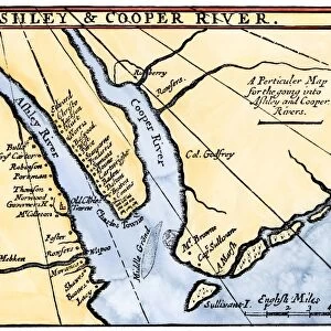
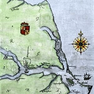
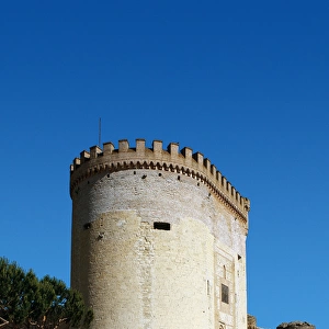
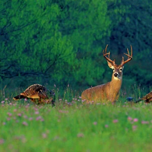
Carolina coast map, 1600s

![]()
Wall Art and Photo Gifts from North Wind
Carolina coast map, 1600s
Map of the Carolinas, showing Charleston and the Outer Banks, north on the right.
Hand-colored woodcut reproduction of a 17th-century map
North Wind Picture Archives brings history to life with stock images and hand-colored illustrations
Media ID 5882489
© North Wind Picture Archives
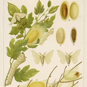
1600s 17th Century Animal Atlantic Atlantic Ocean Beaver Carolina Carolinas Charleston Coast Colonial Colony Compass Deer English English Colony Native Animal North Carolina Ocean Outer Banks Sailing Ship Settlement Ship Silk South South Carolina Southern Turkey Wild Animal Charles Towne Silk Worm
FEATURES IN THESE COLLECTIONS
> Animals
> Birds
> Phasianidae
> Wild Turkey
> Animals
> Insects
> Butterflies
> Silkworm
> Animals
> Mammals
> Castoridae
> American Beaver
> Animals
> Mollusks
> Shipworms
> Arts
> Artists
> T
> Charles Towne
> Asia
> Turkey
> Related Images
> North Wind Picture Archives
> Maps
EDITORS COMMENTS
This hand-colored woodcut reproduction of a 17th-century map takes us back in time to the Carolina coast during the 1600s. The intricate details and vibrant colors bring to life an era of exploration, settlement, and natural beauty. The map showcases the Carolinas, with Charleston and the Outer Banks prominently featured. As we gaze upon it, our eyes are drawn to the north on the right side, reminding us that this is how maps were traditionally oriented centuries ago. Intriguingly, various elements catch our attention within this historical snapshot. We spot sailing ships gracefully navigating the Atlantic Ocean while wild animals roam freely across untouched landscapes. From beavers constructing their dams to turkeys strutting proudly amidst lush vegetation, these native creatures symbolize both abundance and untamed wilderness. Furthermore, hints of human presence can be found throughout this map print. English settlements dotting the coastline indicate early colonial efforts in establishing a foothold in North America's southern region. Notably, silk worms allude to attempts at cultivating silk production—a testament to ambitious endeavors undertaken by settlers during that time. As we admire this piece of artistry steeped in history and heritage, it serves as a reminder of how far we have come as a nation since those early days when Charles Towne (now Charleston) was just beginning its journey towards becoming one of America's most iconic cities
MADE IN AUSTRALIA
Safe Shipping with 30 Day Money Back Guarantee
FREE PERSONALISATION*
We are proud to offer a range of customisation features including Personalised Captions, Color Filters and Picture Zoom Tools
SECURE PAYMENTS
We happily accept a wide range of payment options so you can pay for the things you need in the way that is most convenient for you
* Options may vary by product and licensing agreement. Zoomed Pictures can be adjusted in the Cart.