Fraud Blocker Skip to main content

Home > Europe > Portugal > Maps

Medieval Spain and Portugal map

Medieval Spain and Portugal map
Sold 13
In Stock
We accept all major credit cards

North Wind Photo Prints and Wall Art

Medieval Spain and Portugal map

Map of the Iberian Peninsula in the 1300s and 1400s.
Printed color lithograph reproduction of a 19th-century illustration. North Wind Picture Archives brings history to life with stock images and hand-colored illustrations. © North Wind Picture Archives

Media ID 5882217

1300s 1400s 14th Century 15th Century Europe European Granada Medieval Middle Ages Moors Portugal Portuguese Spain Spanish Aragon Castile Gibraltar Iberia Iberian Peninsula Navarra

FEATURES IN THESE COLLECTIONS

> Arts > Art Movements > Medieval Art

> Europe > Portugal > Maps

> Europe > Portugal > Posters

> Europe > Portugal > Related Images

> Europe > Spain > Granada

> Europe > Spain > Maps

> Europe > Spain > Posters

> Europe > Spain > Related Images

> Maps and Charts > Portugal

> Maps and Charts > Related Images

> North Wind Picture Archives > Maps

SECURE PAYMENTS
We happily accept a wide range of payment options so you can pay for the things you need in the way that is most convenient for you

MADE IN AUSTRALIA
Safe Shipping with 30 Day Money Back Guarantee

FREE PERSONALISATION
We are proud to offer a range of customisation including Cropping, Captions, and Filters. Zoom Cropping can be adjusted in the Basket.


EDITORS COMMENTS

This print takes us on a journey back in time to the medieval era of Spain and Portugal. With its vibrant colors and intricate details, it beautifully captures the essence of the Iberian Peninsula during the 1300s and 1400s. The map showcases the rich history and heritage of this region, highlighting key cities such as Granada, Gibraltar, Aragon, Castile, Navarra, and more. Each city is marked with precision, allowing us to trace the footsteps of ancient civilizations that once thrived here. As we explore this vintage illustration, we are transported to a world where traditional architecture meets European charm. The artistry behind this lithograph reproduction truly brings out the grandeur of medieval Spain and Portugal. One cannot help but marvel at how this map encapsulates centuries of cultural exchange between Christians and Moors. It serves as a testament to their coexistence during these tumultuous times in history. Whether you are an art enthusiast or a history buff, this print offers a glimpse into Europe's fascinating past. It serves as a reminder that even amidst political turmoil and territorial disputes, beauty can be found in every corner of our shared human experience.


Framed Prints

Discover the rich history of Medieval Spain and Portugal with our stunning Framed Print from the Media Storehouse collection. This beautifully detailed map, sourced from North Wind Picture Archives, transports you back in time to the 1300s and 1400s. The intricately designed illustration showcases the Iberian Peninsula during this era, bringing to life the complex tapestry of history. Our Framed Print is a color lithograph reproduction of a 19th-century original, ensuring the highest quality and authenticity. Add this captivating piece to your home or office to ignite curiosity and inspire learning. A perfect addition to any history enthusiast's collection.


Photo Prints

Discover the rich history of Medieval Spain and Portugal with our stunningly detailed and vibrant Photographic Print from Media Storehouse. This captivating map, taken from the North Wind Picture Archives, transports you back in time to the 1300s and 1400s. Printed using color lithography, this reproduction of an original 19th-century illustration showcases the intricacies of the Iberian Peninsula during this fascinating era. Add an authentic and educational touch to your home or office decor with this beautiful, high-quality print.


Poster Prints

Discover the rich history of Medieval Spain and Portugal with our stunning poster print from the Media Storehouse collection. This captivating reproduction, sourced from the North Wind Picture Archives, showcases an intricately detailed map of the Iberian Peninsula from the 1300s and 1400s. With vibrant colors and meticulous attention to detail, this poster transport you back in time to an era of exploration, discovery, and cultural exchange. Hang this beautiful piece in your home or office to add a touch of history and sophistication to your space. Perfect for history enthusiasts, educators, or anyone who appreciates the beauty of historical maps. Bring a piece of the past into your present with our Medieval Spain and Portugal map poster print.


Jigsaw Puzzles

Discover the rich history of Medieval Spain and Portugal with our captivating jigsaw puzzle from Media Storehouse. This intricately detailed puzzle features a stunning reproduction of a 19th-century illustration of the Iberian Peninsula, showcasing the borders of Spain and Portugal during the Medieval period. The vibrant colors and intricate lines of the North Wind Picture Archives map transport you back in time, making this puzzle an engaging and educational experience for puzzle enthusiasts of all ages. Immerse yourself in the history of this fascinating region and enjoy the satisfaction of piecing together this beautiful and intricate puzzle.

diamond
Made With High Grade Materials
thumb_up
Professional Quality Finish
package_2
Carefully Packed To Aid Safe Arrival

You May Also Like


Reference Map of SpainReference Map of Spain
Add to Basket
Medieval Europe at the start of the CrusadesMedieval Europe at the start of the Crusades
Add to Basket
Map of ancient RomeMap of ancient Rome
Add to Basket
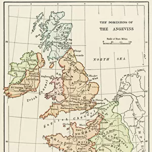
Angevin kings holdings in France and BritainAngevin kings holdings in France and Britain
Add to Basket
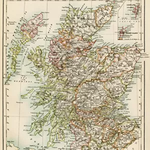
Scotland map, 1870sScotland map, 1870s
Add to Basket
Iceland map, 1800sIceland map, 1800s
Add to Basket
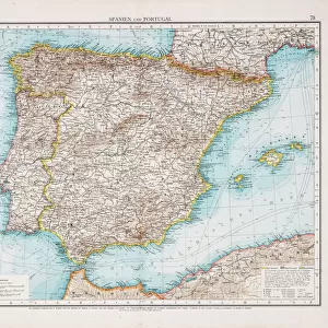
Map of Spain and Portugal 1896Map of Spain and Portugal 1896
Add to Basket
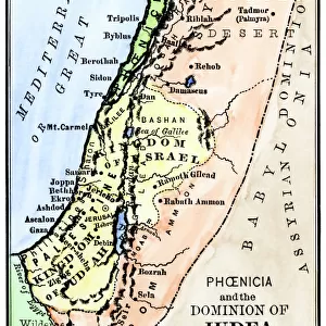
Map of ancient Palestine kingdoms of Judah and IsraelMap of ancient Palestine kingdoms of Judah and Israel
Add to Basket
Map / Europe / France C1000Map / Europe / France C1000
Add to Basket
Map of England, 1800sMap of England, 1800s
Add to Basket
Ireland map, 1870sIreland map, 1870s
Add to Basket
EXPL2A-00352EXPL2A-00352
Add to Basket

Gallery Wall Inspiration

Thirteen original colonies in 1776
Map of England in 1066
Vancouver Island map, 1870s
Medieval Europe at the start of the Crusades
Victoria province, Australia, 1800s
Map of ancient Rome
Scotland map, 1870s
Iceland map, 1800s
Ireland map, 1870s
Map of England, 1800s
Map of the Peloponnesus of ancient Greece
Ancient Greece and its colonies around the Aegean
EXPL2A-00366
New South Wales map, 1800s
Map of ancient Palestine kingdoms of Judah and Israel
Plan of Washington DC, 1793
California under Mexican rule, 1800s
Alaska and British Columbia map, 1872
Erie Canal route
Western US after the Compromise of 1850
PROY2A-00017
Map of Mandan migration
Iroquois Nations map, 1600s
NATI2A-00044
American Indian tribe locations about 1700
Southeast Indian tribe locations in 1776
American Indian tribe locations in 1715

Discover Our Collections


MapsMaps
View Collection
Portugal Related ImagesPortugal Related Images
View Collection
Spain Related ImagesSpain Related Images
View Collection
GranadaGranada
View Collection
MapsMaps
View Collection
MapsMaps
View Collection
Medieval ArtMedieval Art
View Collection
Maps and Charts Related ImagesMaps and Charts Related Images
View Collection
PortugalPortugal
View Collection
PostersPosters
View Collection
PostersPosters
View Collection


© Copyright Media Storehouse, All Rights Reserved 2003 - 2024
Facebook     Pinterest     Card Payments     Reviews IO