Home > Science > Space Exploration > Planets > Earth
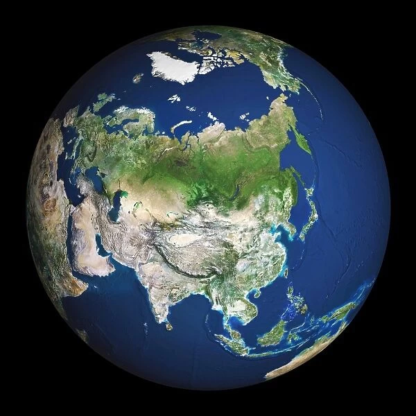
Earth. Satellite image of the Earth, centred on Asia
![]()

Wall Art and Photo Gifts from Science Photo Library
Earth. Satellite image of the Earth, centred on Asia
Earth. Satellite image of the Earth, centred on Asia. The North Pole is at upper centre. Water is blue, vegetation is green, arid areas are brown, and snow and ice are white. Both land and ocean floor topography are shown. The terrain of Asia varies from deserts (brown, central and southern Asia), to tropical rainforests (dark green, South- East Asia), to plains, forests and tundra (lighter green, northern Asia), and mountain ranges (lower centre). Surrounding mainland Asia (clockwise from top) is the Arctic Ocean (with Greenland and North America beyond), the Pacific Ocean, the Malay Archipelago and northern Australia, the Indian Ocean, north-eastern Africa, and Europe
Science Photo Library features Science and Medical images including photos and illustrations
Media ID 6350249
© PLANETOBSERVER/SCIENCE PHOTO LIBRARY
Alaska Arctic Australia Canada China Circle Circular Continent Continental Deserts Earth Observation Eurasia Eurasian Forests From Space Global Globe Greenland Hemisphere Himalayas India Indian Japan Land Malay Archipelago Middle East Mountains Pacific Round Russia Satellite Satellite Image Sphere Spherical
EDITORS COMMENTS
This print showcases our beautiful planet Earth, as seen from space. The satellite image is centred on Asia, with the North Pole positioned at the upper centre of the frame. The vibrant blue hues represent vast bodies of water, while lush green areas indicate thriving vegetation. Arid regions are depicted in shades of brown, and snow-covered landscapes appear pristine white. The topography displayed encompasses both land and ocean floor features, providing a comprehensive view of our diverse planet. As we explore Asia's terrain within this image, we encounter an array of geographical wonders: from expansive deserts in central and southern Asia to dense tropical rainforests in Southeast Asia. Moving northwards reveals plains, forests, tundra regions painted in lighter shades of green along with majestic mountain ranges occupying the lower centre. Surrounding mainland Asia clockwise are various bodies of water including the Arctic Ocean featuring Greenland and North America beyond it; then comes the Pacific Ocean followed by the Malay Archipelago and northern Australia; next is the Indian Ocean leading towards northeastern Africa; finally completing this mesmerizing journey is Europe. This remarkable photograph not only highlights Earth's extraordinary beauty but also serves as a reminder of its intricate interconnectedness across continents and oceans. It invites us to appreciate our planet's rich diversity while igniting a sense of wonder about its countless natural wonders that await exploration.
MADE IN AUSTRALIA
Safe Shipping with 30 Day Money Back Guarantee
FREE PERSONALISATION*
We are proud to offer a range of customisation features including Personalised Captions, Color Filters and Picture Zoom Tools
SECURE PAYMENTS
We happily accept a wide range of payment options so you can pay for the things you need in the way that is most convenient for you
* Options may vary by product and licensing agreement. Zoomed Pictures can be adjusted in the Cart.


