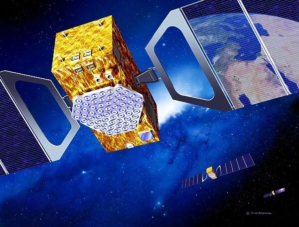
Galileo navigation satellites
![]()

Wall Art and Photo Gifts from Science Photo Library
Galileo navigation satellites
Galileo navigation satellite network. Artwork of several navigation satellites for the European Galileo network, orbiting over Europe (reflection, top right, shows the Mediterranean Sea). Galileo will be a civilian global positioning system (GPS) that will consist of 30 satellites orbiting over 23, 000 kilometres above the Earth. Galileo will be more accurate than, and compatible with, the other GPS systems. Applications include car, train and aircraft guidance, rescue services, and road use taxation. Each satellite is seen with solar panels (blue) to provide power. The complete network is scheduled to operate from 2008
Science Photo Library features Science and Medical images including photos and illustrations
Media ID 6456367
© DETLEV VAN RAVENSWAAY/SCIENCE PHOTO LIBRARY
Agency Arabia Civilian Desert Future Galileo Global Positioning System Guidance Horizontal Mediterranean Middle East Mirror Image Navigation North Africa Orbit Orbiting Planned Reflection Satellite Satellites
EDITORS COMMENTS
This print showcases the future of navigation technology with an artistic representation of Galileo navigation satellites. The artwork depicts several sleek and advanced satellites orbiting over Europe, their mirror-like reflection on the top right revealing the vastness of the Mediterranean Sea. These satellites are part of the European Galileo network, a civilian global positioning system (GPS) that promises unparalleled accuracy and compatibility. With 30 satellites positioned at an impressive altitude of 23,000 kilometers above Earth's surface, Galileo is set to revolutionize various industries. From car and train guidance to aircraft navigation, rescue services to road use taxation, this state-of-the-art GPS system will enhance precision and reliability in countless applications. Each satellite in this illustration is adorned with blue solar panels that provide them with essential power for operation. This planned network was scheduled to be fully functional by 2008 under the supervision of the European Space Agency (ESA). Its coverage spans not only Europe but also extends across North Africa and parts of the Middle East. As we gaze upon this mesmerizing image capturing both technological prowess and natural beauty, it serves as a reminder of humanity's relentless pursuit to explore new frontiers while harnessing cutting-edge advancements for our everyday lives.
MADE IN AUSTRALIA
Safe Shipping with 30 Day Money Back Guarantee
FREE PERSONALISATION*
We are proud to offer a range of customisation features including Personalised Captions, Color Filters and Picture Zoom Tools
SECURE PAYMENTS
We happily accept a wide range of payment options so you can pay for the things you need in the way that is most convenient for you
* Options may vary by product and licensing agreement. Zoomed Pictures can be adjusted in the Cart.

