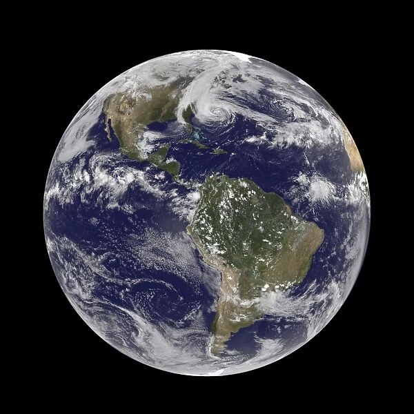
Hurricane Sandy, 28th October 2012 C014 / 5781
![]()

Wall Art and Photo Gifts from Science Photo Library
Hurricane Sandy, 28th October 2012 C014 / 5781
Hurricane Sandy. Satellite image of hurricane Sandy off the east coast of the USA (top centre) on 28th October 2012 at 17.45 UTC. Sandy formed in the Caribbean Sea on the 22nd October, making first landfall on Jamaica on the 24th October. On the 28th October Sandy became the largest hurricane in Atlantic history, with a diameter of 1500 kilometres. As the storm approached, a number of states along the US east coast declared an emergency and low-lying areas were evacuated. Sandy is expected to make landfall in New Jersey on the evening of the 29th October, before converging with two other storm systems and heading north. Image obtained by NOas Geostationary Operational Environmental Satellite (GOES-13)
Science Photo Library features Science and Medical images including photos and illustrations
Media ID 9225685
© NOAA/SCIENCE PHOTO LIBRARY
Atlantic Ocean Clouds Cyclonic Earth Observation East Coast Extreme From Space Hemisphere Hurricane Largest Meteorological Meteorology New York City Noaa Satellite Satellite Image Severe Storm Storm Storm System Tropical Cyclone Weather Whole Earth Hurricane Sandy Superstorm Widest
EDITORS COMMENTS
This print captures the sheer magnitude and destructive power of Hurricane Sandy, one of the most devastating storms in recent history. Taken on October 28th, 2012, by NOAA's Geostationary Operational Environmental Satellite (GOES-13), this satellite image showcases the immense size of Sandy as it looms off the east coast of the United States. With a diameter stretching an astonishing 1500 kilometers, Sandy became the largest hurricane ever recorded in Atlantic history. As it approached landfall, several states along the US east coast declared emergencies and initiated mass evacuations from low-lying areas. The storm was expected to make its first impact in New Jersey on October 29th before merging with two other storm systems and heading northward. The photograph reveals a mesmerizing swirl of clouds surrounding Sandy's eye, showcasing its cyclonic nature. It serves as a stark reminder of Mother Nature's raw power and her ability to unleash catastrophic events upon humanity. The image also highlights how advanced meteorological technology allows us to observe these severe weather phenomena from space. Hurricane Sandy left an indelible mark on American history, causing widespread destruction and claiming numerous lives. Its impact was particularly felt in New York City where flooding devastated parts of Lower Manhattan and caused significant damage across various neighborhoods. This print stands as both a testament to our understanding of meteorology and a haunting reminder that we must remain vigilant in preparing for future extreme weather events like Hurricane Sandy.
MADE IN AUSTRALIA
Safe Shipping with 30 Day Money Back Guarantee
FREE PERSONALISATION*
We are proud to offer a range of customisation features including Personalised Captions, Color Filters and Picture Zoom Tools
SECURE PAYMENTS
We happily accept a wide range of payment options so you can pay for the things you need in the way that is most convenient for you
* Options may vary by product and licensing agreement. Zoomed Pictures can be adjusted in the Cart.

