Home > Science > Space Exploration > Satellite Imagery
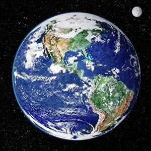
Satellite image of the Earths biosphere

![]()
Wall Art and Photo Gifts from Science Photo Library
Satellite image of the Earths biosphere
The global biosphere. False-colour composite satellite image of Earths biosphere, showing the distribution of vegetation on land & phytoplankton in the oceans. The colours represent chlorophyll densities: from red (most dense) through yellow & blue to pink (least dense) in the oceans; and from dark green to pale yellow on land. The ocean data was acquired by the Coastal Zone Colour Scanner (CZCS), a radiometer with visible light & infrared channels on NASAs Nimbus-7 satellite. The land data is derived from the visible & infrared sensors of the Advanced Very High Resolution Radiometer (AVHRR) on the NOa-7 satellite
Science Photo Library features Science and Medical images including photos and illustrations
Media ID 6350515
© DR GENE FELDMAN, NASA GSFC/SCIENCE PHOTO LIBRARY
Biosphere Earth Science Image Photos Sciences
EDITORS COMMENTS
This print showcases a stunning satellite image of Earth's biosphere, providing us with an extraordinary glimpse into the distribution of vegetation on land and phytoplankton in the oceans. The false-color composite allows us to visualize chlorophyll densities, with red representing the most dense areas and pink indicating the least dense regions in the oceans. On land, we witness a mesmerizing transition from dark green to pale yellow. The oceanic data captured by NASA's Coastal Zone Colour Scanner (CZCS) on board Nimbus-7 satellite reveals intricate details about phytoplankton distribution. This radiometer utilizes visible light and infrared channels to unravel this vital aspect of marine life. Meanwhile, information regarding vegetation distribution on land is derived from Advanced Very High Resolution Radiometer (AVHRR) sensors aboard NOa-7 satellite, which employ both visible and infrared technology. As we delve into this remarkable image, it becomes evident that our planet's biosphere is a complex tapestry interweaving various ecosystems across continents and oceans. It serves as a powerful reminder of Earth's astounding biodiversity and highlights the interconnectedness between different forms of life. Science Photo Library has expertly captured this awe-inspiring moment in earth science history through their meticulous curation of photos related to sciences such as biology and ecology. This particular photograph not only showcases nature's beauty but also contributes significantly to scientific research by aiding our understanding of plankton distribution patterns – knowledge crucial for studying climate change impacts on marine ecosystems.
MADE IN AUSTRALIA
Safe Shipping with 30 Day Money Back Guarantee
FREE PERSONALISATION*
We are proud to offer a range of customisation features including Personalised Captions, Color Filters and Picture Zoom Tools
SECURE PAYMENTS
We happily accept a wide range of payment options so you can pay for the things you need in the way that is most convenient for you
* Options may vary by product and licensing agreement. Zoomed Pictures can be adjusted in the Cart.