Fraud Blocker Skip to main content

Home > Sheffield City Archives > Maps and Plans

Maps and Plans Collection (page 5)

208 items

We are proud to offer this selection in partnership with Sheffield City Archives

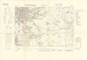
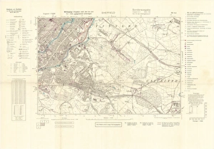
Background imageMaps and Plans Collection: Ordnance Survey map of south Sheffield copied by the Germans, and marked with bombing targets

Ordnance Survey map of south Sheffield copied by the Germans, and marked with bombing targets
Original at Sheffield City Archives MD7731/6 and Sheffield Local Studies Librarys 26 M/3

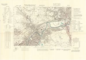
Background imageMaps and Plans Collection: Ordnance Survey map of east end of Sheffield (and Rotherham) copied by the Germans

Ordnance Survey map of east end of Sheffield (and Rotherham) copied by the Germans, and marked with bombing targets
Original at Sheffield City Archives MD7731/2 and Sheffield Local Studies Librarys 26 M/2

Background imageMaps and Plans Collection: Ordnance Survey map of Rotherham copied by the Germans, and marked with bombing targets

Ordnance Survey map of Rotherham copied by the Germans, and marked with bombing targets
Originals at Sheffield City Archives MD7731/3 and Sheffield Local Studies Librarys 26 M/1

Background imageMaps and Plans Collection: Plan of an enlargement of the [General] Cemetery and of a new road leading thereto

Plan of an enlargement of the [General] Cemetery and of a new road leading thereto
Scale 1 inch : 90 yards.Surveyors: Flockton, Lee and Flockton, engineers.Original at Sheffield City Archives: FC/P/SheD/596S

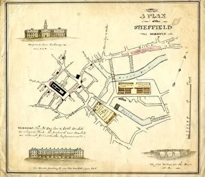
Background imageMaps and Plans Collection: Plan of the Sheffield Markets, [c. 1826]

Plan of the Sheffield Markets, [c. 1826]
Corner drawings of the proposed Corn Exchange, houses fronting the new Hay Market, and the new bridge over the [River] Dun.Scale 5.5 inches : 500 feetOriginal at Sheffield City Archives: AP/10/23

Background imageMaps and Plans Collection: Sheffield, Ashton under Lyme and Manchester Railway, 1846

Sheffield, Ashton under Lyme and Manchester Railway, 1846
Alfred S. Jee, engineer.Scale 1/2 inch : 1 mile.Original dimensions 185 x 80 cm.Original at Sheffield City Archives: SY205/1

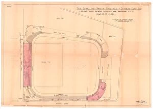
Background imageMaps and Plans Collection: Sheffield United Football Club, Bramall Lane, Sheffield - proposed new terracing, 1901

Sheffield United Football Club, Bramall Lane, Sheffield - proposed new terracing, 1901
Scale 20 feet : 1 inch.Architect: Archibald Leitch (1866 - 1939) 40 St Enoch Square, Glasgow, [Scotland].Original at Sheffield City Archives: CA206/5725

Background imageMaps and Plans Collection: Map of the South Yorkshire Coal Railway, and of the Canals and Railways communicating with

Map of the South Yorkshire Coal Railway, and of the Canals and Railways communicating with the district, 1846
By C. Bartholomew, Civil Engineer.Scale 2 miles : 1 inch.Original at Sheffield City Archives: BM/71

Background imageMaps and Plans Collection: New map of Yorkshire divided into its Ridings, surveyed 1815-1817

New map of Yorkshire divided into its Ridings, surveyed 1815-1817
By Christopher Greenwood.Made on the basis of triangles in the County, determined by Lieut. Col. Wm. Mudge... and Captn. Thos. Colby

Background imageMaps and Plans Collection: Map of the Southern Part of the West Riding of the County of York by Joseph Dickinson, 1750

Map of the Southern Part of the West Riding of the County of York by Joseph Dickinson, 1750
Scale 2 inches : 1 mile.Original at Sheffield City Archives: WWM/MP/95R

Background imageMaps and Plans Collection: Plan and perspective of B Vickers and Co. Brass Founders Atlas Brass Works

Plan and perspective of B Vickers and Co. Brass Founders Atlas Brass Works, Saville Street East / Greystock Street
Scale [1 inch : 30 feet].Thomas A. Wilson, Architect and Surveyor, Sheffield.Original at Sheffield City Archives: WC/2074L

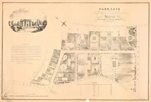
Background imageMaps and Plans Collection: Plan of Park Gate, near Highfield in Ecclesall Bierlow (laid out in building plots)

Plan of Park Gate, near Highfield in Ecclesall Bierlow (laid out in building plots) the property of Offley Shore
Scale 150 yards : 7 foot 4 inches.Original at Sheffield City Archives reference: NSC/4/47 (alternative reference NSC/119)

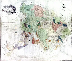
Background imageMaps and Plans Collection: Map of Aston cum Aughton, late 18th century

Map of Aston cum Aughton, late 18th century
Sheffield City Archives reference: MD3516

Background imageMaps and Plans Collection: A map of an estate at Greenhill in the County of Derby, the property of Robert Newton

A map of an estate at Greenhill in the County of Derby, the property of Robert Newton, surveyed by W. Fairbank, 1758
Shows footway to Woodseats, Greenhill Common, Lum wood, Long North Field, Great North Field, Great Croft, Little Croft and Lum Piece.Scale 220 yards : 1 inch.Sheffield City Archives reference

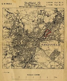
Background imageMaps and Plans Collection: Map of Sheffield (S[outh]) Woodhouse Rix[s]on, Werksgruppe fur 3 Edelstahlwerke

Map of Sheffield (S[outh]) Woodhouse Rix[s]on, Werksgruppe fur 3 Edelstahlwerke
Map title translates as Sheffield (S[outh]) Woodhouse Rixon, Group of 3 high-grade steel works.Forms a section of Ordnance Survey map

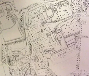
Background imageMaps and Plans Collection: South Yorkshire Asylum - also referred to as Wadsley Asylum later Middlewood Hospital - plan of

South Yorkshire Asylum - also referred to as Wadsley Asylum later Middlewood Hospital - plan of estate
Shows hospital buildings, including female and male wings, administrative block, nurses residence, laundry house and dining hall, as well as Airing courts, Drying Green, boiler buildings

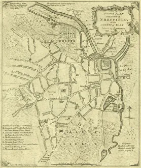
Background imageMaps and Plans Collection: A correct plan of the town of Sheffield by William Fairbank, 1771

A correct plan of the town of Sheffield by William Fairbank, 1771
Scale 440 yards : 3.3 inches. Shows the Bull Stake, slaughterhouses, Town Mill, Irish Cross. Original at Local Studies y09647

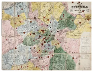
Background imageMaps and Plans Collection: Map of the Town and Environs of Sheffield, 1864

Map of the Town and Environs of Sheffield, 1864
Scale 1 inches : 1 mile. Board and church schools have been indicated at a later date and the ecclesiastical districts have been indicated by colouring.Original at Sheffield Archives ref. SY18/1

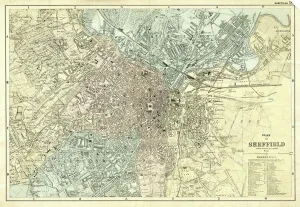
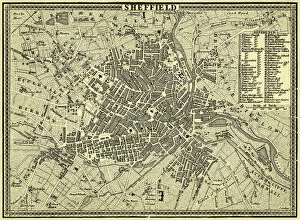
Background imageMaps and Plans Collection: Plan of Sheffield, Yorkshire, c. 1870 - 1905

Plan of Sheffield, Yorkshire, c. 1870 - 1905
Undated but shows the Midland Station as it was built in 1870, therefore between 1870 and 1905 when the station was enlarged. Original at Sheffield Local Studies Library: y11773

Background imageMaps and Plans Collection: North Sheffield marked with bombing targets, c. 1940

North Sheffield marked with bombing targets, c. 1940
Full title: Ordnance Survey map of north Sheffield copied by the Germans, and marked with bombing targets, c. 1940 Original at Sheffield Libraries: y06718

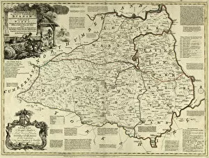
Background imageMaps and Plans Collection: County Map of County Durham, c. 1777

County Map of County Durham, c. 1777
From The Large English Atlas: or, a new set of map of all the counties of England and Wales drawn from the several surveys which have been hitherto been published

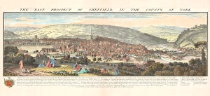
Background imageMaps and Plans Collection: The east prospect of Sheffield in the County of York, 1745

The east prospect of Sheffield in the County of York, 1745
By Nathaniel Buck. Original at Sheffield Local Studies Library: y10740

Background imageMaps and Plans Collection: Plan of Agden Estate, Bradfield, the property of B. J. Young esquire, 1872

Plan of Agden Estate, Bradfield, the property of B. J. Young esquire, 1872
Revised 1872 by Charles J Neale. Scale: 1 inch: 6 chains. Paper backed on linen. Shown on this plan are: Agden Bridge, Agden Dike, Agden House, Agden Reservoir, Agden Wood, Dukes Road, Emlin Dike

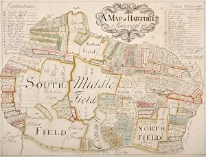
Background imageMaps and Plans Collection: Harthill, Yorkshire, surveyed in 1720

Harthill, Yorkshire, surveyed in 1720
From an original at Sheffield Libraries: arc03267

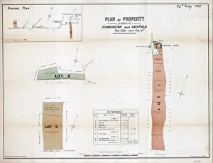
Background imageMaps and Plans Collection: Plan of property situate at Stannington for sale

Plan of property situate at Stannington for sale
Lot 1 house, buildings, yard, Toft head, The Toft, Toft Bottom, Middle Field and Nether Field or Nether Toft (shows Roman Catholic School). Lot 2 Towns Field, Occupation Road

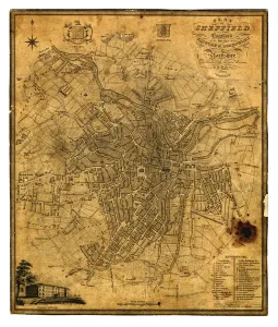
Background imageMaps and Plans Collection: Sheffield, 1822

Sheffield, 1822
Full title: Plan of Sheffield; engraved for the history and directory of Yorkshire, published by Edward Baines, Leeds, 1822 Includes a view of the General Infirmary (bottom left). By Alfred Smith

Background imageMaps and Plans Collection: Plan of Sheffield, 1838

Plan of Sheffield, 1838
Original at Sheffield Local Studies Library

Background imageMaps and Plans Collection: Norton from the survey of W and J Fairbank, 1804

Norton from the survey of W and J Fairbank, 1804
Original at Sheffield Archives ref. NSC/127

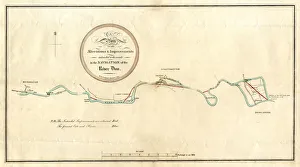
Background imageMaps and Plans Collection: River Don, between Mexborough and Doncaster, 1803

River Don, between Mexborough and Doncaster, 1803
Full title: Plan of alterations and improvements to be made in the navigation of the River Dun [between Mexborough and Doncaster, Yorkshire, 1803 By W. and J. Fairbank. Scale 2 furlongs : 1 inch

Background imageMaps and Plans Collection: Plan of Sheffield, 19th cent

Plan of Sheffield, 19th cent
From an original at Sheffield Libraries: y09469

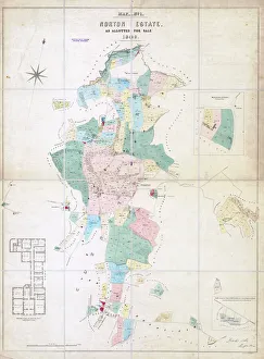
Background imageMaps and Plans Collection: Norton Estate as allotted for sale, 1849

Norton Estate as allotted for sale, 1849
Includes a floor plan of Norton Hall (see also y11091)Sheffield Local Studies Library:s (25) 6A L

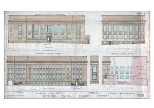
Background imageMaps and Plans Collection: New Central Library and Art Gallery building, Surrey Street - elevations, c. 1930

New Central Library and Art Gallery building, Surrey Street - elevations, c. 1930
Scale: 1 inch : 8 feet. From an original at Sheffield Libraries: arc01118

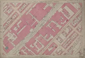
Background imageMaps and Plans Collection: Ordnance Survey Map, Carlisle Street East and Savile Street East area, Sheffield

Ordnance Survey Map, Carlisle Street East and Savile Street East area, Sheffield, 1889 (Yorkshire sheet No. 294. 4. 24)
This map features: Top left: Bessemer Steel Works [Bessemer and Co. Ltd], Carlisle Street East; Midland Railway Goods Line; Atlas Steel and Iron Works [John Brown and Co]

Background imageMaps and Plans Collection: A map of Wm. Carrs Farm at Stanington [Stannington], 1747

A map of Wm. Carrs Farm at Stanington [Stannington], 1747
Scale not stated. Surveyor: William Fairbank I. Fields north and south of Stannington Road, near the junction with Cockshutt Lane (modern Oldfield Avenue)

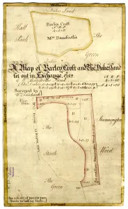
Background imageMaps and Plans Collection: A map of Barley Croft and The Dukes land, Stannington, 1752

A map of Barley Croft and The Dukes land, Stannington, 1752
Scale 2 chains : 1 inch [40 inches : 1 mile] Surveyor: William Fairbank II. Another proposed exchange between the Duke of Norfolk and Mrs Bamforth; acreages and some field names given on the map

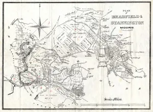
Background imageMaps and Plans Collection: Bradfield and Stannington Moors, 19th cent

Bradfield and Stannington Moors, 19th cent
Showing owners. By O. Spurr (lithographer). Scale 1 mile : 15 inches. Dimensions of original approx. 28 x 38.5 cm. From an original at Sheffield Libraries: arc02906

Background imageMaps and Plans Collection: Plan of the Taxal estate, Cheshire, and Shalcross estate, Derbyshire

Plan of the Taxal estate, Cheshire, and Shalcross estate, Derbyshire, which will be sold by auction, 1832
To be sold by Mr Winstanley at the Ram's Head Inn, Disley, in the county of Chester, on Wednesday, January 4th, 1832, at three o'clock, in twenty-eight lots. Swinnerton, Lithographer, Cheshire

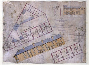
Background imageMaps and Plans Collection: Plan of houses, shop, slaughterhouse to be built in Johnson Street and Livingstone Street

Plan of houses, shop, slaughterhouse to be built in Johnson Street and Livingstone Street, Wincobank Sheffield, c. 1871
Full title: Plan of eight houses, shop, slaughterhouse and out-buildings to be built in Johnson Street and Livingstone Street, Wincobank for Mr Maycock, Butcher, c. 1871

Background imageMaps and Plans Collection: Contoured plan of Rivelin Valley Road, Sheffield, Yorkshire, c. 1900

Contoured plan of Rivelin Valley Road, Sheffield, Yorkshire, c. 1900
Full title: Contoured plan of Rivelin Valley Road shewing land belonging to the Sheffield Water Department, c. 1900 From an original at Sheffield Libraries: arc02953 Scale 25 inches : 1 mile

Background imageMaps and Plans Collection: Norton, Derbyshire, surveyed by Joseph Dickinson, 1737

Norton, Derbyshire, surveyed by Joseph Dickinson, 1737
Full title: A map of all the lands belonging to Robert Newton esquire at Norton in the County of Derby, surveyed by Joseph Dickinson

Background imageMaps and Plans Collection: The Duke of Norfolks estates in Brightside Bierlow, Sheffield, [mid 19th cent]

The Duke of Norfolks estates in Brightside Bierlow, Sheffield, [mid 19th cent]
From an original at Sheffield Libraries: arc03909

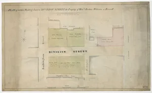
Background imageMaps and Plans Collection: Plan of Rockingham Street, Division Street, Rockingham Lane and Carver Street, Sheffield, 1829

Plan of Rockingham Street, Division Street, Rockingham Lane and Carver Street, Sheffield, 1829
Full title: Plan of certain building land the property of Messrs Brittain, Wilkinson and Brownell. Steel furnaces, cutlers shops and warehouse marked. Surveyed and drawn by J. Fairbank and Son

Background imageMaps and Plans Collection: Plan of the Rivelin Valley from Rivelin Mill to Hollins Bridge, c. 1814

Plan of the Rivelin Valley from Rivelin Mill to Hollins Bridge, c. 1814
From an original at Sheffield Libraries: arc03990. Reading left to right: Rivelin Mill, [River Rivelin], Upper Coppice Wheel, Second Coppice Wheel, Third Coppice Wheel, paper mill

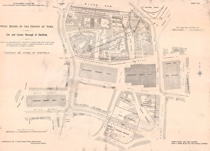
Background imageMaps and Plans Collection: Plan of Waingate / markets area, Sheffield, 1901

Plan of Waingate / markets area, Sheffield, 1901
Full title: Plan of Proposed New Street - Waingate to Blonk Street and Furnival Road; Widening of Exchange Street; Alteration of Banks of River Sheaf; and Acquisition of Lands for Markets

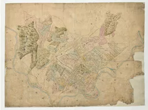
Background imageMaps and Plans Collection: Plan of the Duke of Norfolk's Allotments on Grenno Moor, Ecclesfield, 1793

Plan of the Duke of Norfolk's Allotments on Grenno Moor, Ecclesfield, 1793
Scale 2 chains : 1 inch [40 inches : 1 mile]. Surveyor: William Fairbank II. Includes part of the village of Grenoside; numerical list with tenants and measurements; notes on sales added later (1809)

Background imageMaps and Plans Collection: Ordnance Survey Map, Sheffield, Bramwell Street / Netherthorpe area, 1889 (Yorkshire sheet 294. 7)

Ordnance Survey Map, Sheffield, Bramwell Street / Netherthorpe area, 1889 (Yorkshire sheet 294. 7. 14)
This map features: Top left: Fawcett Street, Daisy Bank, Bramwell Street, Powell Street, Radford Place, Bromley Street, St

Background imageMaps and Plans Collection: Ordnance Survey Map, Sheffield, Banner Street area, Crookes, Sheffield, 1889 (Yorkshire sheet 294)

Ordnance Survey Map, Sheffield, Banner Street area, Crookes, Sheffield, 1889 (Yorkshire sheet 294. 7. 8)
This map features Top left: Springvale Road, Alpine Road, Upperthorpe, Ashberry Road, Sydney Road, Banner Road, Wellfield House, Glen Roy, Albert Villa, Oak Tower, Logan Bank, The Laurels

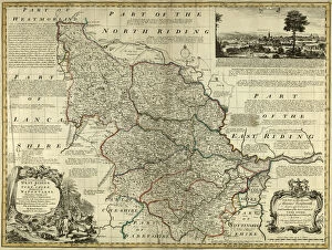
Background imageMaps and Plans Collection: County Map of Yorkshire West Riding, c. 1777

County Map of Yorkshire West Riding, c. 1777
From The Large English Atlas: or, a new set of map of all the counties of England and Wales drawn from the several surveys which have been hitherto been published


All Professionally Made to Order for Quick Shipping


-

Why Choose Us?

We are a leading provider of Art Prints and Photo Gifts since 2004, working in partnership with a range of Sporting Clubs, Charities, Museums and Picture Libraries. A large share of profits from any of their images will go directly towards supporting that charity or club. Our archive of images is carefully curated to bring you a wide range of subjects, including landscapes, wildlife, architecture, and more. We ship from our partner labs in the UK, USA, EU (Netherlands) and Australia.
+

How do I place an order?

Ordering is quick & easy - Just follow 5 Simple Steps:
  1. Find your image: Use our search box or browse our online photo Collections to find the image you want.

  2. Choose your print format: Select your desired product and add it to your cart.

  3. Enter your details: If you're a returning customer, simply enter your email address and password, and we'll fill in your billing and shipping address details. All personal details are held securely and are fully GDPR compliant. As standard, we remove all Personally Identifiable Information after 12 months.

  4. Pay for your purchase: We use state-of-the-art security for online shopping and do not have access to your card details.

  5. Sit back and relax: We'll email you confirmation of your order and when it's dispatched. Registered customers can also track orders in the 'My Account' area.

+

How do I pay for an order?

You can pay for your order with most of the major credit and debit cards, or PayPal. For added security, major financial institutions process payment details separately and securely on our behalf. We do not have access to your online payment card details. Online payments are preferred however we do take phone orders. For UK customers only we accept cheques issued against a UK bank.
+

Is my data safe?

We take data security very seriously. We do not have access to your full card details and all payments are requested over a fully secure connection. Additionally, we fully comply with current European and GDPR legislation, and automatically remove all personal data after at most 12 months (unless you have an account with us and have signed in recently). We also have a strict opt-in policy and would never sell your personal details. Your data is only used to fulfill your order promptly and efficiently.
+

Is wall art ready to hang?

For quick and easy installation all wall art, including framed prints, canvas prints and metal prints are supplied with a ready to hang solution on the back. Generally, saw tooth hangers are applied as they allow wall art to hang flush against the wall. The serrated edge of the hanger prevents the frame from shifting or tilting when hung.
+

Are the photo prints fade resistant?

Yes, we use archival quality photo paper photographic paper for vivid reproduction Prints are an accurate representations of the original artwork, which is preserved for artistic character and authenticity. We guarantee they match previews shown on our web site