
Maps Collection
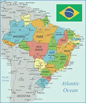
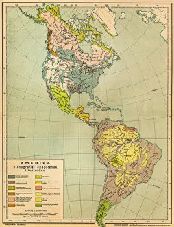
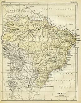
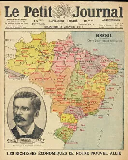
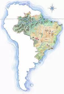
Brazil is the largest country in South America and the fifth largest country in the world and has a diverse landscape
Choose a picture from our Maps Collection for your Wall Art and Photo Gifts
369 items


All Professionally Made to Order for Quick Shipping
-
Maps Collection
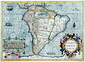
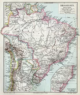
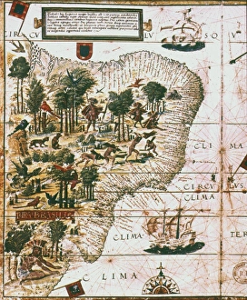
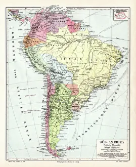
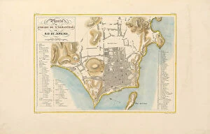
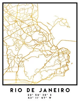
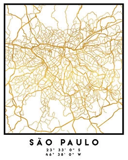
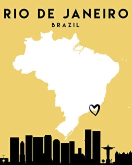
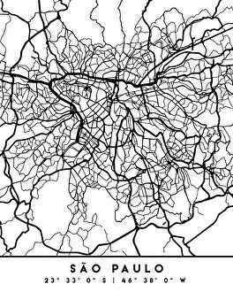
Brazil is the largest country in South America and the fifth largest country in the world and has a diverse landscape, ranging from mountains to rainforests to beaches. Maps of Brazil can be used to explore its many regions, cities, and attractions. The Amazon River runs through the northern part of Brazil and is one of its most iconic features. Other major rivers include the Parana, Sao Francisco, Tocantins, and Xingu Rivers. Major cities include Rio de Janeiro, Sao Paulo, Salvador da Bahia, Brasilia (the capital), Manaus (in the Amazon region), Recife (in northeast Brazil), Belo Horizonte (in southeast Brazil), Curitiba (in southern Brazil) and Fortaleza (in northeast Brazil). Maps of Brazil also show its many national parks such as Chapada Diamantina National Park in Bahia State; Iguacu National Park on the border with Argentina; Fernando de Noronha Marine National Park off northeastern coast; Pantanal Wetlands in Mato Grosso do Sul State; and Lencois Maranhenses National Park near Sao Luis in Maranhao State.
+
Our beautiful pictures are available as Framed Prints, Photos, Wall Art and Photo Gifts
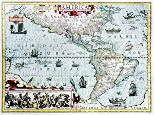
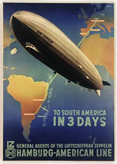
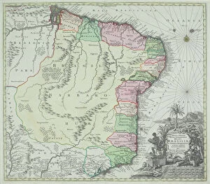
The Maps of Brazil South America collection from Media Storehouse is a stunning selection of wall art and framed prints that showcase the beauty and diversity of Brazil. Our collection features a range of maps, including vintage maps dating back to the 16th century, as well as modern-day cartography that highlights the country's topographical features and major cities. Each print in our collection is expertly crafted using high-quality materials to ensure longevity and durability. From vibrant colors to intricate details, every map captures the essence of Brazil's unique geography, history, and culture. Whether you're looking for a statement piece for your living room or office or want to add some Brazilian flair to your home decor, our collection has something for everyone. With its rich history and natural beauty, Brazil is an inspiring destination that deserves to be celebrated through these beautiful works of art.
+
What are Maps of Brazil South America art prints?
Maps of Brazil South America art prints are high-quality reproductions of maps that depict the geography, topography, and political boundaries of Brazil and other countries in South America. These prints are created using advanced printing techniques to ensure that they accurately capture the intricate details and vibrant colors of the original maps. Maps of Brazil South America art prints can be used for a variety of purposes, including educational or decorative purposes. They make great additions to classrooms, offices, or homes where they can serve as both informative tools and beautiful works of art. These prints come in a range of sizes and formats to suit different needs and preferences. Some may feature additional information such as historical landmarks or cultural sites while others may focus solely on geographical features. Maps of Brazil South America art prints offer an excellent way to explore the rich history and diverse landscapes of this fascinating region while also adding a touch of beauty to any space.
+
What Maps of Brazil South America art prints can I buy from Media Storehouse?
We offer a wide range of Maps of Brazil South America art prints that are perfect for decorating your home or office. You can choose from a variety of styles, including vintage maps, colorful modern designs, and detailed topographical maps. These prints feature the geography and landmarks of Brazil and South America in stunning detail, allowing you to explore the region's diverse landscapes from the comfort of your own space. Whether you're looking for a map to hang on your wall as an educational tool or simply want to add some visual interest to your decor, we have something for everyone. With high-quality printing and durable materials, these art prints are sure to last for years to come. So why not bring a piece of Brazil and South America into your home with one of our beautiful Maps of Brazil South America art prints?
+
How do I buy Maps of Brazil South America art prints?
To purchase Maps of Brazil South America art prints from Media Storehouse, you can browse our extensive collection online. Simply search for the specific map or location you are interested in and select the size and framing options that suit your needs. Once you have made your selection, proceed to checkout where you will be prompted to enter your shipping and payment information. We offer a secure checkout process so you can feel confident in your purchase. After completing your order, sit back and wait for your new artwork to arrive at your doorstep. These maps make great additions to any home or office decor, as well as thoughtful gifts for friends and family who love travel or geography. With high-quality printing techniques used by Media Storehouse, these maps are sure to impress with their vibrant colors and intricate details.
+
How much do Maps of Brazil South America art prints cost?
We offer a wide range of Maps of Brazil South America art prints at varying prices. Our collection includes vintage maps, contemporary designs and detailed topographical maps that cater to different tastes and preferences. The cost of each print depends on factors such as the size, type of paper used, framing options and printing techniques employed. We take pride in providing high-quality prints that are produced using state-of-the-art technology to ensure accurate reproduction of colors and details. Our team works with renowned artists and photographers from around the world to bring you unique pieces that capture the beauty and diversity of Brazil's landscapes. Whether you're looking for a decorative piece for your home or office or an educational tool for your classroom, our Maps of Brazil South America art prints are sure to meet your needs. With our vast selection and competitive pricing, you can find the perfect print within your budget.
+
How will my Maps of Brazil South America art prints be delivered to me?
We take great care in delivering your Maps of Brazil South America art prints to you. We use high-quality packaging materials to ensure that your print arrives in perfect condition. Depending on the size and quantity of your order, we may use either a flat-pack or a tube for delivery. Our standard shipping method is through trusted courier services who will deliver straight to your doorstep. You can track the progress of your shipment using the tracking number provided once it has been dispatched from our warehouse. We understand how important it is for you to receive your artwork promptly and in good condition, which is why we strive to process orders as quickly as possible. Our team works diligently behind the scenes to ensure that all orders are fulfilled within reasonable timeframes. Rest assured that when you purchase Maps of Brazil South America art prints from us, they will be delivered with utmost care and attention.