Home > Africa > Egypt > Maps
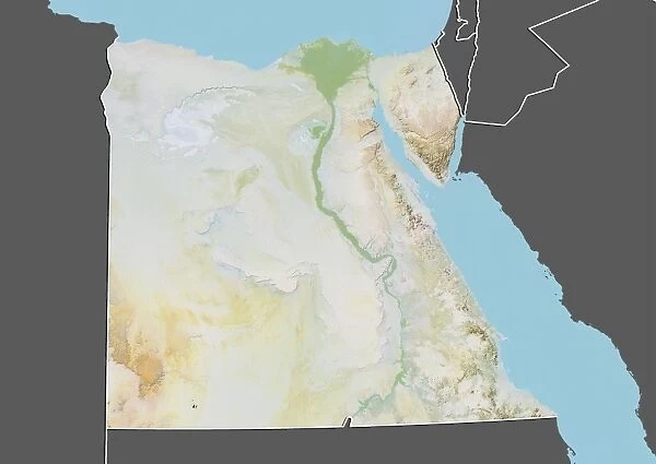
Egypt, Relief Map With Border and Mask
![]()

Wall Art and Photo Gifts from Universal Images Group (UIG)
Egypt, Relief Map With Border and Mask
Relief map of Egypt (with border and mask). This image was compiled from data acquired by landsat 5 & 7 satellites combined with elevation data
Universal Images Group (UIG) manages distribution for many leading specialist agencies worldwide
Media ID 9613039
© Planet Observer/UIG
Assouan Cairo Coastline Desert Egypt Mediterranean Sea Middle East Nile Red Sea Relief Map Shore Satellite View
FEATURES IN THESE COLLECTIONS
> Aerial Photography
> Related Images
> Universal Images Group (UIG)
> Universal Images Group
> Satellite and Aerial
> Planet Observer 4
EDITORS COMMENTS
This print showcases the intricate topography of Egypt, featuring a relief map with a border and mask. The image is a result of combining data acquired by Landsat 5 & 7 satellites along with elevation data, providing an accurate representation of the country's physical geography. The vastness of Egypt's desert dominates the foreground, stretching as far as the eye can see. Its golden hues create a mesmerizing contrast against the deep blue waters of both the Mediterranean Sea and Red Sea that flank its coasts. The Nile River meanders through this arid landscape, cutting through lush green patches that thrive alongside its fertile banks. Intriguingly, Cairo - Egypt's bustling capital city - emerges prominently in this photograph. Nestled on the eastern bank of the Nile, it stands as a testament to ancient civilizations blending seamlessly with modernity. Further south lies Assouan, where one can witness nature's artistry at its finest: islands dotting serene waters amidst rocky outcrops and vibrant vegetation. This horizontal composition allows viewers to immerse themselves in Egypt's diverse landscapes; from sandy deserts to verdant oases and bustling urban centers to tranquil shorelines. With no people present in this image, it serves as an invitation for exploration and discovery. As you gaze upon this stunning relief map captured from satellite view, let your imagination wander across Egypt’s rich tapestry of history and natural wonders.
MADE IN AUSTRALIA
Safe Shipping with 30 Day Money Back Guarantee
FREE PERSONALISATION*
We are proud to offer a range of customisation features including Personalised Captions, Color Filters and Picture Zoom Tools
SECURE PAYMENTS
We happily accept a wide range of payment options so you can pay for the things you need in the way that is most convenient for you
* Options may vary by product and licensing agreement. Zoomed Pictures can be adjusted in the Cart.


