Home > Europe > Italy > Campania > Naples
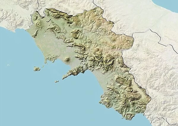
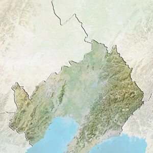
Region of Campania, Italy, Relief Map
![]()

Wall Art and Photo Gifts from Universal Images Group (UIG)
Region of Campania, Italy, Relief Map
Relief map of the region of Campania, Italy. This image was compiled from data acquired by LANDSAT 5 & 7 satellites combined with elevation data
Universal Images Group (UIG) manages distribution for many leading specialist agencies worldwide
Media ID 9619059
© Planet Observer/UIG
Campania Coastline Naples Region Relief Map Shore Satellite View
FEATURES IN THESE COLLECTIONS
> Europe
> Italy
> Campania
> Naples
> Universal Images Group (UIG)
> Universal Images Group
> Satellite and Aerial
> Planet Observer 4
EDITORS COMMENTS
This print showcases the stunning region of Campania, Italy, in all its natural glory. The relief map, compiled from data acquired by LANDSAT 5 & 7 satellites combined with elevation data, offers a unique perspective on the topography of this picturesque area. With its vibrant colors and intricate details, this image is a testament to the beauty and diversity found within Campania. Nestled along the breathtaking coastline of Italy, Campania boasts an array of geographical features that are beautifully depicted in this horizontal photograph. From the rugged cliffs overlooking the azure waters to the rolling hills dotted with charming villages, every corner of this region exudes charm and tranquility. The city of Naples takes center stage in this map as it proudly stands as one of Italy's most iconic destinations. Surrounding Naples are vast stretches of lush landscapes and fertile plains that contribute to Campania's reputation as an agricultural hub. Whether you're an enthusiast for physical geography or simply captivated by satellite views and cartography, this image will surely pique your interest. It provides a comprehensive overview of Campania's diverse terrain without any human presence disturbing its natural splendor. As you gaze upon this remarkable piece from Universal Images Group (UIG), let yourself be transported to the enchanting region that is Campania – where nature meets history and beauty knows no bounds.
MADE IN AUSTRALIA
Safe Shipping with 30 Day Money Back Guarantee
FREE PERSONALISATION*
We are proud to offer a range of customisation features including Personalised Captions, Color Filters and Picture Zoom Tools
SECURE PAYMENTS
We happily accept a wide range of payment options so you can pay for the things you need in the way that is most convenient for you
* Options may vary by product and licensing agreement. Zoomed Pictures can be adjusted in the Cart.

