Home > Africa > Zimbabwe > Maps
Canvas Print : Zimbabwe, Relief Map with Border and Mask


![]()
Canvas Prints from Universal Images Group (UIG)
Zimbabwe, Relief Map with Border and Mask
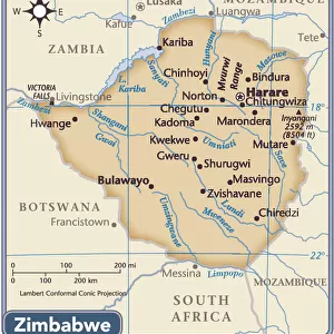
Relief map of Zimbabwe (with border and mask). This image was compiled from data acquired by landsat 5 & 7 satellites combined with elevation data
Universal Images Group (UIG) manages distribution for many leading specialist agencies worldwide
Media ID 9613263
© Planet Observer/UIG
Africa Great Lakes Lake Relief Map River Victoria Falls Zimbabwe Harare Satellite View Zambezi
20"x16" (51x41cm) Canvas Print
Discover the beauty of Zimbabwe's geography with our Canvas Print of the Relief Map from Media Storehouse. This stunning representation of Zimbabwe's borders and topography is derived from satellite data acquired by Landsat 5 & 7. The intricate details of the terrain are brought to life in high-definition on our premium canvas material, creating a captivating piece of art for your home or office. Add a touch of global inspiration to your space with this unique and educational canvas print from Media Storehouse and Universal Images Group.
Delivered stretched and ready to hang our premium quality canvas prints are made from a polyester/cotton blend canvas and stretched over a 1.25" (32mm) kiln dried knot free wood stretcher bar. Packaged in a plastic bag and secured to a cardboard insert for safe transit.
Canvas Prints add colour, depth and texture to any space. Professionally Stretched Canvas over a hidden Wooden Box Frame and Ready to Hang
Estimated Product Size is 50.8cm x 40.6cm (20" x 16")
These are individually made so all sizes are approximate
Artwork printed orientated as per the preview above, with landscape (horizontal) orientation to match the source image.
FEATURES IN THESE COLLECTIONS
> Africa
> Zimbabwe
> Lakes
> Related Images
> Africa
> Zimbabwe
> Related Images
> Africa
> Zimbabwe
> Victoria Falls
> Africa
> Zimbabwe
> Zimbabwe Heritage Sites
> Mosi-oa-Tunya (Victoria Falls)
> Universal Images Group (UIG)
> Universal Images Group
> Satellite and Aerial
> Planet Observer 4
EDITORS COMMENTS
This print showcases the intricate details of Zimbabwe's relief map, complete with its border and a mask-like formation. Compiled from data acquired by landsat 5 & 7 satellites combined with elevation data, this image offers a unique perspective on the physical geography of Zimbabwe. The horizontal composition allows viewers to immerse themselves in the country's topography, revealing its diverse landscapes and natural wonders. From the bustling capital city of Harare to the majestic Victoria Falls and Zambezi River, this photograph captures the essence of Zimbabwe's beauty without any human presence. The color image highlights various geographical features such as lakes, including those within the Great Lakes region, adding depth and vibrancy to this visual representation. Cartographers and geography enthusiasts will appreciate how this satellite view accurately portrays Zimbabwe's terrain. It serves as an invaluable tool for studying and understanding the country's landforms in detail. As a print from Universal Images Group (UIG), it is important to note that this caption does not mention commercial use restrictions. However, regardless of potential limitations on usage rights, one cannot deny that this print provides a stunning glimpse into Zimbabwe’s remarkable natural landscape – making it an ideal addition for anyone seeking inspiration or knowledge about Africa’s physical geography.
MADE IN AUSTRALIA
Safe Shipping with 30 Day Money Back Guarantee
FREE PERSONALISATION*
We are proud to offer a range of customisation features including Personalised Captions, Color Filters and Picture Zoom Tools
SECURE PAYMENTS
We happily accept a wide range of payment options so you can pay for the things you need in the way that is most convenient for you
* Options may vary by product and licensing agreement. Zoomed Pictures can be adjusted in the Cart.