Home > Europe > France > Canton > Bas Rhin
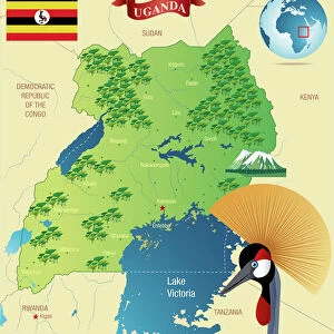
Uganda, Relief Map

![]()
Wall Art and Photo Gifts from Universal Images Group (UIG)
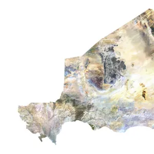
Uganda, Relief Map
Relief map of Uganda. This map was processed from elevation data
Universal Images Group (UIG) manages distribution for many leading specialist agencies worldwide
Media ID 9618301
© Planet Observer
Alsace Bas Rhin Geographical Border Relief Map Satellite View
FEATURES IN THESE COLLECTIONS
> Europe
> France
> Canton
> Bas Rhin
> Europe
> France
> Canton
> Rhin
> Universal Images Group (UIG)
> Universal Images Group
> Satellite and Aerial
> Planet Observer 6
EDITORS COMMENTS
This print showcases the stunning relief map of Uganda, a country known for its diverse landscapes and rich natural beauty. Processed from elevation data, this topographic masterpiece offers an intricate depiction of Uganda's physical geography. From rolling hills to majestic mountains, every contour is meticulously captured in this satellite view. The vibrant colors used in this cartographic representation bring the map to life, highlighting the geographical borders and showcasing the unique features that make Uganda so remarkable. With no people present in the image, viewers are invited to immerse themselves in the raw magnificence of this East African nation. As you gaze upon this vertical photograph, your eyes will be drawn to every detail - each valley and peak telling a story of centuries-old geological processes that have shaped Uganda's landscape. The bas rhin region adds an element of intrigue as it contrasts with the African setting depicted on the map. Whether you're an avid traveler or simply appreciate fine photography, this print from Universal Images Group (UIG) serves as a visual feast for those fascinated by our planet's wonders. It invites you to explore Uganda from afar and sparks curiosity about what lies beyond its borders
MADE IN AUSTRALIA
Safe Shipping with 30 Day Money Back Guarantee
FREE PERSONALISATION*
We are proud to offer a range of customisation features including Personalised Captions, Color Filters and Picture Zoom Tools
SECURE PAYMENTS
We happily accept a wide range of payment options so you can pay for the things you need in the way that is most convenient for you
* Options may vary by product and licensing agreement. Zoomed Pictures can be adjusted in the Cart.