Fraud Blocker Skip to main content

Home > All Images > 2014 > September > 24 Sep 2014

Images Dated 24th September 2014 (page 5)

1,571 items

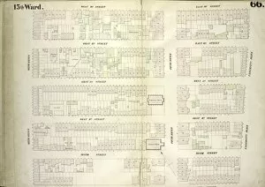
Background imageImages Dated 24th September 2014: Plate 66: Map bounded by West 14th Street, East 14th Street, University Place, East

Plate 66: Map bounded by West 14th Street, East 14th Street, University Place, East 9th Street, West 9th Street, Sixth Avenue

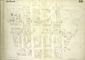
Background imageImages Dated 24th September 2014: Plate 69: Map bounded by West Street, West 12th Street, Hudson Street, Bank Street

Plate 69: Map bounded by West Street, West 12th Street, Hudson Street, Bank Street

Background imageImages Dated 24th September 2014: Plate 68: Map bounded by Bleecker Street, Hudson Street, Gansevoort Street, West

Plate 68: Map bounded by Bleecker Street, Hudson Street, Gansevoort Street, West 13th Street, Greenwich Avenue, West 12th Street, Seventh Avenue, Perry Street, Charles Street

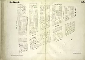
Background imageImages Dated 24th September 2014: Plate 65: Map bounded by University Place, East 14th Street, Fourth Avenue, East

Plate 65: Map bounded by University Place, East 14th Street, Fourth Avenue, East 9th Street

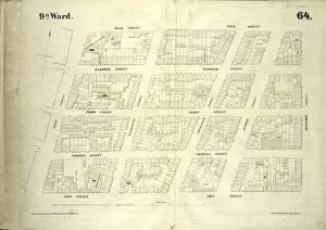
Background imageImages Dated 24th September 2014: Plate 64: Map bounded by Bank Street, Bleecker Street, Amos Street, West Street

Plate 64: Map bounded by Bank Street, Bleecker Street, Amos Street, West Street

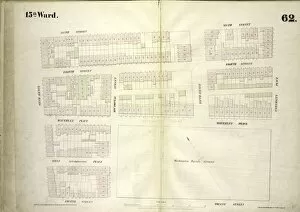
Background imageImages Dated 24th September 2014: Plate 62: Map bounded by West 9th Street, East 9th Street, University Place, East

Plate 62: Map bounded by West 9th Street, East 9th Street, University Place, East 4th Street, West 4th Street, Sixth Avenue

Background imageImages Dated 24th September 2014: Plate 63: Map bounded by Amos Street, Charles Street, West 4th Street, West Washington

Plate 63: Map bounded by Amos Street, Charles Street, West 4th Street, West Washington Place, Sixth Avenue Cornelia Street, Bleecker Street, Carmine Commerce Street, Barrow Street, Hudson Street

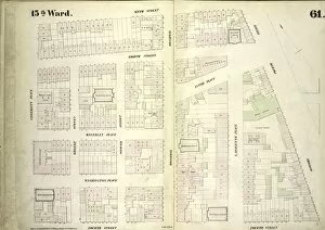
Background imageImages Dated 24th September 2014: Plate 61: Map bounded by East 9th Street, Fourth Avenue, Bowery, East 4th Street

Plate 61: Map bounded by East 9th Street, Fourth Avenue, Bowery, East 4th Street, University Place

Background imageImages Dated 24th September 2014: Plate 59: Map bounded by Barrow Street, Commerce Street, Bleecker Street, Cornelia Street

Plate 59: Map bounded by Barrow Street, Commerce Street, Bleecker Street, Cornelia Street, Sixth Avenue, Hancock Street, Hamersly Street, Hudson Street

Background imageImages Dated 24th September 2014: Plate 96: Map bounded by West 42nd Street, Sixth Avenue, West 37th Street, Eighth Avenue

Plate 96: Map bounded by West 42nd Street, Sixth Avenue, West 37th Street, Eighth Avenue

Background imageImages Dated 24th September 2014: Plate 94: Map bounded by West 37th Street, Eighth Avenue, West 32nd Street, Tenth Avenue

Plate 94: Map bounded by West 37th Street, Eighth Avenue, West 32nd Street, Tenth Avenue

Background imageImages Dated 24th September 2014: Plate 93: Map bounded by West 37th Street, Sixth Avenue, West 32nd Street, Eighth Avenue

Plate 93: Map bounded by West 37th Street, Sixth Avenue, West 32nd Street, Eighth Avenue

Background imageImages Dated 24th September 2014: Plate 95: Map bounded by West 37th Street, Tenth Avenue, West 32nd Street, Eleventh

Plate 95: Map bounded by West 37th Street, Tenth Avenue, West 32nd Street, Eleventh Avenue

Background imageImages Dated 24th September 2014: Plate 60: Map bounded by West Street, Amos Street, Hudson Street, Hamersly Street

Plate 60: Map bounded by West Street, Amos Street, Hudson Street, Hamersly Street

Background imageImages Dated 24th September 2014: Plate 91: Map bounded by West 32nd Street, Eighth Avenue, West 27th Street, Tenth Avenue

Plate 91: Map bounded by West 32nd Street, Eighth Avenue, West 27th Street, Tenth Avenue

Background imageImages Dated 24th September 2014: Plate 89: Map bounded by West 27th Street, Tenth Avenue, West 22nd Street, Eleventh

Plate 89: Map bounded by West 27th Street, Tenth Avenue, West 22nd Street, Eleventh Avenue

Background imageImages Dated 24th September 2014: Plate 90: Map bounded by West 32nd Street, Sixth Avenue, West 27th Street, Eighth Avenue

Plate 90: Map bounded by West 32nd Street, Sixth Avenue, West 27th Street, Eighth Avenue

Background imageImages Dated 24th September 2014: Plate 92: Map bounded by West 32nd Street, Tenth Avenue, West 27th Street, Eleventh

Plate 92: Map bounded by West 32nd Street, Tenth Avenue, West 27th Street, Eleventh Avenue

Background imageImages Dated 24th September 2014: Plate 88: Map bounded by West 27th Street, Eighth Avenue, West 22nd Street, Tenth Avenue

Plate 88: Map bounded by West 27th Street, Eighth Avenue, West 22nd Street, Tenth Avenue

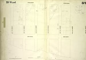
Background imageImages Dated 24th September 2014: Plate 84: Map bounded by Second Avenue, East 43rd Street, First Avenue, East 37th Street

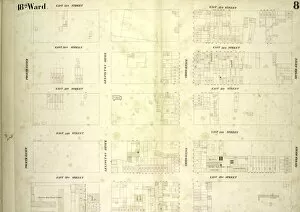
Plate 84: Map bounded by Second Avenue, East 43rd Street, First Avenue, East 37th Street

Background imageImages Dated 24th September 2014: Plate 87: Map bounded by West 27th Street, Sixth Avenue, West 22nd Street, Eighth Avenue

Plate 87: Map bounded by West 27th Street, Sixth Avenue, West 22nd Street, Eighth Avenue

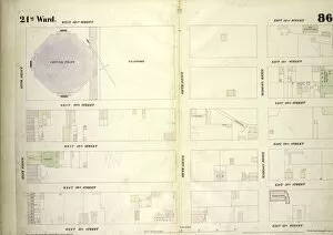
Background imageImages Dated 24th September 2014: Plate 86: Map bounded by West 42nd Street, East 42nd Street, Fourth Avenue, East

Plate 86: Map bounded by West 42nd Street, East 42nd Street, Fourth Avenue, East 37th Street, West 37th Street, Sixth Avenue

Background imageImages Dated 24th September 2014: Plate 83: Map bounded by West 37th Street, East 37th Street, Fourth Avenue, East

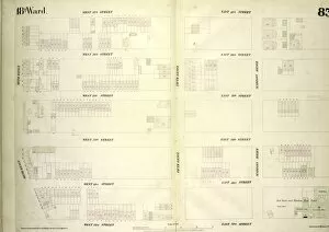
Plate 83: Map bounded by West 37th Street, East 37th Street, Fourth Avenue, East 32nd Street, West 32nd Street, Sixth Avenue

Background imageImages Dated 24th September 2014: Plate 82: Map bounded by East 37th Street, Second Avenue, East 32nd Street, Fourth Avenue

Plate 82: Map bounded by East 37th Street, Second Avenue, East 32nd Street, Fourth Avenue

Background imageImages Dated 24th September 2014: Double Page Plate No. 36, Part of Ward 24, Section 12. Bounded by E. 210th Street

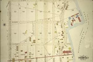
Double Page Plate No. 36, Part of Ward 24, Section 12. Bounded by E. 210th Street, Reservoir Oval West, Perry Avenue, E. 205th Street, Bainbridge Avenue, E. Mosholu Parkway North and Jerome Avenue

Background imageImages Dated 24th September 2014: Double Page Plate No. 38, Part of Ward 24, Section 12

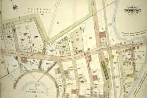
Double Page Plate No. 38, Part of Ward 24, Section 12. Bounded by E. 211th Street Woodlawn Cemetery, Webster Avenue, E. 209th Street, Reservoir Oval West, and Wayne Avenue

Background imageImages Dated 24th September 2014: Double Page Plate No. 35, Part of Ward 24, Section 12

Double Page Plate No. 35, Part of Ward 24, Section 12. Bounded by Jerome Avenue, Mosholu Parkway North, Briggs Avenue and E. 199th Street

Background imageImages Dated 24th September 2014: Double Page Plate No. 37, Part of Ward 24, Section 12. Bounded by Bainbridge Avenue, E

Double Page Plate No. 37, Part of Ward 24, Section 12. Bounded by Bainbridge Avenue, E. 205th Street, Perry Avenue, E. 209th Street, Webster Avenue and E. Mosholu Parkway North

Background imageImages Dated 24th September 2014: Double Page Plate No. 27, Part of Ward 24, Section 11. Bounded by Aqueduct Avenue, E

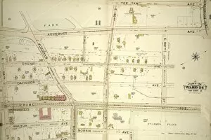
Double Page Plate No. 27, Part of Ward 24, Section 11. Bounded by Aqueduct Avenue, E. 190th Street, Tee Taw Avenue, Kingsbridge Road, Aqueduct Avenue, E. 192nd Street, Jerome Avenue, E

Background imageImages Dated 24th September 2014: Double Page Plate No. 33, Part of Ward 24, Sections 11&12. Bounded by Broadway, E

Double Page Plate No. 33, Part of Ward 24, Sections 11&12. Bounded by Broadway, E. 230th Street, Bailey Avenue, Boston Avenue, Sedgwick Avenue, Kingsbridge Rpad. Emmerich Place, Bailey Avenue and E

Background imageImages Dated 24th September 2014: Double Page Plate No. 31, Part of Ward 24, Section 11

Double Page Plate No. 31, Part of Ward 24, Section 11. Bounded by Jerome Park Reservoir Jerome Avenue, E. 199th Street, Briggs Avenue and Kingsbridge Road

Background imageImages Dated 24th September 2014: Double Page Plate No. 32, Part of Ward 24, Sections 11&12. Bounded by Aqueduct Avenue

Double Page Plate No. 32, Part of Ward 24, Sections 11&12. Bounded by Aqueduct Avenue, Kingsbridge Road, Sedgwick Avenue, Reservoir Avenue Jerome Park Reservoir, Jerome Avenue and E. 192nd Street

Background imageImages Dated 24th September 2014: Double Page Plate No. 24, Part of Ward 24, Section 11. Bounded by E. 180th Street

Double Page Plate No. 24, Part of Ward 24, Section 11. Bounded by E. 180th Street, Aqueduct Avenue, E. 184th Street, Morris Avenue and Burnside Avneue

Background imageImages Dated 24th September 2014: Double Page Plate No. 23, Part of Ward 24, Section 11. Bounded by Morris Avenue, E

Double Page Plate No. 23, Part of Ward 24, Section 11. Bounded by Morris Avenue, E. 183rd Street, Webster Avenue, E. 179th Street, Valentine Avenue E. 179th Street and Burnside Avneue

Background imageImages Dated 24th September 2014: Double Page Plate No. 8, Part of Ward 24, Section 11. Bounded by E. 182nd Street

Double Page Plate No. 8, Part of Ward 24, Section 11. Bounded by E. 182nd Street, Boston Road, E. 181st Street, Bronx Street, E. 177th Street, Marmion Avenue and Southern Boulevard

Background imageImages Dated 24th September 2014: Double Page Plate No. 21, Part of Ward 24, Section 11

Double Page Plate No. 21, Part of Ward 24, Section 11. Bounded by Pelham Avenue Bronx Park, Southern Boulevard, E. 185th Street, Cambreleng Avenue, Crescent Avenue, William Street and Arthur Avenue

Background imageImages Dated 24th September 2014: Double Page Plate No. 2, Part of Ward 24, Section 11. Bounded by E. 174th Street

Double Page Plate No. 2, Part of Ward 24, Section 11. Bounded by E. 174th Street, West Farms Road, Jennings Street and Southern Boulevard

Background imageImages Dated 24th September 2014: Double Page Plate No. 14, Part of Ward 24, Section 11. Bounded by Montgomery Avenue, E

Double Page Plate No. 14, Part of Ward 24, Section 11. Bounded by Montgomery Avenue, E. 177th Street, Aqueduct Avenue, Grand Avenue, Harrison Avenue and Featherbed Lane

Background imageImages Dated 24th September 2014: Double Page Plate No. 4, Part of Ward 24, Section 11

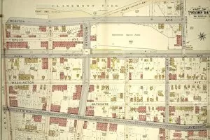
Double Page Plate No. 4, Part of Ward 24, Section 11. Bounded by Webster Avenue, 173rd Street, Park Avenue, E. 174th Street, Fulton Avenue and St. Paul Place

Background imageImages Dated 24th September 2014: Double Page Plate No. 2, Part of Ward 24, Section 11

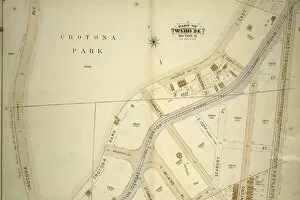
Double Page Plate No. 2, Part of Ward 24, Section 11. Bounded by Crotona Park East Penfold Avenue, Southern Boulevard andtona Park South

Background imageImages Dated 24th September 2014: Double Page Plate No. 2, Part of Ward 24, Section 11. Bounded by Belmont Street, Clay Avenue

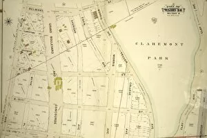
Double Page Plate No. 2, Part of Ward 24, Section 11. Bounded by Belmont Street, Clay Avenue, E. 170th Street and Walton Avenue

Background imageImages Dated 24th September 2014: Double Page Plate No. 2, Part of Ward 24, Sections 9&11. Bounded by Nelson Avenue

Double Page Plate No. 2, Part of Ward 24, Sections 9&11. Bounded by Nelson Avenue, Featherbed Lane, E. 174th Street, Walton Avenue, Elliot Place, Jemorem Avenue, E. 170th Street and Boscobel Avenue

Background imageImages Dated 24th September 2014: Plate 82, Part of Section 13, Borough of the Bronx

Plate 82, Part of Section 13, Borough of the Bronx. Bounded by Broadway, Van Cortlandt Park South, Gun Hill Road, E. 211th Street, Webster Avenue, E. 233rd Street and Mt. Vernon Avenue

Background imageImages Dated 24th September 2014: Plate 57: Map bounded by East 4th Street, Bowery, Houston Street, Green Street

Plate 57: Map bounded by East 4th Street, Bowery, Houston Street, Green Street

Background imageImages Dated 24th September 2014: Atlas of the borough of the Bronx, city of New York : based upon official plans

Atlas of the borough of the Bronx, city of New York : based upon official plans and maps on file in the various city offices; supplemented by careful field measurements and personal observations

Background imageImages Dated 24th September 2014: Plate 58: Map bounded by West 4th Street, East 4th Street, Green Street, Houston Street

Plate 58: Map bounded by West 4th Street, East 4th Street, Green Street, Houston Street, Hancock Street, Bleecker Street, Carmine Street, Sixth Avenue

Background imageImages Dated 24th September 2014: Atlas of the borough of the Bronx, city of New York : based upon official plans

Atlas of the borough of the Bronx, city of New York : based upon official plans and maps on file in the various city offices; supplemented by careful field measurements and personal observations


All Professionally Made to Order for Quick Shipping


-

Why Choose Us?

We are a leading provider of Art Prints and Photo Gifts since 2003, working in partnership with a range of Sporting Clubs, Charities, Museums and Picture Libraries. A large share of profits from any of their images will go directly towards supporting that charity or club. Our archive of images is carefully curated to bring you a wide range of subjects, including landscapes, wildlife, architecture, and more. We ship from our partner labs in the UK, USA, EU (Netherlands) and Australia.
+

How do I place an order?

Ordering is quick & easy - Just follow 5 Simple Steps:
  1. Find your image: Use our search box or browse our online photo Collections to find the image you want.

  2. Choose your print format: Select your desired product and add it to your cart.

  3. Enter your details: If you're a returning customer, simply enter your email address and password, and we'll fill in your billing and shipping address details. All personal details are held securely and are fully GDPR compliant. As standard, we remove all Personally Identifiable Information after 12 months.

  4. Pay for your purchase: We use state-of-the-art security for online shopping and do not have access to your card details.

  5. Sit back and relax: We'll email you confirmation of your order and when it's dispatched. Registered customers can also track orders in the 'My Account' area.

+

How do I pay for an order?

You can pay for your order with most of the major credit and debit cards, or PayPal. For added security, major financial institutions process payment details separately and securely on our behalf. We do not have access to your online payment card details. Online payments are preferred however we do take phone orders. For UK customers only we accept cheques issued against a UK bank.
+

Is my data safe?

We take data security very seriously. We do not have access to your full card details and all payments are requested over a fully secure connection. Additionally, we fully comply with current European and GDPR legislation, and automatically remove all personal data after at most 12 months (unless you have an account with us and have signed in recently). We also have a strict opt-in policy and would never sell your personal details. Your data is only used to fulfill your order promptly and efficiently.
+

Is wall art ready to hang?

For quick and easy installation all wall art, including framed prints, canvas prints and metal prints are supplied with a ready to hang solution on the back. Generally, saw tooth hangers are applied as they allow wall art to hang flush against the wall. The serrated edge of the hanger prevents the frame from shifting or tilting when hung.
+

Are the photo prints fade resistant?

Yes, we use archival quality photo paper photographic paper for vivid reproduction Prints are an accurate representations of the original artwork, which is preserved for artistic character and authenticity. We guarantee they match previews shown on our web site