Fraud Blocker Skip to main content

Home > Asia > Japan > Maps

Maps Collection (page 6)

Maps of Japan Asia are detailed maps that show the various physical features, cities, and other points of interest in Japan and surrounding countries

391 items

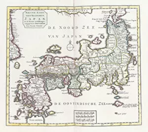
Background imageMaps Collection: A Map of Japan, 1769 (colour engraving)

A Map of Japan, 1769 (colour engraving)
985940 A Map of Japan, 1769 (colour engraving) by German School, (18th century); 42.5x29 cm; Private Collection; (add.info.: A Map of Japan)

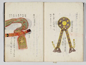
Background imageMaps Collection: Sangoku tsuran zusetsu (Illustrated General Survey of the Three Countries)

Sangoku tsuran zusetsu (Illustrated General Survey of the Three Countries)
3502613 Sangoku tsuran zusetsu (Illustrated General Survey of the Three Countries), 1785 (colour woodblock print) by Shihei, Hayashi (1738-93); Private Collection; (add.info.: SHIHEI)

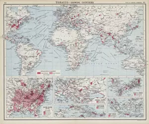
Background imageMaps Collection: Tobacco, growing countries (colour litho)

Tobacco, growing countries (colour litho)
3648673 Tobacco, growing countries (colour litho) by English School, (20th century); Private Collection; (add.info.: Tobacco, growing countries)

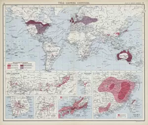
Background imageMaps Collection: Tea, growing countries (colour litho)

Tea, growing countries (colour litho)
3648616 Tea, growing countries (colour litho) by English School, (20th century); Private Collection; (add.info.: Tea, growing countries)

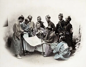
Background imageMaps Collection: 1860s Japan - portrait of a group of southern officers Felice or Felix Beato

1860s Japan - portrait of a group of southern officers Felice or Felix Beato (1832 - 29 January 1909), Italian-British photographer working mostly in India, Japan, China

Background imageMaps Collection: WWI: Indian colonial soldiers examine a map

WWI: Indian colonial soldiers examine a map
Vintage World War One photograph - WWI: Indian colonial soldiers examine a map

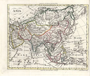
Background imageMaps Collection: Map of Asia, early 19th century

Map of Asia, early 19th century. Showing Asia Minor, Arabia, Persia, Siberia, Tartary, Thibet, Hindoostan, Further India, China, Formosa, Japan. Handcoloured copperplate engraving from Rev

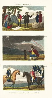
Background imageMaps Collection: Scenes from the history of the United States

Scenes from the history of the United States
William Penn making a treaty in 1682 with the Lenape Native Americans 82, Benjamin Franklin drawing electricity from the sky in a thunderstorm 83

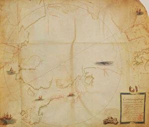
Background imageMaps Collection: Ms. 1288 fol. 1 The Polar Aurora, from a Collection of Dutch Marine Maps

Ms. 1288 fol. 1 The Polar Aurora, from a Collection of Dutch Marine Maps
BIF271726 Ms. 1288 fol. 1 The Polar Aurora, from a Collection of Dutch Marine Maps (engraving) by Gerritsz, Hessel (1581-1632); Bibliotheque de l Institut de France, Paris

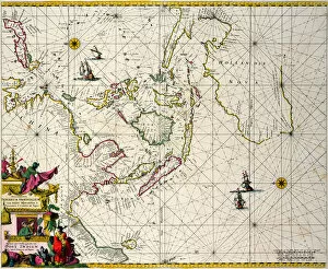
Background imageMaps Collection: East Indies: Sea and coastal chart extending from Southern India to Japan by the way of

East Indies: Sea and coastal chart extending from Southern India to Japan by the way of
BON111060 East Indies: Sea and coastal chart extending from Southern India to Japan by the way of the East Indian archipelago (coloured engraving) by Wit

Background imageMaps Collection: Map of China, Japan and Korea. (engraving, 1638)

Map of China, Japan and Korea. (engraving, 1638)
LRI4678176 Map of China, Japan and Korea. (engraving, 1638) by Blaeu, Willem (1571-1638); Private Collection; (add.info.: Map of China, Japan and Korea)

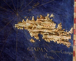
Background imageMaps Collection: Map of Japan (Cipangu or Cypango), c. 1567. (mural painting)

Map of Japan (Cipangu or Cypango), c. 1567. (mural painting)
LRI4595609 Map of Japan (Cipangu or Cypango), c.1567. (mural painting) by Danti, Egnazio (1536-86); Palazzo Vecchio, Florence

Background imageMaps Collection: Map of Korea, Japan and East China. Engraving in 'Le petit journal'

Map of Korea, Japan and East China. Engraving in "Le petit journal"
LSE4323948 Map of Korea, Japan and East China. Engraving in " Le petit journal" 3/09/1894. Selvas collection. by Unknown Artist

Background imageMaps Collection: Sangoku tsuran zusetsu (Illustrated General Survey of the Three Countries)

Sangoku tsuran zusetsu (Illustrated General Survey of the Three Countries)
3502614 Sangoku tsuran zusetsu (Illustrated General Survey of the Three Countries), 1785 (colour woodblock print) by Shihei, Hayashi (1738-93); Private Collection; (add.info.: SHIHEI)

Background imageMaps Collection: Asia (colour litho)

Asia (colour litho)
5996935 Asia (colour litho) by English School, (20th century); Private Collection; (add.info.: Asia. Illustration from The Modern World Encyclopedia)

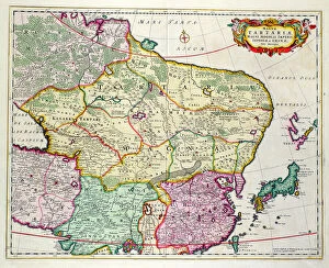
Background imageMaps Collection: Map of Mongolia showing Japan and China, c. 1680 (coloured engraving)

Map of Mongolia showing Japan and China, c. 1680 (coloured engraving)
BAL42851 Map of Mongolia showing Japan and China, c.1680 (coloured engraving) by Wit, Frederick de (1630-1706); O Shea Gallery, London, UK; Dutch, out of copyright

Background imageMaps Collection: Map from Gullivers Travels by Jonathan Swift (1667-1745) (engraving

Map from Gullivers Travels by Jonathan Swift (1667-1745) (engraving
TRV230469 Map from Gullivers Travels by Jonathan Swift (1667-1745) (engraving) (b/w photo) by English School; Private Collection; (add.info)

Background imageMaps Collection: General map including Arabia, Japan, the Korean peninsula

General map including Arabia, Japan, the Korean peninsula
BON111061 General map including Arabia, Japan, the Korean peninsula and the greater part of the Indonesian archipelago, 1631 (colour engraving) by Hondius

Background imageMaps Collection: Map of Sixteenth Century Japan, from the Sala delle Carte Geografiche

Map of Sixteenth Century Japan, from the Sala delle Carte Geografiche
BEN90578 Map of Sixteenth Century Japan, from the Sala delle Carte Geografiche (Hall of Geographical Maps) 1575 (oil on panel) by Bonsignori, Stefano and Danti

Background imageMaps Collection: Map of Asia circa 1810

Map of Asia circa 1810. Handcoloured copperplate engraving by Andrea Bernieri from Giulio Ferrarios Ancient and Modern Costumes of all the Peoples of the World, Florence, Italy, 1843

Background imageMaps Collection: As modern wars are waged, Marshal Oyama leads the battle of Mukden by the tens... (colour litho)

As modern wars are waged, Marshal Oyama leads the battle of Mukden by the tens... (colour litho)
2814804 As modern wars are waged, Marshal Oyama leads the battle of Mukden by the tens... (colour litho) by Beltrame, Achille (1871-1945); Private Collection; (add.info.: Like modern wars)

Background imageMaps Collection: Poster, That which they started we will finish, WW2

Poster, That which they started we will finish, WW2. 1940s

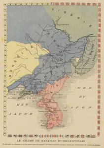
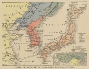
Background imageMaps Collection: Map showing the theatre of the Russo-Japanese War (colour litho)

Map showing the theatre of the Russo-Japanese War (colour litho)
2795817 Map showing the theatre of the Russo-Japanese War (colour litho) by French School, (20th century); Private Collection; (add.info.: Map showing the theatre of the Russo-Japanese War)

Background imageMaps Collection: Nagasaki Harbour (engraving)

Nagasaki Harbour (engraving)
1601911 Nagasaki Harbour (engraving) by English School, (19th century); Private Collection; (add.info.: Nagasaki Harbour. Illustration for The Illustrated London News, 13 January 1855)

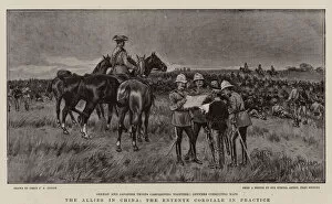
Background imageMaps Collection: The Allies in China, the Entente Cordiale in Practice (engraving)

The Allies in China, the Entente Cordiale in Practice (engraving)
1040017 The Allies in China, the Entente Cordiale in Practice (engraving) by Spence, Percy F.S. (1868-1933) (after); Private Collection; (add.info.: The Allies in China)

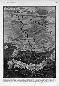
Background imageMaps Collection: Munitions supply to Russia

Munitions supply to Russia
Japan to the rescue! How our Far-Eastern ally supplies Russia with munitions 1915

Background imageMaps Collection: General Nikolai Linevich, new Commander-in-Chief of Russian forces in Manchuria (colour litho)

General Nikolai Linevich, new Commander-in-Chief of Russian forces in Manchuria (colour litho)
2795928 General Nikolai Linevich, new Commander-in-Chief of Russian forces in Manchuria (colour litho) by French School, (20th century); Private Collection; (add.info.: General Nikolai Linevich)

Background imageMaps Collection: Map of the theatre of the Russo-Japanese War (colour litho)

Map of the theatre of the Russo-Japanese War (colour litho)
2795812 Map of the theatre of the Russo-Japanese War (colour litho) by French School, (20th century); Private Collection; (add.info.: Map of the theatre of the Russo-Japanese War)

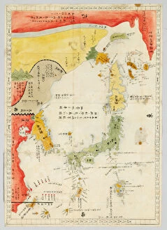
Background imageMaps Collection: Geographic map of Japan, Korea and South China, 17th century. Paris, BN

Geographic map of Japan, Korea and South China, 17th century. Paris, BN
JLJ4619583 Geographic map of Japan, Korea and South China, 17th century. Paris, BN by Unknown Artist, (17th century); Bibliotheque Nationale, Paris, France; (add.info.: Geographic map of Japan)

Background imageMaps Collection: Map of Nagasaki, c. 1801 (colour woodcut)

Map of Nagasaki, c. 1801 (colour woodcut)
1219483 Map of Nagasaki, c.1801 (colour woodcut) by Japanese School, (19th century); Private Collection; The Stapleton Collection; Japanese, out of copyright

Background imageMaps Collection: Asia: Map of the continent including Japan and the East Indies with part of New Guinea, c

Asia: Map of the continent including Japan and the East Indies with part of New Guinea, c
BON111183 Asia: Map of the continent including Japan and the East Indies with part of New Guinea, c.1580 (coloured engraving) by Ortelius

Background imageMaps Collection: General map extending from India and Ceylon to northwestern Australia by way of southern

General map extending from India and Ceylon to northwestern Australia by way of southern
BON111064 General map extending from India and Ceylon to northwestern Australia by way of southern Japan, the Philippines

Background imageMaps Collection: Map of eastern Russia, Korea and Japan during the Japanese Russo conflict (1904-1905)

Map of eastern Russia, Korea and Japan during the Japanese Russo conflict (1904-1905)
LSE4322824 Map of eastern Russia, Korea and Japan during the Japanese Russo conflict (1904-1905). In medallion, Tsar Nicholas II of Russia (1868-1918) and Emperor Meiji of Japan (1852-1912)

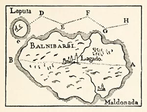
Background imageMaps Collection: Map of Laputa (flying island top right) and Balnibarbii (main port Maldonada) from

Map of Laputa (flying island top right) and Balnibarbii (main port Maldonada) from
3514748 Map of Laputa (flying island top right) and Balnibarbii (main port Maldonada) from Part III: A Voyage to Laputa, Balnibarbi, Luggnagg, Glubbdubdrib

Background imageMaps Collection: Samurai, c. 1868 (b / w photo)

Samurai, c. 1868 (b / w photo)
701535 Samurai, c.1868 (b/w photo) by Beato, Felice (Felix) (1825-c.1908); Private Collection; (add.info.: Probably Satsuma Samurai.); British, out of copyright

Background imageMaps Collection: Globe - 19th century French trade card (chromolitho)

Globe - 19th century French trade card (chromolitho)
961323 Globe - 19th century French trade card (chromolitho) by French School, (19th century); Private Collection; (add.info.: Globe - 19th century French trade card.); © Look and Learn

Background imageMaps Collection: Map of East India and South East Asian territory, 1570 (engraving)

Map of East India and South East Asian territory, 1570 (engraving)
LRI4704952 Map of East India and South East Asian territory, 1570 (engraving) by Ortelius, Abraham (1527-98); Museo Navale di Pegli, Genoa

Background imageMaps Collection: Map of Korea (litho)

Map of Korea (litho)
2818558 Map of Korea (litho) by French School, (19th century); Private Collection; (add.info.: Map of Korea, Japan and eastern China. Carte de Coree)

Background imageMaps Collection: Map of India to New Guinea, c. 1570-1603 (coloured engraving)

Map of India to New Guinea, c. 1570-1603 (coloured engraving)
BON111185 Map of India to New Guinea, c.1570-1603 (coloured engraving) by Ortelius, Abraham (1527-98); 34.7x49.6 cm; Private Collection; Photo eBonhams, London, UK; Flemish, out of copyright

Background imageMaps Collection: Admiral Yamamoto (b / w photo)

Admiral Yamamoto (b / w photo)
PNP272530 Admiral Yamamoto (b/w photo) by Japanese Photographer (20th century); Private Collection; (add.info.: Fleet Admiral Isoruku Yamamoto (1884-1943)

Background imageMaps Collection: Map of Korea at the end of the Russian-Japanese conflict (1904-1905)

Map of Korea at the end of the Russian-Japanese conflict (1904-1905)
LSE4322815 Map of Korea at the end of the Russian-Japanese conflict (1904-1905). Illustration, in " Russia and Japan and a complete history of the war in the far east"

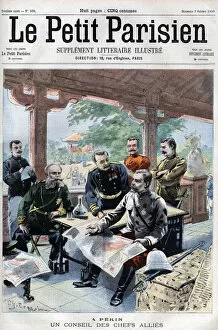
Background imageMaps Collection: Revolt des Boxers: Un conseil des chefs allied (French, Russian, American, English

Revolt des Boxers: Un conseil des chefs allied (French, Russian, American, English
XEE4408301 Revolt des Boxers: Un conseil des chefs allied (French, Russian, American, English, Japanese) (ALLIED COUNCIL OF WAR) - in " Le Petit Parisien"

Background imageMaps Collection: Map of the theatre of the Russian-Japanese War. Map of the War Theatre Russo-Japanese War

Map of the theatre of the Russian-Japanese War. Map of the War Theatre Russo-Japanese War
XEE4159143 Map of the theatre of the Russian-Japanese War. Map of the War Theatre Russo-Japanese War (Japanese Russo War) - Illustration for Le petit Journal, 28 February 1904 by French School

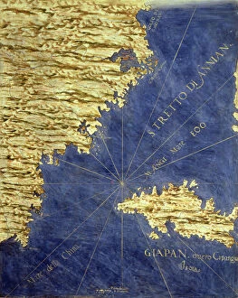
Background imageMaps Collection: Map of China and Japan, c. 1567. (mural painting)

Map of China and Japan, c. 1567. (mural painting)
LRI4595599 Map of China and Japan, c.1567. (mural painting) by Danti, Egnazio (1536-86); Palazzo Vecchio, Florence, Italy; (add.info)

Background imageMaps Collection: Simonoseki Bay, Japan (engraving)

Simonoseki Bay, Japan (engraving)
1102790 Simonoseki Bay, Japan (engraving) by Dower, John (fl.c.1845-55); Private Collection; (add.info.: Simonoseki Bay, Japan)

Background imageMaps Collection: The Harbour of Kagosima, Japan (engraving)

The Harbour of Kagosima, Japan (engraving)
1102861 The Harbour of Kagosima, Japan (engraving) by Dower, John (fl.c.1845-55); Private Collection; (add.info.: The Harbour of Kagosima, Japan)

Background imageMaps Collection: Japanese (chromolitho)

Japanese (chromolitho)
1093634 Japanese (chromolitho) by French School, (19th century); Private Collection; (add.info.: Japanese. French educational card, late 19th or early 20th century.); © Look and Learn

Background imageMaps Collection: The 5th Indian Division smash Japanese bunkers at Tiddim

The 5th Indian Division smash Japanese bunkers at Tiddim. A Dogra patrol returning with a map, notes, a flag and other booty left by the retreating Japanese. November 14, 1944


All Professionally Made to Order for Quick Shipping


-

Maps Collection

Maps of Japan Asia are detailed maps that show the various physical features, cities, and other points of interest in Japan and surrounding countries. They provide an overview of the region's geography, as well as a look at its cultural and historical sites, and are be used to plan trips or to gain a better understanding of the area. They often include information on transportation networks, airports, major roads, national parks and other attractions. It also provide information on population density and climate conditions for each region. With such detailed maps available for Japan Asia, travelers can easily find their way around this fascinating part of the world.
+

Our beautiful pictures are available as Framed Prints, Photos, Wall Art and Photo Gifts

The Maps of Japan Asia collection from Media Storehouse is a stunning compilation of vintage maps that showcase the rich history and geography of Japan and its neighboring countries in Asia. Our collection features beautifully detailed maps dating back to the 18th century, depicting various regions such as Hokkaido, Tokyo, Kyoto, Osaka, China, Korea, Taiwan and more. Each map has been carefully restored to retain its original charm while ensuring clarity and accuracy. The Maps of Japan Asia collection offers a wide range of options for wall art and framed prints that are perfect for home or office decor. These high-quality prints come in different sizes to suit any space. Whether you're an avid collector or simply appreciate the beauty of historical cartography, our collection is sure to impress. With its intricate details and vibrant colors, it's easy to see why these antique maps continue to captivate audiences today.
+

What are Maps of Japan Asia art prints?

Maps of Japan Asia art prints are high-quality reproductions of vintage and contemporary maps depicting the geography, topography, and landmarks of Japan and other Asian countries. These art prints showcase intricate details such as mountain ranges, rivers, cities, towns, temples, shrines, and cultural icons that represent the rich history and diversity of these regions. These maps are not only functional but also aesthetically pleasing pieces that can add a touch of sophistication to any room or office space. They come in various sizes and styles to suit different preferences and interior design themes. Whether you're a history buff or simply appreciate beautiful artwork with a cultural twist, Maps of Japan Asia art prints offer something for everyone. With their vivid colors and fine details captured through high-resolution printing technology on premium quality paper stock or canvas material - they make perfect gifts for anyone who loves travel or has an interest in Japanese culture.
+

What Maps of Japan Asia art prints can I buy from Media Storehouse?

We offer a wide range of Maps of Japan Asia art prints that are perfect for those who love to explore the beauty and culture of this region. These art prints showcase different maps of Japan, including antique maps from the 18th century, modern-day roadmaps, and detailed topographical maps. You can also find artistic renditions of famous landmarks in Japan such as Mount Fuji or Tokyo Tower. In addition to Japanese maps, Media Storehouse also has a collection of Asian map prints that include countries like China, India, Thailand and more. These artworks feature intricate details about each country's geography and history. All these Maps of Japan Asia art prints are available in various sizes and formats to suit your preferences. Whether you want a small print for your home office or a large canvas print for your living room wall, we have got you covered with their extensive selection.
+

How do I buy Maps of Japan Asia art prints?

To buy Maps of Japan Asia art prints from Media Storehouse, you can browse our extensive collection online. Simply search for "Maps of Japan Asia" in the search bar on our website and select the print that catches your eye. You can choose from a variety of sizes and framing options to suit your preferences. Once you have selected your desired print, add it to your cart and proceed to checkout. At this point, you will be prompted to enter your shipping and payment information. We offer secure payment options such as credit card or PayPal so that you can shop with peace of mind. Once your order is confirmed, they will process it promptly and ship it out to you as soon as possible. Buying Maps of Japan Asia art prints from Media Storehouse is a simple process that allows you to enjoy beautiful artwork in the comfort of your own home.
+

How much do Maps of Japan Asia art prints cost?

We offer a wide range of Maps of Japan Asia art prints at varying prices depending on the size and type of print. Our collection includes vintage maps, modern interpretations, and artistic renditions of the region. We pride ourselves on offering high-quality prints that are perfect for home or office decor. Our Maps of Japan Asia art prints come in various sizes ranging from small to large, allowing you to choose the best fit for your space. We also offer different types of paper finishes such as matte, gloss or satin which can affect pricing. We believe that everyone should have access to affordable art prints without compromising quality. Therefore, our prices are competitive and reflect our commitment to providing exceptional value for money. If you're looking for beautiful Maps of Japan Asia art prints that won't break the bank but still look stunning in any setting then Media Storehouse is the place to go.
+

How will my Maps of Japan Asia art prints be delivered to me?

We take great care in delivering your Maps of Japan Asia art prints to you. We use high-quality packaging materials to ensure that your artwork arrives safely and securely at your doorstep. Our standard delivery method is through a trusted courier service, which allows us to track the progress of your shipment and provide you with updates on its status. Once your order has been processed and shipped, you will receive an email notification containing a tracking number that you can use to monitor the progress of your delivery. Depending on where you are located, it may take several days for your package to arrive. We understand how important it is for our customers to receive their orders promptly and in good condition. That's why we work hard to ensure that every aspect of our shipping process meets the highest standards of quality and reliability.