Home > Asia > Related Images
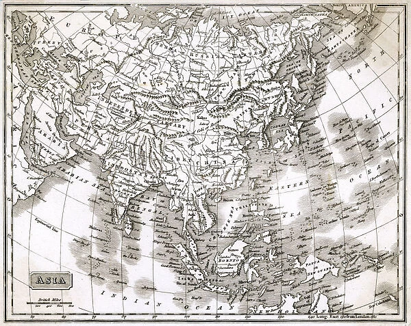
MAP / ASIA 1812
![]()

Wall Art and Photo Gifts from Mary Evans Picture Library
MAP / ASIA 1812
Map of Asia Date: 1812
Mary Evans Picture Library makes available wonderful images created for people to enjoy over the centuries
Media ID 20153881
© Bubblepunk
FEATURES IN THESE COLLECTIONS
> Asia
> Related Images
> Maps and Charts
> Related Images
> Mary Evans Prints Online
> New Images July 2020
EDITORS COMMENTS
This stunning antique map print, titled "Map of Asia" and dated 1812, offers a captivating glimpse into the geographical knowledge of the early 19th century. The intricately detailed map, available from Mary Evans Prints Online, showcases the vast expanse of Asia in all its complexity, with an impressive level of accuracy for the time. The map is adorned with an abundance of annotations, including place names, political boundaries, and topographical features. The cartouche, located in the lower right corner, is adorned with intricate decorative elements and contains an inscription that reads "Drawn from the best Authorities." The map reflects the state of geographical knowledge during the Napoleonic Wars, a period of intense exploration and colonization. The Russian expansion into Siberia is evident, as is the British presence in India and the Dutch colonies in Indonesia. The map also includes the Persian Gulf, the Arabian Peninsula, and the eastern coast of Africa, highlighting the importance of the maritime trade routes that connected Asia with Europe and the Americas. The use of color adds depth and dimension to the map, with shading used to indicate mountain ranges and depths of the ocean. The map also includes a scale bar and a grid system, demonstrating the advanced cartographic techniques of the time. This map is an invaluable historical document, offering insights into the political and geographical landscape of Asia during a pivotal period in world history. It is a must-have for collectors of antique maps, historians, and anyone with an interest in the history of exploration and cartography.
MADE IN AUSTRALIA
Safe Shipping with 30 Day Money Back Guarantee
FREE PERSONALISATION*
We are proud to offer a range of customisation features including Personalised Captions, Color Filters and Picture Zoom Tools
SECURE PAYMENTS
We happily accept a wide range of payment options so you can pay for the things you need in the way that is most convenient for you
* Options may vary by product and licensing agreement. Zoomed Pictures can be adjusted in the Cart.


