Fraud Blocker Skip to main content

Photographic Print > Europe > France > Paris > Maps

Maps Photographic Print Collection (#42)

Discover the enchanting beauty of Paris, France, brought to life through the lens of our skilled photographers. Our Maps of Paris collection showcases the City of Light in a unique and artistic way. Each print features intricate, hand-drawn maps of various Parisian neighborhoods, seamlessly blended with stunning, high-resolution images of iconic landmarks and scenic vistas. Transport yourself to the heart of Europe with these exquisite, museum-quality photographic prints. Perfect for adding a touch of elegance and sophistication to your home or office decor.

Maps of Paris, France, Europe are invaluable resources for anyone visiting or living in the city

2,148 Photographic Prints

Background imageMaps Photographic Print Collection: Blue Water Lilies (detail), 1916-1919 (Oil on Canvas)

Blue Water Lilies (detail), 1916-1919 (Oil on Canvas)
7212116 Blue Water Lilies (detail), 1916-1919 (Oil on Canvas) by Monet, Claude (1840-1926); Musee d Orsay, Paris, France; (add.info.: Blue Water Lilies (detail), 1916-1919. Nympheas Bleus (detail)

Background imageMaps Photographic Print Collection: Entry of Joan of Arc into Orleans, 1429 (chromolitho)

Entry of Joan of Arc into Orleans, 1429 (chromolitho)
7185103 Entry of Joan of Arc into Orleans, 1429 (chromolitho) by French School, (19th century); Private Collection; (add.info)

Background imageMaps Photographic Print Collection: Olive oil production (coloured engraving)

Olive oil production (coloured engraving)
7201018 Olive oil production (coloured engraving) by French School, (19th century); Private Collection; (add.info.: Olive oil production)

Background imageMaps Photographic Print Collection: A Paris Cafe, 1890s (Oil on canvas)

A Paris Cafe, 1890s (Oil on canvas)
7215296 A Paris Cafe, 1890s (Oil on canvas) by Korovin, Konstantin Alekseevich (1861-1939); Tretyakov Gallery, Moscow, Russia; (add.info)

Background imageMaps Photographic Print Collection: Boulevard Saint-Germain (engraving)

Boulevard Saint-Germain (engraving)
7157991 Boulevard Saint-Germain (engraving) by French School, (19th century); Private Collection; (add.info.: Boulevard Saint-Germain. Rue Saint-Dominique)

Background imageMaps Photographic Print Collection: Mosaics from churches in Rome (chromolitho)

Mosaics from churches in Rome (chromolitho)
7173187 Mosaics from churches in Rome (chromolitho) by French School, (19th century); Private Collection; (add.info.: Mosaics from churches in Rome, Italy)

Background imageMaps Photographic Print Collection: Butterflies (coloured engraving)

Butterflies (coloured engraving)
7201034 Butterflies (coloured engraving) by French School, (19th century); Private Collection; (add.info.: Butterflies. Illustration from Bebe Devient Savant, by Madame Doudet (Theodore Lefevre)

Background imageMaps Photographic Print Collection: Chasses et peches autour et dans Paris pendant le siege 1870-1871 (engraving)

Chasses et peches autour et dans Paris pendant le siege 1870-1871 (engraving)
7199927 Chasses et peches autour et dans Paris pendant le siege 1870-1871 (engraving) by French School, (19th century); Private Collection; (add.info)

Background imageMaps Photographic Print Collection: Vue de la colonnade du Louvre (engraving)

Vue de la colonnade du Louvre (engraving)
7179244 Vue de la colonnade du Louvre (engraving) by French School, (19th century); Private Collection; (add.info.: Vue de la colonnade du Louvre)

Background imageMaps Photographic Print Collection: Notre-Dame de Paris (engraving)

Notre-Dame de Paris (engraving)
7194062 Notre-Dame de Paris (engraving) by French School, (19th century); Private Collection; (add.info.: Notre-Dame de Paris)

Background imageMaps Photographic Print Collection: Stained glass, 13th Century (chromolitho)

Stained glass, 13th Century (chromolitho)
7173175 Stained glass, 13th Century (chromolitho) by French School, (19th century); Private Collection; (add.info.: Stained glass, 13th Century)

Background imageMaps Photographic Print Collection: Medieval and Renaissance manuscripts (chromolitho)

Medieval and Renaissance manuscripts (chromolitho)
7173006 Medieval and Renaissance manuscripts (chromolitho) by French School, (19th century); Private Collection; (add.info.: Medieval and Renaissance manuscripts)

Background imageMaps Photographic Print Collection: Fish (coloured engraving)

Fish (coloured engraving)
7201028 Fish (coloured engraving) by French School, (19th century); Private Collection; (add.info.: Fish. Illustration from Bebe Devient Savant, by Madame Doudet (Theodore Lefevre, Paris)

Background imageMaps Photographic Print Collection: Tiles (engraving)

Tiles (engraving)
7185684 Tiles (engraving) by French School, (19th century); Private Collection; (add.info.: Tiles. Illustration for Le Moyen Age et la Renaissance by Paul Lacroix and Ferdinand Sere (Paris)

Background imageMaps Photographic Print Collection: Joan of Arc (photogravure)

Joan of Arc (photogravure)
7185110 Joan of Arc (photogravure) by French School, (19th century); Private Collection; (add.info.: Joan of Arc (c1412-1431)

Background imageMaps Photographic Print Collection: The Last Judgment (chromolitho)

The Last Judgment (chromolitho)
7185093 The Last Judgment (chromolitho) by Bank, John van der (18th century); Private Collection; (add.info.: The Last Judgment, fresco in the cloister of the Campo Santo, Pisa, Italy)

Background imageMaps Photographic Print Collection: St Germain-l Auxerrois, Paris (engraving)

St Germain-l Auxerrois, Paris (engraving)
7192288 St Germain-l Auxerrois, Paris (engraving) by English School, (19th century); Private Collection; (add.info.: St Germain-l Auxerrois, Paris)

Background imageMaps Photographic Print Collection: Puits artesien de Grenelle (Paris) (engraving)

Puits artesien de Grenelle (Paris) (engraving)
7179672 Puits artesien de Grenelle (Paris) (engraving) by French School, (19th century); Private Collection; (add.info.: Puits artesien de Grenelle (Paris)

Background imageMaps Photographic Print Collection: Louvre (engraving)

Louvre (engraving)
7158229 Louvre (engraving) by French School, (19th century); Private Collection; (add.info.: Louvre, Pavillon de l Horloge, Cour du Louvre, Vieux Louvre, Eleve par Lemercier en 1624)

Background imageMaps Photographic Print Collection: Cathedral of Notre Dame, Paris (engraving)

Cathedral of Notre Dame, Paris (engraving)
7192290 Cathedral of Notre Dame, Paris (engraving) by English School, (19th century); Private Collection; (add.info.: Cathedral of Notre Dame, Paris)

Background imageMaps Photographic Print Collection: Opening of the Estates General, Versailles, 5 May 1789 (engraving)

Opening of the Estates General, Versailles, 5 May 1789 (engraving)
7149526 Opening of the Estates General, Versailles, 5 May 1789 (engraving) by French School, (19th century); Private Collection; (add.info.: Opening of the Estates General, Versailles, 5 May 1789)

Background imageMaps Photographic Print Collection: Transformations of Paris under the Second Empire, Haussmann Paris

Transformations of Paris under the Second Empire, Haussmann Paris
LSE4113071 Transformations of Paris under the Second Empire, Haussmann Paris: Humoristic drawing depicting Jean Charles Adolphe Alphand (1817-1891), engineer

Background imageMaps Photographic Print Collection: Map of the expeditions of Zheng He (Zheng-He or Cheng Ho) (1371-1433) in East Africa

Map of the expeditions of Zheng He (Zheng-He or Cheng Ho) (1371-1433) in East Africa
XEE4135126 Map of the expeditions of Zheng He (Zheng-He or Cheng Ho) (1371-1433) in East Africa. Paris College of France, Institute of Advanced Chinese Studies

Background imageMaps Photographic Print Collection: Advertising chromolithography of Guerin Boutron chocolates (chromolithograph)

Advertising chromolithography of Guerin Boutron chocolates (chromolithograph)
5909086 Advertising chromolithography of Guerin Boutron chocolates (chromolithograph) by French School, (20th century); 48.56x31.98 cm; (add.info)

Background imageMaps Photographic Print Collection: Map of the 17th Arrondissement, Paris, France

Map of the 17th Arrondissement, Paris, France
Map of the 17th Arrondissement, Quartier des Epinettes, Paris, France. Date: circa 1900s
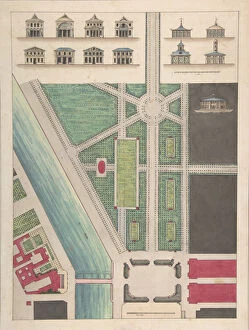
Background imageMaps Photographic Print Collection: Page from The Architects Compendium (litho)

Page from The Architects Compendium (litho)
2809965 Page from The Architects Compendium (litho) by English School, (20th century); Private Collection; (add.info.: Page from The Architects Compendium and Catalogue (Compendium Publishing)

Background imageMaps Photographic Print Collection: The newly discovered Gallo Roman Amphitheatre at Paris (engraving)

The newly discovered Gallo Roman Amphitheatre at Paris (engraving)
1057222 The newly discovered Gallo Roman Amphitheatre at Paris (engraving) by English School, (19th century); Private Collection; (add.info.: The newly discovered Gallo Roman Amphitheatre at Paris)

Background imageMaps Photographic Print Collection: Illustration by Manuel Luque (1854-1919) in La Caricature (1880)

Illustration by Manuel Luque (1854-1919) in La Caricature (1880)
ICA4885867 Illustration by Manuel Luque (1854-1919) in La Caricature (1880), 1886-9-25 - Architecture Urbanisme - Alphand Jean-Charles (1817-1891) by Luque

Background imageMaps Photographic Print Collection: Americas first national map, 1784 (hand-coloured engraving)

Americas first national map, 1784 (hand-coloured engraving)
1268147 Americas first national map, 1784 (hand-coloured engraving) by Buell, Abel (1742-1822); 115.2x128.6 cm; Private Collection; (add.info)

Background imageMaps Photographic Print Collection: Transformations of Paris under the Second Empire, Haussmann Paris

Transformations of Paris under the Second Empire, Haussmann Paris
XEE4153102 Transformations of Paris under the Second Empire, Haussmann Paris: projected plan of the Opera Garnier in Paris in 1860

Background imageMaps Photographic Print Collection: Transformations of Paris under the Second Empire, Haussmann Paris

Transformations of Paris under the Second Empire, Haussmann Paris
LSE4100683 Transformations of Paris under the Second Empire, Haussmann Paris. Plan of Paris since the annexation with its division into 20 arrondissements

Background imageMaps Photographic Print Collection: Franco-Prussian War (engraving)

Franco-Prussian War (engraving)
1104684 Franco-Prussian War (engraving) by English School, (19th century); Private Collection; (add.info.: Franco-Prussian War)

Background imageMaps Photographic Print Collection: Jardin Public, Champs Elysees, n. d Creator: Charles Etienne Pierre Motte

Jardin Public, Champs Elysees, n. d Creator: Charles Etienne Pierre Motte
Jardin Public, Champs Elysees, n.d.. The Jardin des Champs Elysees public park in the 8th arrondissement of Paris designed in 1667 by Andre Le Notre. After Gabriel Thouin

Background imageMaps Photographic Print Collection: Map map Turky Arabia & Persia corrected latest travels

Map map Turky Arabia & Persia corrected latest travels
Map, A map of Turky Arabia & Persia corrected from the latest travels and from the observations of the Royal Societys of London and Paris, Guillaume Delisle (1675-1726), Copperplate print

Background imageMaps Photographic Print Collection: Map Les environs de Paris Guillaume Delisle 1675-1726

Map Les environs de Paris Guillaume Delisle 1675-1726
Map, Les environs de Paris, Guillaume Delisle (1675-1726), Copperplate print

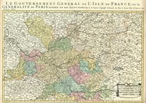
Background imageMaps Photographic Print Collection: Map Gouvernement et GeneralitA de Paris Guillaume Sanson

Map Gouvernement et GeneralitA de Paris Guillaume Sanson
Map, Gouvernement et Generalite de Paris, Guillaume Sanson (-1703), Copperplate print

Background imageMaps Photographic Print Collection: Map Carte Paris France

Map Carte Paris France
Map, Carte particulire du terroir et des environs des Paris qui est la plus grande partie de LIsle de France

Background imageMaps Photographic Print Collection: Map Carte particulire du terroir et des environs des Paris qui est l

Map Carte particulire du terroir et des environs des Paris qui est l
Map, Carte particulire du terroir et des environs des Paris qui est la plus grande partie de LIsle de France

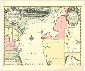
Background imageMaps Photographic Print Collection: Map Carte marine de la Mer Caspiene levA e suivant les ordres de S. M

Map Carte marine de la Mer Caspiene levA e suivant les ordres de S. M
Map, Carte marine de la Mer Caspiene levee suivant les ordres de S.M. czariene, par Mr. Carl Vanverden en 1719, 1720, et 1721

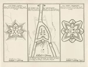
Background imageMaps Photographic Print Collection: Three forts Flanders c 1693-1696 Fort Louis Fort de la Kenoque

Three forts Flanders c 1693-1696 Fort Louis Fort de la Kenoque
Three forts in Flanders, c. 1693-1696 The Fort Louis / The Fort de la Kenoque / The Fort Francois (title on object) The forces of Europe, description of principals villes

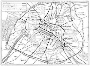
Background imageMaps Photographic Print Collection: Antique scientific engraving illustration: Paris Metro Subway map

Antique scientific engraving illustration: Paris Metro Subway map

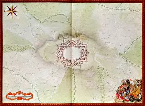
Background imageMaps Photographic Print Collection: Map of Phalsbourg, from the Atlas de Louis XIV (w / c on paper)

Map of Phalsbourg, from the Atlas de Louis XIV (w / c on paper)
2562877 Map of Phalsbourg, from the Atlas de Louis XIV (w/c on paper) by French School, (17th century); Bibliotheque du Genie, Paris, France; (add.info.: Plan of Phalsburg); French, out of copyright

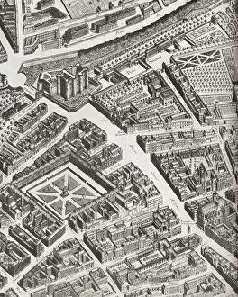
Background imageMaps Photographic Print Collection: Fragment Of The Turgot Map Of Paris, France, Showing La Porte Saint-Antoine

Fragment Of The Turgot Map Of Paris, France, Showing La Porte Saint-Antoine, The Great Entrance To The East Of Paris That Defended The Bastille. From A Contemporary Print

Background imageMaps Photographic Print Collection: View Of 16Th Century Alexandria Egypt. 19Th Century Reproduction Of Woodcut In The Travels Of P

View Of 16Th Century Alexandria Egypt. 19Th Century Reproduction Of Woodcut In The Travels Of P. Belon. Observations De Plusieurs Singularitez Published Paris 1588

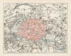
Background imageMaps Photographic Print Collection: Map of Paris 1900

Map of Paris 1900
Meyers hand-Atlas Leipzig und Wien Verlag des Bibliographischen Instituts 1900

Background imageMaps Photographic Print Collection: Plan of a Portion of Westminster Between 1734 and 1748 - Before the Erection of

Plan of a Portion of Westminster Between 1734 and 1748 - Before the Erection of Great George Street, (1881). Map of the area near the Houses of Parliament in London, showing Broad Sanctuary

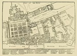
Background imageMaps Photographic Print Collection: A reduced copy of Fishers Ground Plan of the Royal Palace of Whitehall, 1680, (1881)

A reduced copy of Fishers Ground Plan of the Royal Palace of Whitehall, 1680, (1881)
A reduced copy of Fishers Ground Plan of the Royal Palace of Whitehall, taken in the Reign of Charles 2d. 1680, (1881). John Fishers map of the Palace of Whitehall in the village of Westminster

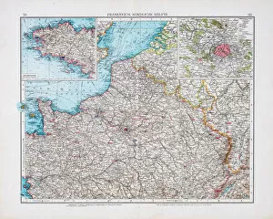
Background imageMaps Photographic Print Collection: Map of France 1896

Map of France 1896
Andres Allgemeiner Handatlas - Bielefeld und Leipzig 1896


All Professionally Made to Order for Quick Shipping


-

Maps Photographic Print Collection

Maps of Paris, France, Europe are invaluable resources for anyone visiting or living in the city. They provide an overview of the city's layout, including its streets and landmarks. They also show public transportation routes and stations, as well as points of interest such as parks and museums. Many it also include information about nearby cities and towns, allowing visitors to plan day trips outside the city limits. Additionally they can help visitors find their way around Paris more easily by providing detailed directions from one point to another. With a map in hand, travelers can explore all that Paris has to offer with confidence.
+

Our beautiful Wall Art and Photo Gifts include Framed Prints, Photo Prints, Poster Prints, Canvas Prints, Jigsaw Puzzles, Metal Prints and so much more

The Maps of Paris France Europe collection from Media Storehouse is a stunning assortment of wall art, framed prints, photo prints, canvas prints, jigsaw puzzles and greeting cards that capture the beauty and history of Paris. Our collection features a wide range of maps depicting different eras in the city's rich cultural heritage. From antique maps dating back to the 18th century to modern-day street maps highlighting popular landmarks such as the Eiffel Tower and Notre-Dame Cathedral, our collection offers something for everyone. Each piece in our collection is carefully crafted using high-quality materials to ensure long-lasting durability and vibrant colors that will stand out on any wall. Whether you're looking for a unique gift or want to add some French charm to your home or office decor, these beautiful pieces are sure to impress. With so many options available at affordable prices, it's easy to find exactly what you need from this impressive selection of artwork.
+

What are Maps of Paris France Europe art prints?

Maps of Paris France Europe art prints are beautiful and detailed depictions of the city of Paris, France, and its surrounding regions. These maps showcase the intricate layout of streets, landmarks, and buildings throughout the area. They are often created using a combination of traditional cartography techniques and modern design elements to produce an aesthetically pleasing representation. These art prints serve as both decorative pieces for your home or office space as well as educational tools for those interested in geography or history. They can be used to plan trips to Paris or simply admired for their artistic value. Maps of Paris France Europe art prints come in various sizes and styles, ranging from vintage designs that capture the essence of old-world charm to contemporary interpretations that reflect modern-day trends. Regardless of your personal style preferences, there is sure to be a map print that will suit your tastes perfectly.
+

What Maps of Paris France Europe art prints can I buy from Media Storehouse?

We offer a wide range of Maps of Paris, France and Europe art prints that are perfect for home decor or as gifts. These maps come in various sizes and styles to suit your preferences. You can choose from vintage-style maps that showcase the intricate details of the city's streets, landmarks, and neighborhoods, or modern designs that highlight its vibrant culture and history. Some popular options include detailed street maps of Paris with iconic landmarks such as the Eiffel Tower, Notre Dame Cathedral, and Arc de Triomphe highlighted. There are also antique-style world maps featuring Europe prominently along with other continents. Media Storehouse also offers panoramic views of Paris' skyline at different times of day including sunrise or sunset which make great wall art pieces for any room in your home. Whether you're looking for something classic or contemporary, we have a vast collection of Maps of Paris France Europe art prints to choose from.
+

How do I buy Maps of Paris France Europe art prints?

To buy Maps of Paris France Europe art prints from Media Storehouse, you can browse our extensive collection of maps and select the one that best suits your preferences. Once you have found the map you want to purchase, simply add it to your cart and proceed to checkout. You will be prompted to enter your shipping information and payment details before finalizing your order. We offer a variety of sizes for their art prints, so make sure to choose the size that fits your needs. We also offer different framing options if you prefer a framed print. If you have any questions or concerns about purchasing Maps of Paris France Europe art prints from Media Storehouse, they have a customer service team available to assist you. Simply reach out via email or phone and they will be happy to help guide you through the process.
+

How much do Maps of Paris France Europe art prints cost?

We offer a wide range of Maps of Paris France Europe art prints, which vary in price depending on the size and type of print. The cost for these prints can be affected by factors such as the quality of paper or canvas used, the printing method employed, and any additional features that may be included with the print. However, it is important to note that Media Storehouse strives to offer affordable prices for all their products while maintaining high-quality standards. You can expect reasonable pricing options for Maps of Paris France Europe art prints without compromising on quality. Whether you are looking for vintage maps or contemporary designs, we have something to suit every taste and budget. With a vast collection available online, you can easily browse through different options before making their purchase decision.
+

How will my Maps of Paris France Europe art prints be delivered to me?

We take great care in ensuring that your Maps of Paris France Europe art prints are delivered to you safely and securely. We use high-quality packaging materials to protect your print during transit, so it arrives at your doorstep in pristine condition. Your print will be carefully rolled and placed inside a protective tube before being shipped out to you. This ensures that the print is not damaged or creased during shipping. Additionally, we work with trusted courier services to ensure timely delivery of your order. Once your package has been dispatched, you will receive a tracking number via email which allows you to track the progress of your shipment online. If for any reason there are issues with the delivery of your order, our customer service team is always available to assist you. We hope that receiving your Maps of Paris France Europe art prints brings joy and inspiration into your home or office space.