Fraud Blocker Skip to main content

Home > Europe > France > Paris > Maps

Maps Collection (page 2)

Maps of Paris, France, Europe are invaluable resources for anyone visiting or living in the city

2,147 items

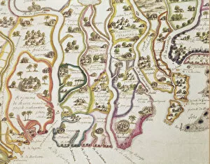
Background imageMaps Collection: Map of the Coast of Africa and the River Gambia, 1622 (coloured engraving)

Map of the Coast of Africa and the River Gambia, 1622 (coloured engraving)
884601 Map of the Coast of Africa and the River Gambia, 1622 (coloured engraving) by French School, (17th century); Bibliotheque Nationale, Paris

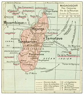
Background imageMaps Collection: Madagascar Comores Islands map 1887

Madagascar Comores Islands map 1887
Map from La Premiere Annee de Geographie par P. Foncin - Paris 1887

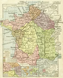
Background imageMaps Collection: France railways system map 1887

France railways system map 1887
Map from La Premiere Annee de Geographie par P. Foncin - Paris 1887

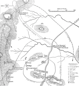
Background imageMaps Collection: Plan of the Battle of Isandhlwana, (Jan. 22, 1879), c1880

Plan of the Battle of Isandhlwana, (Jan. 22, 1879), c1880. From British Battles on Land and Sea, Vol. IV, by James Grant. [Cassell Petter & Galpin, London, Paris & Melbourne, c1880]

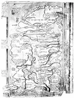
Background imageMaps Collection: MAP OF ENGLAND, c1250. One of the earliest detailed maps of Great Britain extant

MAP OF ENGLAND, c1250. One of the earliest detailed maps of Great Britain extant, drawn about 1250 A.D. by Matthew Paris, artist, historian and monk of St. Albans

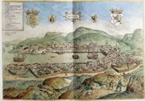
Background imageMaps Collection: Map of Bergen in 16th c. Engraving. FRANCE. Paris

Map of Bergen in 16th c. Engraving. FRANCE. Paris. National Library

Background imageMaps Collection: View Pont Neuf Left Bank 1739 Plan de Paris commence l annee

View Pont Neuf Left Bank 1739 Plan de Paris commence l annee
View of the Pont Neuf and Left Bank, 1739, Plan de Paris: commence l annee 1734, dessine et grave sous les ordres de messire Michel Etienne Turgot, Marquis de Sousmons

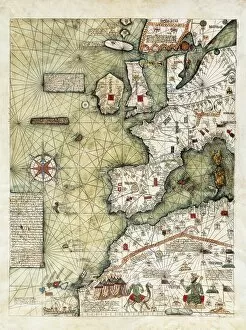
Background imageMaps Collection: CRESQUES, Jafuda (1350-1410); CRESQUES, Abraham

CRESQUES, Jafuda (1350-1410); CRESQUES, Abraham ( -1381). Catalan Atlas. 1375. Third and Fourth Leaves. Map of the world known in the 14th c. (Finisterre and the Mediterranean)

Background imageMaps Collection: CRESQUES, Jafuda (1350-1410); CRESQUES, Abraham

CRESQUES, Jafuda (1350-1410); CRESQUES, Abraham ( -1381). Catalan Atlas. 1375. Third and Fourth Leaves. Map of the world known in the 14th c. (Finisterre and the Mediterranean)

Background imageMaps Collection: Star map using Hebrew characters

Star map using Hebrew characters
Star map. A map of stars with their positions and groupings defined using modified Hebrew characters. This woodcut illustration comes from Curiositez invoyes sur la sculpture talismaique des Persans

Background imageMaps Collection: Map of Magellans round the world voyage, 1519-1521

Map of Magellans round the world voyage, 1519-1521. A Portuguese-born navigator sponsored by Spain, Ferdinand Magellan (c1480-1521)

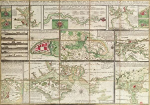
Background imageMaps Collection: A table containing details of the main maritime ports that are represented in the map of

A table containing details of the main maritime ports that are represented in the map of the English Channel
7339430 A table containing details of the main maritime ports that are represented in the map of the English Channel, c.1780 (paper, linen) by Unknown artist

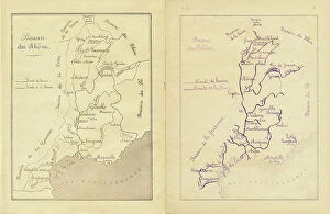
Background imageMaps Collection: Middle course: map of the Rhone basin to be reproduced, c.1880-90 (print)

Middle course: map of the Rhone basin to be reproduced, c.1880-90 (print)
8713431 Middle course: map of the Rhone basin to be reproduced, c.1880-90 (print); 22 x 17 cm; Private Collection; (add.info.: in "Practical method of writing-reading by A)

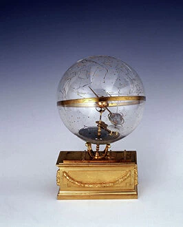
Background imageMaps Collection: Planetarium, c.1825 (brass, glass, gilt brass, enamel, engraved)

Planetarium, c.1825 (brass, glass, gilt brass, enamel, engraved)
7339249 Planetarium, c.1825 (brass, glass, gilt brass, enamel, engraved) by Unknown Artist, (19th century); 28x17 cm; National Maritime Museum, London

Background imageMaps Collection: The capture of Raab by Adolf Schwarzenberg on 28/03/1598. 1653 Print by Franz Hogenberg (1535-1590)

The capture of Raab by Adolf Schwarzenberg on 28/03/1598. 1653 Print by Franz Hogenberg (1535-1590)
BEN5464282 The capture of Raab by Adolf Schwarzenberg on 28/03/1598. 1653 Print by Franz Hogenberg (1535-1590) Cabinet des Estampes, B.N, Paris

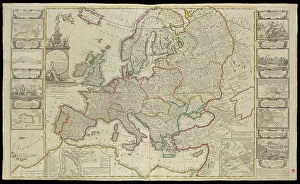
Background imageMaps Collection: New Map of Europe Done from the most accurate observations communicated to the Royal Society's at

New Map of Europe Done from the most accurate observations communicated to the Royal Society's at London & Paris
7340918 New Map of Europe Done from the most accurate observations communicated to the Royal Society's at London & Paris, c.1720 (technical drawing) by Bowles

Background imageMaps Collection: Map of the southwest of Africa, 18th century, 1754 (coloured engraving)

Map of the southwest of Africa, 18th century, 1754 (coloured engraving)
7339407 Map of the southwest of Africa, 18th century, 1754 (coloured engraving) by French School, (18th century); 95x66 cm; National Maritime Museum, London

Background imageMaps Collection: Illustration of the book by Leo Taxil and J. Vindex 'Marat ou les heros de la revolution'

Illustration of the book by Leo Taxil and J. Vindex "Marat ou les heros de la revolution"
PCT4285584 Illustration of the book by Leo Taxil and J. Vindex "Marat ou les heros de la revolution", Librairie anti-clerical (anti-clerical, anticlerical) 1883 - Revolution Francaise

Background imageMaps Collection: Map of Paris, showing the Palais des Tuileries, Vieux Louvre, the River Seine, circa 1730

Map of Paris, showing the Palais des Tuileries, Vieux Louvre, the River Seine, circa 1730
FLO4656917 Map of Paris, showing the Palais des Tuileries, Vieux Louvre, the River Seine, circa 1730. Lithograph from Paul Lacroix 'The Eighteenth Century: Its Institutions, Customs, and Costumes

Background imageMaps Collection: First World War: France, Patriotic Map showing the city of Paris throwing the Germans out of these

First World War: France, Patriotic Map showing the city of Paris throwing the Germans out of these walls
LUX4739374 First World War: France, Patriotic Map showing the city of Paris throwing the Germans out of these walls, titled: 'No garbage before my door', 1914

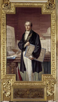
Background imageMaps Collection: Portrait of Louis Joachim Tullius Visconti French architect (1791-1853)

Portrait of Louis Joachim Tullius Visconti French architect (1791-1853). Goblin tapestry panel adorning the Gallery of
ETI4397250 Portrait of Louis Joachim Tullius Visconti French architect (1791-1853). Goblin tapestry panel adorning the Gallery of Apollo. Created by A

Background imageMaps Collection: Female American mathematician and astronomer at work, at the Paris Observatory, 1850

Female American mathematician and astronomer at work, at the Paris Observatory, 1850
3478832 Female American mathematician and astronomer at work, at the Paris Observatory, 1850; (add.info.: Miss Klumpke an American mathematician and astronomer at work on the Carte du Ciel)

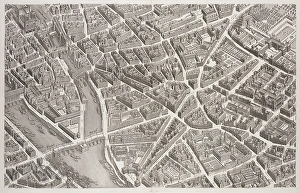
Background imageMaps Collection: map of Paris in 1551 : on the upper right is the Bastille, in the bottom right is the town hall

map of Paris in 1551 : on the upper right is the Bastille, in the bottom right is the town hall, engraving by Truchet
1749806 map of Paris in 1551 : on the upper right is the Bastille, in the bottom right is the town hall, engraving by Truchet; (add.info.: map of Paris in 1551 : on the upper right is the Bastille)

Background imageMaps Collection: project of square and town hall on Malaquet bank along the Seine river in Paris

project of square and town hall on Malaquet bank along the Seine river in Paris, map by architect Patte 18th century
1749462 project of square and town hall on Malaquet bank along the Seine river in Paris, map by architect Patte 18th century; (add.info)

Background imageMaps Collection: Map of Saint Honore Street and Palais Royal, Paris, c.1750 (engraving)

Map of Saint Honore Street and Palais Royal, Paris, c.1750 (engraving)
1968556 Map of Saint Honore Street and Palais Royal, Paris, c.1750 (engraving); (add.info.: Map of Rue Saint Honore and the Palais Royal, France, mid-18th century. Paris)

Background imageMaps Collection: Science. Energy. The gas in Paris. Imagery, France, c.1930 (print)

Science. Energy. The gas in Paris. Imagery, France, c.1930 (print)
3433714 Science. Energy. The gas in Paris. Imagery, France, c.1930 (print); (add.info.: Sciences. Energies. Le gaz, combustible de Paris. Imagerie, France, vers 1930. Coll. Part. Science. Energy)

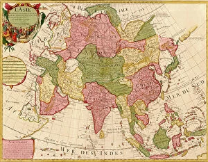
Background imageMaps Collection: Asia - 1700

Asia - 1700
2902856 Asia - 1700; (add.info.: LAsie - dres?e sur les observations de lAcademie Royale des Sciences et quelques autres, et sur les memoires les plus recens. - par G. de LIsle, geographe)

Background imageMaps Collection: 19th Century Map of Paris with the River Seine depicted

19th Century Map of Paris with the River Seine depicted
1578946 19th Century Map of Paris with the River Seine depicted; (add.info.: 19th Century Map of Paris with the River Seine depicted. Dated 1880); Universal History Archive/UIG

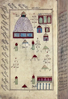
Background imageMaps Collection: View of Mecca, Persian miniature, 17th century (illuminated manscript)

View of Mecca, Persian miniature, 17th century (illuminated manscript)
AIS5355993 View of Mecca, Persian miniature, 17th century (illuminated manscript); Bibliotheque Nationale, Paris, France; © Iberfoto

Background imageMaps Collection: First tubular tramway project in Paris (underground electric railway between Vincennes)

First tubular tramway project in Paris (underground electric railway between Vincennes and Bois de Boulogne)
PCT4293742 First tubular tramway project in Paris (underground electric railway between Vincennes and Bois de Boulogne) - map of the route - cut under the rue de Rivoli showing the tunnel

Background imageMaps Collection: First World War: France, Patriotic map showing a woman mocking a Zeppelin over Paris, 1915

First World War: France, Patriotic map showing a woman mocking a Zeppelin over Paris, 1915, titled map
LUX4741807 First World War: France, Patriotic map showing a woman mocking a Zeppelin over Paris, 1915, titled map, Vas donc eh ballot; (add.info)

Background imageMaps Collection: Letter I. Young boy at school during a geography lecture. Engraving (Chromolithography - Chromo)

Letter I. Young boy at school during a geography lecture. Engraving (Chromolithography - Chromo)
DUV4210203 Letter I. Young boy at school during a geography lecture. Engraving (Chromolithography - Chromo) in " The Great Bebe Alphabet"

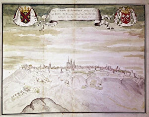
Background imageMaps Collection: Map of the town of Langres (Haute Marne) seen from the west. Gaignieres collection, 1700

Map of the town of Langres (Haute Marne) seen from the west. Gaignieres collection, 1700. Prints studio, B.N., Paris
BEN5464139 Map of the town of Langres (Haute Marne) seen from the west. Gaignieres collection, 1700. Prints studio, B.N., Paris.; Photo © Raffaello Bencini

Background imageMaps Collection: Map of the town of Langres (Haute Marne) and its fortifications. Gaignieres collection, 1700

Map of the town of Langres (Haute Marne) and its fortifications. Gaignieres collection, 1700
BEN5464127 Map of the town of Langres (Haute Marne) and its fortifications. Gaignieres collection, 1700. Prints studio, B.N., Paris.; Photo © Raffaello Bencini

Background imageMaps Collection: bird's eye view of the Monastery of the Chartreux of the rue D Enfer (charteuse de Paris)

bird's eye view of the Monastery of the Chartreux of the rue D Enfer (charteuse de Paris), 19th century (engraving)
5942906 bird's eye view of the Monastery of the Chartreux of the rue D Enfer (charteuse de Paris), 19th century (engraving); Private Collection; (add.info)

Background imageMaps Collection: Map of Asia and America, 1777 (coloured engraving)

Map of Asia and America, 1777 (coloured engraving)
7295385 Map of Asia and America, 1777 (coloured engraving) by Krevelt, Abram van (1732-84); 26x390 cm; National Maritime Museum, London

Background imageMaps Collection: BRAUN, George (1541-1622). ORTELIUS, Abraham (1527-1598). HOGENBERG, Franz (1535-1590)

BRAUN, George (1541-1622). ORTELIUS, Abraham (1527-1598). HOGENBERG, Franz (1535-1590)
CUL4853363 BRAUN, George (1541-1622). ORTELIUS, Abraham (1527-1598). HOGENBERG, Franz (1535-1590). Civitatis Orbis Terrarum (Theatrum orbis terrarum). 1572-1617. Paris (1572). Left lower detail

Background imageMaps Collection: Map of Paris, 1792 (coloured engraving)

Map of Paris, 1792 (coloured engraving)
7340481 Map of Paris, 1792 (coloured engraving) by French School, (19th century); 75x105 cm; National Maritime Museum, London

Background imageMaps Collection: Chart plotting the routes from France and Spain, of the outward

Chart plotting the routes from France and Spain, of the outward and return voyages to the West Indies and East Indies
7339501 Chart plotting the routes from France and Spain, of the outward and return voyages to the West Indies and East Indies, with branches for different destinations, 1686 (engraving) by Val, P

Background imageMaps Collection: Carte d'une partie de la Mer de Chine dressee au Depot des Cartes et Plans de la Marine

Carte d'une partie de la Mer de Chine dressee au Depot des Cartes et Plans de la Marine
7339386 Carte d'une partie de la Mer de Chine dressee au Depot des Cartes et Plans de la Marine, sur les observations du Vice-Amiral Rosili, et publiee par ordre du Ministre

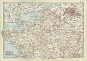
Background imageMaps Collection: Map of France, c.1900 (engraving)

Map of France, c.1900 (engraving)
532942 Map of France, c.1900 (engraving); (add.info.: Map of northern France with insets showing the provinces of France and Paris and Vicinity, circa 1902)

Background imageMaps Collection: Muhammad al-Idrisi. Paris transcript of V-4. The map displays: the northern shoreline of Marmara Sea

Muhammad al-Idrisi. Paris transcript of V-4. The map displays: the northern shoreline of Marmara Sea
529624 Muhammad al-Idrisi. Paris transcript of V-4. The map displays: the northern shoreline of Marmara Sea, Gallipoli Peninsula

Background imageMaps Collection: map of Paris and its fortifications at the time of LouisPhilippe's reign in 1830-1848

map of Paris and its fortifications at the time of LouisPhilippe's reign in 1830-1848
1748748 map of Paris and its fortifications at the time of LouisPhilippe's reign in 1830-1848; (add.info.: map of Paris and its fortifications at the time of LouisPhilippe's reign in 1830-1848)

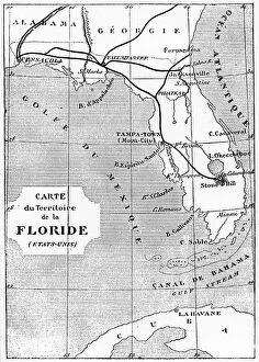
Background imageMaps Collection: Map of Florida showing the position of the launch site of the space craft Columbiad

Map of Florida showing the position of the launch site of the space craft Columbiad, 1865 (engraving)
538405 Map of Florida showing the position of the launch site of the space craft Columbiad, 1865 (engraving); (add.info.: Map of Florida showing the position of the launch site of the space craft)

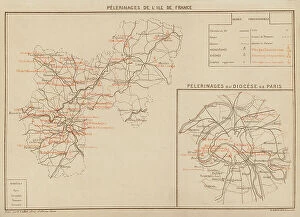
Background imageMaps Collection: Pelerinages De L'Ile De France; Pelerinages Du Diocese De Paris (colour litho)

Pelerinages De L'Ile De France; Pelerinages Du Diocese De Paris (colour litho)
8643157 Pelerinages De L'Ile De France; Pelerinages Du Diocese De Paris (colour litho) by Clerget, Hubert (1818-1899); Private Collection; (add.info)

Background imageMaps Collection: Plan of the harbour, fort, town and environs of Fort Royal in Martinique, 1793 (engraving)

Plan of the harbour, fort, town and environs of Fort Royal in Martinique, 1793 (engraving)
7340437 Plan of the harbour, fort, town and environs of Fort Royal in Martinique, 1793 (engraving) by Booth, William (18th century); 88x70 cm; National Maritime Museum, London

Background imageMaps Collection: Middle course: map of the rail networks of Orleans and the State, c.1880-90 (print)

Middle course: map of the rail networks of Orleans and the State, c.1880-90 (print)
8713434 Middle course: map of the rail networks of Orleans and the State, c.1880-90 (print); 22 x 17 cm; Private Collection; (add.info.: in "Practical method of writing-reading by A)

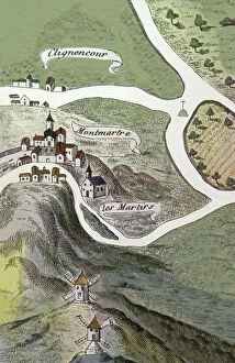
Background imageMaps Collection: Montmartre Abbey, 16th century (engraving)

Montmartre Abbey, 16th century (engraving)
8698354 Montmartre Abbey, 16th century (engraving); (add.info.: Geography. France. Montmartre Abbey in Paris. Map, France, 16th cent.); © Archives Charmet


All Professionally Made to Order for Quick Shipping


-

Maps Collection

Maps of Paris, France, Europe are invaluable resources for anyone visiting or living in the city. They provide an overview of the city's layout, including its streets and landmarks. They also show public transportation routes and stations, as well as points of interest such as parks and museums. Many it also include information about nearby cities and towns, allowing visitors to plan day trips outside the city limits. Additionally they can help visitors find their way around Paris more easily by providing detailed directions from one point to another. With a map in hand, travelers can explore all that Paris has to offer with confidence.
+

Our beautiful pictures are available as Framed Prints, Photos, Wall Art and Photo Gifts

The Maps of Paris France Europe collection from Media Storehouse is a stunning assortment of wall art, framed prints, photo prints, canvas prints, jigsaw puzzles and greeting cards that capture the beauty and history of Paris. Our collection features a wide range of maps depicting different eras in the city's rich cultural heritage. From antique maps dating back to the 18th century to modern-day street maps highlighting popular landmarks such as the Eiffel Tower and Notre-Dame Cathedral, our collection offers something for everyone. Each piece in our collection is carefully crafted using high-quality materials to ensure long-lasting durability and vibrant colors that will stand out on any wall. Whether you're looking for a unique gift or want to add some French charm to your home or office decor, these beautiful pieces are sure to impress. With so many options available at affordable prices, it's easy to find exactly what you need from this impressive selection of artwork.
+

What are Maps of Paris France Europe art prints?

Maps of Paris France Europe art prints are beautiful and detailed depictions of the city of Paris, France, and its surrounding regions. These maps showcase the intricate layout of streets, landmarks, and buildings throughout the area. They are often created using a combination of traditional cartography techniques and modern design elements to produce an aesthetically pleasing representation. These art prints serve as both decorative pieces for your home or office space as well as educational tools for those interested in geography or history. They can be used to plan trips to Paris or simply admired for their artistic value. Maps of Paris France Europe art prints come in various sizes and styles, ranging from vintage designs that capture the essence of old-world charm to contemporary interpretations that reflect modern-day trends. Regardless of your personal style preferences, there is sure to be a map print that will suit your tastes perfectly.
+

What Maps of Paris France Europe art prints can I buy from Media Storehouse?

We offer a wide range of Maps of Paris, France and Europe art prints that are perfect for home decor or as gifts. These maps come in various sizes and styles to suit your preferences. You can choose from vintage-style maps that showcase the intricate details of the city's streets, landmarks, and neighborhoods, or modern designs that highlight its vibrant culture and history. Some popular options include detailed street maps of Paris with iconic landmarks such as the Eiffel Tower, Notre Dame Cathedral, and Arc de Triomphe highlighted. There are also antique-style world maps featuring Europe prominently along with other continents. Media Storehouse also offers panoramic views of Paris' skyline at different times of day including sunrise or sunset which make great wall art pieces for any room in your home. Whether you're looking for something classic or contemporary, we have a vast collection of Maps of Paris France Europe art prints to choose from.
+

How do I buy Maps of Paris France Europe art prints?

To buy Maps of Paris France Europe art prints from Media Storehouse, you can browse our extensive collection of maps and select the one that best suits your preferences. Once you have found the map you want to purchase, simply add it to your cart and proceed to checkout. You will be prompted to enter your shipping information and payment details before finalizing your order. We offer a variety of sizes for their art prints, so make sure to choose the size that fits your needs. We also offer different framing options if you prefer a framed print. If you have any questions or concerns about purchasing Maps of Paris France Europe art prints from Media Storehouse, they have a customer service team available to assist you. Simply reach out via email or phone and they will be happy to help guide you through the process.
+

How much do Maps of Paris France Europe art prints cost?

We offer a wide range of Maps of Paris France Europe art prints, which vary in price depending on the size and type of print. The cost for these prints can be affected by factors such as the quality of paper or canvas used, the printing method employed, and any additional features that may be included with the print. However, it is important to note that Media Storehouse strives to offer affordable prices for all their products while maintaining high-quality standards. You can expect reasonable pricing options for Maps of Paris France Europe art prints without compromising on quality. Whether you are looking for vintage maps or contemporary designs, we have something to suit every taste and budget. With a vast collection available online, you can easily browse through different options before making their purchase decision.
+

How will my Maps of Paris France Europe art prints be delivered to me?

We take great care in ensuring that your Maps of Paris France Europe art prints are delivered to you safely and securely. We use high-quality packaging materials to protect your print during transit, so it arrives at your doorstep in pristine condition. Your print will be carefully rolled and placed inside a protective tube before being shipped out to you. This ensures that the print is not damaged or creased during shipping. Additionally, we work with trusted courier services to ensure timely delivery of your order. Once your package has been dispatched, you will receive a tracking number via email which allows you to track the progress of your shipment online. If for any reason there are issues with the delivery of your order, our customer service team is always available to assist you. We hope that receiving your Maps of Paris France Europe art prints brings joy and inspiration into your home or office space.