Fraud Blocker Skip to main content

Canvas Print > Europe > Republic of Ireland > Maps

Maps Canvas Print Collection (page 5)

Discover the beauty of the Emerald Isle with our Maps of Republic of Ireland Canvas Prints collection from Media Storehouse. These high-quality prints showcase intricate details of the Republic of Ireland's geography, making for a stunning addition to any home or office decor. Each map is meticulously designed to bring out the unique features of the region, transporting you to the heart of Europe's most enchanting country. Order now and bring a piece of Ireland into your space.
The Republic of Ireland is located in the North Atlantic Ocean and is part of Europe

1,485 Canvas Prints

Background imageMaps Canvas Print Collection: Ireland, 1665

Ireland, 1665
2902831 Ireland, 1665; (add.info.: Ireland, 1665.); Buyenlarge Archive/UIG

Background imageMaps Canvas Print Collection: Ireland, 1750

Ireland, 1750
2902830 Ireland, 1750; (add.info.: Ireland, 1750.); Buyenlarge Archive/UIG

Background imageMaps Canvas Print Collection: British - French Claims to North America, 1756

British - French Claims to North America, 1756
2902790 British - French Claims to North America, 1756; (add.info.: British - French Claims to North America, 1756.); Buyenlarge Archive/UIG

Background imageMaps Canvas Print Collection: Isometrical plan of Mr. Grainger's proposed concentration of the termini of the several railways

Isometrical plan of Mr. Grainger's proposed concentration of the termini of the several railways from London
7426778 Isometrical plan of Mr. Grainger's proposed concentration of the termini of the several railways from London, Edinburgh, Carlisle, Shields and Sunderland, at a General Depot at Elswick T

Background imageMaps Canvas Print Collection: Map of the British world empire, from Castle Line Atlas of South Africa, 1895 (print)

Map of the British world empire, from Castle Line Atlas of South Africa, 1895 (print)
7339270 Map of the British world empire, from Castle Line Atlas of South Africa, 1895 (print) by Philip, George (1800-82); 51x20 cm; National Maritime Museum, London

Background imageMaps Canvas Print Collection: A map of the most inhabited part of New England, containing the provinces of Massachusetts Bay

A map of the most inhabited part of New England, containing the provinces of Massachusetts Bay
7339414 A map of the most inhabited part of New England, containing the provinces of Massachusetts Bay and New Hampshire with the colonies of Connecticut and Rhode Island, 1774 (paper) by Jefferys

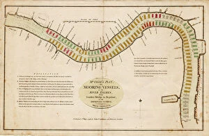
Background imageMaps Canvas Print Collection: Mr Ogle's plan, for mooring vessels, in the River Thames, from London Bridge to Deptford

Mr Ogle's plan, for mooring vessels, in the River Thames, from London Bridge to Deptford, on an improved system
7339403 Mr Ogle's plan, for mooring vessels, in the River Thames, from London Bridge to Deptford, on an improved system, 1796 (coloured engraving) by Ogle

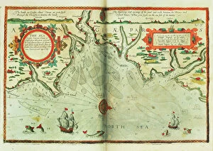
Background imageMaps Canvas Print Collection: A chart of the sea coasts of England, Flanders and Holland, c.1672 (print)

A chart of the sea coasts of England, Flanders and Holland, c.1672 (print)
7340614 A chart of the sea coasts of England, Flanders and Holland, c.1672 (print) by Seller, John (1632-97); National Maritime Museum, London

Background imageMaps Canvas Print Collection: Map of Streatham, Croydon and Sydenham, 1746 (coloured engraving)

Map of Streatham, Croydon and Sydenham, 1746 (coloured engraving)
7340510 Map of Streatham, Croydon and Sydenham, 1746 (coloured engraving) by Rocque, John (c.1704-d.1762); 51x67 cm; National Maritime Museum, London

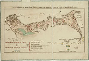
Background imageMaps Canvas Print Collection: A plan of the operations of the British forces in Egypt from the landing in Aboukir Bay on the 8th

A plan of the operations of the British forces in Egypt from the landing in Aboukir Bay on the 8th of March to
7340500 A plan of the operations of the British forces in Egypt from the landing in Aboukir Bay on the 8th of March to the Battle of Alexandria March 21st inclusive, 1801 (paper, engraving) by Faden

Background imageMaps Canvas Print Collection: England East Coast. Sheet 3, late 19th century (print)

England East Coast. Sheet 3, late 19th century (print)
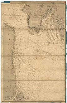
7340596 England East Coast. Sheet 3, late 19th century (print) by Imray, James & Son (19th century); National Maritime Museum, London

Background imageMaps Canvas Print Collection: A military chart of the marches and encampments of the grand army commanded by Major General

A military chart of the marches and encampments of the grand army commanded by Major General Medows from the 26th May
7340494 A military chart of the marches and encampments of the grand army commanded by Major General Medows from the 26th May to the 14th December 1790, 1791 (manuscript) by Mackenzie, C

Background imageMaps Canvas Print Collection: Plymouth Citadel, 1667 (paper, linen)

Plymouth Citadel, 1667 (paper, linen)
7340485 Plymouth Citadel, 1667 (paper, linen) by Gomme, Bernard de (1620-85); 51.5x73.5 cm; National Maritime Museum, London

Background imageMaps Canvas Print Collection: England East coast Orfordness to Blakeney with the off lying shoals between Smith's Knoll

England East coast Orfordness to Blakeney with the off lying shoals between Smith's Knoll and the Outer Dowsing
7340576 England East coast Orfordness to Blakeney with the off lying shoals between Smith's Knoll and the Outer Dowsing, 1888-97 (engraving) by British School

Background imageMaps Canvas Print Collection: The harbour of Halifax, 1777 (engraving)

The harbour of Halifax, 1777 (engraving)
7340410 The harbour of Halifax, 1777 (engraving) by DesBarres, Joseph Frederick Wallet (1721-1824); 84x62 cm; National Maritime Museum, London

Background imageMaps Canvas Print Collection: Pascaart van de Noort Zee verthoonende in zich alle de Custen en havens daer rontom gelegen

Pascaart van de Noort Zee verthoonende in zich alle de Custen en havens daer rontom gelegen. 1654 (print, paper)
7340057 Pascaart van de Noort Zee verthoonende in zich alle de Custen en havens daer rontom gelegen. 1654 (print, paper) by Wit, Frederick de (1630-1706); 50.5x58.5 cm; National Maritime Museum

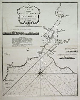
Background imageMaps Canvas Print Collection: A plan of the road and harbour of Fowey or Foy by Lieutenant James Cook of the Royal Navy

A plan of the road and harbour of Fowey or Foy by Lieutenant James Cook of the Royal Navy, 1779 (copperplate engraving)
7340127 A plan of the road and harbour of Fowey or Foy by Lieutenant James Cook of the Royal Navy, 1779 (copperplate engraving) by British School, (18th Century); 73x54 cm; National Maritime Museum

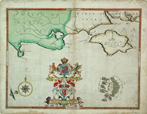
Background imageMaps Canvas Print Collection: The English and Spanish fleets on 1 - 2 August, 1588, c.1590 (coloured engraving)

The English and Spanish fleets on 1 - 2 August, 1588, c.1590 (coloured engraving)
7340027 The English and Spanish fleets on 1 - 2 August, 1588, c.1590 (coloured engraving) by Adams, Robert (1540-95) (after); 38x50 cm; National Maritime Museum, London

Background imageMaps Canvas Print Collection: Chart of Leix and Offaly, Ireland, c.1590 (paper, linen)

Chart of Leix and Offaly, Ireland, c.1590 (paper, linen)
7339830 Chart of Leix and Offaly, Ireland, c.1590 (paper, linen) by Unknown Artist, (16th century); 45x60 cm; National Maritime Museum, London, UK; (add.info.: Creator: unknown From volume eight)

Background imageMaps Canvas Print Collection: Loxodrome, 1601 (paper, linen)

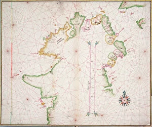
Loxodrome, 1601 (paper, linen)
7339828 Loxodrome, 1601 (paper, linen) by British School, (17th century); 32x53.5 cm; National Maritime Museum, London, UK; (add.info.: Creator)

Background imageMaps Canvas Print Collection: Tralee Bay, Ireland, c.1600 (paper, linen)

Tralee Bay, Ireland, c.1600 (paper, linen)
7339821 Tralee Bay, Ireland, c.1600 (paper, linen) by Unknown Artist, (17th century); 28.5x41 cm; National Maritime Museum, London, UK; (add.info.: Creator: unknown Scale: [ca. 1:63 360 (bar)]

Background imageMaps Canvas Print Collection: Sea chart of the north coast of Ireland, c.1600 (paper, linen)

Sea chart of the north coast of Ireland, c.1600 (paper, linen)
7339820 Sea chart of the north coast of Ireland, c.1600 (paper, linen) by Unknown Artist, (17th century); 38x46 cm; National Maritime Museum, London

Background imageMaps Canvas Print Collection: Province of Munster, Ireland, c.1595 (vellum, linen)

Province of Munster, Ireland, c.1595 (vellum, linen)
7339817 Province of Munster, Ireland, c.1595 (vellum, linen) by Jobson, Francis (16th Century); 69.5x100 cm; National Maritime Museum, London

Background imageMaps Canvas Print Collection: Map of the north of Ireland, c.1600 (laid on linen)

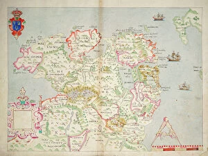
Map of the north of Ireland, c.1600 (laid on linen)
7339809 Map of the north of Ireland, c.1600 (laid on linen) by Unknown Artist, (17th century); 41x56.5 cm; National Maritime Museum, London

Background imageMaps Canvas Print Collection: Chart of Portsmouth, c.1668 (linen, paper)

Chart of Portsmouth, c.1668 (linen, paper)
7339794 Chart of Portsmouth, c.1668 (linen, paper) by Fabvolliere, Daniel Favreau de la (17th century); 44.5x55.5 cm; National Maritime Museum, London

Background imageMaps Canvas Print Collection: Treasure Island, with the map of the island on the frontispiece, 1900-1920 (print)

Treasure Island, with the map of the island on the frontispiece, 1900-1920 (print)
8615298 Treasure Island, with the map of the island on the frontispiece, 1900-1920 (print); (add.info.: Title page of an old Cassell and Company edition (early 20th century)

Background imageMaps Canvas Print Collection: Map of Barnes, Battersea, Putney and Wandsworth, 1746 (coloured engraving)

Map of Barnes, Battersea, Putney and Wandsworth, 1746 (coloured engraving)
7340513 Map of Barnes, Battersea, Putney and Wandsworth, 1746 (coloured engraving) by Rocque, John (c.1704-d.1762); 51x67 cm; National Maritime Museum, London

Background imageMaps Canvas Print Collection: The North Sea [Southern Sheet] from the latest British and foreign surveys

The North Sea [Southern Sheet] from the latest British and foreign surveys, 1871-95 (technical drawing)
7340604 The North Sea [Southern Sheet] from the latest British and foreign surveys, 1871-95 (technical drawing) by Weller, Edward (19th century); 113.8x61.8 cm; National Maritime Museum, London

Background imageMaps Canvas Print Collection: Orford Ness to Blakeney with the off lying shoals between Smiths Knoll and the other Dowsing

Orford Ness to Blakeney with the off lying shoals between Smiths Knoll and the other Dowsing, 1888-95 (engraving)
7340599 Orford Ness to Blakeney with the off lying shoals between Smiths Knoll and the other Dowsing, 1888-95 (engraving) by British School, (19th century); 61.9x107.5 cm; National Maritime Museum

Background imageMaps Canvas Print Collection: England East Coast from Thames Estuary to the Wash, 1698 (engraving)

England East Coast from Thames Estuary to the Wash, 1698 (engraving)
7340591 England East Coast from Thames Estuary to the Wash, 1698 (engraving) by Collins, Greenvile (1643-94); 92x57.5 cm; National Maritime Museum, London

Background imageMaps Canvas Print Collection: England East Coast from Dungeness to Flamborough Head, 1870 (engraving)

England East Coast from Dungeness to Flamborough Head, 1870 (engraving)
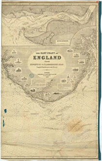
7340588 England East Coast from Dungeness to Flamborough Head, 1870 (engraving) by Imray, James & Son (19th century); 62.5x99 cm; National Maritime Museum, London

Background imageMaps Canvas Print Collection: England East Coast from Dungeness to Flamborough Head, 1870 (engraving)

England East Coast from Dungeness to Flamborough Head, 1870 (engraving)
7340587 England East Coast from Dungeness to Flamborough Head, 1870 (engraving) by Imray, James & Son (19th century); 62.5x99 cm; National Maritime Museum, London

Background imageMaps Canvas Print Collection: England East Coast from Dungeness to Flamborough Head, 1870 (engraving)

England East Coast from Dungeness to Flamborough Head, 1870 (engraving)
7340586 England East Coast from Dungeness to Flamborough Head, 1870 (engraving) by Imray, James & Son (19th century); 62.5x99 cm; National Maritime Museum, London

Background imageMaps Canvas Print Collection: Atlantic coasts of Europe, Norway to Finisterre, 1666 (vellum)

Atlantic coasts of Europe, Norway to Finisterre, 1666 (vellum)
7340461 Atlantic coasts of Europe, Norway to Finisterre, 1666 (vellum) by Comberford, Nicholas (d.1673); 79x27 cm; National Maritime Museum, London

Background imageMaps Canvas Print Collection: A commercial map of Scotland with the roads, stages and distances, 1782 (engraving)

A commercial map of Scotland with the roads, stages and distances, 1782 (engraving)
7340440 A commercial map of Scotland with the roads, stages and distances, 1782 (engraving) by Knox, J. (18th century); 73x56 cm; National Maritime Museum, London, UK; (add.info.: Creator: J)

Background imageMaps Canvas Print Collection: Ipswich Bay and Cape Ann, 1776 (engraving)

Ipswich Bay and Cape Ann, 1776 (engraving)
7340431 Ipswich Bay and Cape Ann, 1776 (engraving) by DesBarres, Joseph Frederick Wallet (1721-1824); 54x75.5 cm; National Maritime Museum, London, UK; (add.info.: Creator: J.F.W)

Background imageMaps Canvas Print Collection: A new hydrographical survey of the British Channel, with part of the Atlantic Ocean as far as Cape

A new hydrographical survey of the British Channel, with part of the Atlantic Ocean as far as Cape Clear
7340129 A new hydrographical survey of the British Channel, with part of the Atlantic Ocean as far as Cape Clear, improved from the large chart of the late Thomas Jeffery's Geographer to the King

Background imageMaps Canvas Print Collection: The battle off the Isle of Wight on 4 August, 1588, c.1590 (coloured engraving)

The battle off the Isle of Wight on 4 August, 1588, c.1590 (coloured engraving)
7340031 The battle off the Isle of Wight on 4 August, 1588, c.1590 (coloured engraving) by Adams, Robert (1540-95) (after); 38x50 cm; National Maritime Museum, London

Background imageMaps Canvas Print Collection: New map of the most flourishing kingdom of England, by Humphrey Lloyd of Denbigh

New map of the most flourishing kingdom of England, by Humphrey Lloyd of Denbigh, 1573 (copperplate engraving on paper)
7340124 New map of the most flourishing kingdom of England, by Humphrey Lloyd of Denbigh, 1573 (copperplate engraving on paper) by Ortelius, Abraham (1527-98); 42x53 cm; National Maritime Museum

Background imageMaps Canvas Print Collection: St Augustine, 1588 (engraving)

St Augustine, 1588 (engraving)
7340020 St Augustine, 1588 (engraving) by Boazio, Baptista (fl.1588-1606); National Maritime Museum, London, UK; (add.info.: Creator)

Background imageMaps Canvas Print Collection: The sea coastes betweene Dover & Orfordness: wherein is conteined the most famous River of Thames

The sea coastes betweene Dover & Orfordness: wherein is conteined the most famous River of Thames with all the sands
7340015 The sea coastes betweene Dover & Orfordness: wherein is conteined the most famous River of Thames with all the sands, bankes, flats

Background imageMaps Canvas Print Collection: Ireland between Londonderry and Dublin, 1595 (linen, paper)

Ireland between Londonderry and Dublin, 1595 (linen, paper)
7339818 Ireland between Londonderry and Dublin, 1595 (linen, paper) by Thomas, John (16th century); 104x113.5 cm; National Maritime Museum, London, UK; (add.info.: Creator: Ihon Thomas Scale: [ca)

Background imageMaps Canvas Print Collection: The description of the castle and landes of Insbeguin lying within 3 miles of Yohall on the west

The description of the castle and landes of Insbeguin lying within 3 miles of Yohall on the west side thereof
7339814 The description of the castle and landes of Insbeguin lying within 3 miles of Yohall on the west side thereof, 1589 (paper, linen) by Unknown Artist

Background imageMaps Canvas Print Collection: Chart of the north-east Atlantic, from Ireland to Cape Verde, c.1600 (manuscript)

Chart of the north-east Atlantic, from Ireland to Cape Verde, c.1600 (manuscript)
7339788 Chart of the north-east Atlantic, from Ireland to Cape Verde, c.1600 (manuscript) by Unknown Artist, (17th century); 47x35 cm; National Maritime Museum, London

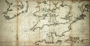
Background imageMaps Canvas Print Collection: A new and correct large draught of the Channell between England

A new and correct large draught of the Channell between England and France with the coast of Ireland St
7339560 A new and correct large draught of the Channell between England and France with the coast of Ireland St. Georges & Bristoll Channell and several of the most noteable harbours at large

Background imageMaps Canvas Print Collection: English Channel, 1730 (engraving)

English Channel, 1730 (engraving)
7339527 English Channel, 1730 (engraving) by Unknown artist, (18th century); 48x58 cm; National Maritime Museum, London, UK; (add.info.: Creator: unknown [ca.1)

Background imageMaps Canvas Print Collection: Chart of the English Channel, 1584 (coloured engraving)

Chart of the English Channel, 1584 (coloured engraving)
7339500 Chart of the English Channel, 1584 (coloured engraving) by Janszoon Waghenaer, Lucas (c.1533-c.1606) ; 33x52 cm; National Maritime Museum, London

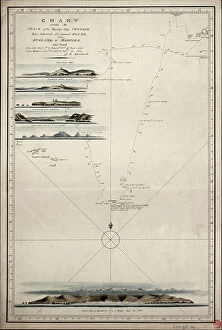
Background imageMaps Canvas Print Collection: Chart showing the track of His Majesty's ship Centaur (1797) from England to Madeira and back

Chart showing the track of His Majesty's ship Centaur (1797) from England to Madeira and back, 1808 (ink, paper)
7339499 Chart showing the track of His Majesty's ship Centaur (1797) from England to Madeira and back, 1808 (ink, paper, watercolour) by Unknown Artist


All Professionally Made to Order for Quick Shipping


-

Maps Canvas Print Collection

The Republic of Ireland is located in the North Atlantic Ocean and is part of Europe. Maps of the Republic of Ireland are widely available, both online and in print. These maps typically show the country's major cities, rivers, lakes, mountains, national parks and other features. They also often include information about roads and other transportation networks as well as political boundaries. They can useful for travelers who wish to explore the country or plan a route from one destination to another. Additionally, they can be used by businesses looking to expand their operations into new markets or investors seeking potential opportunities in different parts of the country.
+

Our beautiful Wall Art and Photo Gifts include Framed Prints, Photo Prints, Poster Prints, Canvas Prints, Jigsaw Puzzles, Metal Prints and so much more

The Maps of Republic of Ireland Europe collection from Media Storehouse is a stunning range of wall art and framed prints that showcase the beauty and diversity of Ireland's landscapes. Our collection features an extensive selection of maps, including antique maps, topographical maps, and modern-day roadmaps. Each print in our collection is carefully crafted to capture the unique character and charm of Ireland's cities, towns, villages, mountains, lakes, rivers and coastlines. Whether you are looking for a striking piece to hang in your home or office or want to give a thoughtful gift to someone special who loves Irish culture and history - our collection has something for everyone. From Dublin's bustling streets to the rugged beauty of Connemara National Park; from the ancient ruins at Newgrange to the rolling hillsides dotted with sheep - these prints offer a glimpse into one of Europe's most enchanting countries. With its rich history, vibrant culture and breathtaking scenery - it's no wonder why so many people fall in love with Ireland.
+

What are Maps of Republic of Ireland Europe art prints?

Maps of Republic of Ireland Europe art prints are high-quality reproductions of maps that depict the geography and topography of the Republic of Ireland. These prints showcase intricate details such as cities, towns, rivers, mountains, and other landmarks that make up the Irish landscape. They are designed to be visually appealing and informative at the same time. These art prints are perfect for anyone who loves history or geography or has an interest in exploring new places. They can be used to decorate homes, offices, schools or any space where a touch of sophistication is needed. Maps of Republic of Ireland Europe art prints come in various sizes and styles to suit different preferences. These art prints offer a unique way to appreciate the beauty and complexity of one's surroundings while also providing valuable information about them. Whether you're looking for a decorative piece or something more educational, Maps of Republic of Ireland Europe art prints from Media Storehouse are sure to impress.
+

What Maps of Republic of Ireland Europe art prints can I buy from Media Storehouse?

We offer a wide range of Republic of Ireland Europe art prints that are perfect for those who want to add a touch of elegance and sophistication to their home or office. These maps showcase the beauty and intricacy of the region, highlighting its unique features and landmarks. Some popular options include vintage-style maps that capture the history and charm of Ireland, as well as modern designs that offer a fresh take on this stunning country. You can choose from different sizes, styles, and finishes to suit your preferences. Whether you're looking for a statement piece or something more subtle, we have plenty of options to choose from. Their high-quality prints are made using premium materials that ensure they look great for years to come. So if you want to bring some Irish flair into your space, be sure to check out their selection today.
+

How do I buy Maps of Republic of Ireland Europe art prints?

To buy Maps of Republic of Ireland Europe art prints from Media Storehouse, you can browse our extensive collection online. Simply search for the specific map or artwork that you are interested in and add it to your cart. You can also refine your search by selecting different categories such as size, orientation, and color. Once you have added all the items to your cart, proceed to checkout where you will be prompted to enter your shipping and payment information. After completing the purchase process, Media Storehouse will process your order and ship it directly to your desired location. We offer a wide range of high-quality art prints featuring maps of Republic of Ireland Europe that are perfect for decorating any space in your home or office. Whether you're looking for a vintage-style map or a modern interpretation, they have something for everyone's taste and budget. So start exploring our collection today.
+

How much do Maps of Republic of Ireland Europe art prints cost?

As We offer a wide range of maps of the Republic of Ireland and Europe art prints, the cost may vary depending on factors such as size, framing options, and printing materials. However, you can be assured that they will receive high-quality prints at reasonable prices. The company sources its images from top photographers and archives worldwide to ensure that our collection is diverse and unique. Our maps of the Republic of Ireland and Europe art prints are perfect for those who want to add a touch of sophistication to their home or office decor. These prints come in various sizes ranging from small to large formats, making them suitable for any space. You can choose between unframed or framed options based on their preferences. We provide excellent value for money when it comes to purchasing maps of the Republic of Ireland and Europe art prints. Their products are affordable yet maintain exceptional quality standards that meet customer expectations.
+

How will my Maps of Republic of Ireland Europe art prints be delivered to me?

Your Maps of Republic of Ireland Europe art prints will be delivered to you in a safe and secure manner. We take great care in packaging your order so that it arrives at your doorstep without any damage. The prints are carefully rolled and placed inside a sturdy tube, which is then sealed with protective caps on both ends. We use reliable courier services to deliver your order, ensuring that it reaches you within the estimated delivery time frame. You can track your package using the tracking number provided once it has been dispatched from our warehouse. We understand how important it is for our customers to receive their orders promptly and in perfect condition. That's why we have partnered with trusted shipping companies who share our commitment to quality service. Rest assured that when you order Maps of Republic of Ireland Europe art prints from us, they will be delivered to you safely and efficiently.