Fraud Blocker Skip to main content

Home > Europe > United Kingdom > Wales > Maps

Maps Collection (page 9)

Wales is a country located in the United Kingdom, and it has been mapped for centuries

1,217 items

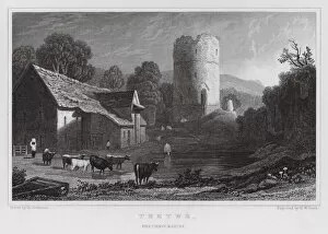
Background imageMaps Collection: Tretwr, Brecknockshire (engraving)

Tretwr, Brecknockshire (engraving)
7159331 Tretwr, Brecknockshire (engraving) by Gastineau, Henry (1791-1876) (after); Private Collection; (add.info.: Tretwr, Brecknockshire)

Background imageMaps Collection: Gateway and Bridge, Ragland, Monmouthshire (engraving)

Gateway and Bridge, Ragland, Monmouthshire (engraving)
7159326 Gateway and Bridge, Ragland, Monmouthshire (engraving) by Gastineau, Henry (1791-1876) (after); Private Collection; (add.info.: Gateway and Bridge, Ragland, Monmouthshire)

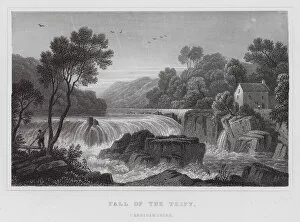
Background imageMaps Collection: Fall of the Teify, Cardiganshire (engraving)

Fall of the Teify, Cardiganshire (engraving)
7159318 Fall of the Teify, Cardiganshire (engraving) by Gastineau, Henry (1791-1876) (after); Private Collection; (add.info.: Fall of the Teify, Cardiganshire)

Background imageMaps Collection: Craig y Dinas, Breconshire (engraving)

Craig y Dinas, Breconshire (engraving)
7159314 Craig y Dinas, Breconshire (engraving) by Gastineau, Henry (1791-1876) (after); Private Collection; (add.info.: Craig y Dinas, Breconshire)

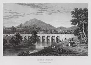
Background imageMaps Collection: Abergavenny, Monmouthshire (engraving)

Abergavenny, Monmouthshire (engraving)
7159312 Abergavenny, Monmouthshire (engraving) by Gastineau, Henry (1791-1876) (after); Private Collection; (add.info.: Abergavenny, Monmouthshire)

Background imageMaps Collection: Remains of the Cloisters of Margam Abbey, Glamorganshire (engraving)

Remains of the Cloisters of Margam Abbey, Glamorganshire (engraving)
7159307 Remains of the Cloisters of Margam Abbey, Glamorganshire (engraving) by Gastineau, Henry (1791-1876) (after); Private Collection; (add.info.: Remains of the Cloisters of Margam Abbey)

Background imageMaps Collection: Royal Atlas, c 1900: Average Rainfall (colour litho)

Royal Atlas, c 1900: Average Rainfall (colour litho)
7198200 Royal Atlas, c 1900: Average Rainfall (colour litho) by English School, (20th century); Private Collection; (add.info.: Average Rainfall)

Background imageMaps Collection: Royal Atlas, c 1900: Average Temperature (colour litho)

Royal Atlas, c 1900: Average Temperature (colour litho)
7198199 Royal Atlas, c 1900: Average Temperature (colour litho) by English School, (20th century); Private Collection; (add.info.: Average Temperature)

Background imageMaps Collection: Royal Atlas, c 1900: Parliamentary Representation (colour litho)

Royal Atlas, c 1900: Parliamentary Representation (colour litho)
7198196 Royal Atlas, c 1900: Parliamentary Representation (colour litho) by English School, (20th century); Private Collection; (add.info.: Parliamentary Representation)

Background imageMaps Collection: Royal Atlas, c 1900: Density of Population (colour litho)

Royal Atlas, c 1900: Density of Population (colour litho)
7198195 Royal Atlas, c 1900: Density of Population (colour litho) by English School, (20th century); Private Collection; (add.info.: Density of Population)

Background imageMaps Collection: Royal Atlas, c 1900: Counties and Boroughs (colour litho)

Royal Atlas, c 1900: Counties and Boroughs (colour litho)
7198193 Royal Atlas, c 1900: Counties and Boroughs (colour litho) by English School, (20th century); Private Collection; (add.info.: Counties and Boroughs)

Background imageMaps Collection: Royal Atlas, c 1900: Central London (colour litho)

Royal Atlas, c 1900: Central London (colour litho)
7198210 Royal Atlas, c 1900: Central London (colour litho) by English School, (20th century); Private Collection; (add.info.: Central London)

Background imageMaps Collection: King George V and the Prince of Wales (colour litho)

King George V and the Prince of Wales (colour litho)
7201167 King George V and the Prince of Wales (colour litho) by Pearse, Alfred (1856-1933); Private Collection; (add.info.: King George V and the Prince of Wales, the future King Edward VIII)

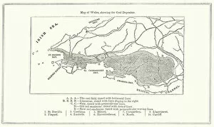
Background imageMaps Collection: Map of Wales, showing the Coal Deposits (engraving)

Map of Wales, showing the Coal Deposits (engraving)
7165959 Map of Wales, showing the Coal Deposits (engraving) by English School, (19th century); Private Collection; (add.info.: Map of Wales, showing the Coal Deposits)

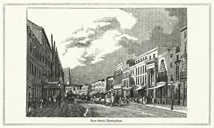
Background imageMaps Collection: New Street, Birmingham (engraving)

New Street, Birmingham (engraving)
7165956 New Street, Birmingham (engraving) by English School, (19th century); Private Collection; (add.info.: New Street, Birmingham)

Background imageMaps Collection: High Street, Borough (engraving)

High Street, Borough (engraving)
7165946 High Street, Borough (engraving) by English School, (19th century); Private Collection; (add.info.: High Street, Borough)

Background imageMaps Collection: Dudley Castle, in Staffordshire (engraving)

Dudley Castle, in Staffordshire (engraving)
7170507 Dudley Castle, in Staffordshire (engraving) by English School, (18th century); Private Collection; (add.info.: Dudley Castle, in Staffordshire)

Background imageMaps Collection: Netley Abbey, in Hampshire (engraving)

Netley Abbey, in Hampshire (engraving)
7170496 Netley Abbey, in Hampshire (engraving) by English School, (18th century); Private Collection; (add.info.: Netley Abbey, in Hampshire)

Background imageMaps Collection: Barfreston Church, in Kent (engraving)

Barfreston Church, in Kent (engraving)
7170490 Barfreston Church, in Kent (engraving) by English School, (18th century); Private Collection; (add.info.: Barfreston Church, in Kent)

Background imageMaps Collection: Lindisfarne Monastery, in Northumberland (engraving)

Lindisfarne Monastery, in Northumberland (engraving)
7170486 Lindisfarne Monastery, in Northumberland (engraving) by English School, (18th century); Private Collection; (add.info.: Lindisfarne Monastery, in Northumberland)

Background imageMaps Collection: Edgars Tower, at Worcester (engraving)

Edgars Tower, at Worcester (engraving)
7170477 Edgars Tower, at Worcester (engraving) by English School, (18th century); Private Collection; (add.info.: Edgars Tower, at Worcester)

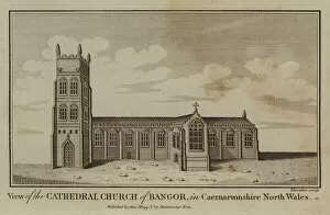
Background imageMaps Collection: View of the Cathedral Church of Bangor, in Caernarvonshire North Wales (engraving)

View of the Cathedral Church of Bangor, in Caernarvonshire North Wales (engraving)
7170435 View of the Cathedral Church of Bangor, in Caernarvonshire North Wales (engraving) by English School, (18th century); Private Collection; (add.info.: View of the Cathedral Church of Bangor)

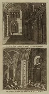
Background imageMaps Collection: View into the South Transept of St Albans Church, Hertfordshire; View of part of the Body

View into the South Transept of St Albans Church, Hertfordshire; View of part of the Body
7170429 View into the South Transept of St Albans Church, Hertfordshire; View of part of the Body and Ailes of St Albans Church (engraving) by English School

Background imageMaps Collection: A Perspective View of the Cathedral-Church of Chester, in Cheshire (engraving)

A Perspective View of the Cathedral-Church of Chester, in Cheshire (engraving)
7170416 A Perspective View of the Cathedral-Church of Chester, in Cheshire (engraving) by English School, (18th century); Private Collection; (add.info)

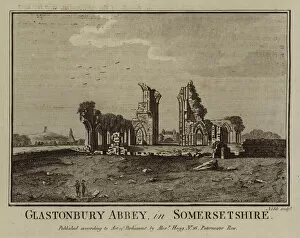
Background imageMaps Collection: Glastonbury Abbey, in Somersetshire (engraving)

Glastonbury Abbey, in Somersetshire (engraving)
7170399 Glastonbury Abbey, in Somersetshire (engraving) by English School, (18th century); Private Collection; (add.info.: Glastonbury Abbey, in Somersetshire)

Background imageMaps Collection: Fountains Abbey, in Yorkshire (engraving)

Fountains Abbey, in Yorkshire (engraving)
7170385 Fountains Abbey, in Yorkshire (engraving) by English School, (18th century); Private Collection; (add.info.: Fountains Abbey, in Yorkshire)

Background imageMaps Collection: Framlingham Castle, in Suffolk (engraving)

Framlingham Castle, in Suffolk (engraving)
7170350 Framlingham Castle, in Suffolk (engraving) by English School, (18th century); Private Collection; (add.info.: Framlingham Castle, in Suffolk)

Background imageMaps Collection: Netherhall, in Essex (engraving)

Netherhall, in Essex (engraving)
7170347 Netherhall, in Essex (engraving) by English School, (18th century); Private Collection; (add.info.: Netherhall, in Essex)

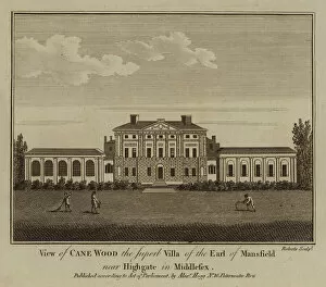
Background imageMaps Collection: View of Cane Wood the Superb Villa of the Earl of Mansfield, near Highgate in Middlesex (engraving)

View of Cane Wood the Superb Villa of the Earl of Mansfield, near Highgate in Middlesex (engraving)
7170346 View of Cane Wood the Superb Villa of the Earl of Mansfield, near Highgate in Middlesex (engraving) by English School

Background imageMaps Collection: The Cathedral Church of St Peter, at Glocester (engraving)

The Cathedral Church of St Peter, at Glocester (engraving)
7170341 The Cathedral Church of St Peter, at Glocester (engraving) by English School, (18th century); Private Collection; (add.info.: The Cathedral Church of St Peter, at Glocester)

Background imageMaps Collection: St Augustines Monastery, in Kent (engraving)

St Augustines Monastery, in Kent (engraving)
7170334 St Augustines Monastery, in Kent (engraving) by English School, (18th century); Private Collection; (add.info.: St Augustines Monastery, in Kent)

Background imageMaps Collection: Arches in the Wall of the City of Canterbury, in Kent (engraving)

Arches in the Wall of the City of Canterbury, in Kent (engraving)
7170332 Arches in the Wall of the City of Canterbury, in Kent (engraving) by English School, (18th century); Private Collection; (add.info.: Arches in the Wall of the City of Canterbury, in Kent)

Background imageMaps Collection: View of the Cathedral Church of Chichester in Sussex (engraving)

View of the Cathedral Church of Chichester in Sussex (engraving)
7170322 View of the Cathedral Church of Chichester in Sussex (engraving) by English School, (18th century); Private Collection; (add.info.: View of the Cathedral Church of Chichester in Sussex)

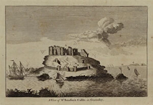
Background imageMaps Collection: A View of St Samsons Castle, in Guernsey (engraving)

A View of St Samsons Castle, in Guernsey (engraving)
7170283 A View of St Samsons Castle, in Guernsey (engraving) by English School, (18th century); Private Collection; (add.info.: A View of St Samsons Castle, in Guernsey)

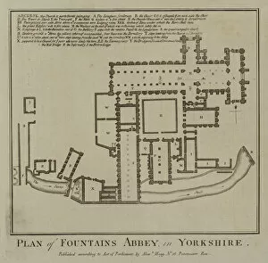
Background imageMaps Collection: Plan of Fountains Abbey, in Yorkshire (engraving)

Plan of Fountains Abbey, in Yorkshire (engraving)
7170254 Plan of Fountains Abbey, in Yorkshire (engraving) by English School, (18th century); Private Collection; (add.info.: Plan of Fountains Abbey, in Yorkshire)

Background imageMaps Collection: Hovedene Church, in Yorkshire (engraving)

Hovedene Church, in Yorkshire (engraving)
7170240 Hovedene Church, in Yorkshire (engraving) by English School, (18th century); Private Collection; (add.info.: Hovedene Church, in Yorkshire)

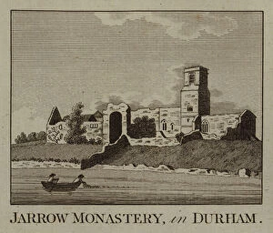
Background imageMaps Collection: Jarrow Monastery, in Durham (engraving)

Jarrow Monastery, in Durham (engraving)
7170232 Jarrow Monastery, in Durham (engraving) by English School, (18th century); Private Collection; (add.info.: Jarrow Monastery, in Durham)

Background imageMaps Collection: Hadleigh Castle, in Essex (engraving)

Hadleigh Castle, in Essex (engraving)
7170229 Hadleigh Castle, in Essex (engraving) by English School, (18th century); Private Collection; (add.info.: Hadleigh Castle, in Essex)

Background imageMaps Collection: Clithero Castle, in Lancashire (engraving)

Clithero Castle, in Lancashire (engraving)
7170192 Clithero Castle, in Lancashire (engraving) by English School, (18th century); Private Collection; (add.info.: Clithero Castle, in Lancashire)

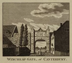
Background imageMaps Collection: Wincheap Gate, at Canterbury (engraving)

Wincheap Gate, at Canterbury (engraving)
7170187 Wincheap Gate, at Canterbury (engraving) by English School, (18th century); Private Collection; (add.info.: Wincheap Gate, at Canterbury)

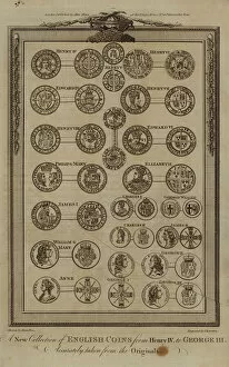
Background imageMaps Collection: A New Collection of English Coins from Henry IV to George III

A New Collection of English Coins from Henry IV to George III, Accurately taken from the Originals (engraving)
7170164 A New Collection of English Coins from Henry IV to George III, Accurately taken from the Originals (engraving) by English School

Background imageMaps Collection: The Gate of Tynemouth Castle, in Northumberland (engraving)

The Gate of Tynemouth Castle, in Northumberland (engraving)
7170426 The Gate of Tynemouth Castle, in Northumberland (engraving) by English School, (18th century); Private Collection; (add.info.: The Gate of Tynemouth Castle, in Northumberland)

Background imageMaps Collection: Warkworth Castle, in Northumberland (engraving)

Warkworth Castle, in Northumberland (engraving)
7170425 Warkworth Castle, in Northumberland (engraving) by English School, (18th century); Private Collection; (add.info.: Warkworth Castle, in Northumberland)

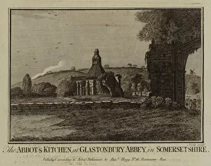
Background imageMaps Collection: The Abbots Kitchen, at Glastonbury Abbey, in Somersetshire (engraving)

The Abbots Kitchen, at Glastonbury Abbey, in Somersetshire (engraving)
7170398 The Abbots Kitchen, at Glastonbury Abbey, in Somersetshire (engraving) by English School, (18th century); Private Collection; (add.info.: The Abbots Kitchen, at Glastonbury Abbey)

Background imageMaps Collection: The Garden View of the Priory at Hitchin in Hertfordshire (engraving)

The Garden View of the Priory at Hitchin in Hertfordshire (engraving)
7170390 The Garden View of the Priory at Hitchin in Hertfordshire (engraving) by English School, (18th century); Private Collection; (add.info)

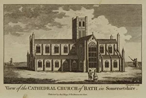
Background imageMaps Collection: View of the Cathedral Church of Bath in Somersetshire (engraving)

View of the Cathedral Church of Bath in Somersetshire (engraving)
7170371 View of the Cathedral Church of Bath in Somersetshire (engraving) by English School, (18th century); Private Collection; (add.info.: View of the Cathedral Church of Bath in Somersetshire)

Background imageMaps Collection: Inchcolm Abbey, in the Firth of Forth (engraving)

Inchcolm Abbey, in the Firth of Forth (engraving)
7170267 Inchcolm Abbey, in the Firth of Forth (engraving) by English School, (18th century); Private Collection; (add.info.: Inchcolm Abbey, in the Firth of Forth)

Background imageMaps Collection: Bliburgh Priory, in Suffolk (engraving)

Bliburgh Priory, in Suffolk (engraving)
7170258 Bliburgh Priory, in Suffolk (engraving) by English School, (18th century); Private Collection; (add.info.: Bliburgh Priory, in Suffolk)


All Professionally Made to Order for Quick Shipping


-

Maps Collection

Wales is a country located in the United Kingdom, and it has been mapped for centuries. Maps of Wales have been used to document its geography, topography, and infrastructure. These they are be found in various formats such as paper maps, online maps, and digital GIS systems. They provide detailed information about the physical features of Wales such as mountains, rivers, lakes, roads and railways. Additionally they also show political boundaries between countries within Europe that border Wales such as England and Ireland. Maps of Wales are an invaluable resource for anyone wanting to explore this beautiful country or understand its history better.
+

Our beautiful pictures are available as Framed Prints, Photos, Wall Art and Photo Gifts

Media Storehouse offers a collection of Maps of Wales United Kingdom Europe, which includes various wall art options such as framed prints, photo prints, canvas prints, jigsaw puzzles and greeting cards. The maps showcase the geography and topography of Wales in detail with different scales and styles. Our collection features historical maps from the 16th century to modern-day versions that highlight the country's political boundaries, cities, towns and natural landmarks. These maps are perfect for those interested in Welsh history or geography enthusiasts who want to explore the region's diverse landscapes. The Media Storehouse Maps of Wales United Kingdom Europe collection is an excellent way to add character to any room while also providing educational value. Whether it be for personal use or as a gift idea for someone special, these maps offer something unique that can't be found elsewhere. With so many options available at affordable prices, anyone can find their ideal map print or puzzle within this extensive collection.
+

What are Maps of Wales United Kingdom Europe art prints?

Maps of Wales United Kingdom Europe art prints are high-quality reproductions of historical and contemporary maps that depict the geography, topography, and landmarks of Wales, the United Kingdom, and Europe. These prints showcase the intricate details of each map in stunning clarity and vivid colors. They are perfect for anyone who loves history, geography or wants to add a touch of sophistication to their home decor. These art prints come in various sizes and styles to suit different tastes and preferences. Some feature antique maps from centuries ago while others show modern-day roadmaps with detailed information on cities, towns, highways, rivers, mountains among others. The Maps of Wales United Kingdom Europe art prints make great gifts for students studying geography or history as well as those who have an interest in cartography. Overall these beautiful pieces offer a unique way to explore the rich cultural heritage of Wales UK & Europe through its landscapes depicted on paper.
+

What Maps of Wales United Kingdom Europe art prints can I buy from Media Storehouse?

We offer a wide range of Maps of Wales United Kingdom Europe art prints that showcase the beauty and diversity of this region. You can choose from vintage maps, contemporary designs, and everything in between. These prints are available in various sizes to suit your needs and preferences. Some popular options include antique maps that depict the historical boundaries of Wales or detailed topographical maps that highlight its natural features. You can also find artistic renditions that capture the unique character and charm of Welsh towns and cities. Whether you're looking for a decorative piece for your home or office, or you want to gift someone with a meaningful keepsake, we have something for everyone. Their high-quality prints are produced using state-of-the-art printing technology on premium materials to ensure long-lasting durability and vibrant colors. With so many options to choose from, you're sure to find the perfect map print that captures your love for Wales United Kingdom Europe.
+

How do I buy Maps of Wales United Kingdom Europe art prints?

To purchase Maps of Wales United Kingdom Europe art prints, you can visit our online gallery. We offer a wide range of high-quality maps that are perfect for decorating your home or office space. You can browse through our collection and select the map that best suits your preferences. Once you have selected the map, you can choose from various sizes and framing options to customize it according to your needs. We offer a variety of frames such as black wood, white wood, silver metal, and gold metal. To complete your order, simply add the item to your cart and proceed to checkout. You will be prompted to enter your shipping information and payment details before submitting the order. Media Storehouse ensures that all their products are printed on high-quality paper using state-of-the-art printing technology. This guarantees that you receive a beautiful piece of artwork that is both durable and visually stunning.
+

How much do Maps of Wales United Kingdom Europe art prints cost?

We offer a wide range of Maps of Wales United Kingdom Europe art prints at varying prices. Our collection includes vintage and contemporary maps that showcase the beauty and history of Wales, the United Kingdom, and Europe as a whole. The cost of these prints depends on several factors such as size, framing options, and paper quality. Our you can choose from different sizes ranging from small to large formats to suit their needs. We also provide various framing options such as black or white frames that complement the artwork's style. Additionally, our high-quality paper ensures that each print is durable and long-lasting. Whether you're looking for a unique piece to decorate your home or office space or searching for an ideal gift for someone special who loves maps, we have something for everyone in our collection. So explore our website today to discover beautiful Maps of Wales United Kingdom Europe art prints at affordable prices.
+

How will my Maps of Wales United Kingdom Europe art prints be delivered to me?

We take great care in ensuring that your Maps of Wales United Kingdom Europe art prints are delivered to you safely and securely. We use high-quality packaging materials to protect your artwork during transit, so it arrives at your doorstep in pristine condition. We work with trusted delivery partners who have a proven track record for delivering packages on time and without any damage. Depending on where you live, we may use different carriers to ensure the fastest possible delivery times. Once your order is dispatched from our warehouse, you will receive an email notification with tracking information so that you can keep tabs on its progress. If there are any issues with the delivery or if you have any questions about your order, our customer service team is always available to assist you. We strive to make sure that receiving your Maps of Wales United Kingdom Europe art prints is a hassle-free experience that leaves you completely satisfied with both the product and service provided by Media Storehouse.