Home > Europe > United Kingdom > Heritage Sites > Maritime Greenwich
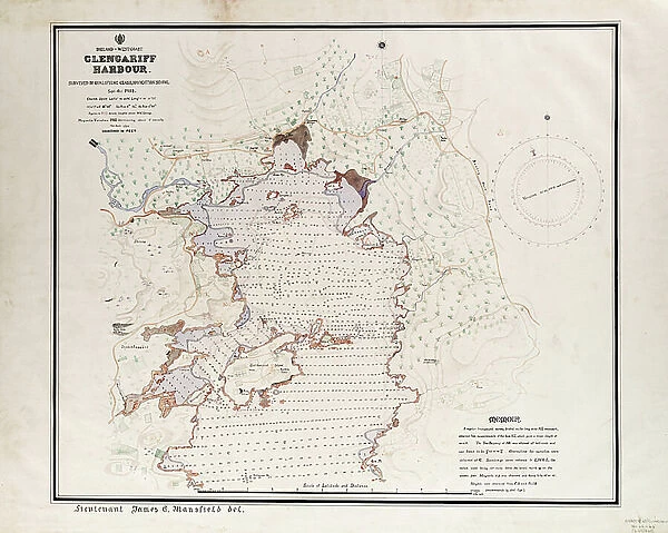
Ireland - West Coast, Glengariff Harbour. Surveyed by Qualifying Class, Navigation School Sept - Oct 1912., 1912 (paper, ink, watercolour, linen)
![]()

Wall Art and Photo Gifts from Fine Art Finder
Ireland - West Coast, Glengariff Harbour. Surveyed by Qualifying Class, Navigation School Sept - Oct 1912., 1912 (paper, ink, watercolour, linen)
7339437 Ireland - West Coast, Glengariff Harbour. Surveyed by Qualifying Class, Navigation School Sept - Oct 1912., 1912 (paper, ink, watercolour, linen) by British School, (20th century) ; 60x69 cm; National Maritime Museum, London, UK; (add.info.: Creator: James C. Mansfield
Single sheet. Coloured manuscript, drawn in ink and watercolour on linen-backed paper. Scale: 1:6,084. The bar scale is in sea miles and the soundings are in feet. The chart is ungraduated and contains a memoir on the surveying method at bottom left: .
A detailed and attractive chart of part of Bantry Bay, surveyed and drawn by Lt Mansfield as a training exercise.); © National Maritime Museum, Greenwich, London
Media ID 38509926
© © National Maritime Museum, Greenwich, London / Bridgeman Images
Boat Dock Coast Line Harbor Area Harbour Area Harbours Ireland Irish Port Area Watercolors Watercolour Paint 1900 1910 Years 10 10s 1910 1919 Years 10 10s Years 1910 Years 10 Years Ten
FEATURES IN THESE COLLECTIONS
> Europe
> United Kingdom
> Heritage Sites
> Maritime Greenwich
> Fine Art Finder
> Artists
> British School
EDITORS COMMENTS
This stunning print captures the beauty of Ireland's West Coast, specifically Glengariff Harbour, as surveyed by the Qualifying Class of Navigation School in September - October 1912. The intricate details and vibrant colors of this piece showcase the talent and precision of British School artists from the early 20th century.
The chart, drawn on linen-backed paper with ink and watercolor, provides a detailed view of part of Bantry Bay, complete with soundings in feet and a bar scale in sea miles. Lt Mansfield's training exercise resulted in a visually captivating map that highlights the coastal landscape and maritime features of the region.
As you gaze upon this historical artifact from the National Maritime Museum in London, you can almost feel yourself transported back to a time when sailors relied on hand-drawn charts like these for navigation. The artistry and skill involved in creating such a piece are truly remarkable, serving as both a practical tool for seafaring travelers and a work of art for admirers of cartography.
Let this image immerse you in the rich history and natural beauty of Ireland's coastline, offering a glimpse into an era when exploration was guided by meticulous craftsmanship and attention to detail.
MADE IN AUSTRALIA
Safe Shipping with 30 Day Money Back Guarantee
FREE PERSONALISATION*
We are proud to offer a range of customisation features including Personalised Captions, Color Filters and Picture Zoom Tools
SECURE PAYMENTS
We happily accept a wide range of payment options so you can pay for the things you need in the way that is most convenient for you
* Options may vary by product and licensing agreement. Zoomed Pictures can be adjusted in the Cart.

