Home > Arts > Landscape paintings > Waterfall and river artworks > River artworks
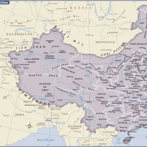
Sketch Map, exhibiting the Variations of the Two Great Rivers of China within the Period of History (colour litho)
")
![]()
Wall Art and Photo Gifts from Fine Art Finder
Sketch Map, exhibiting the Variations of the Two Great Rivers of China within the Period of History (colour litho)
3628576 Sketch Map, exhibiting the Variations of the Two Great Rivers of China within the Period of History (colour litho) by English School, (20th century); Private Collection; (add.info.: Sketch Map, exhibiting the Variations of the Two Great Rivers of China within the Period of History. Illustration for The Book of Ser Marco Polo, translated and edited by Henry Yule (3rd edn, John Murray, 1921).); © Look and Learn
Media ID 22985254
© Look and Learn / Bridgeman Images
Exhibiting Far East Journeys Marco Polo Sketch Map Travels Chineses Variations
FEATURES IN THESE COLLECTIONS
> Arts
> Artists
> Related Images
> Arts
> Landscape paintings
> Waterfall and river artworks
> River artworks
> Fine Art Finder
> Artists
> English School
> Maps and Charts
> Early Maps
EDITORS COMMENTS
This print showcases a Sketch Map that vividly illustrates the ever-changing paths of the Two Great Rivers of China throughout history. Created by an English School artist in the 20th century, this colour lithograph is part of a private collection and holds immense historical significance. The map was originally featured in The Book of Ser Marco Polo, translated and edited by Henry Yule in its third edition published by John Murray in 1921. It beautifully captures the extensive journeys undertaken by Marco Polo during his travels through China and Asia. As we delve into this mesmerizing piece, we are transported back to a time when exploration and discovery were at their peak. The intricate details on this sketch map allow us to trace the routes taken by these great rivers over centuries, offering valuable insights into Chinese history. With its rich hues and meticulous craftsmanship, this artwork takes us on a visual journey through time. It serves as a testament to the remarkable cultural heritage found within China's borders while also highlighting the significant role played by explorers like Marco Polo in bridging East and West. This photograph print from Bridgeman Images not only celebrates our fascination with travel but also reminds us of how interconnected our world truly is.
MADE IN AUSTRALIA
Safe Shipping with 30 Day Money Back Guarantee
FREE PERSONALISATION*
We are proud to offer a range of customisation features including Personalised Captions, Color Filters and Picture Zoom Tools
SECURE PAYMENTS
We happily accept a wide range of payment options so you can pay for the things you need in the way that is most convenient for you
* Options may vary by product and licensing agreement. Zoomed Pictures can be adjusted in the Cart.