Home > Maps and Charts > Early Maps
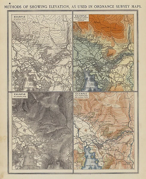
Methods of showing Elevation, as used in Ordnance Survey Maps (colour litho)
![]()

Wall Art and Photo Gifts from Fine Art Finder
Methods of showing Elevation, as used in Ordnance Survey Maps (colour litho)
8658791 Methods of showing Elevation, as used in Ordnance Survey Maps (colour litho) by English School, (20th century); Private Collection; (add.info.: Methods of showing Elevation, as used in Ordnance Survey Maps. Illustration for The London School Atlas edited by H O Arnold-Forster (London School Atlas Company, 1904 or earlier).); © Look and Learn
Media ID 38384334
© © Look and Learn / Bridgeman Images
FEATURES IN THESE COLLECTIONS
> Fine Art Finder
> Artists
> English School
> Fine Art Finder
> Artists
> Harold Copping
> Maps and Charts
> Early Maps
EDITORS COMMENTS
This print showcases the intricate methods of showing elevation as used in Ordnance Survey Maps, a crucial tool for understanding and navigating geographical terrain. The detailed colour lithograph, created by an English School artist in the early 20th century, is a visual representation of the complex yet essential cartographic techniques employed to accurately depict varying elevations on maps.
The illustration, originally featured in The London School Atlas edited by H.O. Arnold-Forster, offers a glimpse into the meticulous craftsmanship and attention to detail required in mapmaking during this era. Each line and symbol serves a specific purpose in conveying elevation information, highlighting the expertise and precision involved in creating accurate representations of landscapes.
As we admire this historical artwork, we are reminded of the importance of cartography in shaping our understanding of geography and topography. The blend of artistry and science evident in this print exemplifies the dedication and skill required to produce informative and visually appealing maps that aid explorers, hikers, geographers, and enthusiasts alike.
Whether studying it for educational purposes or simply appreciating its aesthetic value, this print serves as a testament to the enduring significance of mapping techniques throughout history. It stands as a tribute to those who have dedicated their talents to charting our world with accuracy and beauty.
MADE IN AUSTRALIA
Safe Shipping with 30 Day Money Back Guarantee
FREE PERSONALISATION*
We are proud to offer a range of customisation features including Personalised Captions, Color Filters and Picture Zoom Tools
SECURE PAYMENTS
We happily accept a wide range of payment options so you can pay for the things you need in the way that is most convenient for you
* Options may vary by product and licensing agreement. Zoomed Pictures can be adjusted in the Cart.


