Fraud Blocker Skip to main content

Home > Maps and Charts > Related Images

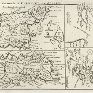
Antique map, Channel Island, Jersey, Guernsey, Alderney 19th Century

Antique map, Channel Island, Jersey, Guernsey, Alderney 19th Century
Sold 3
In Stock
We accept all major credit cards

Fine Art Storehouse Photo Prints and Wall Art

Antique map, Channel Island, Jersey, Guernsey, Alderney 19th Century

Vintage engraving of a Antique map, Channel Island, Jersey, Guernsey, Alderney 19th Century with detail of St Helier. Unleash your creativity and transform your space into a visual masterpiece. © This content is subject to copyright

duncan1890

Media ID 15231367

Alderney

FEATURES IN THESE COLLECTIONS

> Fine Art Storehouse > Map > Historical Maps

> Fine Art Storehouse > Map

> Maps and Charts > Related Images

SECURE PAYMENTS
We happily accept a wide range of payment options so you can pay for the things you need in the way that is most convenient for you

MADE IN AUSTRALIA
Safe Shipping with 30 Day Money Back Guarantee

FREE PERSONALISATION
We are proud to offer a range of customisation including Cropping, Captions, and Filters. Zoom Cropping can be adjusted in the Basket.


EDITORS COMMENTS

This print takes us back in time to the 19th century, where we find ourselves immersed in the beauty and intricacy of an antique map showcasing the Channel Islands. The islands of Jersey, Guernsey, and Alderney are brought to life through this vintage engraving, capturing our attention with its remarkable detail. As we gaze upon this piece, our eyes are immediately drawn to St Helier, a focal point that stands out amidst the surrounding islands. The artist's skillful hand has meticulously crafted every line and curve on this map, allowing us to appreciate the artistry involved in creating such a historical document. The warm tones and aged texture of this print evoke a sense of nostalgia as we imagine what life was like during that era. It transports us to a time when exploration was at its peak and maps were essential tools for navigation. Whether you have a personal connection to these Channel Islands or simply admire their rich history, this print is sure to be a cherished addition to any collection. Its timeless appeal will captivate viewers from all walks of life while serving as a reminder of the importance of preserving our past for future generations.


Framed Prints

Discover the rich history of the Channel Islands with our stunning Framed Print of "Antique map, Channel Island, Jersey, Guernsey, Alderney 19th Century" by duncan1890 from the Media Storehouse Fine Art collection. This beautiful vintage engraving transports you back in time, showcasing intricate detail of St Helier, the largest town in Jersey, and the islands of Guernsey and Alderney. Add a touch of history and character to your home or office with this exquisite piece of art. The high-quality print is carefully framed to preserve its antique charm, making it a perfect addition to any decor. Bring the beauty of the past into your present with Media Storehouse's Framed Print collection.


Photo Prints

Discover the rich history of the Channel Islands with this stunning antique map print from the Media Storehouse range at Fine Art Storehouse. This vintage engraving, created in the 19th century by duncan1890, beautifully captures the detail of Jersey, Guernsey, and Alderley. The intricate depiction of St. Helier, the capital of Jersey, adds an extra layer of interest to this historical piece. Bring a touch of the past into your home or office with this authentic and captivating antique map print.


Poster Prints

Discover the charm of the past with our exquisite selection of Antique Map Poster Prints from the Media Storehouse and Fine Art Storehouse range. This particular print showcases a stunning vintage engraving of the Channel Islands, featuring Jersey, Guernsey, and Alderney in the 19th century. The intricate detailing of this antique map is truly captivating, with a special focus on St Helier, the capital of Jersey. Bring history into your home or office with this beautiful, vintage piece that transports you back in time. Order now and let the enchanting allure of the past adorn your walls.


Jigsaw Puzzles

Discover the rich history and intricate details of the Channel Islands with our stunning antique map jigsaw puzzle from the Media Storehouse collection. This beautiful vintage engraving, created by duncan1890 from Fine Art Storehouse, showcases a captivating image of Jersey, Guernsey, and Alderney from the 19th century. Marvel at the intricate depiction of St. Helier and other notable landmarks, all waiting to be pieced together in this captivating puzzle. Immerse yourself in a world of history and bring the past to life with this exquisite antique map puzzle.

diamond
Made With High Grade Materials
thumb_up
Professional Quality Finish
package_2
Carefully Packed To Aid Safe Arrival

You May Also Like


Map / Channel Islands 18CMap / Channel Islands 18C
Add to Basket
Cobo Bay, Guernsey, Channel Islands, United Kingdom, EuropeCobo Bay, Guernsey, Channel Islands, United Kingdom, Europe
Add to Basket
Map of LondonMap of London
Add to Basket
St. Peter Port at dusk, Guernsey, Channel Islands, UKSt. Peter Port at dusk, Guernsey, Channel Islands, UK
Add to Basket
Map of London 1894Map of London 1894
Add to Basket
Walliss Guide for Strangers Through London, 1841 (colour litho)Walliss Guide for Strangers Through London, 1841 (colour litho)
Add to Basket
Alderney HarbourAlderney Harbour
Add to Basket
Poster, Guernsey AirwaysPoster, Guernsey Airways
Add to Basket
Battle Of GuernseyBattle Of Guernsey
Add to Basket
Keown Parlour 040501AFC. jpgKeown Parlour 040501AFC. jpg
Add to Basket
Arsene Wenger the Arsenal manager and Thirry Henry (Arsenal)Arsene Wenger the Arsenal manager and Thirry Henry (Arsenal)
Add to Basket
Leroy Lita runs to the Reading fans after scoring against ChelseaLeroy Lita runs to the Reading fans after scoring against Chelsea
Add to Basket

Gallery Wall Inspiration

Map Of New Holland
Antique map of Britain under the Anglo Saxons
Antique map of Britain under the Ancient Romans
Carte du Tendre: imaginary map by a character in the novel Cl├®lie
Map of Exeter in Devon, England Victorian Engraving, 1840
Map of Anglo-Saxon Kingdoms and the Danelaw, 9th Century
England in the Ninth Century
Map of Devon 1883
Newfoundland map 1884
Map of Middle East - illustration
Antique map of the Roman Empire
Old engraved map of Battle of Naseby (14. 06. 1645)
Map of Cyprus, published in 1880
Apostle Pauls Missionary Journeys, lithograph, published in 1886
Battle Of Waterloo
Map of Ireland 1897
Cornwall map 1884
Sicily map 1895
Antique map of Tasmania
Old map of Australia 1899
Ethnological map of the Austro-Hungarian Empire, lithograph, published in 1897
Map of Whitby
Antique map, Scotland, Isle of Skye, South and North Uist
Earth map according to Herodotus
Antique map of Hadrians wall
Antique map of Ireland
Old Caucasus map

Discover Our Collections


MapMap
View Collection
Maps and Charts Related ImagesMaps and Charts Related Images
View Collection
Historical MapsHistorical Maps
View Collection


© Copyright Media Storehouse, All Rights Reserved 2003 - 2024
Facebook     Pinterest     Card Payments     Reviews IO