Home > Africa > South Africa > Maps
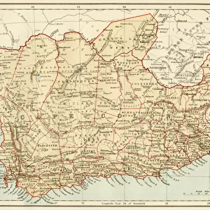
Map of South Africa during the Second Boer War, 1899-1902
![]()

Wall Art and Photo Gifts from Fine Art Storehouse
Map of South Africa during the Second Boer War, 1899-1902
Topographic map of South Africa during the Second Anglo Boer War (11 October 1899 - 31 May 1902). Lithograph, published in 1900
Unleash your creativity and transform your space into a visual masterpiece!
ZU_09
Media ID 35842694
FEATURES IN THESE COLLECTIONS
> Africa
> South Africa
> Maps
> Fine Art Storehouse
> Map
> Historical Maps
> Maps and Charts
> Early Maps
EDITORS COMMENTS
This topographic map of South Africa, published in 1900, provides a detailed and intricate depiction of the region during the Second Boer War, which took place between October 11, 1899, and May 31, 1902. The conflict arose from the resistance of two Boer republics, the Transvaal and the Orange Free State, against the British Empire's encroachment on their territories. The map highlights the strategic locations of major towns, rivers, railways, and roads during the war. The British forces, represented in red, are shown advancing from the ports of Cape Town and Durban towards the interior of the country, where the Boer Republics were located. The Boer forces, depicted in blue, are shown defending their territories, with their strongholds and fortifications clearly marked. The map also shows the vast expanses of the African savannah and the rugged terrain of the Drakensberg Mountains, which provided challenging conditions for both sides during the war. The intricate detail of the map reflects the extensive surveying and cartographic expertise required to create an accurate representation of the region during this time of conflict. The Second Boer War was marked by brutal fighting and guerrilla warfare, with both sides employing scorched earth tactics and targeting civilian populations. The conflict resulted in significant loss of life and property, and ultimately led to the eventual defeat of the Boer Republics and the consolidation of British rule in South Africa. This map serves as an important historical document, providing a visual representation of the complex geography and military strategies employed during the Second Boer War. It offers a glimpse into the past, shedding light on the political and military dynamics of the region during a pivotal moment in South African history.
MADE IN AUSTRALIA
Safe Shipping with 30 Day Money Back Guarantee
FREE PERSONALISATION*
We are proud to offer a range of customisation features including Personalised Captions, Color Filters and Picture Zoom Tools
SECURE PAYMENTS
We happily accept a wide range of payment options so you can pay for the things you need in the way that is most convenient for you
* Options may vary by product and licensing agreement. Zoomed Pictures can be adjusted in the Cart.


