Home > Maps and Charts > Early Maps
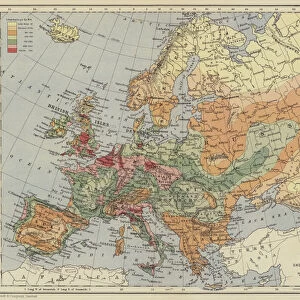
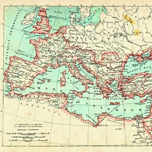
Population density in Europe in 19th century

![]()
Wall Art and Photo Gifts from Fine Art Storehouse
Population density in Europe in 19th century
Illustration of a Population density in Europe in 19th century
Unleash your creativity and transform your space into a visual masterpiece!
Nastasic
Media ID 15309450
© This content is subject to copyright
FEATURES IN THESE COLLECTIONS
> Europe
> Related Images
> Fine Art Storehouse
> Map
> Historical Maps
> Maps and Charts
> Early Maps
EDITORS COMMENTS
This print titled "Population density in Europe in the 19th century" takes us on a visual journey back in time. Created by the talented artist Nastasic, this illustration offers a unique perspective on the population distribution across Europe during that era. As we gaze upon this artwork, our eyes are immediately drawn to the intricate details and vibrant colors that bring each region to life. The artist skillfully captures the essence of this historical period, providing us with a glimpse into how people were dispersed throughout Europe at that time. The image showcases varying shades and gradients, representing different levels of population density across countries and regions. From densely populated urban centers to sparsely inhabited rural areas, every corner of Europe is meticulously depicted. Through this thought-provoking piece, we are reminded of how human settlements have evolved over centuries and how they continue to shape our societies today. It serves as a reminder of the interconnectedness between geography, culture, and demography. Nastasic's artistic prowess shines through as he successfully conveys complex information using visuals alone. This print not only appeals to history enthusiasts but also sparks curiosity among those interested in demographics or European studies. Whether displayed in homes or educational institutions alike, "Population density in Europe in the 19th century" is an exquisite work of art that invites viewers to delve deeper into understanding our past while appreciating its aesthetic beauty.
MADE IN AUSTRALIA
Safe Shipping with 30 Day Money Back Guarantee
FREE PERSONALISATION*
We are proud to offer a range of customisation features including Personalised Captions, Color Filters and Picture Zoom Tools
SECURE PAYMENTS
We happily accept a wide range of payment options so you can pay for the things you need in the way that is most convenient for you
* Options may vary by product and licensing agreement. Zoomed Pictures can be adjusted in the Cart.