Home > Maps and Charts > Early Maps
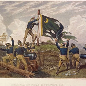
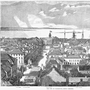
Plan of the Siege of Charleston, American Revolutionary War

![]()
Wall Art and Photo Gifts from Fine Art Storehouse
Plan of the Siege of Charleston, American Revolutionary War
Vintage engraving of a Plan of the Siege of Charleston a major engagement and major British victory, fought between March 29 to May 12, 1780 during the American Revolutionary War
Unleash your creativity and transform your space into a visual masterpiece!
duncan1890
Media ID 19684471
© of Duncan P Walker
FEATURES IN THESE COLLECTIONS
> Fine Art Storehouse
> History
> Battles & Wars
> Historcal Battle Maps and Plans
> Fine Art Storehouse
> Map
> Historical Maps
> Maps and Charts
> Early Maps
EDITORS COMMENTS
This vintage engraving captures the historical significance of the Siege of Charleston, a major engagement during the American Revolutionary War. The print showcases a meticulously detailed plan of the siege, offering viewers a glimpse into this pivotal moment in history. Taking place between March 29 and May 12,1780, the Siege of Charleston was marked by intense fighting and strategic maneuvers that ultimately resulted in a resounding victory for the British forces. This print serves as an important visual representation of this significant event. The intricate engravings depict various elements such as fortifications, troop movements, and artillery placements employed by both sides during the battle. It offers viewers an opportunity to delve into the tactical intricacies involved in this historic conflict. As we observe this image today, it reminds us of how far-reaching and impactful these events were on shaping our nation's history. The Siege of Charleston played a crucial role in determining America's path towards independence. Duncan1890's masterful reproduction allows us to appreciate not only his artistic skill but also provides us with an invaluable window into one of America's most defining moments. This print is more than just an artwork; it is a testament to bravery, strategy, and sacrifice exhibited by those who fought for freedom during that tumultuous time.
MADE IN AUSTRALIA
Safe Shipping with 30 Day Money Back Guarantee
FREE PERSONALISATION*
We are proud to offer a range of customisation features including Personalised Captions, Color Filters and Picture Zoom Tools
SECURE PAYMENTS
We happily accept a wide range of payment options so you can pay for the things you need in the way that is most convenient for you
* Options may vary by product and licensing agreement. Zoomed Pictures can be adjusted in the Cart.