




Framed Prints From MapSeeker
Framed Print of Old Street Map of The Strand, West End and River Thames 1908
Detailed colour Street Plan of London from 1908 covering the area around The Strand, The West End and the River Thames.The image has been remastered from Bartholomews Handy Atlas of London and Suburbs 1908. Welcome to the Mapseeker Image library and enter an historic gateway to one of the largest on-line collections of Historic Maps, Nostalgic Views, Vista's and Panorama's from a World gone by. © Mapseeker Publishing Ltd, Collins Bartholomew Ltd
Artwork supplied by MapSeeker (London Street Plan - Map Plate Remastered from the pages of Bartholomews Handy Atlas of London and Suburbs 1908 by Mapseeker Publishing courtesy of the Collins Bartholomew Map Archive)
Your chosen combination is quickly and professionally made to order, our shipping page has more details
If you are not entirely happy with your items, simply return them to us within 30 days for a replacement or full refund. Please read our full returns policy.
Media ID 20347773
Editors Comments
Step back in time with our Old Street Map of The Strand, West End and River Thames 1908 by John Bartholomew. This beautifully remastered print, published by MapSeeker, shows a detailed colour Street Plan of London from 1908. Explore the history of the area around The Strand, The West End, and the River Thames with this intricately detailed map. A perfect addition to any home or office, this framed print is a great conversation starter and a way to appreciate the evolution of London's streets over the years.
This artwork is also available as...
Photo Prints - Step back in time with our vintage photographic print of an Old Street Map of The Strand, West End and River Thames from 1908. This beautiful, detailed image, published by MapSeeker and Collins BartholomewMapseeker Publishing, is taken from the renowned Bartholomew's Handy Atlas of London. Carefully remastered, the print shows the historical street plan of London's West End and The Strand, as well as the River Thames, capturing the essence of this iconic city in a bygone era. A perfect addition to your home or office, this print is not just a map, but a window into London's rich history.
Greetings Cards - Step back in time with our Old Street Map of The Strand, West End and River Thames 1908. This beautifully remastered greeting card features an intricately detailed color street plan of London, taken from the renowned Bartholomew's Handy Atlas of London published by Collins BartholomewMapseeker Publishing in 1908. Ideal for history enthusiasts or as a thoughtful gift for someone with a connection to London, this vintage map card is a way to add a touch of nostalgia to your correspondence.
Photo Mugs - Step back in time with our Photo Mug featuring an old street map of The Strand, West End, and River Thames from 1908. This vintage map, published by Collins BartholomewMapseeker Publishing, is a detailed and colourful representation of London's history. The image has been meticulously remastered from the original Bartholomew's Handy Atlas of London. Each sip from this mug will transport you back to the early 20th century, making it a thoughtful gift for history enthusiasts and London lovers alike.
Poster Prints - Step back in time with our Old Street Map of The Strand, West End and River Thames 1908 by John Bartholomew from MapSeeker Publishing. This poster print is a detailed and colourful representation of London's historic street plan, taken from the renowned Bartholomew's Handy Atlas of London. Perfect for those who love history or are fascinated by the evolution of cities, this beautifully remastered image transports you back over a century to explore the West End, The Strand and the River Thames as they once were. Bring a piece of London's rich history into your home or office with this poster print.
Metal Prints - Step back in time with our vintage Old Street Map of The Strand, West End, and River Thames 1908 by John Bartholomew. This detailed and colourful street plan, published by Collins BartholomewMapseeker Publishing, is a remastered image from the Handy Atlas of London. Bring the history of London's iconic landmarks and bustling streets into your home or office with our Metal Print. Each print is meticulously crafted to preserve the intricate details and rich colours of the original map, ensuring a addition to your decor. Order now and travel back in time with every glance.
Canvas Prints - Step back in time with our vintage Canvas Print of the Old Street Map of The Strand, West End and River Thames 1908 by John Bartholomew, published by Collins BartholomewMapseeker. This beautifully detailed and remastered image from the Bartholomew's Handy Atlas of London offers a glimpse into the history of London around The Strand, The West End, and the River Thames. Bring the rich heritage of this iconic city into your home or office with this intriguing piece of art. Perfect for map enthusiasts, history buffs, or anyone who appreciates the beauty of the past.
Cushions - Step back in time and transport yourself to the charming streets of London's West End as seen on this 1908 map. cushion features a reproduction of John Bartholomew's original artwork, bringing the nostalgia and romance of a bygone era into your home. Perfect for anyone who loves history, travel or just wants to add a touch of classic charm to their space.
Mouse Mats - Step into the past with our Mouse Mats, featuring a 1908 map of London's iconic The Strand and River Thames. This beautifully detailed colour street plan shows the city's rich history, transporting you to an era of horse-drawn carriages and vintage charm.
Premium Frame A1 (A2 Poster)
Ready to Hang Contemporary Framed Prints adds style, protection, and a polished touch to your space - effortlessly.
Your artwork will be printed as shown in the preview. To adjust please select Edit Printed Image under the Buy button
Premium Paradise Wooden Range A1 Premium Poster Frame (86x62cm) with A2 Poster (59x42cm) and mounted behind a white matt board to make your photo really stand out. FSC Certified and Rainforest Alliance Certified for environmental, social, and economic sustainably. High transparency tempered glass window with a smooth finished frame. Great for filling empty walls, decorating blank spaces, or creating eye-catching gallery walls. Frames arrive ready to hang. Sent with secure, protective packaging. Smooth wooden veneer mimics the real wood look and feel with ultra-durable scratch resistance tempered glass. Note: measurements provided are estimated outer dimensions, which include both the image and the frame. While we aim to keep sizing consistent, exact dimensions may vary slightly due to differences in print size or production requirements, which may result in a variation in the overall size (up to approximately 2.5cm (1"))
These are individually made so all sizes are approximate
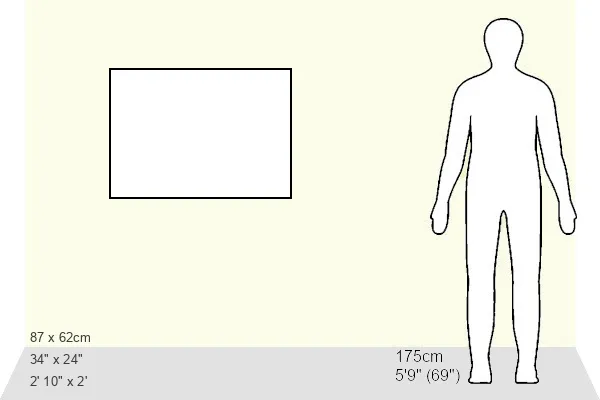
Estimated Image Size (if not cropped) is 58.8cm x 39.2cm (23.1" x 15.4")
Estimated Product Size is 86.6cm x 62cm (34.1" x 24.4")
Features In These Collections
> Europe > United Kingdom > England > London > River Thames
> MapSeeker > British Town and City Plans > English and Welsh PORTFOLIO