Fraud Blocker Skip to main content

Age Of Discovery Collection (page 7)

The Age of Discovery, a remarkable era in history, was characterized by the exploration and mapping of new territories

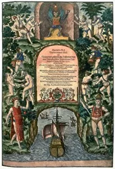
Background imageAge Of Discovery Collection: DE BRY: FRONTISPIECE. Frontispiece for a book about the discovery of the New World

DE BRY: FRONTISPIECE. Frontispiece for a book about the discovery of the New World. Color line engraving by Theodor de Bry, 16th century

Background imageAge Of Discovery Collection: NEW WORLD: VOYAGE, 1592. The departure of an exploratory voyage to the New World from Lisbon

NEW WORLD: VOYAGE, 1592. The departure of an exploratory voyage to the New World from Lisbon. Colored engraving, 1592, by Theodor de Bry

Background imageAge Of Discovery Collection: NEW WORLD: SPANISH, 1590. Departure of a Spanish voyage to the New World

NEW WORLD: SPANISH, 1590. Departure of a Spanish voyage to the New World. Engraving by Theodor de Bry, 1590

Background imageAge Of Discovery Collection: VERRAZZANO: MAP, 1542. Giovanni da Verrazzanos map of North America, entitled

VERRAZZANO: MAP, 1542. Giovanni da Verrazzanos map of North America, entitled, Regiones orbis terrar, issued in 1542

Background imageAge Of Discovery Collection: CABEZA de VACA (c1490-c1557). Alvar Nu├▒ez Cabeza de Vaca. Spanish explorer

CABEZA de VACA (c1490-c1557). Alvar Nu├▒ez Cabeza de Vaca. Spanish explorer. The arrival of Cabeza de Vaca and his companions

Background imageAge Of Discovery Collection: RIBAULT EXPEDITION, 1562. A French expedition under the command of Jean Ribault arrives at Port

RIBAULT EXPEDITION, 1562. A French expedition under the command of Jean Ribault arrives at Port Royal (present-day Beaufort), South Carolina, 1562

Background imageAge Of Discovery Collection: GERHARDUS MERCATOR (1512-1594). Flemish geographer. Wood engraving, 19th century

GERHARDUS MERCATOR (1512-1594). Flemish geographer. Wood engraving, 19th century

Background imageAge Of Discovery Collection: FLORIDA: MAP, 1591. Engraved map of Florida by Jacques Le Moyne de Morgues published by Theodor de

FLORIDA: MAP, 1591. Engraved map of Florida by Jacques Le Moyne de Morgues published by Theodor de Bry at Frankfort, 1591

Background imageAge Of Discovery Collection: COLUMBUS AT BARCELONA. Christopher Columbus at the court of Barcelona, Spain

COLUMBUS AT BARCELONA. Christopher Columbus at the court of Barcelona, Spain, following his return from the New World, 1493. Wood engraving, American, 19th century

Background imageAge Of Discovery Collection: MAP OF PERU, 1597. Engraved map from Cornelius Wytfliets Descriptionis Ptolemaicae Augmentum, 1597

MAP OF PERU, 1597. Engraved map from Cornelius Wytfliets Descriptionis Ptolemaicae Augmentum, 1597

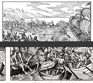
Background imageAge Of Discovery Collection: SANTA MARIA: WRECK, 1492. Natives of Hispaniola aid Christopher Columbus crew in salvaging

SANTA MARIA: WRECK, 1492. Natives of Hispaniola aid Christopher Columbus crew in salvaging supplies from the Santa Maria, wrecked on a coral reef, Christmas Day 1492; Columbus

Background imageAge Of Discovery Collection: SANTA MARIA: WRECK, 1492. / nNatives of Hispaniola aid Christopher Columbus crew

SANTA MARIA: WRECK, 1492. / nNatives of Hispaniola aid Christopher Columbus crew
SANTA MARIA: WRECK, 1492. /nNatives of Hispaniola aid Christopher Columbus crew in salvaging supplies from the Santa Maria, wrecked on a coral reef on Christmas Day 1492

Background imageAge Of Discovery Collection: AMERIGO VESPUCCI (1454-1512). / nItalian navigator

AMERIGO VESPUCCI (1454-1512). / nItalian navigator
AMERIGO VESPUCCI (1454-1512). /nItalian navigator. Vespucci and his crew beset by native Indians as they arrive on the coast of what is now Guiana during their voyage of 1499-1500

Background imageAge Of Discovery Collection: COLUMBUS AND THE EGG. Christopher Columbus and the Egg. Wood engraving, 19th century

COLUMBUS AND THE EGG. Christopher Columbus and the Egg. Wood engraving, 19th century

Background imageAge Of Discovery Collection: FLORIDA: FORT CAROLINE. Huguenot colonists at Fort Caroline, Florida building a ship to return

FLORIDA: FORT CAROLINE. Huguenot colonists at Fort Caroline, Florida building a ship to return them to France, 1562. Wood engraving, 19th century

Background imageAge Of Discovery Collection: COLUMBUS: JAMAICA, 1504. The inhabitants of Jamaica astonished by the eclipse of the moon predicted

COLUMBUS: JAMAICA, 1504. The inhabitants of Jamaica astonished by the eclipse of the moon predicted, with the aid of an almanac, by Christopher Columbus for the last night of February 1504

Background imageAge Of Discovery Collection: PANFILO de NARVAEZ, 1528. Panfilo de Narvaez (c1480-1528) and his companions reach the Gulf of

PANFILO de NARVAEZ, 1528. Panfilo de Narvaez (c1480-1528) and his companions reach the Gulf of Mexico after crossing Florida, 1528. Wood engraving, 19th century

Background imageAge Of Discovery Collection: JUAN PONCE DE LEON and his men searching for the Fountain of Youth: engraving, 19th century

JUAN PONCE DE LEON and his men searching for the Fountain of Youth: engraving, 19th century

Background imageAge Of Discovery Collection: ROANOKE FOUNDING, 1587. The founding of the English colony at Roanoke Island in 1587

ROANOKE FOUNDING, 1587. The founding of the English colony at Roanoke Island in 1587. Contrary to the engraved legend, Sir Walter Raleigh, though the promoter of the expedition

Background imageAge Of Discovery Collection: EXPLORATORY VOYAGE, 1592. The departure of an exploratory voyage to the New World from Lisbon, Spain

EXPLORATORY VOYAGE, 1592. The departure of an exploratory voyage to the New World from Lisbon, Spain. Line engraving, 1592

Background imageAge Of Discovery Collection: VASCO da GAMA: FLAGSHIP. The Sao Gabriel. Line engraving, 19th century

VASCO da GAMA: FLAGSHIP. The Sao Gabriel. Line engraving, 19th century

Background imageAge Of Discovery Collection: DE SOTO IN FLORIDA, 1539. The bivouac in Florida of Hernando de Sotos 1539 expedition

DE SOTO IN FLORIDA, 1539. The bivouac in Florida of Hernando de Sotos 1539 expedition. Wood engraving, 19th century

Background imageAge Of Discovery Collection: COLUMBUS: VOYAGE, 1492. Christopher Columbus (1451-1506) planning his voyage which resulted in his

COLUMBUS: VOYAGE, 1492. Christopher Columbus (1451-1506) planning his voyage which resulted in his discovery of America: steel engraving, 19th century

Background imageAge Of Discovery Collection: FRANCISCO de CORONADO (c1510-1554). Francisco Vasquez de Coronado. Spanish explorer

FRANCISCO de CORONADO (c1510-1554). Francisco Vasquez de Coronado. Spanish explorer. Map of Coronados expeditions to Cibola and Quivira in 1540. German, 19th century

Background imageAge Of Discovery Collection: ROANOKE: COLONY, c1587. The settlement at Roanoke Island, North Carolina, c1587

ROANOKE: COLONY, c1587. The settlement at Roanoke Island, North Carolina, c1587. Wood engraving, American, 19th century

Background imageAge Of Discovery Collection: MAP OF CHESAPEAKE BAY, 1590. Detail of Chesapeake Bay engraved by Theodor de Bry, 1590

MAP OF CHESAPEAKE BAY, 1590. Detail of Chesapeake Bay engraved by Theodor de Bry, 1590, after John White

Background imageAge Of Discovery Collection: SIR FRANCIS DRAKE (1540?-1596) encounters a Native American king in California

SIR FRANCIS DRAKE (1540?-1596) encounters a Native American king in California. Wood engraving, 19th century

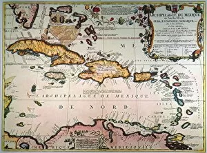
Background imageAge Of Discovery Collection: MAP: WEST INDIES. Engraved map of the West Indies published in Paris in 1688; the elaborately

MAP: WEST INDIES. Engraved map of the West Indies published in Paris in 1688; the elaborately embellished cartouche shows plants, animals, and natives of the region

Background imageAge Of Discovery Collection: GIOVANNI da VERRAZZANO (c1485-c1528). Florentine navigator. Line engraving, 19th century

GIOVANNI da VERRAZZANO (c1485-c1528). Florentine navigator. Line engraving, 19th century

Background imageAge Of Discovery Collection: MAGELLAN COMPASS. An early 16th century compass depicted in Antonio Pigafettas published account

MAGELLAN COMPASS. An early 16th century compass depicted in Antonio Pigafettas published account of Ferdinand Magellans circumnavigation of the earth

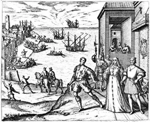
Background imageAge Of Discovery Collection: COLUMBUS: DEPARTURE, 1492. The departure of Christopher Columbus from Palos, Spain

COLUMBUS: DEPARTURE, 1492. The departure of Christopher Columbus from Palos, Spain, on 3 August 1492 (the presence of Ferdinand of Aragon and Isabella of Castile is symbolic and was not actual)

Background imageAge Of Discovery Collection: MAP OF NEW FRANCE, 1566. Engraved map of New France by Bolognino Zaltieri, published at Venice

MAP OF NEW FRANCE, 1566. Engraved map of New France by Bolognino Zaltieri, published at Venice, Itlay, in 1556. Zaltieris work is notable for being the first printed map to show the Strait of Anian

Background imageAge Of Discovery Collection: SIR GILBERT HUMPHREY (c1539-1583). English navigator and soldier

SIR GILBERT HUMPHREY (c1539-1583). English navigator and soldier. Gilbert taking possession of Newfoundland for Queen Elizabeth at St. Johns on 3 August 1583. Line engraving, 19th century

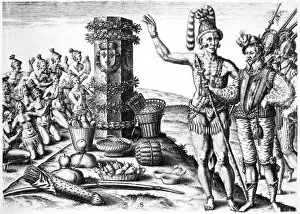
Background imageAge Of Discovery Collection: DE BRY: FLORIDA NATIVE AMERICANS. Rene de Laudonniere and the Florida Native Americans

DE BRY: FLORIDA NATIVE AMERICANS. Rene de Laudonniere and the Florida Native Americans. Copper engraving, 1591, by Theodor de Bry after Jacques Le Moyne de Morgues

Background imageAge Of Discovery Collection: WORLD MAP: GRYNAEUS. Detail from the Grynaeus world map, attributed to Hans Holbein the Younger

WORLD MAP: GRYNAEUS. Detail from the Grynaeus world map, attributed to Hans Holbein the Younger, 1532

Background imageAge Of Discovery Collection: JUAN PONCE DE LEON (1460-1521). Spanish explorer and colonial administrator in America

JUAN PONCE DE LEON (1460-1521). Spanish explorer and colonial administrator in America. Line engraving, 1728

Background imageAge Of Discovery Collection: PEDRO de ALVARADO (1495?-1541). Spanish soldier in America. Line engraving, Spanish

PEDRO de ALVARADO (1495?-1541). Spanish soldier in America. Line engraving, Spanish, early 19th century

Background imageAge Of Discovery Collection: NEW WORLD: DISCOVERY, 1550. A view of the newly found isles in the New World

NEW WORLD: DISCOVERY, 1550. A view of the newly found isles in the New World: engraving from Sebastian Munsters Cosmographiae Universalis printed in Basle, 1550


All Professionally Made to Order for Quick Shipping

The Age of Discovery, a remarkable era in history, was characterized by the exploration and mapping of new territories. Maps from this period provide glimpses into the vast knowledge gained during these expeditions. Ortelius's map of the Ottoman Empire in 1570 showcases the intricate details and boundaries of this powerful empire, and is a testament to the expanding horizons and growing curiosity of explorers during this time. Captain John Smith's map of Virginia in 1612 offers insights into early English colonization efforts in North America. This detailed depiction highlights the challenges faced by settlers as they navigated unfamiliar lands. Abraham Ortelius' engraved Azores map from around 1584 provides an intriguing glimpse into one of Europe's most important maritime regions. The accuracy and precision displayed on this map demonstrate advancements made in cartography during this age. Oronce Fine's world map from 1531 presents a fascinating perspective on global geography at that time. Its inclusion of newly discovered lands reflects how explorers were continuously pushing boundaries and uncovering previously unknown territories. Juan Vespucci's world map from 1526, based on his uncle Amerigo Vespucci's voyages, contributes to our understanding of early European exploration across continents. This significant document sheds light on how discoveries were being disseminated throughout Europe. The Cantino World Map from 1502 reveals Western half geographical knowledge at that time, showcasing Portuguese discoveries along with other European nations' contributions to expanding geographic understanding. A seventeenth-century New World map illustrates how Europeans gradually began comprehending the vastness and diversity present within these uncharted lands. It serves as a reminder that every voyage brought forth new information about these mysterious territories. A Map of Europe dating back to 1700 captures political borders amidst shifting alliances during an era marked by territorial disputes among European powers. Such maps played crucial roles in shaping diplomatic negotiations and military strategies alike.